Gayton

Settlement in Staffordshire Stafford

England

Gayton

Farm Track and Footpath This footpath crosses other footpaths on its way towards Fradswell, joining the Wallbrook road at the Hawkins lane junction.     <a title="https://www.geograph.org.uk/photo/2700053" href="https://www.geograph.org.uk/photo/2700053">Link</a>
Farm Track and Footpath Credit: Mick Malpass

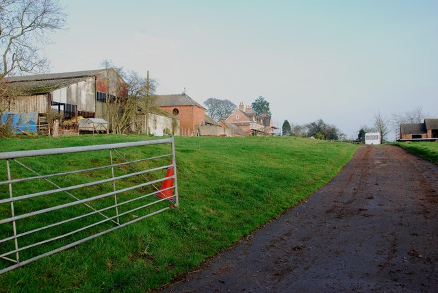
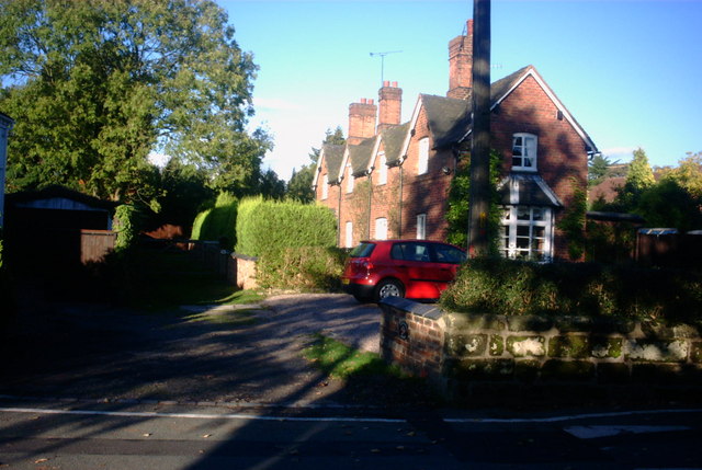
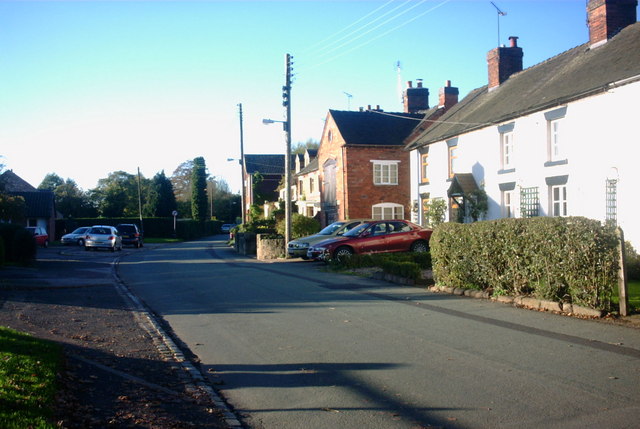
Gayton is a small village situated in the Staffordshire county of England. Located approximately 4 miles northwest of the town of Stafford, it falls within the civil parish of Hilderstone. The village is nestled amidst picturesque countryside, surrounded by lush green fields, and benefits from its proximity to the River Sow.

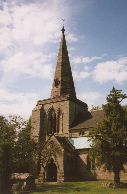
Gayton has a modest population, with a close-knit community that values its peaceful and charming environment. The village offers a mix of traditional architecture, with a number of quaint cottages and larger, more modern houses. The well-preserved St. John the Baptist Church, built in the 12th century, stands as a prominent landmark in the area.

While Gayton does not boast a large selection of amenities, it does host a local pub, The Royal Oak, which warmly welcomes both residents and visitors. For more extensive facilities such as shops, restaurants, and recreational activities, the nearby town of Stafford provides easy access.

The village enjoys excellent transport links, with the nearby A518 road connecting it to Stafford and other surrounding towns. Additionally, Gayton benefits from regular bus services, making it convenient for commuting or exploring the broader region.

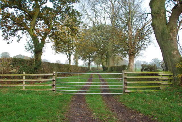
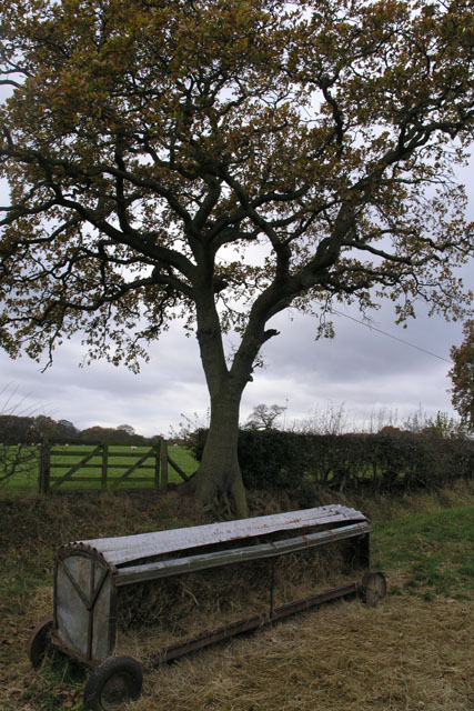
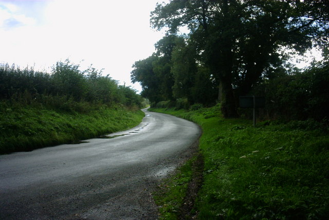
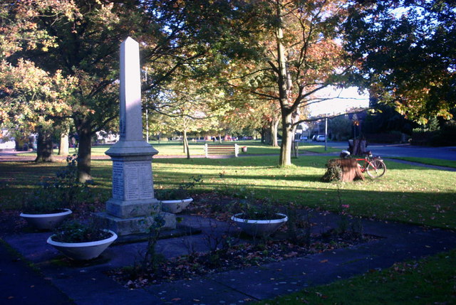
For those seeking outdoor activities, Gayton offers ample opportunities for leisurely walks and hikes in the idyllic Staffordshire countryside. The tranquil atmosphere and beautiful scenery make it an ideal destination for nature enthusiasts and those looking for a peaceful retreat.

In summary, Gayton is a small, picturesque village in Staffordshire, known for its tranquil setting, close community, and easy access to amenities in nearby towns.

If you have any feedback on the listing, please let us know in the comments section below.

Gayton Images

Images are sourced within 2km of 52.853911/-2.0271045 or Grid Reference SJ9828. Thanks to Geograph Open Source API. All images are credited.

Farm Track and Footpath This footpath crosses other footpaths on its way towards Fradswell, joining the Wallbrook road at the Hawkins lane junction.     <a title="https://www.geograph.org.uk/photo/2700053" href="https://www.geograph.org.uk/photo/2700053">Link</a>
Farm Track and Footpath
This footpath crosses other footpaths on its way towards Fradswell, joining the Wallbrook road at the Hawkins lane junction. Link
Stone Circles Challenge Footpath near the Gamkeepers cottage The Stone Circles Challenge joins twenty or more walks around the Stone area.   <span class="nowrap"><a title="http://www.bbc.co.uk/stoke/content/articles/2008/07/14/stone_circles_feature.shtml" rel="nofollow ugc noopener" href="http://www.bbc.co.uk/stoke/content/articles/2008/07/14/stone_circles_feature.shtml">Link</a><img style="margin-left:2px;" alt="External link" title="External link - shift click to open in new window" src="https://s1.geograph.org.uk/img/external.png" width="10" height="10"/></span>
Stone Circles Challenge Footpath near the Gamkeepers cottage
The Stone Circles Challenge joins twenty or more walks around the Stone area. LinkExternal link
The Doglands Farm  near Fradswell
The Doglands Farm near Fradswell
Sheep feeder In a field north of Gayton, a peaceful hamlet near the A51.
Sheep feeder
In a field north of Gayton, a peaceful hamlet near the A51.
Twenty Acre Pit This appears to be the name of the patch of trees on the 1:25,000 map.  This also shows that they surround a small rectangular pond, presumably that's the "pit".
Twenty Acre Pit
This appears to be the name of the patch of trees on the 1:25,000 map. This also shows that they surround a small rectangular pond, presumably that's the "pit".
Amerton Farm Train Model Steam Train at Amerton Farm Craft Centre
Amerton Farm Train
Model Steam Train at Amerton Farm Craft Centre
Weston upon Trent Church St Andrew's Church has an very broad tower in Early English style, and there is other early 13C work inside, but the remainder of the exterior is Victorian, of 1860 and 1872.
Weston upon Trent Church
St Andrew's Church has an very broad tower in Early English style, and there is other early 13C work inside, but the remainder of the exterior is Victorian, of 1860 and 1872.
St. Peter, Gayton
St. Peter, Gayton
Pitt's Column Abandoned and hidden in the trees, this is a memorial column to William Pitt the Younger. Erected in the year of his death (1806).
Pitt's Column
Abandoned and hidden in the trees, this is a memorial column to William Pitt the Younger. Erected in the year of his death (1806).
Pitt's Column More general view of the memorial.
Pitt's Column
More general view of the memorial.
Un-named Lane to A51 near Weston, Stafford This country lane is leading towards the A51 near to Weston, near Stafford.  Going in the other direction takes you to Gayton, a small hamlet surrounded by lovely countryside.
Un-named Lane to A51 near Weston, Stafford
This country lane is leading towards the A51 near to Weston, near Stafford. Going in the other direction takes you to Gayton, a small hamlet surrounded by lovely countryside.
Footpath and Dimple A footpath runs by the side of this giant depression in this field.  The map doesn't give any clues but it looks man made.
Footpath and Dimple
A footpath runs by the side of this giant depression in this field. The map doesn't give any clues but it looks man made.
Cherry Lane Cherry Lane in Gayton is a footpath as well as being home to a bus shelter and a post box.
Cherry Lane
Cherry Lane in Gayton is a footpath as well as being home to a bus shelter and a post box.
Cottage, Weston Cottage just off Green Lane at Weston.
Cottage, Weston
Cottage just off Green Lane at Weston.
Cottages on Green Lane Cottages on Green Lane, Weston
Cottages on Green Lane
Cottages on Green Lane, Weston
2 World Wars - 1 Village This War Memorial, to those who were lost from the village of Weston during the two World Wars, is next to the village green.
2 World Wars - 1 Village
This War Memorial, to those who were lost from the village of Weston during the two World Wars, is next to the village green.
War Memorial, South Face South face of the War Memorial in Weston Village
War Memorial, South Face
South face of the War Memorial in Weston Village
War Memorial, East Face East Face of the War Memorial at Weston.
War Memorial, East Face
East Face of the War Memorial at Weston.
Show me another place!

Gayton is located at Grid Ref: SJ9828 (Lat: 52.853911, Lng: -2.0271045)

Administrative County: Staffordshire

District: Stafford

Police Authority: Staffordshire

What 3 Words

///premature.waffle.latest. Near Great Haywood, Staffordshire

Nearby Locations

Gayton

Related Wikis

Gayton, Staffordshire

Gayton is a small rural village and civil parish in Staffordshire, located approximately 1 mile from the A51 between Stone and Stafford. In 2001 it had...
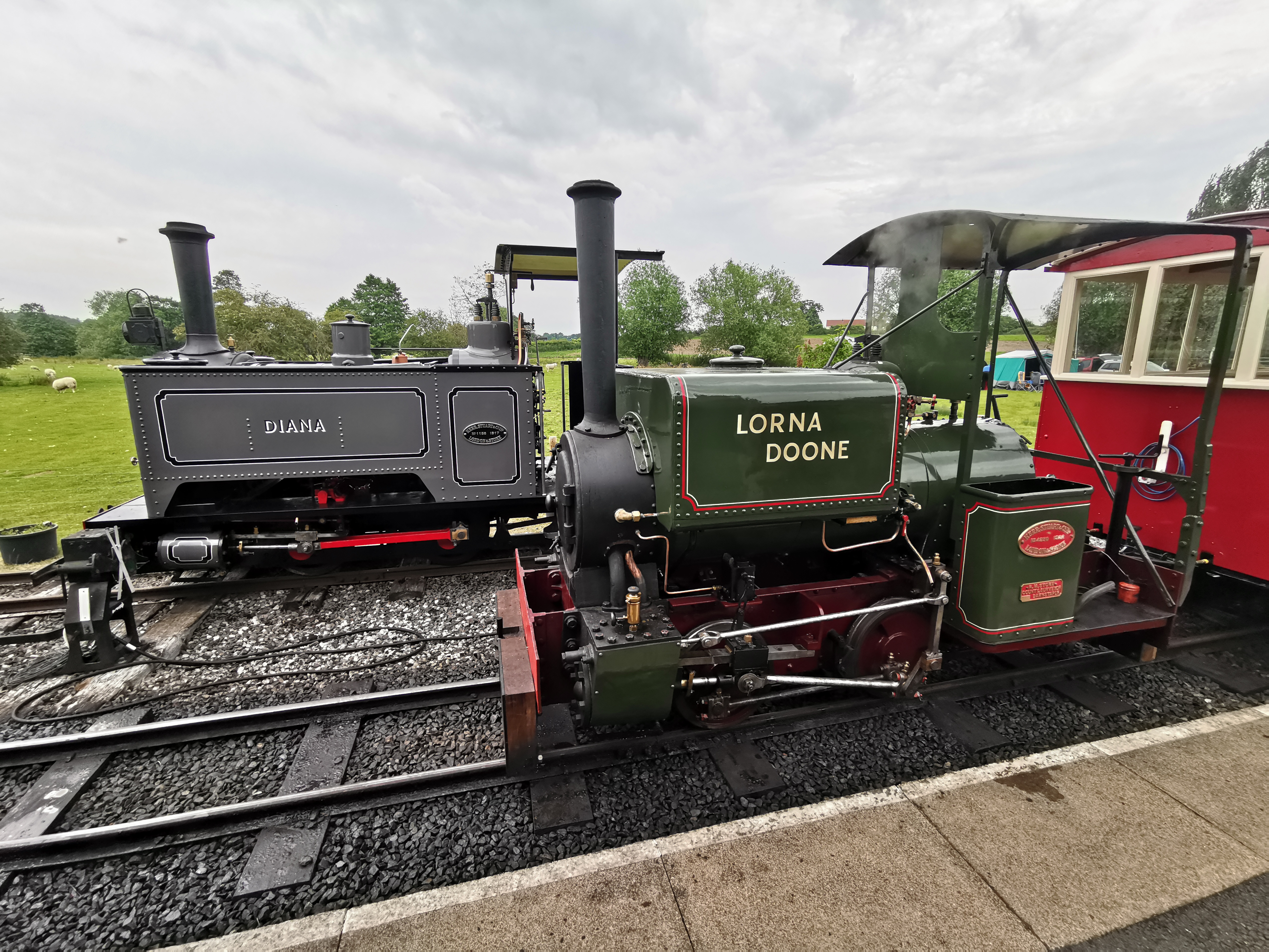
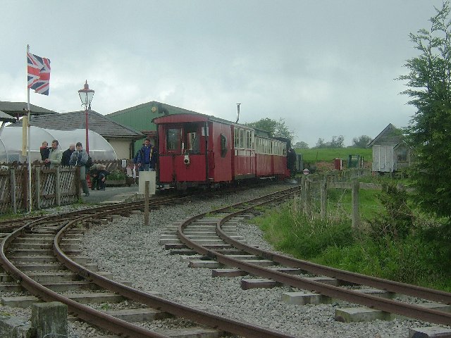
Amerton Railway

The Amerton Railway is a 2 ft (610 mm) narrow gauge heritage railway in the English county of Staffordshire. It is owned by Staffordshire Narrow Gauge...

Weston and Ingestre railway station

Weston and Ingestre railway station was a former British railway station opened by the North Staffordshire Railway to serve the village of Ingestre in...

Weston, Staffordshire

Weston is a village and civil parish. within the English county of Staffordshire. The parish is in the local authority of Stafford (non-metropolitan district...

Ingestre railway station

Ingestre and Weston railway station was a former British railway station to serve the village of Ingestre in Staffordshire.It was opened by the Stafford...

Amerton

Amerton is a small village in the Borough of Stafford, Staffordshire, England, situated on the A518 road between Stafford and Uttoxeter. The population...

RAF Hixon

Royal Air Force Hixon, or more simply RAF Hixon, was a Royal Air Force station located on the north western edge of the village of Hixon in Staffordshire...

RAF Seighford

Royal Air Force Seighford or more simply RAF Seighford is a former Royal Air Force satellite station located 3.6 miles (5.8 km) northwest of Stafford,...

Nearby Amenities

Located within 500m of 52.853911,-2.0271045
Bus Stop
Cherry Lane
Bus: yes
Naptan AtcoCode: 3800C703600
Naptan Bearing: SW
Naptan CommonName: Cherry Lane
Naptan Indicator: Adj
Naptan Landmark: Cherry Lane
Naptan Street: Vicarage Bank
Naptan Verified: no
Public Transport: platform
Source: naptan_import
Lat/Long: 52.8537518/-2.0268997
Gayton
Place: hamlet
Source: NLS - OS 1:25k 1st Series 1937-61
Wikidata: Q3385502
Lat/Long: 52.853594/-2.028728
Booth: K6
Covered: booth
Disused Amenity: telephone
Man Made: telephone_box
Lat/Long: 52.8541419/-2.0276397
Give Way
Direction: backward
Lat/Long: 52.8538196/-2.0269777
Give Way
Direction: forward
Lat/Long: 52.853759/-2.0269164
The data included in this document is from www.openstreetmap.org. The data is made available under ODbL.

Have you been to Gayton?

Leave your review of Gayton below (or comments, questions and feedback).