Shoal Neck

Lake, Pool, Pond, Freshwater Marsh in Cornwall

England

Shoal Neck

Field with prehistoric cairn and field system To the east of Barnaby Lane, which runs just over the wall on the right.

Scheduled Monument List Entry Number:1015002  <span class="nowrap"><a title="https://historicengland.org.uk/listing/the-list/list-entry/1015002?section=official-list-entry" rel="nofollow ugc noopener" href="https://historicengland.org.uk/listing/the-list/list-entry/1015002?section=official-list-entry">Link</a><img style="margin-left:2px;" alt="External link" title="External link - shift click to open in new window" src="https://s1.geograph.org.uk/img/external.png" width="10" height="10"/></span>
Field with prehistoric cairn and field system Credit: David Lally

Shoal Neck is a picturesque freshwater marsh located in Cornwall, England. Nestled amidst the serene and idyllic countryside, it offers a tranquil retreat for both locals and tourists seeking to escape the hustle and bustle of city life.

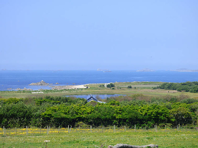
The main attraction of Shoal Neck is its stunning lake, which stretches across a considerable area, providing a serene and picturesque landscape. The lake is encompassed by rolling hills and lush greenery, creating a breathtaking view that is perfect for nature enthusiasts and photographers alike. With its crystal-clear waters, the lake offers various recreational activities such as swimming, boating, and fishing.

Adjacent to the lake is a pool, a smaller body of water that is ideal for those looking for a more secluded and private swimming experience. The pool is surrounded by dense vegetation, providing a sense of seclusion and tranquility for visitors.

In addition to the lake and pool, Shoal Neck also features a charming pond. The pond is home to a diverse range of aquatic plants and is a haven for various species of birds and wildlife. It serves as a popular spot for birdwatching and nature enthusiasts, who can observe the vibrant ecosystem thriving within its waters.

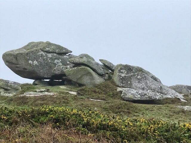
The entire area of Shoal Neck is a freshwater marsh, characterized by its rich biodiversity and unique ecosystem. The marshland is a haven for numerous species of plants, insects, and animals, offering a unique opportunity for nature enthusiasts to explore and appreciate the wonders of the natural world.

Overall, Shoal Neck in Cornwall is a haven for those seeking a peaceful and serene natural environment. With its stunning lake, secluded pool, charming pond, and diverse freshwater marsh, it offers a perfect retreat for individuals who wish to immerse themselves in the beauty of nature.

If you have any feedback on the listing, please let us know in the comments section below.

Shoal Neck Images

Images are sourced within 2km of 49.883944/-6.3663937 or Grid Reference SV8607. Thanks to Geograph Open Source API. All images are credited.

Field with prehistoric cairn and field system To the east of Barnaby Lane, which runs just over the wall on the right.

Scheduled Monument List Entry Number:1015002  <span class="nowrap"><a title="https://historicengland.org.uk/listing/the-list/list-entry/1015002?section=official-list-entry" rel="nofollow ugc noopener" href="https://historicengland.org.uk/listing/the-list/list-entry/1015002?section=official-list-entry">Link</a><img style="margin-left:2px;" alt="External link" title="External link - shift click to open in new window" src="https://s1.geograph.org.uk/img/external.png" width="10" height="10"/></span>
Field with prehistoric cairn and field system
To the east of Barnaby Lane, which runs just over the wall on the right. Scheduled Monument List Entry Number:1015002 LinkExternal link
Table laid-out for the St Agnes Coronation Street Party The “street” in this case is Old Lane.  No traffic order is required to close the road here! The Island Hall on the left had tables groaning under the weight of many cakes and other treats.
Table laid-out for the St Agnes Coronation Street Party
The “street” in this case is Old Lane. No traffic order is required to close the road here! The Island Hall on the left had tables groaning under the weight of many cakes and other treats.
Remains of a 19th century gig-shed On the north east edge of Per Askin. 

Of all the islands St Agnes as it is the most south westerly was in the best-placed to spot incoming vessels and launch a pilot-gig . Per Askin at the south west of the island would further increase the chance of getting a pilot aboard first. St Agnes pilots (typically named Hicks)  would then guide the ships as far as Bristol or the south coast ports. A major source of income for the Island throughout the 19th century.

A Scheduled Monument List Entry Number:1009280 <span class="nowrap"><a title="https://historicengland.org.uk/listing/the-list/list-entry/1009280?section=official-list-entry" rel="nofollow ugc noopener" href="https://historicengland.org.uk/listing/the-list/list-entry/1009280?section=official-list-entry">Link</a><img style="margin-left:2px;" alt="External link" title="External link - shift click to open in new window" src="https://s1.geograph.org.uk/img/external.png" width="10" height="10"/></span>
Remains of a 19th century gig-shed
On the north east edge of Per Askin. Of all the islands St Agnes as it is the most south westerly was in the best-placed to spot incoming vessels and launch a pilot-gig . Per Askin at the south west of the island would further increase the chance of getting a pilot aboard first. St Agnes pilots (typically named Hicks) would then guide the ships as far as Bristol or the south coast ports. A major source of income for the Island throughout the 19th century. A Scheduled Monument List Entry Number:1009280 LinkExternal link
A stile to Browarth A tad more conventional than 15 years ago <a href="https://www.geograph.org.uk/photo/827432">SV8708 : Crate Based Stile</a>.
A stile to Browarth
A tad more conventional than 15 years ago SV8708 : Crate Based Stile.
Two post-medieval quays These quays are believed to have been built to land coal for the St Agnes lighthouse.

For more details see the details on their Historic England listing:
List Entry Number:1016512. <span class="nowrap"><a title="https://historicengland.org.uk/listing/the-list/list-entry/1016512?section=official-list-entry" rel="nofollow ugc noopener" href="https://historicengland.org.uk/listing/the-list/list-entry/1016512?section=official-list-entry">Link</a><img style="margin-left:2px;" alt="External link" title="External link - shift click to open in new window" src="https://s1.geograph.org.uk/img/external.png" width="10" height="10"/></span>

The named quay “Uncle Tom’s Quay” is the more eroded of the two but can still be discerned to the right of the picture surmounted by a herring gull.
Two post-medieval quays
These quays are believed to have been built to land coal for the St Agnes lighthouse. For more details see the details on their Historic England listing: List Entry Number:1016512. LinkExternal link The named quay “Uncle Tom’s Quay” is the more eroded of the two but can still be discerned to the right of the picture surmounted by a herring gull.
Refloating Elvera This small launch is probably about 90 years old now.

It's spent the winter in a nearby field undergoing "months of work" according to its owner (on the right of the picture standing on the slipway.)

I expressed surprise that they had towed it down at such a low tide "You are going to let the tide float her?" "Yes, she's full of leaks".
Refloating Elvera
This small launch is probably about 90 years old now. It's spent the winter in a nearby field undergoing "months of work" according to its owner (on the right of the picture standing on the slipway.) I expressed surprise that they had towed it down at such a low tide "You are going to let the tide float her?" "Yes, she's full of leaks".
The St Agnes Lighthouse and attached house From Old lane.

The lighthouse is both a Grade II* listed building List Entry Number:1328835 <span class="nowrap"><a title="https://historicengland.org.uk/listing/the-list/list-entry/1328835" rel="nofollow ugc noopener" href="https://historicengland.org.uk/listing/the-list/list-entry/1328835">Link</a><img style="margin-left:2px;" alt="External link" title="External link - shift click to open in new window" src="https://s1.geograph.org.uk/img/external.png" width="10" height="10"/></span>

and a Scheduled Monument List Entry Number:1014999 <span class="nowrap"><a title="https://historicengland.org.uk/listing/the-list/list-entry/1014999?section=official-list-entry" rel="nofollow ugc noopener" href="https://historicengland.org.uk/listing/the-list/list-entry/1014999?section=official-list-entry">Link</a><img style="margin-left:2px;" alt="External link" title="External link - shift click to open in new window" src="https://s1.geograph.org.uk/img/external.png" width="10" height="10"/></span>

The house is Grade II List Entry Number:1218288 <span class="nowrap"><a title="https://historicengland.org.uk/listing/the-list/list-entry/1218288" rel="nofollow ugc noopener" href="https://historicengland.org.uk/listing/the-list/list-entry/1218288">Link</a><img style="margin-left:2px;" alt="External link" title="External link - shift click to open in new window" src="https://s1.geograph.org.uk/img/external.png" width="10" height="10"/></span>
The St Agnes Lighthouse and attached house
From Old lane. The lighthouse is both a Grade II* listed building List Entry Number:1328835 LinkExternal link and a Scheduled Monument List Entry Number:1014999 LinkExternal link The house is Grade II List Entry Number:1218288 LinkExternal link
Refloating Elvera Taken a few minutes before <a href="https://www.geograph.org.uk/photo/7486422">SV8708 : Refloating Elvera</a>. This shows a family group bringing an heirloom back into use.

60 years ago this little launch would take my family (weather permitting) to Catholic Mass on St Mary's when holidaying on St Agnes . It would be sailed by the father of the man on driving the tractor and grandfather of the two men at the stern of the boat.
Refloating Elvera
Taken a few minutes before SV8708 : Refloating Elvera. This shows a family group bringing an heirloom back into use. 60 years ago this little launch would take my family (weather permitting) to Catholic Mass on St Mary's when holidaying on St Agnes . It would be sailed by the father of the man on driving the tractor and grandfather of the two men at the stern of the boat.
Refloating Elvera Taken a minute or two after <a href="https://www.geograph.org.uk/photo/7491445">SV8708 : Refloating Elvera</a>. See that for a bit of history.
Refloating Elvera
Taken a minute or two after SV8708 : Refloating Elvera. See that for a bit of history.
Old Lane A small group of isolated cottages between the lighthouse and Periglis do not merit even a Scillonian recognition as a "Town".
Old Lane
A small group of isolated cottages between the lighthouse and Periglis do not merit even a Scillonian recognition as a "Town".
Kate's Bakes Cake stall with honesty box and card reader.  Lovely cakes!
Kate's Bakes
Cake stall with honesty box and card reader. Lovely cakes!
Traditional woven "ink pot" lobster pots Made from tamarisk and willow harvested on the island.  And laid using oar and sail.
Traditional woven "ink pot" lobster pots
Made from tamarisk and willow harvested on the island. And laid using oar and sail.
Wingletang Carn Subject of the first for this square.  <a href="https://www.geograph.org.uk/photo/45046">SV8807 : Wingletang Down</a>
Wingletang Carn
Subject of the first for this square. SV8807 : Wingletang Down
St Agnes orchard Now used for cider.
St Agnes orchard
Now used for cider.
Old Lifeboat Shed The St Agnes lifeboat shed
Old Lifeboat Shed
The St Agnes lifeboat shed
Old rails for the lifeboat trolley For the St Agnes Lifeboat
Old rails for the lifeboat trolley
For the St Agnes Lifeboat
Daymark on Burnt Island From St Agnes
Daymark on Burnt Island
From St Agnes
View of St. Agnes pool from the road to the lighthouse The strange 'daymark' visible top left of the picture
View of St. Agnes pool from the road to the lighthouse
The strange 'daymark' visible top left of the picture
Show me another place!

Shoal Neck is located at Grid Ref: SV8607 (Lat: 49.883944, Lng: -6.3663937)

Division: Isles of Scilly

Unitary Authority: Isles of Scilly

Police Authority: Devon and Cornwall

What 3 Words

///optimists.potions.lake. Near St Agnes, Isles of Scilly

Related Wikis

Annet, Isles of Scilly

Annet (Cornish: Anet, lit. 'kittiwake') is the second largest of the fifty or so uninhabited Isles of Scilly, 1 kilometre (0.62 mi) west of St Agnes with...

Thomas W. Lawson (ship)

Thomas W. Lawson was a seven-masted, steel-hulled schooner built for the Pacific trade, but used primarily to haul coal and oil along the East Coast of...

Burnt Island, Isles of Scilly

Burnt Island is a small, uninhabited island in the Isles of Scilly, Cornwall, United Kingdom. It is covered in thrift and long grasses. and is linked to...

St Agnes Lifeboat Station, Isles of Scilly

St Agnes' Lifeboat Station was situated in St Agnes, Isles of Scilly and provided a service for the Royal National Lifeboat Institution from 1891 to 1920...

Have you been to Shoal Neck?

Leave your review of Shoal Neck below (or comments, questions and feedback).