Loch Fada

Lake, Pool, Pond, Freshwater Marsh in Inverness-shire

Scotland

Loch Fada

Ruined buildings at Buaile-mhòr
Ruined buildings at Buaile-mhòr Credit: Toby Speight

Loch Fada is a picturesque freshwater loch located in Inverness-shire, Scotland. Nestled amidst the stunning Highland landscape, it covers an area of approximately 25 acres and sits at an elevation of 600 feet above sea level. The loch is situated near the village of Strathconon, surrounded by rolling hills and dense forests, making it an ideal spot for nature lovers and outdoor enthusiasts.

The name "Loch Fada" translates to "long loch" in Scottish Gaelic, which is fitting as it stretches for about 1.5 miles in length. It has a narrow shape, with an average width of around 200 meters. The loch is fed by several small streams and springs, ensuring a constant flow of freshwater.

The clear and tranquil waters of Loch Fada are home to a variety of fish species, including brown trout, salmon, and pike, making it a popular destination for anglers. The loch's calm surface also attracts waterfowl, such as ducks and swans, creating a serene atmosphere.

Surrounding the loch, there are patches of freshwater marshes and wetlands, providing a habitat for diverse flora and fauna. These marshy areas are adorned with vibrant water lilies, reeds, and sedges, creating a beautiful and vibrant ecosystem.

Loch Fada offers breathtaking views of the surrounding mountains, including Ben Wyvis, which stands majestically to the northeast. The tranquil atmosphere, combined with the stunning natural scenery, makes Loch Fada a haven for those seeking solitude and a connection with nature.

If you have any feedback on the listing, please let us know in the comments section below.
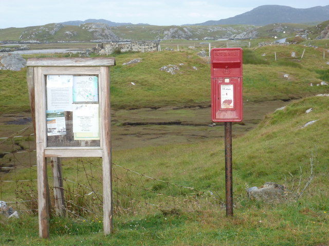
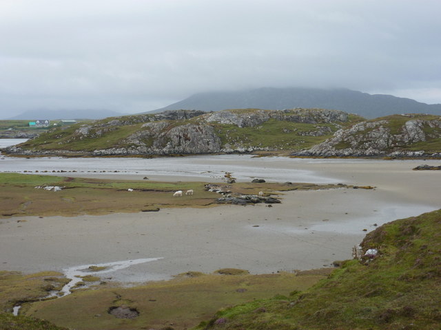
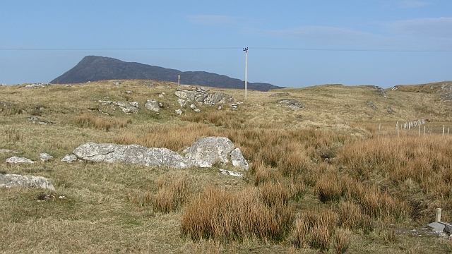
Loch Fada Images

Images are sourced within 2km of 57.489623/-7.2348232 or Grid Reference NF8656. Thanks to Geograph Open Source API. All images are credited.

Ruined buildings at Buaile-mhòr
Gearraidh Dubh Looking over the shore near Gearraidh Dubh towards Eabhal.
Gearraidh Dubh
Looking over the shore near Gearraidh Dubh towards Eabhal.
Loch na Faoileag on Grimsay One of many small islets on Loch na Faoileag on the Isle of Grimsay
Loch na Faoileag on Grimsay
One of many small islets on Loch na Faoileag on the Isle of Grimsay
Loch na Faoileag Shoreline A view along the shoreline to north west finger on Loch na Faoileag (Isle of Grimsay) .Taken on the opposite bank from the roadside.
Loch na Faoileag Shoreline
A view along the shoreline to north west finger on Loch na Faoileag (Isle of Grimsay) .Taken on the opposite bank from the roadside.
Loch na Faoileag Cairn A small cairn situated at the south-eastern end of Loch na Faoileag.
Loch na Faoileag Cairn
A small cairn situated at the south-eastern end of Loch na Faoileag.
Near Gearraidh Dubh
Near Gearraidh Dubh
Bagh Sgotbheinn Not all Hebridean buildings fall into disrepair. I note that Dave Fergusson's 2007 photograph includes this small building, but now, twelve years later it has a new roof and is looking well cared for.
Bagh Sgotbheinn
Not all Hebridean buildings fall into disrepair. I note that Dave Fergusson's 2007 photograph includes this small building, but now, twelve years later it has a new roof and is looking well cared for.
Old harbour, Grimsay A crofthouse sitting on a reclaimed piece of land at Baymore (Bagh mor) which was the main harbour on the island before the Kallin (Ceallan) development.  The harbour is littered with lots of old creels and other flotsam and there are many old stone piers.
Old harbour, Grimsay
A crofthouse sitting on a reclaimed piece of land at Baymore (Bagh mor) which was the main harbour on the island before the Kallin (Ceallan) development. The harbour is littered with lots of old creels and other flotsam and there are many old stone piers.
The summit region of Grimsay Grimsay is a low island between North Uist and Benbecula. It is difficult to be certain of its highest point, but this eminence, 25m or so above Mean Sea Level, is a good contender.
The summit region of Grimsay
Grimsay is a low island between North Uist and Benbecula. It is difficult to be certain of its highest point, but this eminence, 25m or so above Mean Sea Level, is a good contender.
Isle of Ronay View towards North Uist
Isle of Ronay
View towards North Uist
Sandy inlet on the coast of Grimsay One of a maze of inlets and channels around Grimsay. This view is interesting as there are remains of old field walls [possibly iron age/centre picture] visible in the sand, indicating a lower sea level at some time. Cloud capped Eabhal rises in the distance.
Sandy inlet on the coast of Grimsay
One of a maze of inlets and channels around Grimsay. This view is interesting as there are remains of old field walls [possibly iron age/centre picture] visible in the sand, indicating a lower sea level at some time. Cloud capped Eabhal rises in the distance.
Baymore: postbox № HS6 15 One of four postboxes on the island of Grimsay. Apart from the one on the main road close to the post office, they are emptied at 11:45am on weekdays and at 9:30am on Saturdays.
Baymore: postbox № HS6 15
One of four postboxes on the island of Grimsay. Apart from the one on the main road close to the post office, they are emptied at 11:45am on weekdays and at 9:30am on Saturdays.
Gearadu: postbox № HS6 34 One of four postboxes on the island of Grimsay. Apart from the one on the main road close to the post office, they are emptied at 11:45am on weekdays and at 9:30am on Saturdays.
Gearadu: postbox № HS6 34
One of four postboxes on the island of Grimsay. Apart from the one on the main road close to the post office, they are emptied at 11:45am on weekdays and at 9:30am on Saturdays.
Kallin: postbox № HS6 25 One of four postboxes on the island of Grimsay. Apart from the one on the main road close to the post office, they are emptied at 11:45am on weekdays and at 9:30am on Saturdays.
Kallin: postbox № HS6 25
One of four postboxes on the island of Grimsay. Apart from the one on the main road close to the post office, they are emptied at 11:45am on weekdays and at 9:30am on Saturdays.
Kallin: a deer He spotted me as soon as I spotted him!
Kallin: a deer
He spotted me as soon as I spotted him!
Kallin: the harbour Looking across the harbour from the road above.
Kallin: the harbour
Looking across the harbour from the road above.
Grimsay: Bàgh Tràight A bay on the north side of Grimsay, with a complicated shape with many inlets and promontories.
Grimsay: Bàgh Tràight
A bay on the north side of Grimsay, with a complicated shape with many inlets and promontories.
Àird nan Srùban Pasture on Grimsay with Eabhal in the background.
Àird nan Srùban
Pasture on Grimsay with Eabhal in the background.
Show me another place!

Loch Fada is located at Grid Ref: NF8656 (Lat: 57.489623, Lng: -7.2348232)

Unitary Authority: Na h-Eileanan an Iar

Police Authority: Highlands and Islands

What 3 Words

///backward.bins.conceals. Near Balivanich, Na h-Eileanan Siar

Related Wikis

Grimsay

Grimsay (Scottish Gaelic: Griomasaigh) is a tidal island in the Outer Hebrides of Scotland. == Geography == Grimsay is the largest of the low-lying stepping...

Fraoch-Eilean

Fraoch-eilean is a small island with an uncertain population north of Benbecula in the Outer Hebrides of Scotland. It is about 55 hectares (140 acres...

Flodaigh

Flodaigh is a tidal island lying to the north of Benbecula and south of Grimsay in the Outer Hebrides, Scotland. It is connected to Benbecula by a causeway...

Baile Glas

Baile Glas or Ballaglasa (Scottish Gaelic: Am Baile Glas) is a settlement on Grimsay in the Outer Hebrides, Scotland. Ballaglasa is within the parish of...

Nearby Amenities

Located within 500m of 57.489623,-7.2348232
Bus Stop
Grimsay Island
Naptan AtcoCode: 6010731677
Naptan Bearing: E
Naptan CommonName: Grimsay Island
Naptan Indicator: Scotvein
Naptan Landmark: Scotvein
Naptan NaptanCode: 94723528
Naptan Street: Scotvein
Naptan Verified: no
Source: naptan_import
Lat/Long: 57.4858066/-7.2362608
Barrier: cattle_grid
Lat/Long: 57.4863334/-7.2402444
Passing Place
Lat/Long: 57.4855814/-7.2340522
Passing Place
Lat/Long: 57.4857731/-7.2364884
Scotbheinn
Name En: Scotvein
Name Gd: Scotbheinn
Place: hamlet
Lat/Long: 57.4864243/-7.2394324
Marketplace
Opening Hours: We 15:00-18:00
Operator: Ceann na h-Àirigh
Lat/Long: 57.4866788/-7.2403322
Cafe
Description: Tea/Coffee/Cake
Opening Hours: Tu,Th,Fr 11:00-13:30; We 11:00-18:00
Operator: Ceann na h-Airigh
Lat/Long: 57.4866874/-7.2402705
Post Office
Grimsay Post Office
Addr City: Uibhist a Tuath
Addr City En: Isle of North Uist
Addr Country: GB
Addr Postcode: HS6 5JA
Addr Suburb: Grimsay
Opening Hours: Mo-Fr 11:00-13:00
Ref Pol Id: 140232
Lat/Long: 57.4867213/-7.2403631
Power: pole
Lat/Long: 57.4860099/-7.2383873
Power: pole
Lat/Long: 57.4860438/-7.2370533
Power: pole
Lat/Long: 57.4859605/-7.2362691
Power: pole
Lat/Long: 57.4858203/-7.2349002
Power: pole
Lat/Long: 57.4856995/-7.233777
Power: pole
Lat/Long: 57.4855898/-7.2326544
Passing Place
Lat/Long: 57.4861108/-7.2392311
The data included in this document is from www.openstreetmap.org. The data is made available under ODbL.

Have you been to Loch Fada?

Leave your review of Loch Fada below (or comments, questions and feedback).