Gaydon

Settlement in Warwickshire Stratford-on-Avon

England

Gaydon

Wade Lane, Lighthorne Heath The British Motor Museum is on the right behind the trees.
Wade Lane, Lighthorne Heath Credit: David Howard

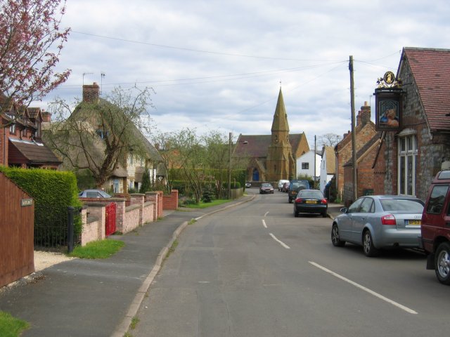
Gaydon is a small village located in the county of Warwickshire, in the West Midlands region of England. Situated approximately 10 miles southeast of the town of Warwick, Gaydon is nestled in a rural setting characterized by picturesque countryside and rolling hills.

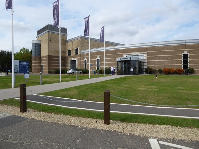
The village is predominantly known for being the home of the British Motor Museum, which houses the largest collection of historic British cars in the world. The museum showcases over 300 vehicles spanning more than a century of automotive history, including iconic brands like Jaguar, Aston Martin, and Rolls-Royce. The site also features numerous interactive exhibits and displays, making it a popular destination for automobile enthusiasts and tourists alike.

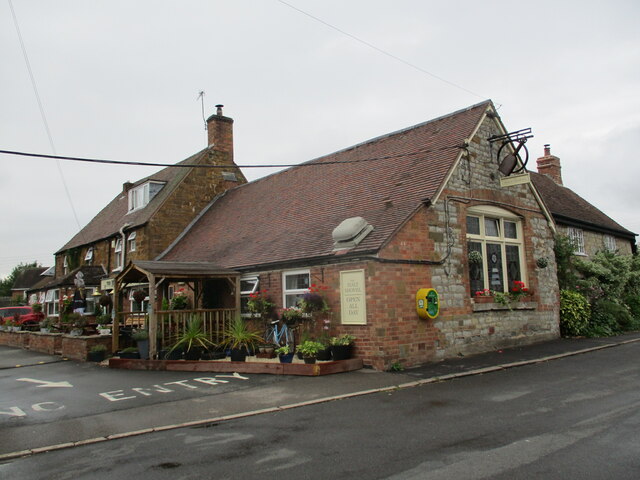
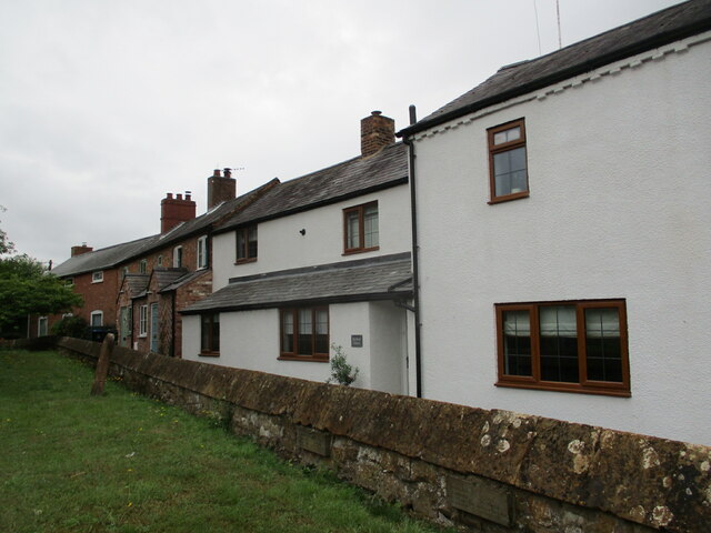
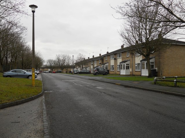
Aside from the motor museum, Gaydon has a small and close-knit community. The village itself is quaint and charming, with traditional stone buildings and a peaceful atmosphere. It offers a range of amenities including a village hall, a primary school, and a local pub, providing a sense of community for its residents.

Surrounded by the Warwickshire countryside, Gaydon offers excellent opportunities for outdoor activities such as hiking, cycling, and exploring the nearby nature reserves. Its location also benefits from easy access to major transportation routes, with the M40 motorway located just a few miles away, making it convenient for commuters and visitors to explore the wider region.

In summary, Gaydon is a delightful village in Warwickshire, renowned for its world-class automobile museum and its tranquil rural setting. It offers a blend of history, natural beauty, and community spirit, making it an appealing destination for both enthusiasts and those seeking a peaceful retreat.

If you have any feedback on the listing, please let us know in the comments section below.

Gaydon Images

Images are sourced within 2km of 52.182426/-1.471341 or Grid Reference SP3653. Thanks to Geograph Open Source API. All images are credited.

Wade Lane, Lighthorne Heath The British Motor Museum is on the right behind the trees.
Wade Lane, Lighthorne Heath
The British Motor Museum is on the right behind the trees.
Small roundabout on Wade Lane, Lighthorne Heath
Chadshunt Cottages On Watery Lane.
Chadshunt Cottages
On Watery Lane.
Chadshunt Farmland Off Watery Lane.
Chadshunt Farmland
Off Watery Lane.
The British Motor Museum The British Motor Museum at Gaydon.
The British Motor Museum
The British Motor Museum at Gaydon.
Wade Lane near Swallowfields Farm
Ditch along the edge of the churchyard, Chadshunt The churchyard is raised above the level of the neighbouring field and separated from it by a ditch.
Ditch along the edge of the churchyard, Chadshunt
The churchyard is raised above the level of the neighbouring field and separated from it by a ditch.
Track across a grass field, Chadshunt
Remains of a medieval cross, Chadshunt Was once a substantial structure <span class="nowrap"><a title="https://historicengland.org.uk/listing/the-list/list-entry/1019662?section=official-list-entry" rel="nofollow ugc noopener" href="https://historicengland.org.uk/listing/the-list/list-entry/1019662?section=official-list-entry">Link</a><img style="margin-left:2px;" alt="External link" title="External link - shift click to open in new window" src="https://s1.geograph.org.uk/img/external.png" width="10" height="10"/></span>
Remains of a medieval cross, Chadshunt
Was once a substantial structure LinkExternal link
Old driveway to Chadshunt House
The Malt Shovel, Gaydon
Cottages, Church Walk, Gaydon
Branch into Kineton Depot Seen from the B4100 (ex A41) bridge the freight branch reaches its destination.  Kineton MOD depot is seen in the distance.
Branch into Kineton Depot
Seen from the B4100 (ex A41) bridge the freight branch reaches its destination. Kineton MOD depot is seen in the distance.
Church of All Saints, Chadshunt. Interior looking west The nave is the accumulated work of the twelfth, fourteenth and fifteenth centuries <span class="nowrap"><a title="https://historicengland.org.uk/listing/the-list/list-entry/1035627?section=official-list-entry" rel="nofollow ugc noopener" href="https://historicengland.org.uk/listing/the-list/list-entry/1035627?section=official-list-entry">Link</a><img style="margin-left:2px;" alt="External link" title="External link - shift click to open in new window" src="https://s1.geograph.org.uk/img/external.png" width="10" height="10"/></span>
Church of All Saints, Chadshunt. Interior looking west
The nave is the accumulated work of the twelfth, fourteenth and fifteenth centuries LinkExternal link
Church of All Saints, Chadshunt. Chancel interior Built about 1730 <span class="nowrap"><a title="https://historicengland.org.uk/listing/the-list/list-entry/1035627?section=official-list-entry" rel="nofollow ugc noopener" href="https://historicengland.org.uk/listing/the-list/list-entry/1035627?section=official-list-entry">Link</a><img style="margin-left:2px;" alt="External link" title="External link - shift click to open in new window" src="https://s1.geograph.org.uk/img/external.png" width="10" height="10"/></span>
Church of All Saints, Chadshunt. Chancel interior
Built about 1730 LinkExternal link
Churchyard path, Chadshunt
Gateway to Chadshunt House
The Village Hall, Gaydon Dates from 1886.
The Village Hall, Gaydon
Dates from 1886.
Show me another place!

Gaydon is located at Grid Ref: SP3653 (Lat: 52.182426, Lng: -1.471341)

Administrative County: Warwickshire

District: Stratford-on-Avon

Police Authority: Warwickshire

What 3 Words

///dressings.upwards.animates. Near Gaydon, Warwickshire

Nearby Locations

Gaydon

Related Wikis

Gaydon

Gaydon is a civil parish and village in the Stratford-on-Avon District of Warwickshire, England, situated between Leamington Spa and Banbury. In the 2001...

British Motor Museum

The British Motor Museum in Gaydon, Warwickshire, England holds the world's largest collection of historic British cars, with over 300 cars on display...
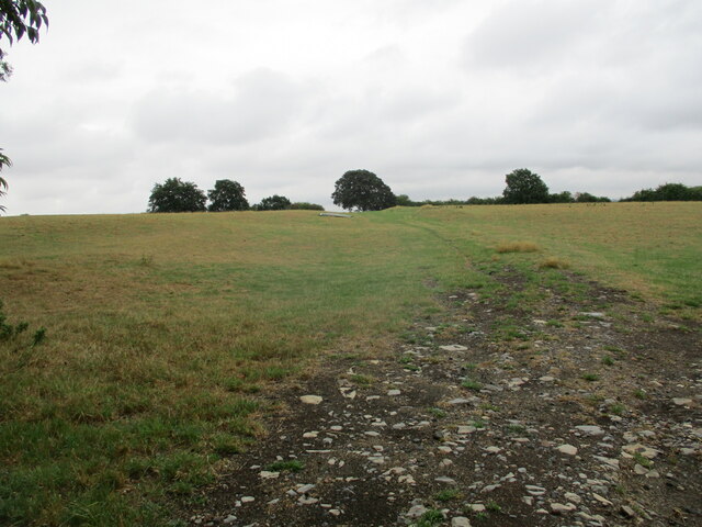
RAF Gaydon

Royal Air Force Gaydon or more simply RAF Gaydon is a former Royal Air Force station located 5.2 miles (8.4 km) east of Wellesbourne, Warwickshire and...

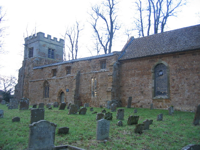
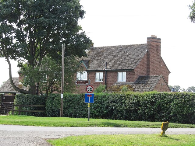
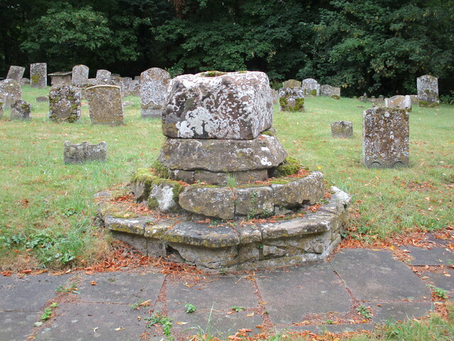
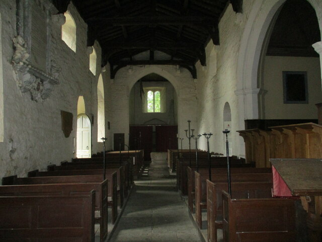
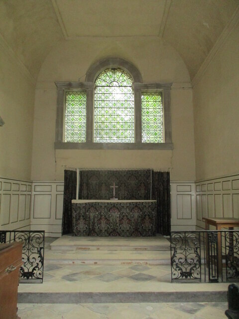
All Saints Church, Chadshunt

All Saints Church is a redundant Anglican church in the parish of Chadshunt, Warwickshire, England. It is recorded in the National Heritage List for England...

Chadshunt

Chadshunt is a small village and civil parish in the Stratford-on-Avon district, in the county of Warwickshire, England. Chadshunt is located in between...

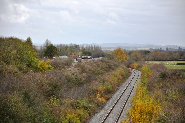
Burton Dassett railway station

Burton Dassett Halt was a railway station on the former Stratford-upon-Avon and Midland Junction Railway in Warwickshire, England. == History == It was...

Lighthorne Heath

Lighthorne Heath is a village in the civil parish of Upper Lighthorne, in the Stratford-on-Avon District, in the county of Warwickshire, England. It is...

Temple Herdewyke

Temple Herdewyke is a village in Warwickshire, England, that was built to house staff at Defence Munitions (DM) Kineton. It forms part of the parish of...

Nearby Amenities

Located within 500m of 52.182426,-1.471341
Turning Circle
Lat/Long: 52.1823078/-1.4695911
Bus Stop
Green
Bus: yes
Naptan AtcoCode: 4200F023500
Naptan Bearing: NE
Naptan CommonName: Green
Naptan Indicator: Adj
Naptan Landmark: Bus Shelter
Naptan NaptanCode: wardgjpj
Naptan Street: Kineton Road
Naptan Verified: no
Public Transport: platform
Shelter: yes
Source: naptan_import
Lat/Long: 52.1832883/-1.4707594
Bus Stop
Green
Bus: yes
Naptan AtcoCode: 4200F023501
Naptan Bearing: SW
Naptan BusStopType: CUS
Naptan CommonName: Green
Naptan Indicator: Opp
Naptan NaptanCode: wardgjpm
Naptan Street: Kineton Road
Naptan Verified: no
Public Transport: platform
Source: naptan_import
Lat/Long: 52.1831969/-1.4704387
Bus Stop
Malt Shovel
Bus: yes
Naptan AtcoCode: 4200F023700
Naptan Bearing: NW
Naptan CommonName: Malt Shovel
Naptan Indicator: Adj
Naptan Landmark: Malt Shovel
Naptan NaptanCode: wardgjpw
Naptan Street: Church Road
Naptan Verified: no
Public Transport: platform
Source: naptan_import
Lat/Long: 52.1831374/-1.4693238
Bus Stop
Village Hall
Bus: yes
Naptan AtcoCode: 4200F023800
Naptan Bearing: SE
Naptan CommonName: Village Hall
Naptan Indicator: Adj
Naptan Landmark: Village Hall
Naptan NaptanCode: wardgjta
Naptan Street: Church Road
Naptan Verified: no
Public Transport: platform
Source: naptan_import
Lat/Long: 52.1829461/-1.4689137
Bus Stop
Gaydon Inn
Bus: yes
Naptan AtcoCode: 4200F023801
Naptan Bearing: S
Naptan CommonName: Gaydon Inn
Naptan Indicator: Opp
Naptan Landmark: Gaydon Inn
Naptan NaptanCode: wardgjtd
Naptan Street: Banbury Road
Naptan Verified: no
Public Transport: platform
Shelter: yes
Source: naptan_import
Lat/Long: 52.1841928/-1.4659804
Barrier: kissing_gate
Lat/Long: 52.1822272/-1.4677559
Barrier: stile
Lat/Long: 52.1815605/-1.4666669
Barrier: stile
Lat/Long: 52.1808122/-1.4675092
Barrier: stile
Lat/Long: 52.1794469/-1.4673932
Post Box
Collection Times: Mo-Fr 16:00; Sa 08:45
Operator: Royal Mail
Operator Wikidata: Q638098
Post Box Type: lamp
Ref: CV35 73
Royal Cypher: EIIR
Royal Cypher Wikidata: Q33102113
Source: survey
Lat/Long: 52.182944/-1.4673465
Public Bookcase
Booth: K6
Covered: booth
Disused Amenity: telephone
Man Made: telephone_box
Note: now a community library
Old Phone: +44 1926 640443
Public Bookcase Type: phone_box
Source: survey
Lat/Long: 52.1829479/-1.4672845
Atm
Source: survey
Lat/Long: 52.1837181/-1.4654674
Fast Food
Subway
Brand: Subway
Brand Wikidata: Q244457
Brand Wikipedia: en:Subway (restaurant)
Cuisine: sandwich
Takeaway: yes
Lat/Long: 52.1838255/-1.4653645
Fast Food
Greggs
Brand: Greggs
Brand Wikidata: Q3403981
Brand Wikipedia: en:Greggs
Contact Website: https://www.greggs.co.uk/shop-finder?shop-code=3755
Cuisine: sandwich;bakery
Takeaway: yes
Lat/Long: 52.1838995/-1.4654457
Turning Circle
Lat/Long: 52.1830785/-1.4723691
Defibrillator
Defibrillator Location: Outside wall of pub. Streetside
Emergency: defibrillator
Indoor: no
Ref: 4881
Source: survey
Lat/Long: 52.1833389/-1.4696605
Man Made: flagpole
Lat/Long: 52.1835023/-1.4704078
Bench
Lat/Long: 52.1834898/-1.4705747
Generator Method: photovoltaic
Generator Output Electricity: yes
Generator Source: solar
Generator Type: solar_photovoltaic_panel
Location: roof
Power: generator
Lat/Long: 52.1851814/-1.4688608
Generator Method: photovoltaic
Generator Output Electricity: yes
Generator Source: solar
Generator Type: solar_photovoltaic_panel
Location: roof
Power: generator
Lat/Long: 52.1843987/-1.4704487
Generator Method: photovoltaic
Generator Output Electricity: yes
Generator Source: solar
Generator Type: solar_photovoltaic_panel
Location: roof
Power: generator
Lat/Long: 52.1841109/-1.4700463
Generator Method: photovoltaic
Generator Output Electricity: yes
Generator Source: solar
Generator Type: solar_photovoltaic_panel
Location: roof
Power: generator
Lat/Long: 52.1841997/-1.4701644
Generator Method: photovoltaic
Generator Output Electricity: yes
Generator Source: solar
Generator Type: solar_photovoltaic_panel
Location: roof
Power: generator
Lat/Long: 52.184818/-1.4683807
Generator Method: photovoltaic
Generator Output Electricity: yes
Generator Source: solar
Generator Type: solar_photovoltaic_panel
Location: roof
Power: generator
Lat/Long: 52.1825148/-1.4695179
Fuel
Esso
Addr City: Gaydon
Addr Postcode: CV35 0HA
Addr Street: Banbury Road
Brand: Esso
Brand Wikidata: Q867662
Brand Wikipedia: en:Esso
Contact Website: https://www.esso.co.uk/en-gb/find-station/esso-gaydon-essoeggaydon-100200219
Fhrs Id: 503154
Mapillary: 1180301172431583
Survey Date: 2021-04-14
Lat/Long: 52.1838729/-1.4656964
Gaydon Village Store
Shop: yes
Website: http://www.gaydon-village-store.co.uk/
Lat/Long: 52.1832214/-1.4695278
Natural: spring
Source: OS
Lat/Long: 52.1824817/-1.4734624
Source: OS
Lat/Long: 52.1819438/-1.4719755
The data included in this document is from www.openstreetmap.org. The data is made available under ODbL.

Have you been to Gaydon?

Leave your review of Gaydon below (or comments, questions and feedback).