Loch Beag

Lake, Pool, Pond, Freshwater Marsh in Inverness-shire

Scotland

Loch Beag

Houses on Boreray/Boraraigh
Houses on Boreray/Boraraigh Credit: Sandy Gerrard

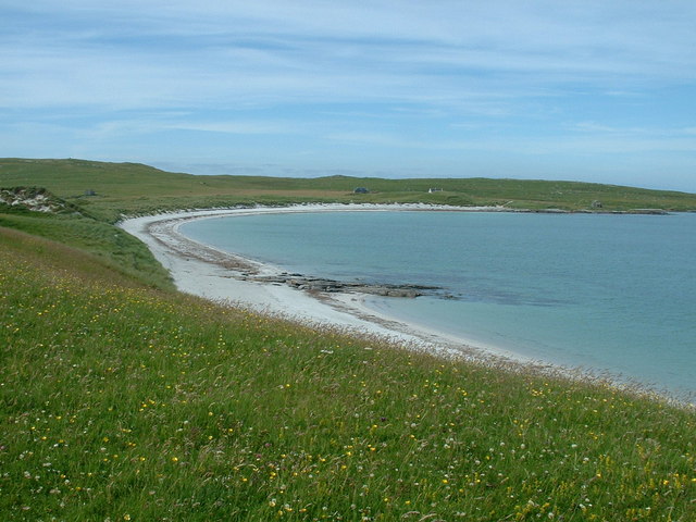
Loch Beag is a small freshwater loch located in the county of Inverness-shire, Scotland. With its tranquil setting and picturesque surroundings, it is a popular destination for nature enthusiasts and visitors seeking a peaceful retreat.

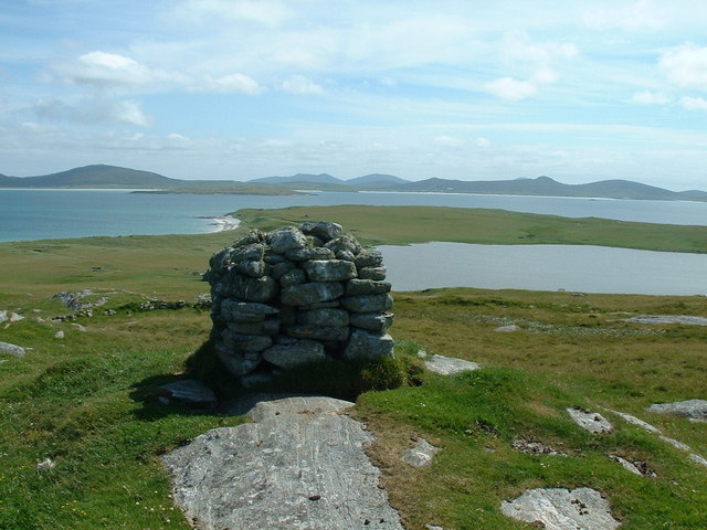
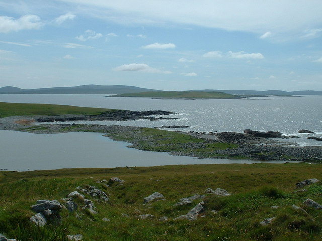
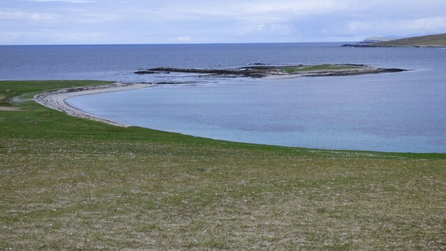
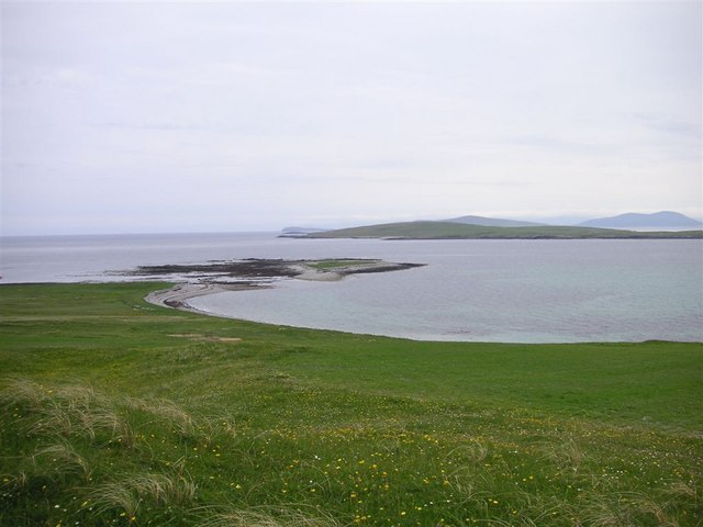
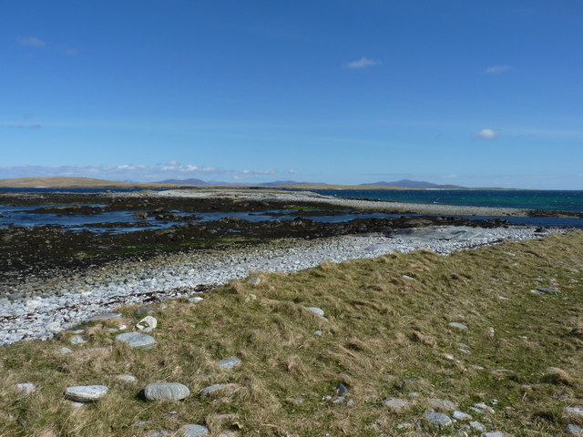
Situated amidst the rugged and scenic landscape of the Scottish Highlands, Loch Beag offers breathtaking views of rolling hills and dense forests. The loch itself is relatively small in size, spanning approximately 200 meters in length and 100 meters in width. Its depth varies throughout, with the deepest point reaching around 15 meters.

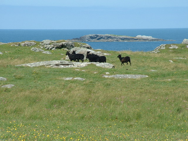
The calm and clear waters of Loch Beag are home to a diverse range of aquatic flora and fauna. The loch supports a variety of freshwater fish species, including brown trout and perch. It is also a haven for birdlife, attracting a number of species such as ducks, swans, and herons. The surrounding marshland is a fertile habitat for wetland plants and supports an array of wildlife, including otters and water voles.

Visitors to Loch Beag can take advantage of several recreational activities. Anglers can enjoy fishing for trout, while birdwatchers can observe the diverse avian population. The loch is also suitable for kayaking and canoeing, allowing visitors to explore its calm waters and surrounding wetlands at their leisure.

In summary, Loch Beag is a small but beautiful freshwater loch in Inverness-shire, Scotland. With its stunning scenery, diverse wildlife, and opportunities for outdoor activities, it offers a peaceful and enjoyable experience for nature lovers and visitors to the Scottish Highlands.

If you have any feedback on the listing, please let us know in the comments section below.
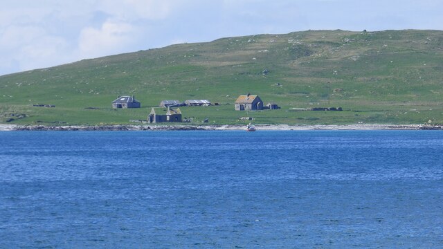
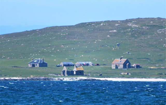
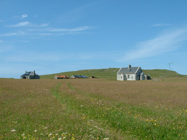
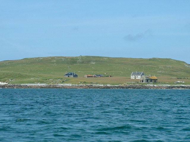
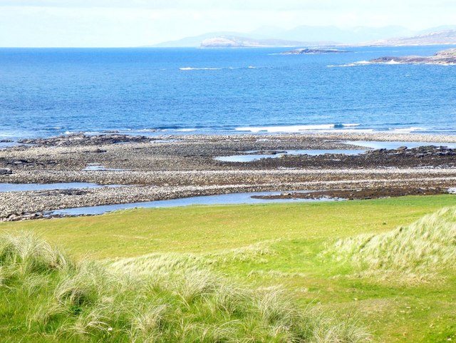
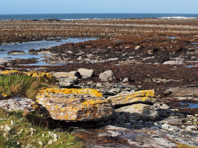
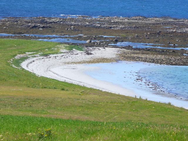
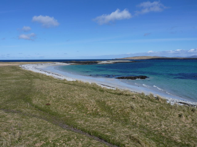
Loch Beag Images

Images are sourced within 2km of 57.705232/-7.2909961 or Grid Reference NF8480. Thanks to Geograph Open Source API. All images are credited.

Houses on Boreray/Boraraigh
Boreray from Rubha Bhoisnis Looking across to the buildings on Boreray from Rubha Bhoisnis on Berneray. Signs of habitation on the island with two houses that look weatherproof, plus a red tractor and dinghy with outboard motor, neither of which are likely to be of much use to the dozens of small white specs which are grazing sheep.
Boreray from Rubha Bhoisnis
Looking across to the buildings on Boreray from Rubha Bhoisnis on Berneray. Signs of habitation on the island with two houses that look weatherproof, plus a red tractor and dinghy with outboard motor, neither of which are likely to be of much use to the dozens of small white specs which are grazing sheep.
Houses on Boreray (North Uist) Boreray has a population of 1. I visited it on a boat trip organised from Berneray in July 2006. I believe the photo shows the residents house and another house which is let to viitors.
Houses on Boreray (North Uist)
Boreray has a population of 1. I visited it on a boat trip organised from Berneray in July 2006. I believe the photo shows the residents house and another house which is let to viitors.
Boreray (North Uist) from the sea Picture was taken from a boat at anchor off the beach, before boarding a dinghy to land on the beach.
Boreray (North Uist) from the sea
Picture was taken from a boat at anchor off the beach, before boarding a dinghy to land on the beach.
Boreray Sheep Some of the many blcak sheep grazing on Boreray (North Uist).
Boreray Sheep
Some of the many blcak sheep grazing on Boreray (North Uist).
View from Mullach Mor, Boreray, North Uist Looking SSE from Mullach Mor, over Loch Mor and towards North Uist.
View from Mullach Mor, Boreray, North Uist
Looking SSE from Mullach Mor, over Loch Mor and towards North Uist.
Mol Mor, Boreray, North Uist Looking over the narrow strip of land which separates Loch Mor from the sea.
Mol Mor, Boreray, North Uist
Looking over the narrow strip of land which separates Loch Mor from the sea.
Coastal Crevasse on Boreray North Uist A trap for the unwary walking along the Southwest coast of Boreray. As this feature does not appear on the map, the location may be slightly incorrect, but it is to the South of Loch Mor.
Coastal Crevasse on Boreray North Uist
A trap for the unwary walking along the Southwest coast of Boreray. As this feature does not appear on the map, the location may be slightly incorrect, but it is to the South of Loch Mor.
Beach on Boreray North Uist Looking at the beach from the machair.
Beach on Boreray North Uist
Looking at the beach from the machair.
Blackhouse ruins on Boreray North Uist Ruins of blackhouse near the South end of the beach on Boreray, North Uist. These ruins may date from the nineteenth century.
Blackhouse ruins on Boreray North Uist
Ruins of blackhouse near the South end of the beach on Boreray, North Uist. These ruins may date from the nineteenth century.
Eilean a' Mhòrain
Eilean a' Mhòrain
Aird a'Mhorrain Trig on a small hill that was probably once an island. Now its at the end of a very long beach.
Aird a'Mhorrain
Trig on a small hill that was probably once an island. Now its at the end of a very long beach.
Eilean a Mhorain Eilean a Mhorain is in the foreground; Boreray and Pabbay in the distance
Eilean a Mhorain
Eilean a Mhorain is in the foreground; Boreray and Pabbay in the distance
View from Àird a' Mhòrain Looking north to the headland with the hills of the Isle of Harris in the distance
View from Àird a' Mhòrain
Looking north to the headland with the hills of the Isle of Harris in the distance
End of the Grenitote peninsula At the end of the peninsula there is a large area of flat rocks, exposed at low tide.
End of the Grenitote peninsula
At the end of the peninsula there is a large area of flat rocks, exposed at low tide.
Lon Hulabhaig Grass, sandy bay and rocks at the northern tip of Aird a' Mhorain, North Uist.
Lon Hulabhaig
Grass, sandy bay and rocks at the northern tip of Aird a' Mhorain, North Uist.
Across Hamaran on the Greinetobht peninsula Hamaran is the name given to the lower slopes of the Àird a’ Mhòrain dune hills, whilst Mol nan Easgann appears to be the shallow bay to the east. Boraraigh lies just offshore to the north.
Across Hamaran on the Greinetobht peninsula
Hamaran is the name given to the lower slopes of the Àird a’ Mhòrain dune hills, whilst Mol nan Easgann appears to be the shallow bay to the east. Boraraigh lies just offshore to the north.
Lòn Hulabhaig The wave-cut rocks at the northern end of the Greinetobht peninsula, with the small islets of Eilean a'Mhòrain amongst them.
Lòn Hulabhaig
The wave-cut rocks at the northern end of the Greinetobht peninsula, with the small islets of Eilean a'Mhòrain amongst them.
Show me another place!

Loch Beag is located at Grid Ref: NF8480 (Lat: 57.705232, Lng: -7.2909961)

Unitary Authority: Na h-Eileanan an Iar

Police Authority: Highlands and Islands

What 3 Words

///dishes.marinated.visit. Near Lochmaddy, Na h-Eileanan Siar

Related Wikis

Boreray, North Uist

Boreray (Scottish Gaelic: Boraraigh) is an island with a single croft, lying 2 kilometres (1.2 mi) north of North Uist in the Outer Hebrides of Scotland...

Lingeigh, North Uist

Lingeigh is an uninhabited island off North Uist, south east of Boreray. It is separated from North Uist by Traigh Lingeigh. == Footnotes ==

North Uist Machair and Islands

The North Uist Machair and Islands is a protected wetland area in the Outer Hebrides of Scotland. A total of 4,705 hectares comprises seven separate areas...

Oronsay, Outer Hebrides

Oronsay (Gaelic Orasaigh) is a tidal island off North Uist in the Outer Hebrides. Lying to the north of Vallaquie Strand, the island has been uninhabited...

Nearby Amenities

Located within 500m of 57.705232,-7.2909961
Source: PGS
Lat/Long: 57.7022544/-7.2867575
Source: PGS
Lat/Long: 57.7020561/-7.2906439
Source: PGS
Lat/Long: 57.7022282/-7.2913763
Source: PGS
Lat/Long: 57.7024856/-7.2912927
Source: PGS
Lat/Long: 57.7026659/-7.2920002
Source: PGS
Lat/Long: 57.7028919/-7.2924732
Source: PGS
Lat/Long: 57.7030878/-7.2928342
Source: PGS
Lat/Long: 57.7033885/-7.2930006
Source: PGS
Lat/Long: 57.703837/-7.2933438
Source: PGS
Lat/Long: 57.70394/-7.2939676
Source: PGS
Lat/Long: 57.7040467/-7.2948169
Source: PGS
Lat/Long: 57.7043139/-7.2948338
Source: PGS
Lat/Long: 57.7044997/-7.294961
Source: PGS
Lat/Long: 57.704844/-7.2952033
Source: PGS
Lat/Long: 57.7051556/-7.2954617
Source: PGS
Lat/Long: 57.7054285/-7.2956466
Source: PGS
Lat/Long: 57.7057828/-7.2959967
Source: PGS
Lat/Long: 57.7060785/-7.2962742
Source: PGS
Lat/Long: 57.7063888/-7.2966259
Source: PGS
Lat/Long: 57.7064816/-7.2972336
Source: PGS
Lat/Long: 57.7067451/-7.2981196
Source: PGS
Lat/Long: 57.7082416/-7.2969218
Source: PGS
Lat/Long: 57.7084841/-7.2963982
The data included in this document is from www.openstreetmap.org. The data is made available under ODbL.

Have you been to Loch Beag?

Leave your review of Loch Beag below (or comments, questions and feedback).