Loch nan Cuileag

Lake, Pool, Pond, Freshwater Marsh in Inverness-shire

Scotland

Loch nan Cuileag

End of the road at Àird Mhòr
End of the road at Àird Mhòr Credit: Hugh Venables

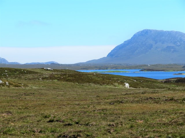
Loch nan Cuileag, located in Inverness-shire, Scotland, is a picturesque freshwater loch surrounded by magnificent landscapes. With its serene beauty and abundant wildlife, it is a popular destination for nature enthusiasts and tourists.

Covering an area of approximately 20 hectares, Loch nan Cuileag is a relatively small body of water nestled in the heart of the Scottish Highlands. Its name translates to "Loch of the Flies," which is believed to refer to the presence of insects that inhabit the area during certain seasons.

The loch is known for its crystal-clear waters, which reflect the surrounding hills and lush vegetation. It is home to a diverse range of aquatic plants, including water lilies and reeds, which provide a habitat for numerous species of fish, amphibians, and waterfowl.

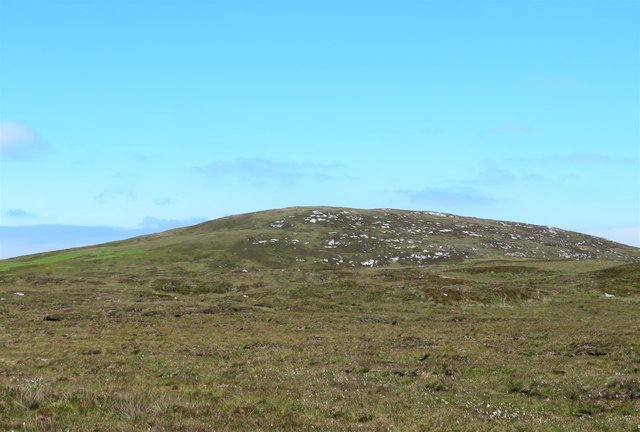
The surrounding area of Loch nan Cuileag is characterized by rocky outcrops, heather-covered hills, and dense forests, adding to the loch's natural charm. It is a haven for birdwatchers, as various species of waterfowl, such as ducks, swans, and herons, can be spotted along the shoreline.

Visitors to Loch nan Cuileag can enjoy a variety of outdoor activities, including fishing, boating, and walking along the tranquil paths that encircle the loch. The loch's peaceful atmosphere and breathtaking scenery also make it an ideal spot for picnics and photography.

Overall, Loch nan Cuileag offers a unique and tranquil experience for those seeking to immerse themselves in the beauty of the Scottish countryside. Its diverse ecosystem, stunning surroundings, and recreational opportunities make it a must-visit destination for nature lovers and adventurers alike.

If you have any feedback on the listing, please let us know in the comments section below.

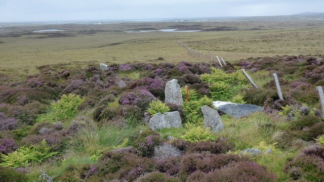
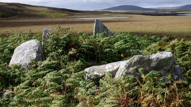
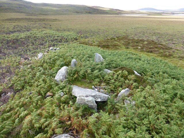
Loch nan Cuileag Images

Images are sourced within 2km of 57.527201/-7.2881973 or Grid Reference NF8360. Thanks to Geograph Open Source API. All images are credited.

End of the road at Àird Mhòr
Outside Talla Chairinis, North Uist
Blar Chairinis
Blar Chairinis
Moorcroft Campsite at low tide
Field and houses at Carinish
Bagh a’ Ghriasaiche
Bagh a’ Ghriasaiche
Fèithe na Fala - The ditch of blood
Free Church, Cairinis
A not very useful gate
Track above Loch Creag nan Speireag
Cotton grass, Creag nan Speireag
East from Creag nan Speireag
View towards Beinn na Coille
Caravat Barp chambered cairn and shieling
Carinish stone circle
Craonaval chambered cairn
Oban Nam Fiadh chambered cairn
Show me another place!

Loch nan Cuileag is located at Grid Ref: NF8360 (Lat: 57.527201, Lng: -7.2881973)

Unitary Authority: Na h-Eileanan an Iar

Police Authority: Highlands and Islands

What 3 Words

///pumpkin.fury.dumpling. Near Balivanich, Na h-Eileanan Siar

Related Wikis

Carinish

Carinish (Scottish Gaelic: Càirinis), is a hamlet on North Uist, in the Outer Hebrides, Scotland. It is in the south of the island, about two miles (three...

Battle of Carinish

The Battle of Carinish was a Scottish clan battle fought in North Uist in 1601. It was part of a year of feuding between Clan MacLeod of Dunvegan and the...

Teampull na Trionaid

Teampull na Trionaid ("trinity church") is a ruined 13th-century Augustinian nunnery at Carinish, on North Uist, in the Outer Hebrides of Scotland. �...

Bail' Iochdrach

Bail' Iochdrach or Baliochrach (Scottish Gaelic: Am Baile Ìochdrach) is a village on Benbecula in the Outer Hebrides, Scotland. Baliochrach is within the...

Nearby Amenities

Located within 500m of 57.527201,-7.2881973
Description: Guide post lain on the ground, possibly never installed
Information: guidepost
Tourism: information
Lat/Long: 57.5269516/-7.2957225
Information: guidepost
Osmc Symbol: yellow_bar
Symbol: Yellow bar
Tourism: information
Lat/Long: 57.5231361/-7.2849301
Description: Hebridean Way
Information: guidepost
Tourism: information
Lat/Long: 57.5251763/-7.2877497
Description: Hebridean Way
Information: guidepost
Tourism: information
Lat/Long: 57.5246383/-7.2864435
Description: Hebridean Way
Information: guidepost
Tourism: information
Lat/Long: 57.524308/-7.285817
Information: guidepost
Osmc Symbol: yellow_bar
Symbol: Yellow bar
Tourism: information
Lat/Long: 57.5251687/-7.2854093
Information: guidepost
Osmc Symbol: yellow_bar
Symbol: Yellow bar
Tourism: information
Lat/Long: 57.5265092/-7.2852867
Description: unmarked
Information: guidepost
Tourism: information
Lat/Long: 57.5269268/-7.2910643
Description: Hebridean Way
Information: guidepost
Tourism: information
Lat/Long: 57.5265125/-7.2909163
Description: Hebridean Way
Information: guidepost
Tourism: information
Lat/Long: 57.5259787/-7.2901799
Information: guidepost
Osmc Symbol: yellow_bar
Symbol: Yellow bar
Tourism: information
Lat/Long: 57.5249919/-7.2909192
Description: unmarked
Information: guidepost
Tourism: information
Lat/Long: 57.5268604/-7.2944191
Description: unmarked
Information: guidepost
Tourism: information
Lat/Long: 57.5267436/-7.2932757
Description: unmarked
Information: guidepost
Tourism: information
Lat/Long: 57.5269504/-7.2924377
Description: unmarked
Information: guidepost
Tourism: information
Lat/Long: 57.526918/-7.2916178
Description: unmarked
Information: guidepost
Tourism: information
Lat/Long: 57.5257806/-7.289925
Description: Hebriden Way and Yellow Stripe
Information: guidepost
Tourism: information
Lat/Long: 57.5243082/-7.2910264
Description: Green base with red top
Information: guidepost
Tourism: information
Lat/Long: 57.5237324/-7.2906169
Description: Green base with red top
Information: guidepost
Tourism: information
Lat/Long: 57.5235819/-7.2900513
The data included in this document is from www.openstreetmap.org. The data is made available under ODbL.

Have you been to Loch nan Cuileag?

Leave your review of Loch nan Cuileag below (or comments, questions and feedback).