Loch na Craoibhe Bige

Lake, Pool, Pond, Freshwater Marsh in Inverness-shire

Scotland

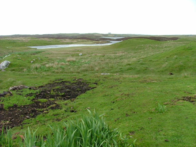
Loch na Craoibhe Bige
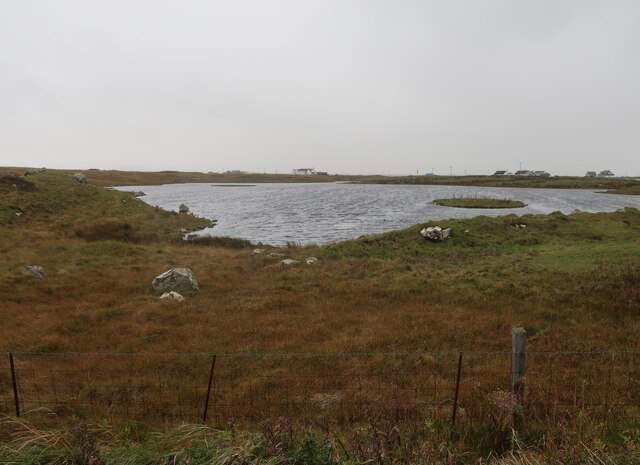
Unnamed loch on Benbecula
Unnamed loch on Benbecula Credit: Hugh Venables

The requested URL returned error: 429 Too Many Requests

If you have any feedback on the listing, please let us know in the comments section below.

Loch na Craoibhe Bige Images

Images are sourced within 2km of 57.419413/-7.327212 or Grid Reference NF8049. Thanks to Geograph Open Source API. All images are credited.

Unnamed loch on Benbecula
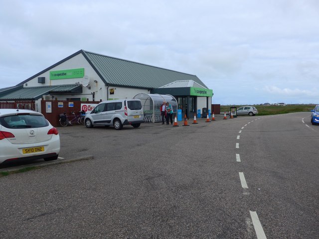
The Co-operative store, Creagorry (Benbecula) A good sized shop.  Just don't ask when the newspapers come in;  it's usually mid-afternoon!
The Co-operative store, Creagorry (Benbecula)
A good sized shop. Just don't ask when the newspapers come in; it's usually mid-afternoon!
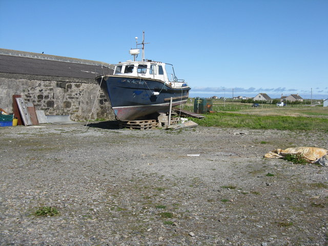
Boat in an hotel yard In the car park of the Isle of Benbecula Hotel at Creagorry/Creag Ghoraidh.
Boat in an hotel yard
In the car park of the Isle of Benbecula Hotel at Creagorry/Creag Ghoraidh.
Salt marsh at Creagorry/Creag Ghoraidh Directly across the road [A865] from the Creagorry Hotel.
Salt marsh at Creagorry/Creag Ghoraidh
Directly across the road [A865] from the Creagorry Hotel.
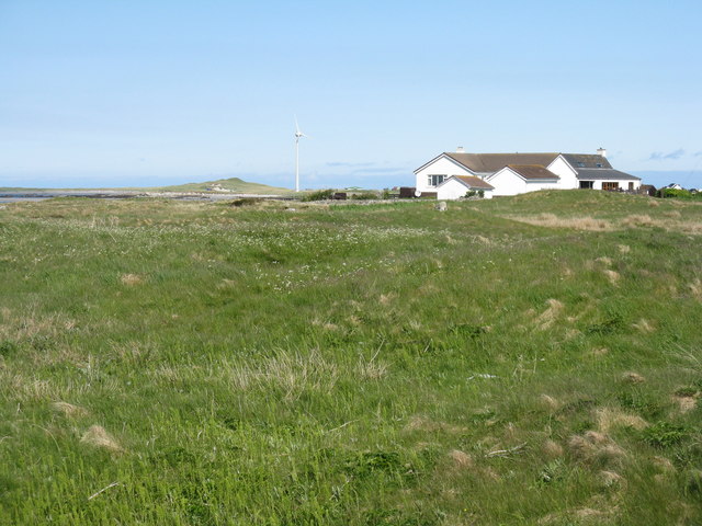
Houses at Creagorry/Creag Ghoraidh Overlooking sea and salt marsh.
Houses at Creagorry/Creag Ghoraidh
Overlooking sea and salt marsh.
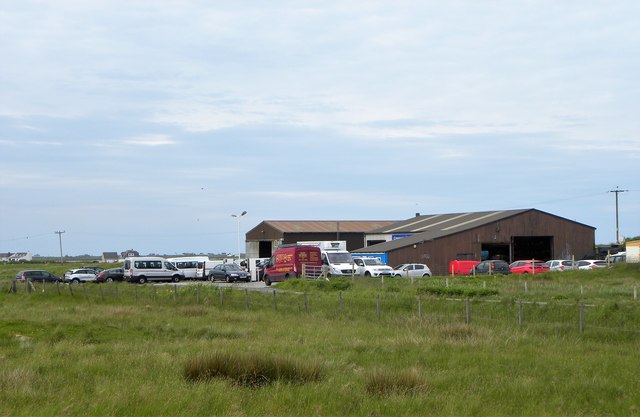
Garage by the A865 Filling station and workshops by the A865 on Benbecula. Fuel might be expensive on the Outer Hebrides, but it's still cheaper than motorway prices.
Garage by the A865
Filling station and workshops by the A865 on Benbecula. Fuel might be expensive on the Outer Hebrides, but it's still cheaper than motorway prices.
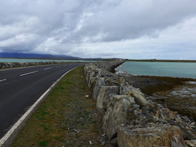
The causeway to South Uist from Benbecula
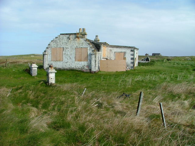
Ruined croft house, 5-6 Hacklet (Hacleit), in 1995 Looking northeast across upper Loch Chearabhaigh (a sea loch) towards the scattered township of Kilerivagh.

According to local information from Mary Harman in 2018, the house is still there with the mid gable with chimney standing, but the roof is entirely gone. The windows are still clear, and the winnowing hole in the barn at the left hand side of the picture is still there. The telegraph pole behind the house, being redundant is no longer there.

The building probably dates from the 19th century and is Category B listed [<span class="nowrap"><a title="http://portal.historicenvironment.scot/designation/LB18754" rel="nofollow ugc noopener" href="http://portal.historicenvironment.scot/designation/LB18754">Link</a><img style="margin-left:2px;" alt="External link" title="External link - shift click to open in new window" src="https://s1.geograph.org.uk/img/external.png" width="10" height="10"/></span>]. It also appears on the Buildings at Risk Register [<span class="nowrap"><a title="https://www.buildingsatrisk.org.uk/search/keyword/hacklet/event_id/898243/building_name/5-6-hacklet" rel="nofollow ugc noopener" href="https://www.buildingsatrisk.org.uk/search/keyword/hacklet/event_id/898243/building_name/5-6-hacklet">Link</a><img style="margin-left:2px;" alt="External link" title="External link - shift click to open in new window" src="https://s1.geograph.org.uk/img/external.png" width="10" height="10"/></span>].
Ruined croft house, 5-6 Hacklet (Hacleit), in 1995
Looking northeast across upper Loch Chearabhaigh (a sea loch) towards the scattered township of Kilerivagh. According to local information from Mary Harman in 2018, the house is still there with the mid gable with chimney standing, but the roof is entirely gone. The windows are still clear, and the winnowing hole in the barn at the left hand side of the picture is still there. The telegraph pole behind the house, being redundant is no longer there. The building probably dates from the 19th century and is Category B listed [LinkExternal link]. It also appears on the Buildings at Risk Register [LinkExternal link].
Northern end of the South Ford causeway The causeway and short bridge was officially opened in November 1982 during a howling gale. The causeway replaced an 82 span bridge which opened in 1942, but which was in a poor state of repair by the end of the 1970s.
Northern end of the South Ford causeway
The causeway and short bridge was officially opened in November 1982 during a howling gale. The causeway replaced an 82 span bridge which opened in 1942, but which was in a poor state of repair by the end of the 1970s.
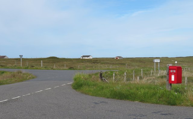
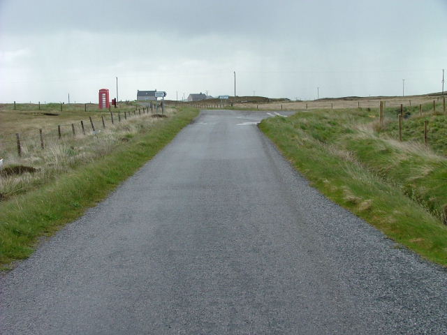
Postbox at the junction A junction of minor roads at Haclait. Stuart Wilding's photo from 2008 shows a telephone kiosk next to the postbox, but that is no longer there - possibly blown away in a Hebridean gale?
Postbox at the junction
A junction of minor roads at Haclait. Stuart Wilding's photo from 2008 shows a telephone kiosk next to the postbox, but that is no longer there - possibly blown away in a Hebridean gale?
Croft beyond the loch Looking across Loch na Craoibhe Bige [which might mean 'loch of the small tree'] towards some grassland on a Benbecula croft.
Croft beyond the loch
Looking across Loch na Craoibhe Bige [which might mean 'loch of the small tree'] towards some grassland on a Benbecula croft.
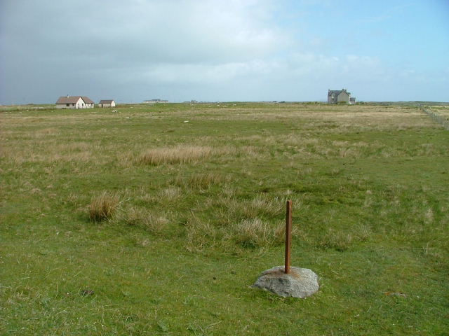
Croftland at Torlum A redundant fencepost looks towards houses at Lionacleit.
Croftland at Torlum
A redundant fencepost looks towards houses at Lionacleit.
Loch na Craoibhe Bige From the B891 road to Port Pheadair.
Loch na Craoibhe Bige
From the B891 road to Port Pheadair.
Road Junction and Telephone box At Haclait.
Road Junction and Telephone box
At Haclait.
Moorland and Loch na h-Aibhne Baine Northeast of Creag Ghoraidh, Benbecula.
Moorland and Loch na h-Aibhne Baine
Northeast of Creag Ghoraidh, Benbecula.
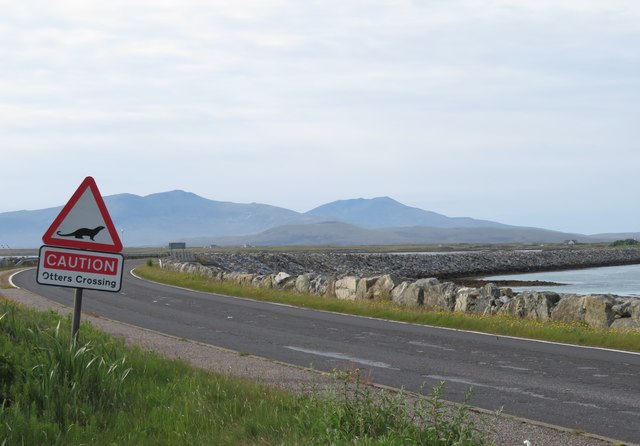
Causeway from Benbecula to South Uist. Houses at Càrnan on South Uist can be seen in the distance.
Causeway from Benbecula to South Uist.
Houses at Càrnan on South Uist can be seen in the distance.
Benbecula to South Uist Causeway House at Carnan can be seen on the other side of the causeway.
Benbecula to South Uist Causeway
House at Carnan can be seen on the other side of the causeway.
Loch Dubh Mor 5.43am, on an early morning walk on Benbecula. The road crossed this little loch. The distant mountains are on South Uist, the next island to the south.
Loch Dubh Mor
5.43am, on an early morning walk on Benbecula. The road crossed this little loch. The distant mountains are on South Uist, the next island to the south.
Show me another place!

Loch na Craoibhe Bige is located at Grid Ref: NF8049 (Lat: 57.419413, Lng: -7.327212)

Unitary Authority: Na h-Eileanan an Iar

Police Authority: Highlands and Islands

What 3 Words

///goggles.octagonal.blushed. Near Balivanich, Na h-Eileanan Siar

Related Wikis

Uist

Uist is a group of six islands that are part of the Outer Hebridean Archipelago, which is part of the Outer Hebrides of Scotland. North Uist and South...

Benbecula

Benbecula ( ; Scottish Gaelic: Beinn nam Fadhla or Beinn na Faoghla) is an island of the Outer Hebrides in the Atlantic Ocean off the west coast of Scotland...

Borve Castle, Benbecula

Borve Castle, also known as Castle Wearie, and Caisteal Bhuirgh in Scottish Gaelic, is a ruined 14th-century tower house, located at the south-west of...

Grimsay (South East Benbecula)

Grimsay, south east of Benbecula is a tidal island of the Outer Hebrides. It is connected to Benbecula by a causeway which carries the B891. In the 2001...

Nearby Amenities

Located within 500m of 57.419413,-7.327212
Passing Place
Lat/Long: 57.4176765/-7.3223454
Passing Place
Lat/Long: 57.4193756/-7.3288325
Turning Circle
Turning Circle: knuckle
Lat/Long: 57.4186709/-7.3276212
Passing Place
Lat/Long: 57.4203887/-7.3352822
Power: pole
Lat/Long: 57.422496/-7.3293185
Power: pole
Lat/Long: 57.4216829/-7.3290208
Power: pole
Lat/Long: 57.4208452/-7.3286989
Power: pole
Lat/Long: 57.4203426/-7.3285112
Power: pole
Lat/Long: 57.4192305/-7.330142
Power: pole
Lat/Long: 57.4186166/-7.3290597
Power: pole
Lat/Long: 57.4198212/-7.3283207
Power: pole
Lat/Long: 57.4186896/-7.3279117
Power: pole
Lat/Long: 57.4174684/-7.3303565
Power: pole
Lat/Long: 57.4165699/-7.3306087
Power: pole
Lat/Long: 57.4159979/-7.3302332
Power: pole
Lat/Long: 57.4153407/-7.3297504
Power: pole
Lat/Long: 57.4152627/-7.3290959
Power: pole
Lat/Long: 57.4156845/-7.3283342
Power: pole
Lat/Long: 57.416099/-7.3275885
Power: pole
Lat/Long: 57.416749/-7.3277816
Power: pole
Lat/Long: 57.4172806/-7.3278433
Power: pole
Lat/Long: 57.4180057/-7.3280123
Power: pole
Lat/Long: 57.4178612/-7.3275711
Power: pole
Lat/Long: 57.416957/-7.3272425
Power: pole
Lat/Long: 57.4162181/-7.3269832
Power: pole
Lat/Long: 57.4153884/-7.3266417
Power: pole
Lat/Long: 57.4168938/-7.3212363
Power: pole
Lat/Long: 57.4171983/-7.3220427
Power: pole
Lat/Long: 57.41752/-7.3228835
Power: pole
Lat/Long: 57.4180464/-7.3239886
Power: pole
Lat/Long: 57.4182754/-7.3245436
Power: pole
Lat/Long: 57.417447/-7.3243498
Power: pole
Lat/Long: 57.4173977/-7.325663
Power: pole
Lat/Long: 57.4173755/-7.3268287
Power: pole
Lat/Long: 57.4180725/-7.3307438
Power: pole
Lat/Long: 57.4186434/-7.3310816
Power: pole
Lat/Long: 57.4191189/-7.3313659
Power: pole
Lat/Long: 57.4198953/-7.331827
Power: pole
Lat/Long: 57.4200372/-7.3318013
Power: pole
Lat/Long: 57.4201209/-7.3326313
Power: pole
Lat/Long: 57.4200398/-7.3315916
Power: pole
Lat/Long: 57.4200429/-7.3311926
Power: pole
Lat/Long: 57.4200029/-7.3294304
Passing Place
Lat/Long: 57.420149/-7.3331499
Passing Place
Lat/Long: 57.4197958/-7.3308087
Passing Place
Lat/Long: 57.4187496/-7.3265889
Passing Place
Lat/Long: 57.4171729/-7.3209658
Power: pole
Lat/Long: 57.4224781/-7.3321143
Power: pole
Lat/Long: 57.4216837/-7.3319172
Power: pole
Lat/Long: 57.4209298/-7.3317509
Power: pole
Lat/Long: 57.4200662/-7.3306267
Power: pole
Lat/Long: 57.4183799/-7.3251189
Power: pole
Lat/Long: 57.4185776/-7.3242929
Power: pole
Lat/Long: 57.4187403/-7.3244049
The data included in this document is from www.openstreetmap.org. The data is made available under ODbL.

Have you been to Loch na Craoibhe Bige?

Leave your review of Loch na Craoibhe Bige below (or comments, questions and feedback).