Loch Olabhat

Lake, Pool, Pond, Freshwater Marsh in Inverness-shire

Scotland

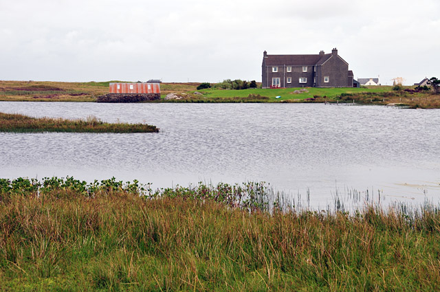
Loch Olabhat
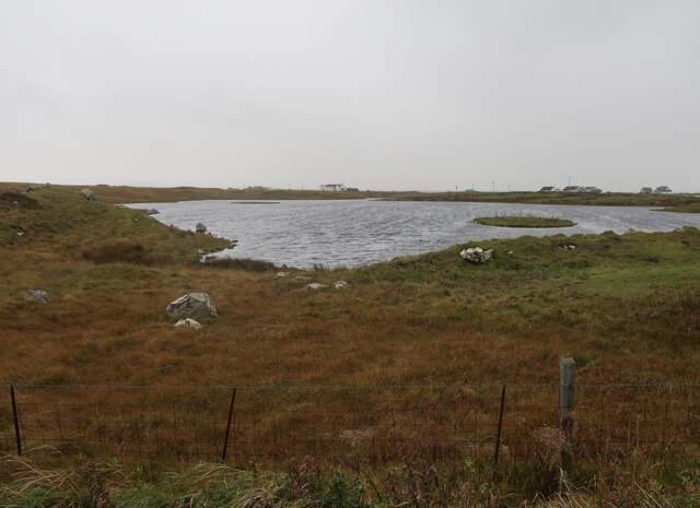
Unnamed loch on Benbecula
Unnamed loch on Benbecula Credit: Hugh Venables

The requested URL returned error: 429 Too Many Requests

If you have any feedback on the listing, please let us know in the comments section below.

Loch Olabhat Images

Images are sourced within 2km of 57.434447/-7.3330235 or Grid Reference NF8050. Thanks to Geograph Open Source API. All images are credited.
Unnamed loch on Benbecula
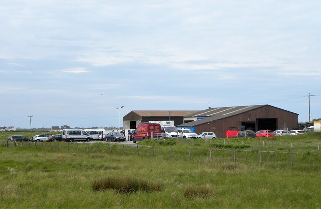
Garage by the A865 Filling station and workshops by the A865 on Benbecula. Fuel might be expensive on the Outer Hebrides, but it's still cheaper than motorway prices.
Garage by the A865
Filling station and workshops by the A865 on Benbecula. Fuel might be expensive on the Outer Hebrides, but it's still cheaper than motorway prices.
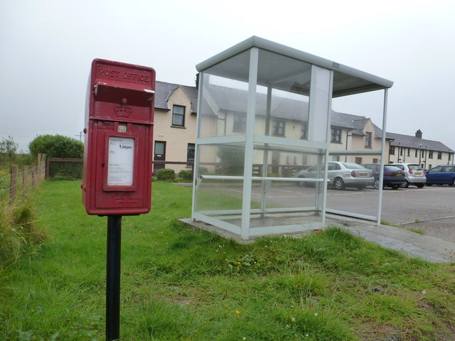
Griminish: postbox № HS7 43, Church Hill This postbox stands in probably what would be considered the centre of the village, by a cluster of houses which we see in the background, through the walls of a bus shelter. The box is emptied at 1:30pm on weekdays and at 9:15am on Saturdays.

Griminish did have a post office from 1 June 1938 until some time in 1979. I believe the post office was a few hundred yards to the west of here.
Griminish: postbox № HS7 43, Church Hill
This postbox stands in probably what would be considered the centre of the village, by a cluster of houses which we see in the background, through the walls of a bus shelter. The box is emptied at 1:30pm on weekdays and at 9:15am on Saturdays. Griminish did have a post office from 1 June 1938 until some time in 1979. I believe the post office was a few hundred yards to the west of here.
Croft beyond the loch Looking across Loch na Craoibhe Bige [which might mean 'loch of the small tree'] towards some grassland on a Benbecula croft.
Croft beyond the loch
Looking across Loch na Craoibhe Bige [which might mean 'loch of the small tree'] towards some grassland on a Benbecula croft.
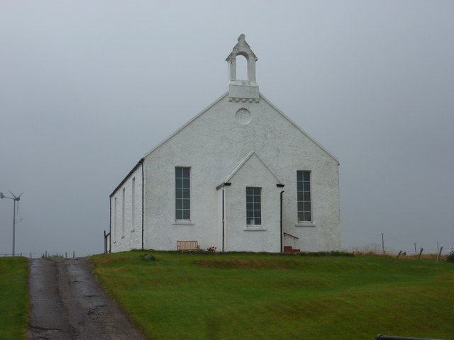
Griminish: Benbecula parish church Situated centrally on the island, this church is dated AD1885 below the little tower.
Griminish: Benbecula parish church
Situated centrally on the island, this church is dated AD1885 below the little tower.
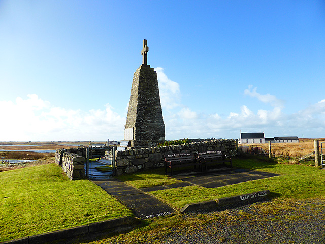
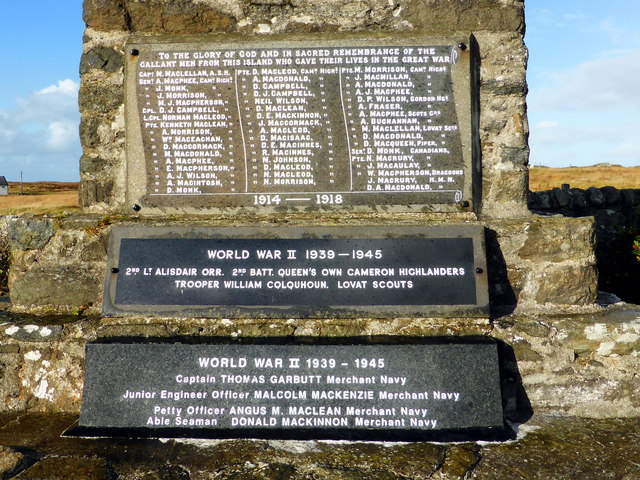
Benbecula War Memorial See also <a href="https://www.geograph.org.uk/photo/4244201">NF8051 : Benbecula War Memorial</a> and <span class="nowrap"><a title="http://warmemscot.s4.bizhat.com/warmemscot-post-31198.html" rel="nofollow ugc noopener" href="http://warmemscot.s4.bizhat.com/warmemscot-post-31198.html">Link</a><img style="margin-left:2px;" alt="External link" title="External link - shift click to open in new window" src="https://s1.geograph.org.uk/img/external.png" width="10" height="10"/></span>
Benbecula War Memorial
Benbecula War Memorial A sadly high number of Great War casualties, given the size of the island. Mostly Cameron Highlanders, the various battalions of which took part in most of the major battles of the war.

See also <a href="https://www.geograph.org.uk/photo/4244159">NF8051 : Benbecula War Memorial</a> and <span class="nowrap"><a title="http://warmemscot.s4.bizhat.com/warmemscot-post-31198.html" rel="nofollow ugc noopener" href="http://warmemscot.s4.bizhat.com/warmemscot-post-31198.html">Link</a><img style="margin-left:2px;" alt="External link" title="External link - shift click to open in new window" src="https://s1.geograph.org.uk/img/external.png" width="10" height="10"/></span>
Benbecula War Memorial
A sadly high number of Great War casualties, given the size of the island. Mostly Cameron Highlanders, the various battalions of which took part in most of the major battles of the war. See also NF8051 : Benbecula War Memorial and LinkExternal link
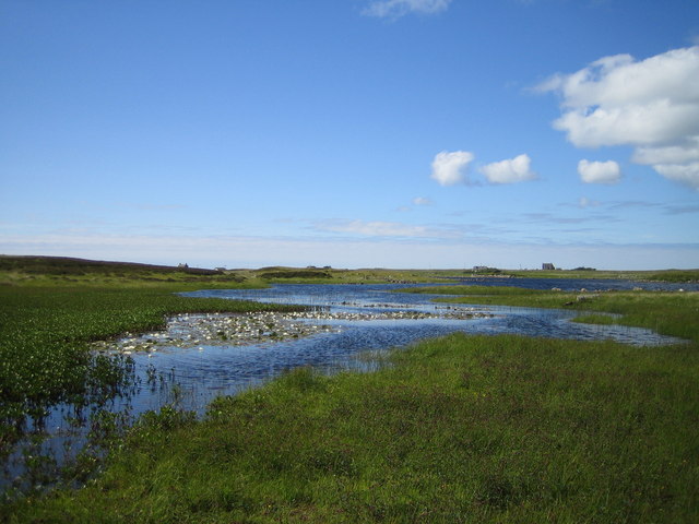
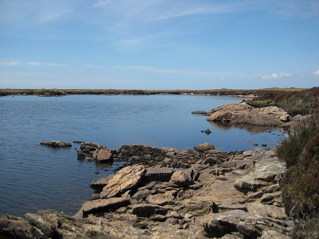
Loch Olabhat Loch Olavat for those of us with no Gaelic. Like many lochs on Benbecula it is difficult to say where the loch ends and the surrounding bog begins, squelch! The white specks in the foreground are water lilies.
Loch Olabhat
Loch Olavat for those of us with no Gaelic. Like many lochs on Benbecula it is difficult to say where the loch ends and the surrounding bog begins, squelch! The white specks in the foreground are water lilies.
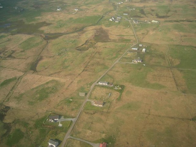
Torlum, Benbecula Viewed from the Loganair (British Airways) Twin Otter en route from Barra on approach to Benbecula Airport
Torlum, Benbecula
Viewed from the Loganair (British Airways) Twin Otter en route from Barra on approach to Benbecula Airport
Croft at Torlum Isle of Benbecula.
Croft at Torlum
Isle of Benbecula.
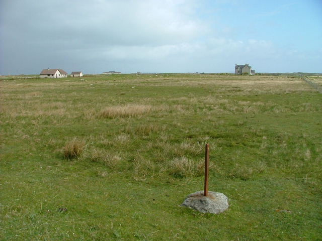
Croftland at Torlum A redundant fencepost looks towards houses at Lionacleit.
Croftland at Torlum
A redundant fencepost looks towards houses at Lionacleit.
Loch na Craoibhe Bige From the B891 road to Port Pheadair.
Loch na Craoibhe Bige
From the B891 road to Port Pheadair.
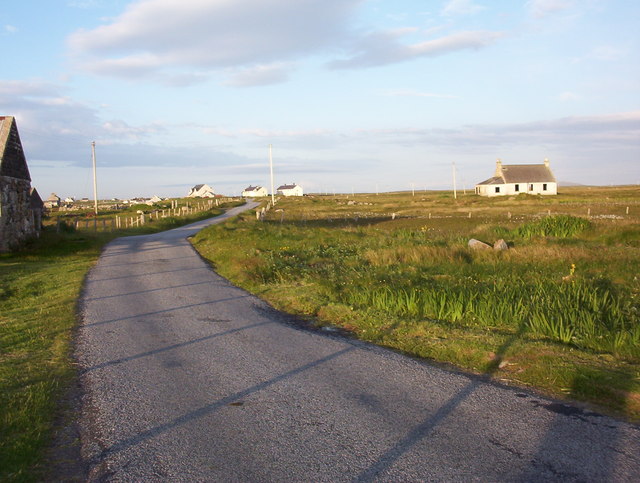
Griminis Looking east along the minor road at Griminis, Isle of Benbecula
Griminis
Looking east along the minor road at Griminis, Isle of Benbecula
White croft and waterlilies, Loch na Craoibhe Bige 6.30 on a June morning, Benbecula. The only sounds were redshanks, oystercatchers, and a snipe drumming overhead.
White croft and waterlilies, Loch na Craoibhe Bige
6.30 on a June morning, Benbecula. The only sounds were redshanks, oystercatchers, and a snipe drumming overhead.
Modern South Uist house Moss Cottage seen across Loch a' Ghara chruaidh.
Modern South Uist house
Moss Cottage seen across Loch a' Ghara chruaidh.
Bagh an Rubha Bhuidhe Myriad of islets in the shallow tidal area between Benbecula and South Uist.
<span class="nowrap"><a title="http://www.visithebrides.com/islands/suist/" rel="nofollow ugc noopener" href="http://www.visithebrides.com/islands/suist/">Link</a><img style="margin-left:2px;" alt="External link" title="External link - shift click to open in new window" src="https://s1.geograph.org.uk/img/external.png" width="10" height="10"/></span>
Bagh an Rubha Bhuidhe
Myriad of islets in the shallow tidal area between Benbecula and South Uist. LinkExternal link
Loch Mhic Mharcuis
Loch Mhic Mharcuis
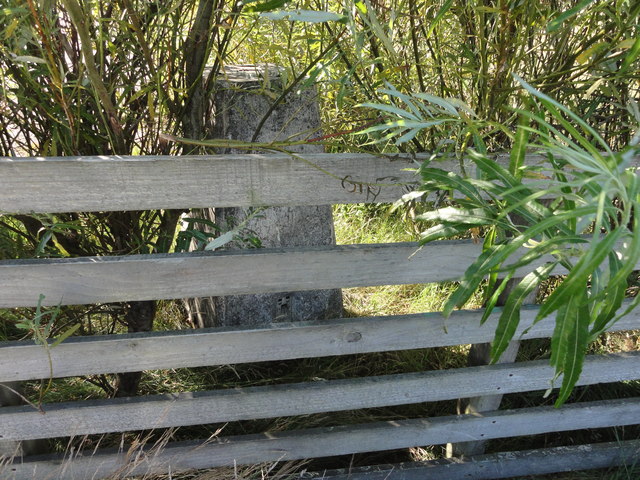
Ordnance Survey triangulation pillar Located in the garden of a dwelling.
Ordnance Survey triangulation pillar
Located in the garden of a dwelling.
Show me another place!

Loch Olabhat is located at Grid Ref: NF8050 (Lat: 57.434447, Lng: -7.3330235)

Unitary Authority: Na h-Eileanan an Iar

Police Authority: Highlands and Islands

What 3 Words

///imparting.deprives.horn. Near Balivanich, Na h-Eileanan Siar

Related Wikis

Uist

Uist is a group of six islands that are part of the Outer Hebridean Archipelago, which is part of the Outer Hebrides of Scotland. North Uist and South...

Benbecula

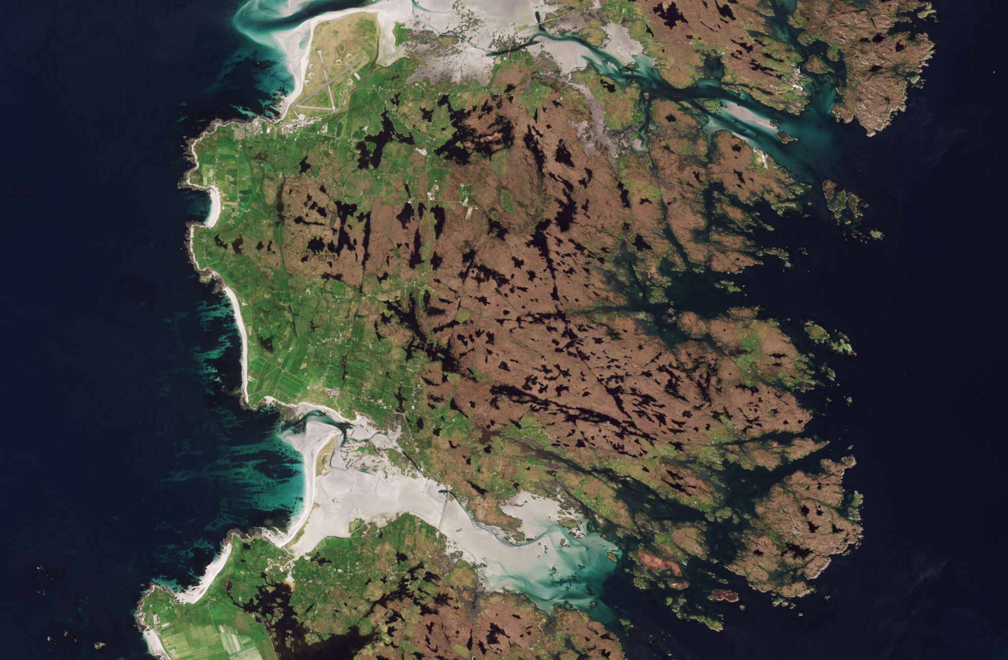
Benbecula ( ; Scottish Gaelic: Beinn nam Fadhla or Beinn na Faoghla) is an island of the Outer Hebrides in the Atlantic Ocean off the west coast of Scotland...

Borve Castle, Benbecula

Borve Castle, also known as Castle Wearie, and Caisteal Bhuirgh in Scottish Gaelic, is a ruined 14th-century tower house, located at the south-west of...

Nunton, Benbecula

Nunton (Scottish Gaelic: Baile nan Cailleach) is a settlement on Benbecula in the Outer Hebrides, Scotland. Nunton is within the parish of South Uist,...

Nearby Amenities

Located within 500m of 57.434447,-7.3330235
Passing Place
Lat/Long: 57.433716/-7.3315305
Passing Place
Lat/Long: 57.4347832/-7.3309455
Passing Place
Lat/Long: 57.4359221/-7.3311084
Passing Place
Lat/Long: 57.4308378/-7.3336597
Passing Place
Lat/Long: 57.4316783/-7.3330751
Passing Place
Lat/Long: 57.4371443/-7.3316868
Passing Place
Lat/Long: 57.4383322/-7.3326277
Dùn Ruadh
Historic: ruins
Lat/Long: 57.4366324/-7.337209
Power: pole
Lat/Long: 57.4377235/-7.3283985
Power: pole
Lat/Long: 57.4369425/-7.3289913
Power: pole
Lat/Long: 57.4361766/-7.3295612
Power: pole
Lat/Long: 57.4343352/-7.330787
Power: pole
Lat/Long: 57.4335266/-7.3311397
Power: pole
Lat/Long: 57.4325867/-7.3315609
Power: pole
Lat/Long: 57.4315292/-7.3321282
Power: pole
Lat/Long: 57.4308021/-7.3324768
Power: pole
Lat/Long: 57.4302188/-7.3322368
Power: pole
Lat/Long: 57.4301697/-7.3338922
Power: pole
Lat/Long: 57.4305209/-7.333679
Power: pole
Lat/Long: 57.4348516/-7.3305471
Power: pole
Lat/Long: 57.4356019/-7.3299889
Power: pole
Lat/Long: 57.4323088/-7.3317116
Barrier: cattle_grid
Lat/Long: 57.4309344/-7.3337661
The data included in this document is from www.openstreetmap.org. The data is made available under ODbL.

Have you been to Loch Olabhat?

Leave your review of Loch Olabhat below (or comments, questions and feedback).