Garvellachs

Island Group in Argyllshire

Scotland

Garvellachs

The Garvellachs Seen from around 3,000ft altitude.
The Garvellachs Credit: John Allan

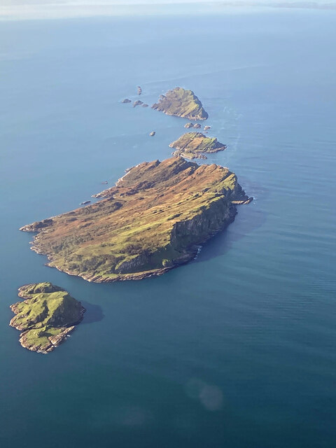
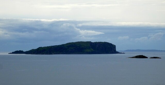
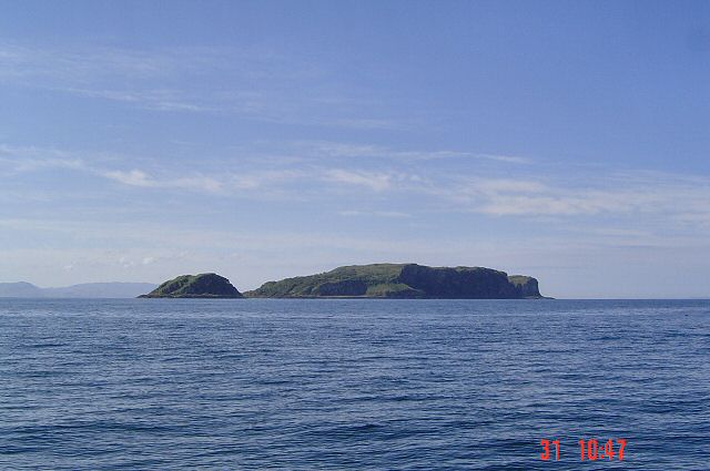
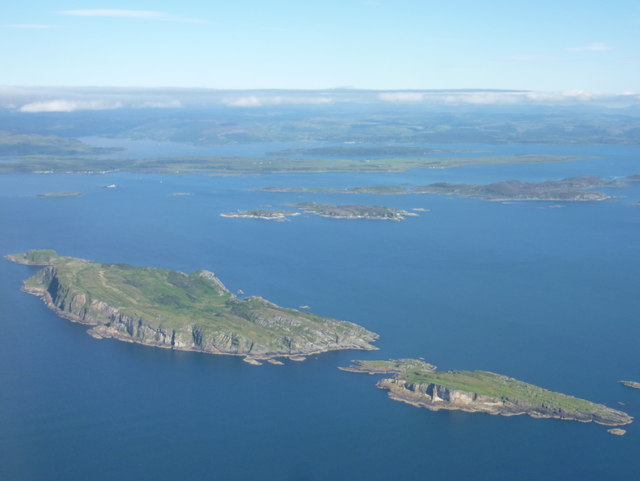
The Garvellachs are a group of islands located in the Inner Hebrides of Scotland, specifically in the Argyllshire region. Comprising of several small rocky islets, the archipelago is situated in the Firth of Lorn, approximately 10 miles southwest of Oban. The main islands in the group are Eileach an Naoimh, Eileach Mòr, and the Maiden Island, along with numerous smaller skerries and reefs.

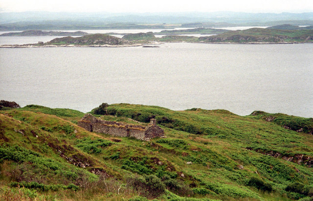
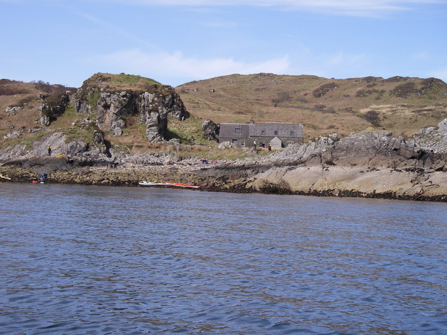
Eileach an Naoimh is the largest and most significant island in the Garvellachs. It holds historical and religious importance, as it was once home to an early Christian monastery founded by Saint Brendan in the 6th century. The ruins of this monastery, including a stone chapel and a beehive cell, can still be observed today. Eileach Mòr, on the other hand, is uninhabited and home to a lighthouse.

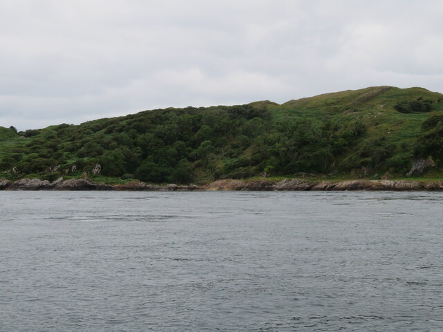
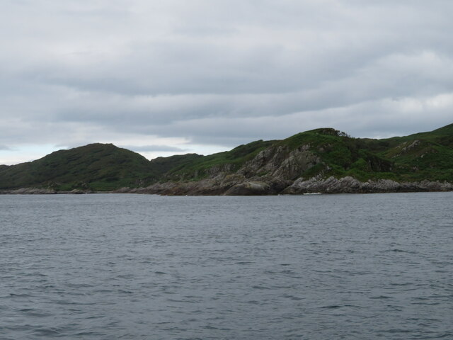
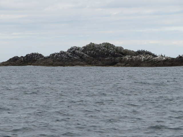
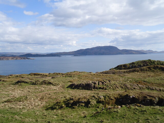
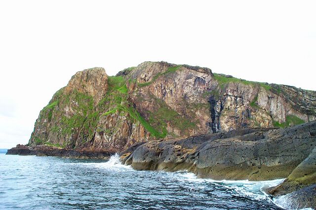
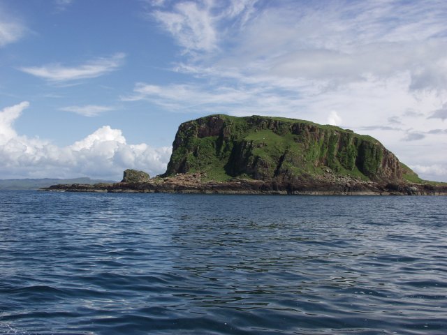
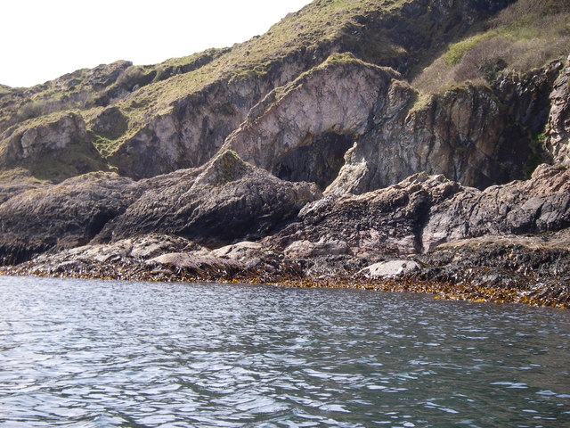
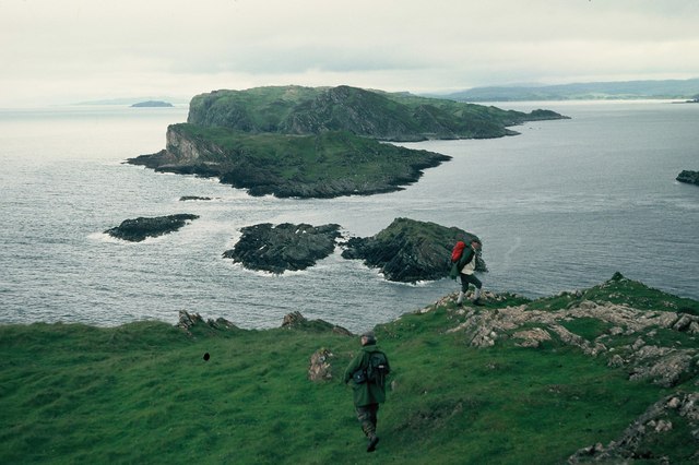
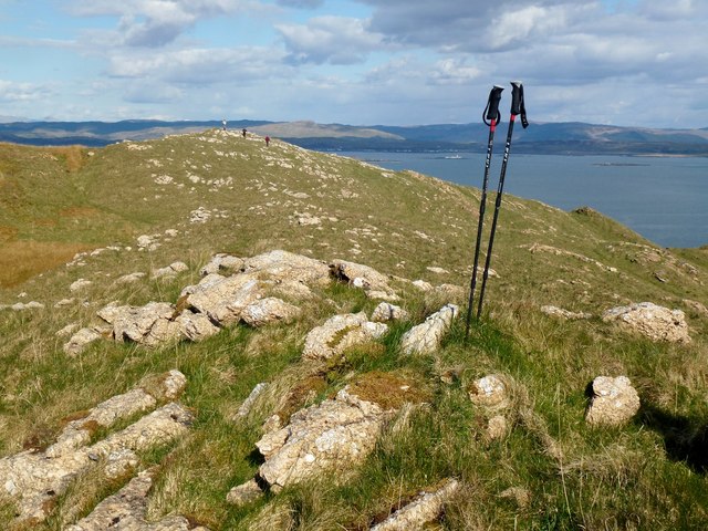
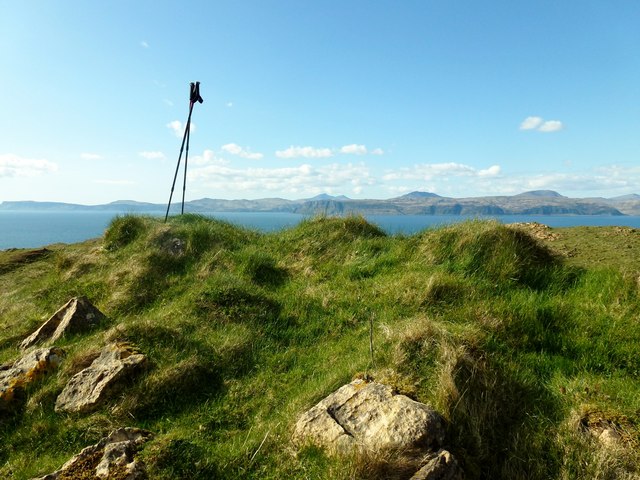
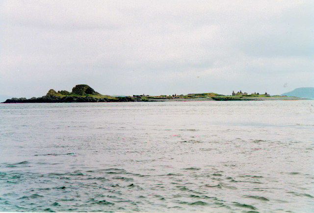
The Garvellachs are known for their rugged and picturesque landscapes, with sheer cliffs and rocky shores that provide habitat for a variety of bird species, including puffins and guillemots. The islands also boast a rich marine environment, making them a popular destination for divers and sailors. The surrounding waters are teeming with marine life, including seals, dolphins, and basking sharks.

Due to their significance as a historical and ecological site, the Garvellachs are protected and managed by various conservation organizations, ensuring the preservation of their natural and cultural heritage. Visitors to the islands can enjoy exploring the ancient ruins, observing wildlife, or simply immersing themselves in the serene and untouched beauty of this remote island group.

If you have any feedback on the listing, please let us know in the comments section below.

Garvellachs Images

Images are sourced within 2km of 56.236079/-5.7812007 or Grid Reference NM6511. Thanks to Geograph Open Source API. All images are credited.

The Garvellachs Seen from around 3,000ft altitude.
The Garvellachs
Seen from around 3,000ft altitude.
Deciduous woodland on Garbh Eileach A rare patch of woodland on the Garvellachs in the Firth of Lorn.
Deciduous woodland on Garbh Eileach
A rare patch of woodland on the Garvellachs in the Firth of Lorn.
Deciduous woodland on Garbh Eileach A rare patch of woodland on the Garvellachs in the Firth of Lorn.
Deciduous woodland on Garbh Eileach
A rare patch of woodland on the Garvellachs in the Firth of Lorn.
Sgeir nam Marag A skerry, east of Eileach an Naoimh and south of A' Chùli, in the Garvellachs with perching Shags. Its location can be seen in <a href="https://www.geograph.org.uk/photo/4518586">NM6410 : Eileach an Naoimh</a>, the dark skerry at mid-right.
Sgeir nam Marag
A skerry, east of Eileach an Naoimh and south of A' Chùli, in the Garvellachs with perching Shags. Its location can be seen in NM6410 : Eileach an Naoimh, the dark skerry at mid-right.
Garbh Eileach from Easdale The island of Garbh Eileach, the largest of the Garvellachs as seen from the top of the hill on Easdale. The two little rocks to the right of the image are <a href="https://www.geograph.org.uk/photo/7259874">NM7014 : Dubh-fhèith islets from Easdale</a>
Garbh Eileach is a reasonably large island at 142ha (351 acres = 0.55 mile²) its highest point is 110m (361') near the north coast. It is an uninhabited island but the presence of a burial ground attests to its former population.
Garbh Eileach from Easdale
The island of Garbh Eileach, the largest of the Garvellachs as seen from the top of the hill on Easdale. The two little rocks to the right of the image are NM7014 : Dubh-fhèith islets from Easdale Garbh Eileach is a reasonably large island at 142ha (351 acres = 0.55 mile²) its highest point is 110m (361') near the north coast. It is an uninhabited island but the presence of a burial ground attests to its former population.
The summit region of Garbh Eileach Looking just east of south across the Firth of Lorn.

To the left (in shadow) is Lunga, with the small island of Guirasdeal on its right. The large island dominating the photo is Scarba, and part of north Jura can be seen on the right.
The summit region of Garbh Eileach
Looking just east of south across the Firth of Lorn. To the left (in shadow) is Lunga, with the small island of Guirasdeal on its right. The large island dominating the photo is Scarba, and part of north Jura can be seen on the right.
Garvellachs The northern face of this group of islands.
Garvellachs
The northern face of this group of islands.
Garvellachs The islands viewed from the NE. These islands are in the Firth of Lorn that separates Mull from the mainland.
Garvellachs
The islands viewed from the NE. These islands are in the Firth of Lorn that separates Mull from the mainland.
The Garvellachs
The Garvellachs
Sea Arch on Garvellachs
Garvellachs shepherd's Bothy
Sgeir nam Maraig
Sgeir nam Maraig
Garbh Eileach On the low hill on Garbh Eileach.
Garbh Eileach
On the low hill on Garbh Eileach.
Garbh Eileach from N point of Eileach an Naoimh View over A'Chuli to Garbh Eileach showing the strong tidal race between the islets.
Garbh Eileach from N point of Eileach an Naoimh
View over A'Chuli to Garbh Eileach showing the strong tidal race between the islets.
Croft House ruin on Garbh Eileach A deserted croft house on the northeast slopes of Garbh Eileach. It has a glorious view out over the Slate Isles. A view now only enjoyed by deer - and the occasional tourist.
Croft House ruin on Garbh Eileach
A deserted croft house on the northeast slopes of Garbh Eileach. It has a glorious view out over the Slate Isles. A view now only enjoyed by deer - and the occasional tourist.
Garbh Eileach South and Probable Summit Lovely island with deer and trees, again there are a few choices for the top. Jim Bloomer took some abney readings with the true summit found eventually as this one to the south looking at the northern top and Mull beyond and what a view. Third top is towards the far west of the island.

Name: Garbh Eileach
Hill number: 4872
Height: 110m / 361ft
Area: 20A: Jura, Scarba and Colonsay
Class: Hu
Grid ref: NM 67326 12486
Summit feature: no feature
Drop: 110m
Col: Sea
Garbh Eileach South and Probable Summit
Lovely island with deer and trees, again there are a few choices for the top. Jim Bloomer took some abney readings with the true summit found eventually as this one to the south looking at the northern top and Mull beyond and what a view. Third top is towards the far west of the island. Name: Garbh Eileach Hill number: 4872 Height: 110m / 361ft Area: 20A: Jura, Scarba and Colonsay Class: Hu Grid ref: NM 67326 12486 Summit feature: no feature Drop: 110m Col: Sea
Garbh Eileach W Summit This was going to be a quick grab because the summit was said to be unambiguous. However, not to be - another festive round of multiple lumps to guess which one could be it. Never mind, the view and weather were unambiguously good.
W top at NM 66860 12319 is probably just lower than ground 70m NW at NM 67273 12530 is as high true southern top at NM 67326 12486.
Garbh Eileach W Summit
This was going to be a quick grab because the summit was said to be unambiguous. However, not to be - another festive round of multiple lumps to guess which one could be it. Never mind, the view and weather were unambiguously good. W top at NM 66860 12319 is probably just lower than ground 70m NW at NM 67273 12530 is as high true southern top at NM 67326 12486.
The Garvellachs: Garbh Eileach and A’ Chùli Looking down from a Colonsay-Oban flight as we pass the Garvellachs. These are the two northernmost of the three main islands.

Beyond, we see various other islands - from front to back: Eilean Dubh Mòr and Eilean Dubh Bheag in the centre; Lunga on the right of the picture; Belnahua isolated on the far left; Luing spanning almost the entire picture behind that; and Shuna behind Luing (darker, just right of centre). In the distance, Loch Melfort punctuates the mainland coastline on the left.
The Garvellachs: Garbh Eileach and A’ Chùli
Looking down from a Colonsay-Oban flight as we pass the Garvellachs. These are the two northernmost of the three main islands. Beyond, we see various other islands - from front to back: Eilean Dubh Mòr and Eilean Dubh Bheag in the centre; Lunga on the right of the picture; Belnahua isolated on the far left; Luing spanning almost the entire picture behind that; and Shuna behind Luing (darker, just right of centre). In the distance, Loch Melfort punctuates the mainland coastline on the left.
Show me another place!

Garvellachs is located at Grid Ref: NM6511 (Lat: 56.236079, Lng: -5.7812007)

Unitary Authority: Argyll and Bute

Police Authority: Argyll and West Dunbartonshire

What 3 Words

///stages.insolvent.teach. Near Lochbuie, Argyll & Bute

Nearby Locations

A' Chùli Garvellachs

Related Wikis

Garvellachs

The Garvellachs (Scottish Gaelic: Garbh Eileaich) or Isles of the Sea form a small archipelago in the Inner Hebrides of Scotland. Part of the Argyll and...

Garbh Eileach

Garbh Eileach is an uninhabited island in the Inner Hebrides of the west coast of Scotland. It is the largest of the Garvellachs and lies in the Firth...

Eileach an Naoimh

Eileach an Naoimh, also known as Holy Isle, is an uninhabited island in the Inner Hebrides of the west coast of Scotland. It is the southernmost of the...

Dùn Chonnuill

Dùn Chonnuill is a small island in the Garvellachs in the Firth of Lorn, Scotland. Dùn Chonnuill lies north east of Garbh Eileach, the largest of the archipelago...

Eilean Dubh Mòr

Eilean Dubh Mòr (Scottish Gaelic: big black island) is an uninhabited island in the Inner Hebrides of Scotland. It lies at the mouth of the Firth of Lorn...

Lunga, Firth of Lorn

Lunga is one of the Slate Islands in the Firth of Lorn in Argyll and Bute, Scotland. The "Grey Dog" tidal race, which runs in the sea channel to the south...

Scarba, Lunga and the Garvellachs National Scenic Area

Scarba, Lunga and the Garvellachs is the name of one of the 40 national scenic areas of Scotland. The designated area covers the islands of Scarba, Lunga...

Belnahua

Belnahua is one of the Slate Islands, in the Firth of Lorn in Scotland, known for its deserted slate quarries. The bedrock that underpins its human history...

Nearby Amenities

Located within 500m of 56.236079,-5.7812007
Created By: dmgroom_coastlines
Source: PGS
Lat/Long: 56.236693/-5.774434
Created By: dmgroom_coastlines
Source: PGS
Lat/Long: 56.236672/-5.775353
Created By: dmgroom_coastlines
Source: PGS
Lat/Long: 56.236907/-5.77629
Created By: dmgroom_coastlines
Source: PGS
Lat/Long: 56.237031/-5.776529
Created By: dmgroom_coastlines
Source: PGS
Lat/Long: 56.237153/-5.776767
Created By: dmgroom_coastlines
Source: PGS
Lat/Long: 56.237143/-5.777227
Created By: dmgroom_coastlines
Source: PGS
Lat/Long: 56.23701/-5.777448
Created By: dmgroom_coastlines
Source: PGS
Lat/Long: 56.236876/-5.777667
Created By: dmgroom_coastlines
Source: PGS
Lat/Long: 56.236739/-5.778117
Created By: dmgroom_coastlines
Source: PGS
Lat/Long: 56.237506/-5.778173
Created By: dmgroom_coastlines
Source: PGS
Lat/Long: 56.237527/-5.777254
Created By: dmgroom_coastlines
Source: PGS
Lat/Long: 56.238033/-5.777522
Created By: dmgroom_coastlines
Source: PGS
Lat/Long: 56.238289/-5.77754
Created By: dmgroom_coastlines
Source: PGS
Lat/Long: 56.236969/-5.773534
Created By: dmgroom_coastlines
Source: PGS
Lat/Long: 56.236959/-5.773993
Created By: dmgroom_coastlines
Source: PGS
Lat/Long: 56.236826/-5.774215
The data included in this document is from www.openstreetmap.org. The data is made available under ODbL.

Have you been to Garvellachs?

Leave your review of Garvellachs below (or comments, questions and feedback).