The Small Isles

Island Group in Inverness-shire / Argyllshire

Scotland

The Small Isles

Along the Dibidil path The path from Dibidil contours around the hillside. The path is a bit rough, with some grass, rocks and muddy parts.

Views across to the Isle of Eigg on the right, partly hidden in the mist.
Along the Dibidil path Credit: Craig Wallace

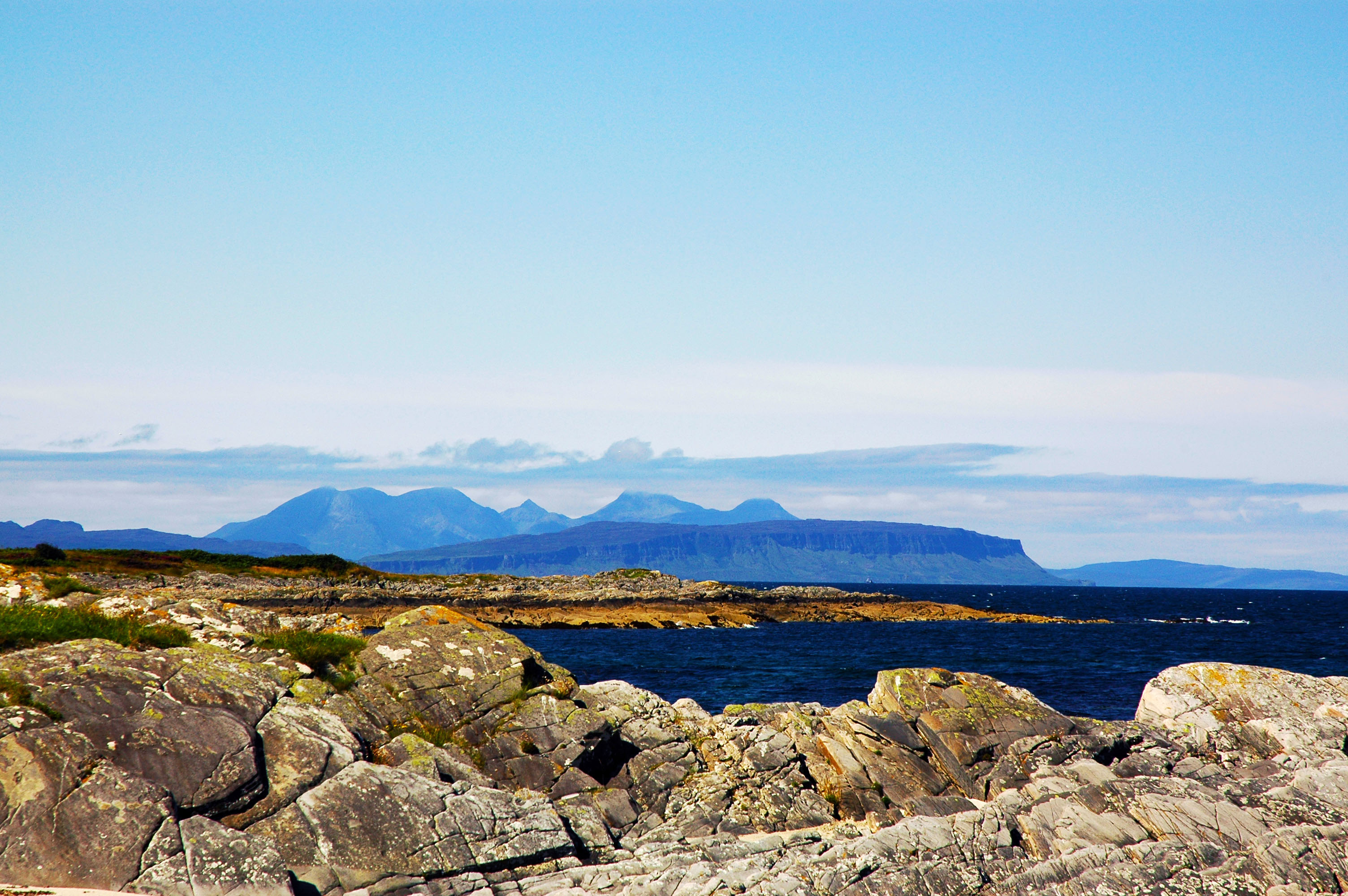
The Small Isles is a group of islands located off the west coast of Scotland, in the council areas of Inverness-shire and Argyllshire. The islands that make up this group include Canna, Eigg, Muck, and Rum. These islands are known for their stunning natural beauty, rugged landscapes, and rich biodiversity.

Canna is the westernmost island in the Small Isles and is home to a small population of residents as well as a diverse range of wildlife. Eigg is known for its community-owned renewable energy system and pristine beaches, making it a popular destination for eco-tourism. Muck is the smallest of the Small Isles and is known for its picturesque scenery and laid-back atmosphere. Rum is the largest island in the group and is home to a national nature reserve, which is a haven for rare wildlife and bird species.

Visitors to the Small Isles can enjoy hiking, birdwatching, and exploring the unique cultural heritage of these remote and beautiful islands. Ferries operate between the islands and the mainland, making it relatively easy to visit this hidden gem of the Scottish Highlands.

If you have any feedback on the listing, please let us know in the comments section below.

The Small Isles Images

Images are sourced within 2km of 56.951875/-6.2739249 or Grid Reference NM4092. Thanks to Geograph Open Source API. All images are credited.

Along the Dibidil path The path from Dibidil contours around the hillside. The path is a bit rough, with some grass, rocks and muddy parts.

Views across to the Isle of Eigg on the right, partly hidden in the mist.
Along the Dibidil path
The path from Dibidil contours around the hillside. The path is a bit rough, with some grass, rocks and muddy parts. Views across to the Isle of Eigg on the right, partly hidden in the mist.
Hooked extension of land
On the Papadil path Along the path from Papadil, shortly before it drops down towards Glen Dibidil. Much of this part of the path is grass covered, with some boggy bits.
On the Papadil path
Along the path from Papadil, shortly before it drops down towards Glen Dibidil. Much of this part of the path is grass covered, with some boggy bits.
Rum to Eigg On the path to Papadil on southeast Rum.
Rum to Eigg
On the path to Papadil on southeast Rum.
Glen Dibidil The seaward end, where the river falls steeply into the sea.  
Rivers from the Rùm of the past carried platinum into the sea, and there are deposits to this day on the surrounding seabed. No plans to exploit it though.
Glen Dibidil
The seaward end, where the river falls steeply into the sea. Rivers from the Rùm of the past carried platinum into the sea, and there are deposits to this day on the surrounding seabed. No plans to exploit it though.
Coastal gully
Coastal gully
On the Dibidil path, Rum Peaks of Sgùrr nan Gillean in cloud.
On the Dibidil path, Rum
Peaks of Sgùrr nan Gillean in cloud.
Rum - coastline at Dibidil
Dibidil Bothy Dibidil Bothy on Rhum which is maintained by The Mountain Bothies Association.
Dibidil Bothy
Dibidil Bothy on Rhum which is maintained by The Mountain Bothies Association.
Allt nam Ba Waterfall where the burn running off the Cuillin encounters a ravine along the course of a dyke. The softer shattered dyke rock has been preferentially eroded leaving a deep slot in the surrounding gabbro. Eigg lies offshore.
Warning! This is not typical Rum weather.
Allt nam Ba
Waterfall where the burn running off the Cuillin encounters a ravine along the course of a dyke. The softer shattered dyke rock has been preferentially eroded leaving a deep slot in the surrounding gabbro. Eigg lies offshore. Warning! This is not typical Rum weather.
Dibidil Path The path squeezes between Beinn nan Stac and the sea.
Dibidil Path
The path squeezes between Beinn nan Stac and the sea.
East coast of Rum Seen from just west of Sgeir a'Mhaim-ard.
East coast of Rum
Seen from just west of Sgeir a'Mhaim-ard.
Natural arch below Beinn nan Stac This sea stack has a hole through it and provides some interesting scrambling.
Natural arch below Beinn nan Stac
This sea stack has a hole through it and provides some interesting scrambling.
Sunrise over Eigg
Sunrise over Eigg
Glen Dibidil on Rum The river Dibidil runs down the glen from the Rum Cuillin plateau and is often used as a route back to Kinloch. On the left is Sron na Iolaire and behind it, Ainshval.  The peak on the right is Askival
Glen Dibidil on Rum
The river Dibidil runs down the glen from the Rum Cuillin plateau and is often used as a route back to Kinloch. On the left is Sron na Iolaire and behind it, Ainshval. The peak on the right is Askival
Glen Dibidil There are a lot of Dividals/Dibidales scattered around the Norse world. This is an exceptional glen, dominated by Askival and the southern Cuillin. Weather is strange though, taken in April, yet the river was warm enough to swim in.
Glen Dibidil
There are a lot of Dividals/Dibidales scattered around the Norse world. This is an exceptional glen, dominated by Askival and the southern Cuillin. Weather is strange though, taken in April, yet the river was warm enough to swim in.
Summit of Beinn nan Stac. View into the head of Glen Dibidil. The spike is Trollaval.
Summit of Beinn nan Stac.
View into the head of Glen Dibidil. The spike is Trollaval.
Shearwater Burrow. The higher reaches of the Rum Cuillin are covered in burrows. These are the nesting sites of the Manx Shearwater (Puffinus puffinus). They return to the nest only at night. It is said that Trollaval gets its name from the weird nocturnal noises heard up here during the breeding season. This is their only mountain breeding site, normally they use low lying small islands. The birds supports a large rat population as well. Taken on the way up Askival
Shearwater Burrow.
The higher reaches of the Rum Cuillin are covered in burrows. These are the nesting sites of the Manx Shearwater (Puffinus puffinus). They return to the nest only at night. It is said that Trollaval gets its name from the weird nocturnal noises heard up here during the breeding season. This is their only mountain breeding site, normally they use low lying small islands. The birds supports a large rat population as well. Taken on the way up Askival
Show me another place!

The Small Isles is located at Grid Ref: NM4092 (Lat: 56.951875, Lng: -6.2739249)

Unitary Authority: Highland

Police Authority: Highlands and Islands

What 3 Words

///protects.fuses.reference. Near Elgol, Highland

Nearby Locations

The Small Isles

Related Wikis

Small Isles

The Small Isles (Scottish Gaelic: Na h-Eileanan Tarsainn) are a small archipelago of islands in the Inner Hebrides, off the west coast of Scotland. They...

Askival

Askival is the highest mountain on the island of Rùm, in the Inner Hebrides of Scotland. It is located 5 kilometres (3.1 mi) south of Kinloch, the main...
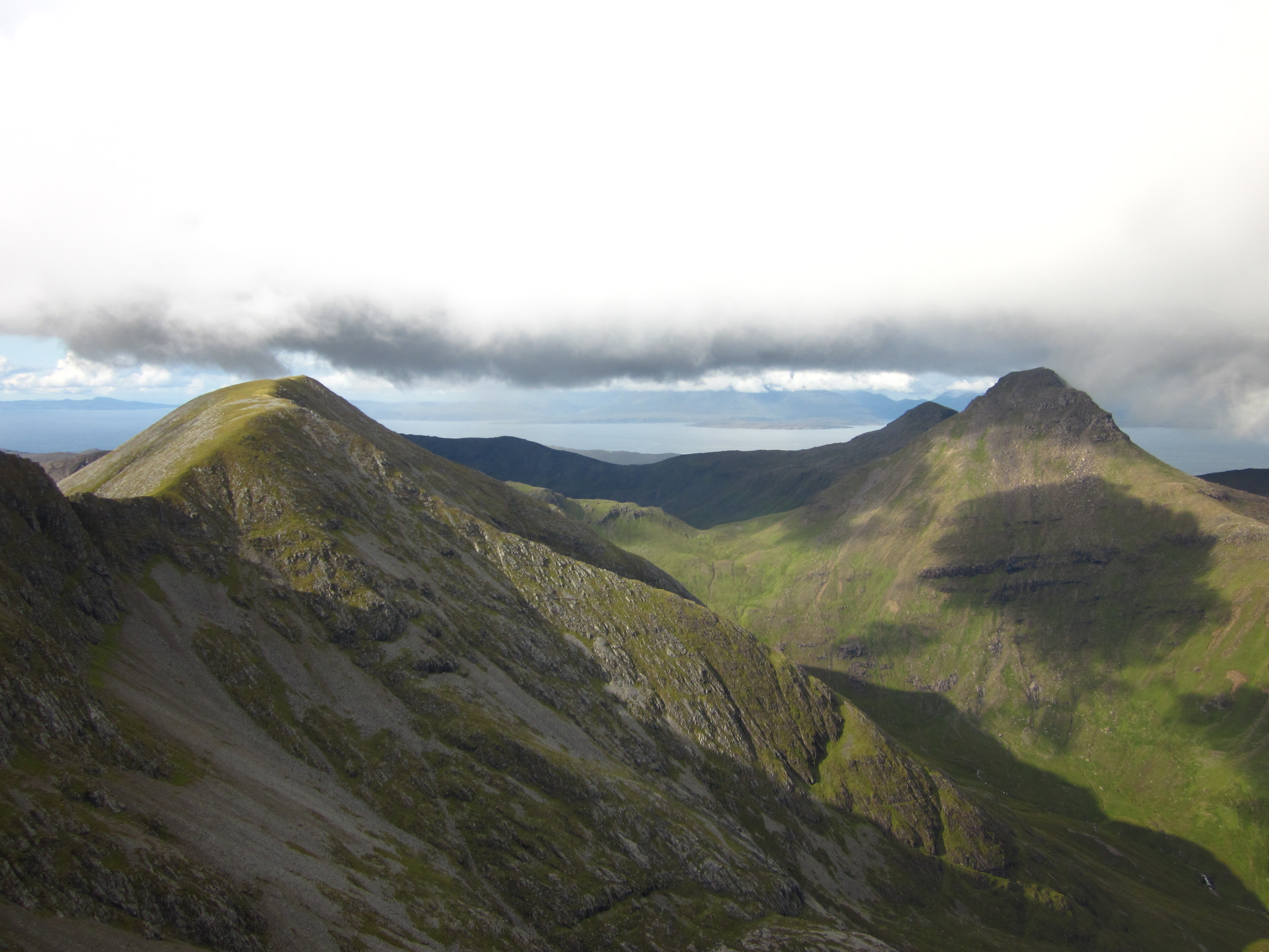
Ainshval

Ainshval is the second highest mountain on the island of Rùm, in the Inner Hebrides of Scotland, after Askival. It is part of the Rùm Cuillin, a range...

Trollabhal

Trollabhal (also known as Trallval) (702 m) is a mountain in the island of Rùm in Lochaber, Scotland. Although the lowest of the 'Rum Cuillin' in the south...

Have you been to The Small Isles?

Leave your review of The Small Isles below (or comments, questions and feedback).