Garvald

Settlement in Peeblesshire

Scotland

Garvald

Track between Dunsyre and Garvald A good, firm track – at this point anyway.
Track between Dunsyre and Garvald Credit: Alan O'Dowd

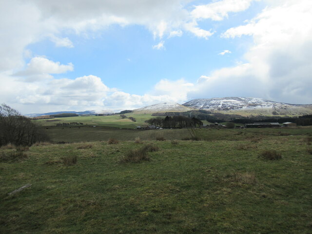
Garvald is a small village located in Peeblesshire, in the Scottish Borders region of Scotland. Situated in a picturesque rural setting, the village is surrounded by rolling hills and stunning countryside. It is approximately 5 miles west of the town of Haddington and 20 miles east of Edinburgh.

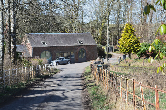
Garvald is a close-knit community with a population of around 200 residents. The village maintains a peaceful and tranquil atmosphere, making it an ideal place for those seeking a quieter way of life. The architecture in Garvald is predominantly traditional, with charming stone houses and cottages lining its streets.

The village is home to a few amenities, including a local pub, which serves as a gathering place for both residents and visitors. Additionally, there is a primary school in the village, ensuring that young families have access to education within their local community.

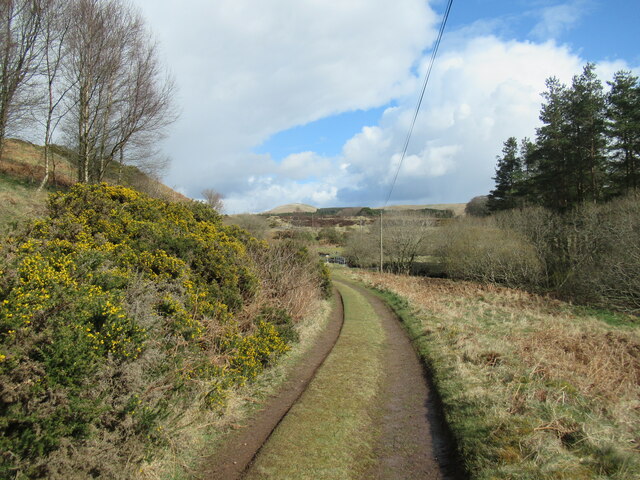
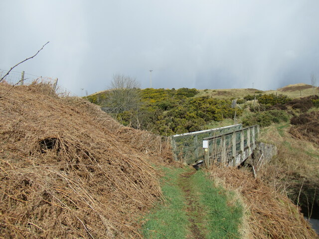
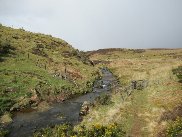
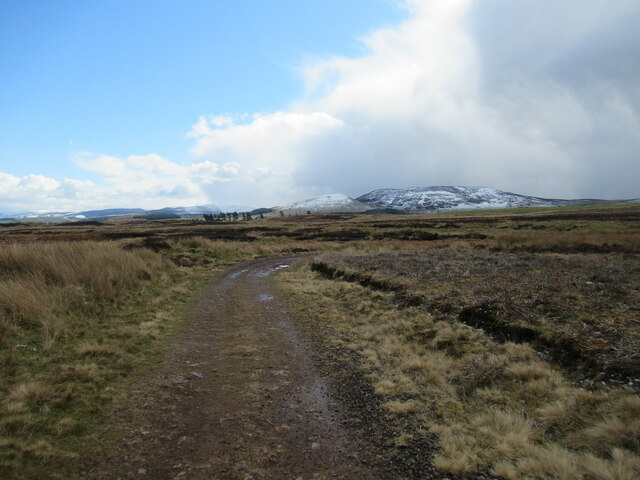
Garvald is surrounded by a rich natural environment, making it an attractive location for outdoor enthusiasts. There are numerous walking and cycling routes in the area, offering stunning views of the surrounding countryside. The nearby Lammermuir Hills provide opportunities for hillwalking and wildlife spotting.

Overall, Garvald is a peaceful and picturesque village, offering residents and visitors a close connection to nature and a sense of community. Its location, nestled in the beautiful Peeblesshire countryside, provides a serene and idyllic setting for those looking to escape the hustle and bustle of city life.

If you have any feedback on the listing, please let us know in the comments section below.

Garvald Images

Images are sourced within 2km of 55.725833/-3.4504255 or Grid Reference NT0949. Thanks to Geograph Open Source API. All images are credited.

Track between Dunsyre and Garvald A good, firm track – at this point anyway.
Track between Dunsyre and Garvald
A good, firm track – at this point anyway.
Footbridge over the West Water A bridge carrying an old right of way on to the moors at the western end of the Pentland Hills.
Footbridge over the West Water
A bridge carrying an old right of way on to the moors at the western end of the Pentland Hills.
Path by the West Water An old right of way on to the moors at the western end of the Pentland Hills.
Path by the West Water
An old right of way on to the moors at the western end of the Pentland Hills.
Track across moorland above Easton A cold spell has replaced the previous week's warm spring weather and some snow and hail showers were rattling through, whitening the hillsides.
Track across moorland above Easton
A cold spell has replaced the previous week's warm spring weather and some snow and hail showers were rattling through, whitening the hillsides.
Farm buildings at Easton, with the Black Mount behind A cold spell has replaced the previous week's warm spring weather and some snow and hail showers were rattling through, whitening the hillsides.
Farm buildings at Easton, with the Black Mount behind
A cold spell has replaced the previous week's warm spring weather and some snow and hail showers were rattling through, whitening the hillsides.
Road at Garvald The road from Dolphinton approaching the home farm at Garvald.
Road at Garvald
The road from Dolphinton approaching the home farm at Garvald.
Near the top of Dunsyre Hill A view towards distant Mendick Hill with the small rocky outcrop on which Dunsyre Hill's summit cairn sits visible on the right-hand side of the photo.
Near the top of Dunsyre Hill
A view towards distant Mendick Hill with the small rocky outcrop on which Dunsyre Hill's summit cairn sits visible on the right-hand side of the photo.
Summit cairn on Dunsyre Hill This small pile of stones sits on top of the remains of a prehistoric cairn. For more information see: <span class="nowrap"><a title="https://canmore.org.uk/site/48824/dunsyre-hill" rel="nofollow ugc noopener" href="https://canmore.org.uk/site/48824/dunsyre-hill">Link</a><img style="margin-left:2px;" alt="External link" title="External link - shift click to open in new window" src="https://s1.geograph.org.uk/img/external.png" width="10" height="10"/></span>

Although only 401 metres above sea level, this summit commands great views.
Summit cairn on Dunsyre Hill
This small pile of stones sits on top of the remains of a prehistoric cairn. For more information see: LinkExternal link Although only 401 metres above sea level, this summit commands great views.
Steep descent off Dunsyre Hill Although a small, compact hill, the southern slopes of Dunsyre Hill are steep in places with rock outcrops.

The farm buildings at Easton are visible in the distance, with Mendick Hill beyond.
Steep descent off Dunsyre Hill
Although a small, compact hill, the southern slopes of Dunsyre Hill are steep in places with rock outcrops. The farm buildings at Easton are visible in the distance, with Mendick Hill beyond.
View across the southern flank of Dunsyre Hill The low winter sun shows up the rig-and-furrow pattern of medieval to post-medieval cultivation terraces on the east and south-east side of this small, steep hill.

For more information, see <span class="nowrap"><a title="https://canmore.org.uk/site/48821/dunsyre-hill" rel="nofollow ugc noopener" href="https://canmore.org.uk/site/48821/dunsyre-hill">Link</a><img style="margin-left:2px;" alt="External link" title="External link - shift click to open in new window" src="https://s1.geograph.org.uk/img/external.png" width="10" height="10"/></span>
View across the southern flank of Dunsyre Hill
The low winter sun shows up the rig-and-furrow pattern of medieval to post-medieval cultivation terraces on the east and south-east side of this small, steep hill. For more information, see LinkExternal link
Cultivation terraces on Dunsyre Hill The low winter sun shows up the rig-and-furrow pattern of medieval to post-medieval cultivation terraces on the east and south-east sides of this small, steep hill.

For more information, see <span class="nowrap"><a title="https://canmore.org.uk/site/48821/dunsyre-hill" rel="nofollow ugc noopener" href="https://canmore.org.uk/site/48821/dunsyre-hill">Link</a><img style="margin-left:2px;" alt="External link" title="External link - shift click to open in new window" src="https://s1.geograph.org.uk/img/external.png" width="10" height="10"/></span>
Cultivation terraces on Dunsyre Hill
The low winter sun shows up the rig-and-furrow pattern of medieval to post-medieval cultivation terraces on the east and south-east sides of this small, steep hill. For more information, see LinkExternal link
Moorland track by the West Water Moody skies on an unusually chilly and changeable day for July.
Moorland track by the West Water
Moody skies on an unusually chilly and changeable day for July.
Track by the West Water above Easton Looking towards the Black Mount with some moody skies, on a cool and changeable early-July day, with showers passing through between spells of sunshine.
Track by the West Water above Easton
Looking towards the Black Mount with some moody skies, on a cool and changeable early-July day, with showers passing through between spells of sunshine.
Tunnel through the old railway embankment, Dunsyre The Dunsyre Burn flows through this tunnel under the now dismantled railway line from Dolphinton to Carstairs.
Tunnel through the old railway embankment, Dunsyre
The Dunsyre Burn flows through this tunnel under the now dismantled railway line from Dolphinton to Carstairs.
Cultivation terraces, Dunsyre Hill Ancient cultivation terraces on the eastern flank of the hill.
Cultivation terraces, Dunsyre Hill
Ancient cultivation terraces on the eastern flank of the hill.
Minor road to Easton The public road runs east of Dunsyre for about 1 km, after which the farm track continues to Easton. Mendick Hill is in the background.
Minor road to Easton
The public road runs east of Dunsyre for about 1 km, after which the farm track continues to Easton. Mendick Hill is in the background.
Old railway bridge near Dunsyre A sturdy stone bridge remains after the Dolphinton - Carstairs railway has long been dismantled. Dunsyre Hill is in the background.
Old railway bridge near Dunsyre
A sturdy stone bridge remains after the Dolphinton - Carstairs railway has long been dismantled. Dunsyre Hill is in the background.
Old railway trackbed east of Dunsyre The route of the Dolphinton - Carstairs line seen from the bridge shown in <a href="https://www.geograph.org.uk/photo/2488686">NT0848 : Old railway bridge near Dunsyre</a>.
Old railway trackbed east of Dunsyre
The route of the Dolphinton - Carstairs line seen from the bridge shown in NT0848 : Old railway bridge near Dunsyre.
Show me another place!

Garvald is located at Grid Ref: NT0949 (Lat: 55.725833, Lng: -3.4504255)

Unitary Authority: The Scottish Borders

Police Authority: The Lothians and Scottish Borders

What 3 Words

///hairstyle.beans.cuts. Near West Linton, Scottish Borders

Nearby Locations

Garvald

Related Wikis

Garvald, South Lanarkshire

Garvald is a small settlement on the boundary between the Scottish Borders and South Lanarkshire, Scotland. == References == The geographic coordinates...

Dunsyre railway station

Dunsyre railway station served the village of Dunsyre, South Lanarkshire, Scotland from 1867 to 1945 on the Dolphinton branch. == History == The station...

Dunsyre

Dunsyre (Scottish Gaelic: Dùn Saghair) is a village in South Lanarkshire, Scotland. It is 10 kilometres (6 mi) from Carnwath. Dunsyre is associated with...

Dolphinton (CR) railway station

Dolphinton railway station served the village of Dolphinton, Lanarkshire, Scotland, from 1867 to 1945 on the Dolphinton branch. == History == The station...

Nearby Amenities

Located within 500m of 55.725833,-3.4504255
Bridge Support: abutment
Lat/Long: 55.7231009/-3.4458276
Bridge Support: abutment
Lat/Long: 55.7231059/-3.445752
Power: pole
Lat/Long: 55.7261896/-3.4578009
Power: pole
Lat/Long: 55.7263529/-3.456983
Power: pole
Lat/Long: 55.726527/-3.4560832
Power: pole
Lat/Long: 55.7267792/-3.4547545
Power: pole
Lat/Long: 55.7270065/-3.4536003
Power: pole
Lat/Long: 55.7272492/-3.4523389
Power: pole
Lat/Long: 55.727499/-3.4510459
Power: pole
Lat/Long: 55.727673/-3.4501587
Power: pole
Lat/Long: 55.7278613/-3.4491811
Power: pole
Lat/Long: 55.7280578/-3.448174
Power: pole
Lat/Long: 55.728336/-3.4471102
Power: pole
Lat/Long: 55.7285278/-3.4463975
Power: pole
Lat/Long: 55.7287184/-3.4456365
The data included in this document is from www.openstreetmap.org. The data is made available under ODbL.

Have you been to Garvald?

Leave your review of Garvald below (or comments, questions and feedback).