Aunk

Settlement in Devon East Devon

England

Aunk

Road Bridge over the River View of the road bridge crossing the River Clyst in the village of Cyst Hydon in Devon.
Road Bridge over the River Credit: John P Reeves

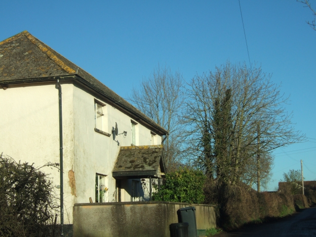
Aunk is a small village located in Devon, England. Situated in the South Hams district, it is nestled amidst picturesque countryside and offers a tranquil and idyllic setting. With a population of around 500 residents, Aunk is known for its close-knit community and friendly atmosphere.

The village is primarily residential, consisting of charming cottages and traditional houses. Aunk retains much of its rural character, with beautiful gardens and well-maintained green spaces. The surrounding countryside provides ample opportunities for outdoor activities such as walking, cycling, and horse riding.

Despite its small size, Aunk boasts a few amenities to cater to the local population. There is a well-regarded primary school that serves the village and the surrounding areas. A local pub, The Aunk Arms, is a popular spot for residents and visitors alike, offering a warm and welcoming atmosphere along with traditional pub fare.

For shopping and more extensive services, residents of Aunk can easily access nearby towns and villages. The market town of Kingsbridge is just a short drive away and offers a range of shops, supermarkets, and other amenities.

Aunk is also well-situated to explore the wider Devon area. The stunning coastline, with its sandy beaches and dramatic cliffs, is easily accessible. The Dartmoor National Park, known for its rugged landscapes and rich wildlife, is also within reach.

Overall, Aunk is a charming village that provides a peaceful and picturesque living environment, surrounded by natural beauty and a strong sense of community.

If you have any feedback on the listing, please let us know in the comments section below.
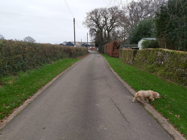
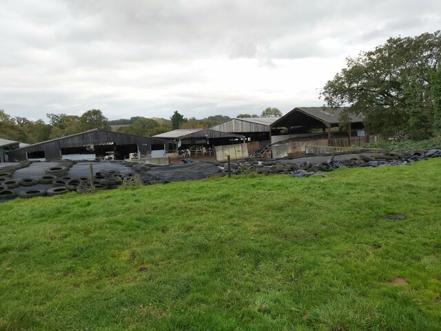
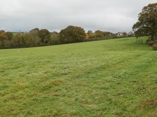
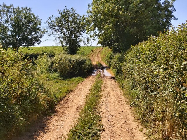
Aunk Images

Images are sourced within 2km of 50.794358/-3.352152 or Grid Reference ST0400. Thanks to Geograph Open Source API. All images are credited.

Road Bridge over the River View of the road bridge crossing the River Clyst in the village of Cyst Hydon in Devon.
Road Bridge over the River
View of the road bridge crossing the River Clyst in the village of Cyst Hydon in Devon.
St Andrew Church in Clyst Hydon A front view of St Andrew Church in Clyst Hydon, Devon as seen from the public footpath running through the adjoining farmers field.
St Andrew Church in Clyst Hydon
A front view of St Andrew Church in Clyst Hydon, Devon as seen from the public footpath running through the adjoining farmers field.
St Andrew Church in Clyst Hydon A side view of St Andrew Church in Clyst Hydon, Devon as seen from the public footpath running through the adjoining farmers field.
St Andrew Church in Clyst Hydon
A side view of St Andrew Church in Clyst Hydon, Devon as seen from the public footpath running through the adjoining farmers field.
Lane to Twynhayes Farm A view down the small lane to Twynhayes Farm running from Clyst Hydon village in East Devon.
Lane to Twynhayes Farm
A view down the small lane to Twynhayes Farm running from Clyst Hydon village in East Devon.
Parklands Farm A view of the back of Parklands Farm in Talaton, East Devon as seen from the public footpath that runs past it in the adjoining field.
Parklands Farm
A view of the back of Parklands Farm in Talaton, East Devon as seen from the public footpath that runs past it in the adjoining field.
Field near Newtown A view across the fields towards Newtown, Talaton in Devon from the country lane that runs between Newtown and Whimple.
Field near Newtown
A view across the fields towards Newtown, Talaton in Devon from the country lane that runs between Newtown and Whimple.
Railway heading to Exeter A view of the railway heading to Exeter from a road bridge between Newtown and Whimple in Devon.
Railway heading to Exeter
A view of the railway heading to Exeter from a road bridge between Newtown and Whimple in Devon.
 A Herd of Cows A herd of cows gather around a style on the public footpath between Sunny View Farm and Westcott in Devon.
A Herd of Cows
A herd of cows gather around a style on the public footpath between Sunny View Farm and Westcott in Devon.
Road Bridge over the Railway This is the road bridge over the railway between the village of Newtown and Whimple in Devon. The railway is the Great Western Railway line that runs between Exeter and Honiton.
Road Bridge over the Railway
This is the road bridge over the railway between the village of Newtown and Whimple in Devon. The railway is the Great Western Railway line that runs between Exeter and Honiton.
Gate onto a Field At the end of a track from the country lane between Newtown and Whimple lies this metal gate which allows access to the farmer's field.
Gate onto a Field
At the end of a track from the country lane between Newtown and Whimple lies this metal gate which allows access to the farmer's field.
Wooden Gate A wooden five-bar gate marking the entrance to a field and the public footpath running between Rull Farm and Aunk village in Devon.
Wooden Gate
A wooden five-bar gate marking the entrance to a field and the public footpath running between Rull Farm and Aunk village in Devon.
Footpath through a crop A view through a farmer's crop field on the public footpath running between Rull Farm and Aunk village in Devon.
Footpath through a crop
A view through a farmer's crop field on the public footpath running between Rull Farm and Aunk village in Devon.
Rutton Farm A view of Rutton Farm across a field as viewed from the public footpath running between Rull Farm and Aunk village in Devon.
Rutton Farm
A view of Rutton Farm across a field as viewed from the public footpath running between Rull Farm and Aunk village in Devon.
Path through a crop field The public footpath through a farmer's maize crop field, running between Rutton Farm and Courtney's Farm in Devon.
Path through a crop field
The public footpath through a farmer's maize crop field, running between Rutton Farm and Courtney's Farm in Devon.
Flooded Farm Track A flooded farm track, caused by a crossing stream, on the public footpath running between Rutton Farm and Courtney's Farm in Devon.
Flooded Farm Track
A flooded farm track, caused by a crossing stream, on the public footpath running between Rutton Farm and Courtney's Farm in Devon.
Country Lane A view down the country lane running between Courtney's Farm and the village of Aunk in Devon.
Country Lane
A view down the country lane running between Courtney's Farm and the village of Aunk in Devon.
Farm Entrance The entrance to Courtney's Farm as viewed from the country lane running between the farm and the village of Aunk in Devon.
Farm Entrance
The entrance to Courtney's Farm as viewed from the country lane running between the farm and the village of Aunk in Devon.
Country Lane A view down the country lane running between Courtney's Farm and the village of Aunk in Devon near the area of Broad Oak.
Country Lane
A view down the country lane running between Courtney's Farm and the village of Aunk in Devon near the area of Broad Oak.
Show me another place!

Aunk is located at Grid Ref: ST0400 (Lat: 50.794358, Lng: -3.352152)

Administrative County: Devon

District: East Devon

Police Authority: Devon and Cornwall

What 3 Words

///mailings.basket.mass. Near Whimple, Devon

Nearby Locations

Aunk

Related Wikis

Aunk

Aunk (anciently Anke) is a small hamlet and former manor in the parish of Clyst Hydon in East Devon, England. The place-name is of Celtic origin along...

Clyst Hydon

Clyst Hydon is a village and civil parish in the county of Devon, England. It was in the Cliston Hundred and has a church dedicated to St Andrew. The parish...

Clyst St Lawrence

Clyst St Lawrence is a village and civil parish about 8 miles north-east of the city of Exeter in the county of Devon, England. Historically it formed...

Plymtree

Plymtree is a small village and civil parish about 3.5 miles south of the town of Cullompton in the county of Devon, England. The parish is surrounded...

Nearby Amenities

Located within 500m of 50.794358,-3.352152
Aunk
Is In: Devon, England, UK
Place: hamlet
Wikidata: Q4821932
Lat/Long: 50.7945391/-3.3505999
Barrier: kissing_gate
Lat/Long: 50.7948427/-3.3545035
The data included in this document is from www.openstreetmap.org. The data is made available under ODbL.

Have you been to Aunk?

Leave your review of Aunk below (or comments, questions and feedback).