Muckle Head

Coastal Feature, Headland, Point in Shetland

Scotland

Muckle Head

Coastal inlet Top of the coastal inlet
Coastal inlet Credit: Mat Tuck

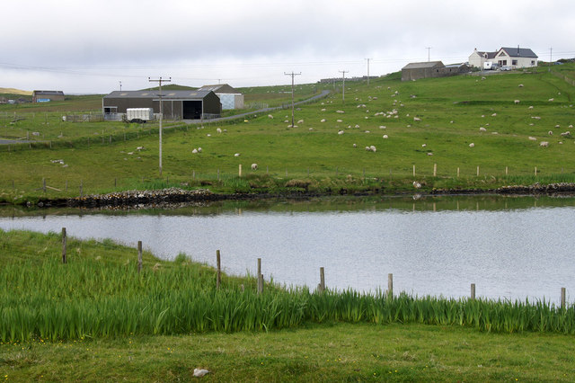
Muckle Head is a prominent coastal feature located on the island of Unst in the Shetland archipelago, Scotland. It is a headland that extends into the North Sea, forming the northernmost point of the British Isles. With its rugged cliffs and stunning views, Muckle Head is a popular destination for nature enthusiasts and hikers.

The headland is characterized by its steep cliffs, which rise to a height of approximately 120 meters (394 feet) above sea level. These cliffs are composed of ancient rock formations, including sandstone and conglomerate, which provide a glimpse into the geological history of the area.

Muckle Head offers breathtaking panoramic views of the surrounding coastline and the North Sea. On clear days, visitors can see as far as the neighboring islands of Yell and Fetlar. The headland is also known for its diverse wildlife, with numerous seabird colonies inhabiting the cliffs. Species such as puffins, guillemots, and kittiwakes can be observed nesting and fishing in the surrounding waters.

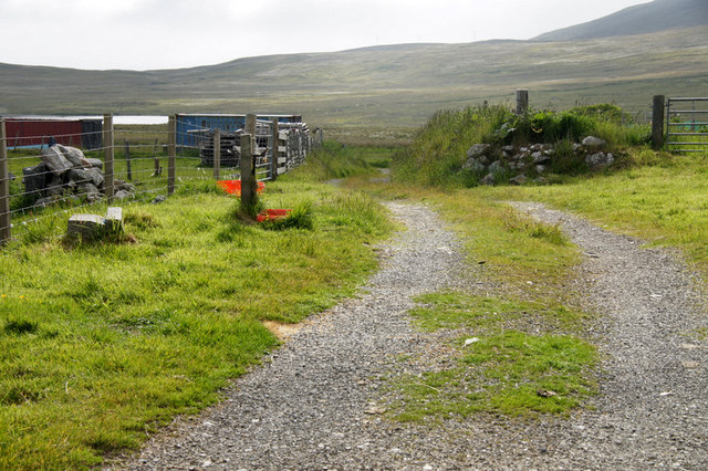
Access to Muckle Head is possible via a coastal path that winds its way along the rugged shoreline. The path offers stunning vistas and allows visitors to explore the area's unique flora and fauna. However, caution is advised as the terrain can be challenging and the cliffs are steep and potentially dangerous.

Overall, Muckle Head is a remarkable coastal feature that showcases the natural beauty and ruggedness of the Shetland Islands. Its dramatic cliffs, breathtaking views, and rich wildlife make it a must-visit destination for nature lovers and outdoor enthusiasts.

If you have any feedback on the listing, please let us know in the comments section below.

Muckle Head Images

Images are sourced within 2km of 60.326092/-1.1324088 or Grid Reference HU4860. Thanks to Geograph Open Source API. All images are credited.

Coastal inlet Top of the coastal inlet
Coastal inlet
Top of the coastal inlet
The Vadill, Billister, at high tide Vadill means a place that can be waded across, but the tide is in.
The Vadill, Billister, at high tide
Vadill means a place that can be waded across, but the tide is in.
House between Billister and Laxfirth Overlooking the head of the Vadill.
House between Billister and Laxfirth
Overlooking the head of the Vadill.
Head of the Vadill, Billister The pink plant on the left is a garden escape, Sweet Rocket.
Head of the Vadill, Billister
The pink plant on the left is a garden escape, Sweet Rocket.
North Nesting Public Hall. Laxfirth
Quoys pier Pier at Quoys
Quoys pier
Pier at Quoys
Quoys pier A small piece of land by Quoys Pier.  There is a picnic bench and space to pull up several cars, making a useful wild camping spot.
Quoys pier
A small piece of land by Quoys Pier. There is a picnic bench and space to pull up several cars, making a useful wild camping spot.
Billister: the pier A tiny harbour on Lax Firth, an inlet from the much larger Dury Voe, which is in the background.
Billister: the pier
A tiny harbour on Lax Firth, an inlet from the much larger Dury Voe, which is in the background.
Billister: old Zetland County Council stone This small slab of stone is almost hidden in the long grass opposite the pier (see <a href="https://www.geograph.org.uk/photo/2758868">HU4760 : Billister: the pier</a>) and is inscribed with the Zetland County Council emblem with the name Billister Pier below.

Zetland County Council is the predecessor (1974) to the present-day Shetland Islands Council.
Billister: old Zetland County Council stone
This small slab of stone is almost hidden in the long grass opposite the pier (see HU4760 : Billister: the pier) and is inscribed with the Zetland County Council emblem with the name Billister Pier below. Zetland County Council is the predecessor (1974) to the present-day Shetland Islands Council.
Billister: the telephone box Looking down the lane towards Billister pier, with a red telephone box on the right. The box also acts as the repository for post for the wheelchair-bound lady, who lives in the cottage, as I discovered when I found a letter (visible on the shelf) inside the box. I knocked on the door and she cheerfully told me that her home help or other visitors checked the box before coming in.
Billister: the telephone box
Looking down the lane towards Billister pier, with a red telephone box on the right. The box also acts as the repository for post for the wheelchair-bound lady, who lives in the cottage, as I discovered when I found a letter (visible on the shelf) inside the box. I knocked on the door and she cheerfully told me that her home help or other visitors checked the box before coming in.
Billister, North Nesting Three houses of different ages, possibly even built in different centuries.
Billister, North Nesting
Three houses of different ages, possibly even built in different centuries.
Billister pier, North Nesting Formerly the route to Whalsay.
Billister pier, North Nesting
Formerly the route to Whalsay.
Ruined crofthouse beside Lax Firth, North Nesting
House at Billister, North Nesting The Bight of Bellister is beyond. Billister may be an OS typo, given that the Bight is called Bellister and this name is also used on larger scale OS maps, although the roadsign says Billister.
House at Billister, North Nesting
The Bight of Bellister is beyond. Billister may be an OS typo, given that the Bight is called Bellister and this name is also used on larger scale OS maps, although the roadsign says Billister.
Track at Billister, North Nesting The head of the Bight of Bellister is just visible on the left.
Track at Billister, North Nesting
The head of the Bight of Bellister is just visible on the left.
Fish farm in Loura Voe, Dury Voe Taken from the Whalsay ferry (photographer grid reference taken from GPS).
Fish farm in Loura Voe, Dury Voe
Taken from the Whalsay ferry (photographer grid reference taken from GPS).
Swarta Skerry, Dury Voe
Green Isle, Dury Voe Taken from the Whalsay ferry (and position checked by GPS).
Green Isle, Dury Voe
Taken from the Whalsay ferry (and position checked by GPS).
Show me another place!

Muckle Head is located at Grid Ref: HU4860 (Lat: 60.326092, Lng: -1.1324088)

Unitary Authority: Shetland Islands

Police Authority: Highlands and Islands

What 3 Words

///slider.punctured.hook. Near Vidlin, Shetland Islands

Related Wikis

Billister

Billister is a settlement in the parish of Nesting, on the island of Mainland, in Shetland, Scotland. It is on Lax Firth. Billister was formerly the terminal...

Nesting, Shetland

Nesting is a parish in the Shetland Islands, Scotland. It includes a part of the east Shetland Mainland, measuring about twelve by four miles (19 by 6...

Brettabister

Brettabister is a settlement on the island of Mainland in Shetland, Scotland. It is in the parish of Nesting. St. Ola's parish church lies to the east...

Neap

Neap is a small village in the east coast of the Mainland of the Shetland Islands, Scotland. Neap is situated at the end of the road from Brettabister...

Laxo

Laxo is a small settlement at the end of Laxo Voe in Vidlin, Shetland, Scotland. A ferry from the Mainland to Symbister in Whalsay operates from the nearby...

Geopark Shetland

Geopark Shetland is the name used by the Geopark formally established in September 2009 on its entry into the European Geoparks Network. The Geopark extends...

Vidlin

Vidlin (from Old Norse: VaĆ°ill meaning a ford) is a small village located on Mainland, Shetland, Scotland. The settlement is within the parish of Nesting...

Viking Wind Farm

Viking Wind Farm is a large on-shore wind farm under construction in the Shetland Islands which is being developed by Viking Energy, a partnership between...

Nearby Amenities

Located within 500m of 60.326092,-1.1324088
Bight of Bellister
Natural: bay
Lat/Long: 60.3254393/-1.1236954
Power: pole
Lat/Long: 60.3242744/-1.1328395
Power: pole
Lat/Long: 60.3248103/-1.1338833
Power: pole
Lat/Long: 60.3244275/-1.1331783
Power: pole
Lat/Long: 60.3240447/-1.1324756
Power: pole
Lat/Long: 60.3239963/-1.1333967
Power: pole
Lat/Long: 60.3232284/-1.1326735
Power: pole
Lat/Long: 60.3225021/-1.1319571
Power: pole
Lat/Long: 60.322019/-1.1312361
The data included in this document is from www.openstreetmap.org. The data is made available under ODbL.

Have you been to Muckle Head?

Leave your review of Muckle Head below (or comments, questions and feedback).