Green Head
Coastal Feature, Headland, Point in Shetland
Scotland
Green Head
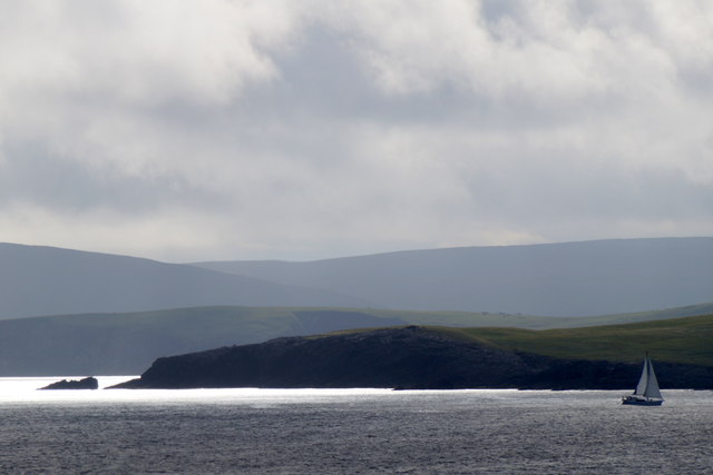
Green Head is a prominent coastal feature located in the Shetland Islands, which are part of Scotland. It is classified as a headland, also commonly referred to as a point, due to its distinctive geographical structure. Situated on the eastern side of the main island, it offers stunning views of the North Sea.
Green Head is characterized by its rugged and rocky terrain, typical of the Shetland landscape. It stands tall and imposing, jutting out into the sea, and is surrounded by steep cliffs that provide a natural defense against the crashing waves. The headland is covered in lush green vegetation, giving it its name and contrasting beautifully with the deep blue of the ocean.
This coastal feature is a popular destination for both locals and visitors. Its dramatic cliffs and picturesque surroundings make it a favorite spot for hiking and enjoying the breathtaking coastal scenery. Green Head is also known for its diverse wildlife, including various seabirds nesting on the cliffs, such as puffins and guillemots.
The headland's location in the North Sea means it is subject to the ever-changing weather conditions of the region. It experiences strong winds and heavy rainfall, which have contributed to the formation of its unique landscape over time. Its exposure to the elements also makes it a fascinating place for geologists and nature enthusiasts, as the rocks and formations found here offer insights into the geological history of the area.
Overall, Green Head is an exceptional coastal feature that showcases the natural beauty and ruggedness of the Shetland Islands. Its impressive cliffs, vibrant vegetation, and abundant wildlife make it a must-visit destination for nature lovers and those seeking a true Scottish coastal experience.
If you have any feedback on the listing, please let us know in the comments section below.
Green Head Images
Images are sourced within 2km of 59.992944/-1.1703956 or Grid Reference HU4623. Thanks to Geograph Open Source API. All images are credited.


Green Head is located at Grid Ref: HU4623 (Lat: 59.992944, Lng: -1.1703956)
Unitary Authority: Shetland Islands
Police Authority: Highlands and Islands
What 3 Words
///swept.importers.contracting. Near Sandwick, Shetland Islands
Nearby Locations
Related Wikis

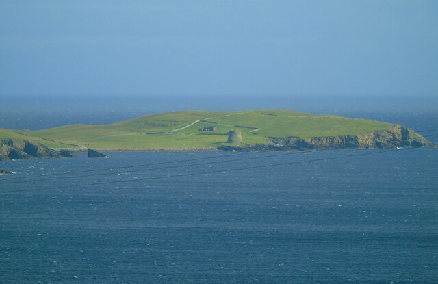
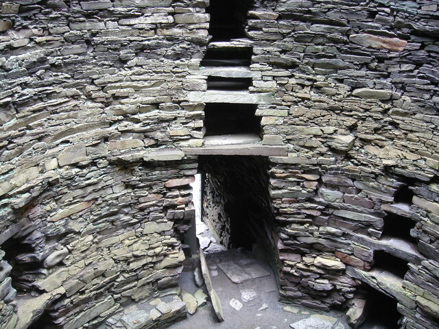
Broch of Mousa
Broch of Mousa (or Mousa Broch) is a preserved Iron Age broch or round tower. It is on the island of Mousa in Shetland, Scotland. It is the tallest broch...

Mousa
Mousa (Old Norse: Mosey "moss island") is a small island in Shetland, Scotland, uninhabited since the nineteenth century. The island is known for the...

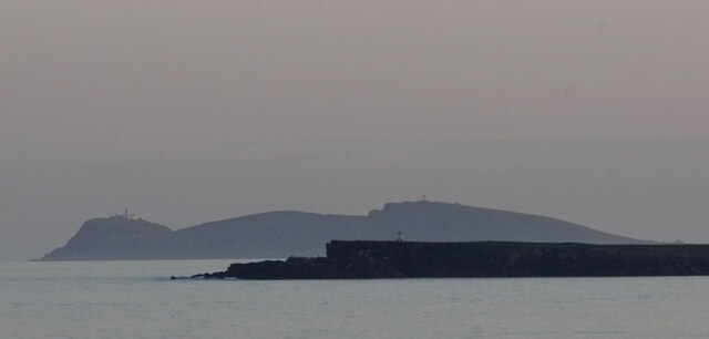
Peerie Bard
Perie Bard is one of the Shetland Islands. It is a small islet off the east coast of the island of Mousa.Although named 'Perie Bard' on OS Maps, the name...

Sandwick, Dunrossness
see also Sandwick, Whalsay and Sandwick, OrkneySandwick (Old Norse: Sandvik "Sandy Bay") is a village and an ancient parish in the Shetland Islands, Scotland...

Hoswick
Hoswick is a settlement in Sandwick in the south mainland of Shetland, Scotland, on the eastern part of the Dunrossness civil parish. It is separated from...

Catpund
Catpund is a quarry site in Shetland, Scotland, where steatite vessels were cut from the rock from prehistory onwards. The quarrying marks are still visible...

Mail, Shetland
Mail is a hamlet on the island of Mainland, in the Shetland Islands, Scotland. == Geography == Mail is located on the south-eastern side of the island...

Levenwick
Levenwick is a small village about 17 miles (27 km) south of Lerwick, on the east side of the South Mainland of Shetland, Scotland. It is part of the parish...
Nearby Amenities
Located within 500m of 59.992944,-1.1703956Have you been to Green Head?
Leave your review of Green Head below (or comments, questions and feedback).