Muckle Bard

Coastal Feature, Headland, Point in Shetland

Scotland

Muckle Bard

Mousa and the Broch We are at the parking place above Crossie Geo just north of Leebitten, roughly half-way between Sumburgh Head and Lerwick on the mainland of Shetlant, and looking across Mousa Sound to the island of Mousa and the Broch of Mousa. The wind proved to be too strong on this particular day for us to make the crossing to view the broch close up.
Mousa and the Broch Credit: Carroll Pierce

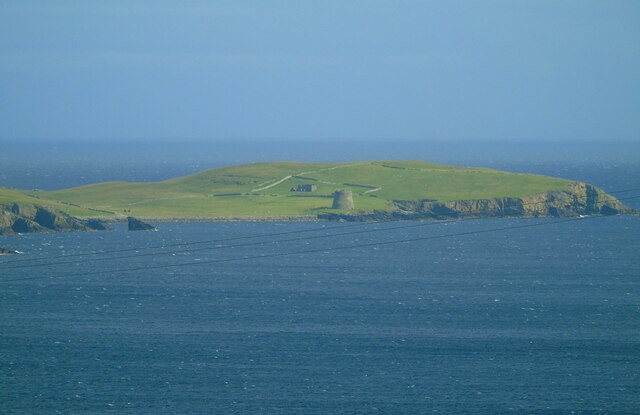
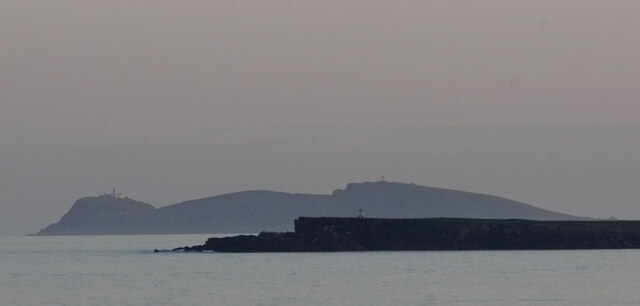
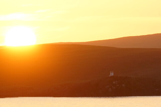
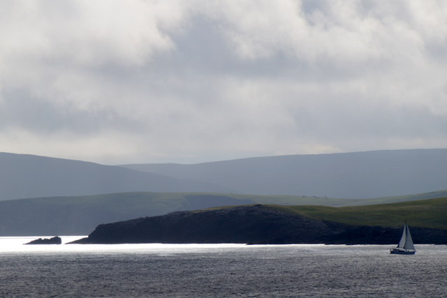
Muckle Bard is a prominent coastal feature located in Shetland, an archipelago in Scotland. It is categorized as a headland or a point, depending on the perspective. Situated along the rugged coastline, Muckle Bard offers breathtaking views of the North Atlantic Ocean and the surrounding cliffs.

The headland is characterized by its towering cliffs, which rise dramatically from the sea, reaching heights of up to 200 feet. These cliffs are formed from layers of sedimentary rocks such as sandstone and shale, showcasing the geological history of the region.

Muckle Bard is known for its diverse wildlife, particularly seabirds. The cliffs provide nesting grounds for various species, including puffins, guillemots, and razorbills. Birdwatchers flock to this area to observe these magnificent creatures in their natural habitat.

The headland is also a popular spot for outdoor enthusiasts and hikers. A well-maintained trail leads visitors along the edge of the cliffs, offering stunning views of the coastline and the surrounding countryside. The challenging terrain and the fresh sea air make Muckle Bard an ideal location for those seeking an adventurous experience.

Due to its exposed location, Muckle Bard can experience strong winds and rough seas, adding to its rugged charm. It is advisable to exercise caution when visiting, especially during inclement weather.

Overall, Muckle Bard is a captivating coastal feature that showcases the natural beauty and diversity of Shetland. Whether you are a nature lover, a hiker, or simply seeking a peaceful escape, this headland offers a unique and unforgettable experience.

If you have any feedback on the listing, please let us know in the comments section below.
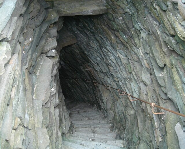
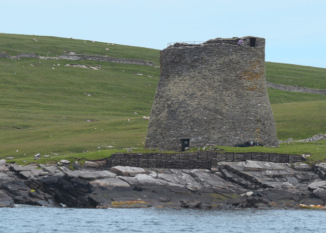
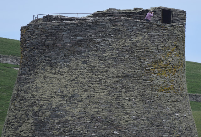
Muckle Bard Images

Images are sourced within 2km of 59.994877/-1.1623164 or Grid Reference HU4623. Thanks to Geograph Open Source API. All images are credited.

Mousa and the Broch We are at the parking place above Crossie Geo just north of Leebitten, roughly half-way between Sumburgh Head and Lerwick on the mainland of Shetlant, and looking across Mousa Sound to the island of Mousa and the Broch of Mousa. The wind proved to be too strong on this particular day for us to make the crossing to view the broch close up.
Mousa and the Broch
We are at the parking place above Crossie Geo just north of Leebitten, roughly half-way between Sumburgh Head and Lerwick on the mainland of Shetlant, and looking across Mousa Sound to the island of Mousa and the Broch of Mousa. The wind proved to be too strong on this particular day for us to make the crossing to view the broch close up.
Broch of Mousa from the air
West Ham and East Ham, Mousa, from the air
Mousa Sound and Mousa from the air
Broch of Mousa Taken from the viewing point on the South Road above Leebitten, Sandwick, on the main island of Shetland, I am looking south east towards the island of Mousa. The Broch of Mousa (centre of shot) is the best-preserved of Scotland's brochs or Iron Age roundhouses. The island can be accessed by boat from Sandwick (weather and wind permitting).
Broch of Mousa
Taken from the viewing point on the South Road above Leebitten, Sandwick, on the main island of Shetland, I am looking south east towards the island of Mousa. The Broch of Mousa (centre of shot) is the best-preserved of Scotland's brochs or Iron Age roundhouses. The island can be accessed by boat from Sandwick (weather and wind permitting).
Lighthouses on Mousa and at Sumburgh Head from off Helli Ness
Sun setting beyond Mousa
The Broch of Mousa Looking north towards Burgi Ayre.
The Broch of Mousa
Looking north towards Burgi Ayre.
The Broch of Mousa The detail of the stonework is very clear in this photo. The entrance is on the left, and inside it is possible to climb to the top of the tower - hence the railings.
The Broch of Mousa
The detail of the stonework is very clear in this photo. The entrance is on the left, and inside it is possible to climb to the top of the tower - hence the railings.
The top of the broch The stairs descend to the left from the gate between the walls. Note the grid, bottom right, to prevent falls back into the broch.

Top right is the ruin of The Haa, the former residence of the laird of the island.
The top of the broch
The stairs descend to the left from the gate between the walls. Note the grid, bottom right, to prevent falls back into the broch. Top right is the ruin of The Haa, the former residence of the laird of the island.
The interior of the Broch of Mousa Excellent detail in the stonework. The exit is at bottom centre, veering left.
The interior of the Broch of Mousa
Excellent detail in the stonework. The exit is at bottom centre, veering left.
Broch of Mousa - the start of the descent The climb and descent of the Broch of Mousa is by a fairly steep spiral staircase, and the treads are quite narrow. So the provision of a modern handrail is a useful precaution.
Broch of Mousa - the start of the descent
The climb and descent of the Broch of Mousa is by a fairly steep spiral staircase, and the treads are quite narrow. So the provision of a modern handrail is a useful precaution.
Yacht passing the southern end of Mousa Taken from the ferry en route to Orkney, from about 3 km distance.
Yacht passing the southern end of Mousa
Taken from the ferry en route to Orkney, from about 3 km distance.
Broch of Mousa, Shetland Believed to be more than two thousand years old, the Broch of Mousa has survived extraordinarily well.
Broch of Mousa, Shetland
Believed to be more than two thousand years old, the Broch of Mousa has survived extraordinarily well.
Broch of Mousa, Shetland Some fine stonework on the two thousand year old broch
Broch of Mousa, Shetland
Some fine stonework on the two thousand year old broch
Broch of Mousa The Broch of Mousa is considered to be the best preserved broch anywhere in the world. It stands a few yards from the western coast of the Isle of Mousa looking across Mousa Sound towards Sandwick on Mainland, Shetland. It is thought to be unusually massive for a broch, and this together with its remote and isolated location and particularly sturdy construction have probably been the main factors in its survival in such good condition.
It is about 2000 years old making it date from the Iron Age period which in Scotland and the Northern Isles coincides with the Pictish period, though in Shetland the influences have always been largely Norse or Scandinavian.
Although at 44'(13m) thought to be unusually tall, its diameter, and in particular, its inner diameter is  unusually narrow, giving it great solidity and strength which have no doubt helped it endure. It is shaped as a narrowly tapering frustum of a cone with a slight widening again at the top. This makes it remarkably similar in shape to the cooling towers associated with electricity generating stations.
The visitor can enter the central chamber, and climb up a stone staircase between the inner and outer walls. This staircase allows views into the interior of the broch through several internal windows, though there are no external ones. The staircase eventually leads out to a wall walk along the circumference of the top of the tower, thankfully with tall enough external walls to prevent plummeting! There is a strong grille over the central opening to avoid any similar fate on the inside.
Broch of Mousa
The Broch of Mousa is considered to be the best preserved broch anywhere in the world. It stands a few yards from the western coast of the Isle of Mousa looking across Mousa Sound towards Sandwick on Mainland, Shetland. It is thought to be unusually massive for a broch, and this together with its remote and isolated location and particularly sturdy construction have probably been the main factors in its survival in such good condition. It is about 2000 years old making it date from the Iron Age period which in Scotland and the Northern Isles coincides with the Pictish period, though in Shetland the influences have always been largely Norse or Scandinavian. Although at 44'(13m) thought to be unusually tall, its diameter, and in particular, its inner diameter is unusually narrow, giving it great solidity and strength which have no doubt helped it endure. It is shaped as a narrowly tapering frustum of a cone with a slight widening again at the top. This makes it remarkably similar in shape to the cooling towers associated with electricity generating stations. The visitor can enter the central chamber, and climb up a stone staircase between the inner and outer walls. This staircase allows views into the interior of the broch through several internal windows, though there are no external ones. The staircase eventually leads out to a wall walk along the circumference of the top of the tower, thankfully with tall enough external walls to prevent plummeting! There is a strong grille over the central opening to avoid any similar fate on the inside.
The Southern Tip of Mousa The island of Mousa lies off the eastern coast of Mainland, Shetland. It is about 0.7 miles² (180 ha) in area, divided in two by the isthmus between West and East Ham inlets. The two parts are simply named North Isle and South Isle, the latter being by far the larger of the two. The highest point on the island is at Mid Field where it rises to a maximum height of 180' (55m) 
There are two comparatively large pools on the southeast of the island named East and West Pool which are isolated from the sea at low tide.
The name of the island derives from Mósey, the Old Norse for "Mossy Island". It is pronounced "Moose-a" (i.e. like the elk rather than the small rodent !).
Though now uninhabited, in 1774 it had a population of 70, and there were still people living here well into the C19th. There are the remains of several crofts, a more substantial farm and the Old Haa, the former laird's house. But the most remarkable and famous structure on the island is its Broch, the best preserved such structure in the World. (See separate description for Mousa Broch)
The Southern Tip of Mousa
The island of Mousa lies off the eastern coast of Mainland, Shetland. It is about 0.7 miles² (180 ha) in area, divided in two by the isthmus between West and East Ham inlets. The two parts are simply named North Isle and South Isle, the latter being by far the larger of the two. The highest point on the island is at Mid Field where it rises to a maximum height of 180' (55m) There are two comparatively large pools on the southeast of the island named East and West Pool which are isolated from the sea at low tide. The name of the island derives from Mósey, the Old Norse for "Mossy Island". It is pronounced "Moose-a" (i.e. like the elk rather than the small rodent !). Though now uninhabited, in 1774 it had a population of 70, and there were still people living here well into the C19th. There are the remains of several crofts, a more substantial farm and the Old Haa, the former laird's house. But the most remarkable and famous structure on the island is its Broch, the best preserved such structure in the World. (See separate description for Mousa Broch)
Show me another place!

Muckle Bard is located at Grid Ref: HU4623 (Lat: 59.994877, Lng: -1.1623164)

Unitary Authority: Shetland Islands

Police Authority: Highlands and Islands

What 3 Words

///movie.debate.routs. Near Sandwick, Shetland Islands

Related Wikis

Peerie Bard

Perie Bard is one of the Shetland Islands. It is a small islet off the east coast of the island of Mousa.Although named 'Perie Bard' on OS Maps, the name...

Mousa

Mousa (Old Norse: Mosey "moss island") is a small island in Shetland, Scotland, uninhabited since the nineteenth century. The island is known for the...

Broch of Mousa

Broch of Mousa (or Mousa Broch) is a preserved Iron Age broch or round tower. It is on the island of Mousa in Shetland, Scotland. It is the tallest broch...

Sandwick, Dunrossness

see also Sandwick, Whalsay and Sandwick, OrkneySandwick (Old Norse: Sandvik "Sandy Bay") is a village and an ancient parish in the Shetland Islands, Scotland...

Hoswick

Hoswick is a settlement in Sandwick in the south mainland of Shetland, Scotland, on the eastern part of the Dunrossness civil parish. It is separated from...

Catpund

Catpund is a quarry site in Shetland, Scotland, where steatite vessels were cut from the rock from prehistory onwards. The quarrying marks are still visible...

Mail, Shetland

Mail is a hamlet on the island of Mainland, in the Shetland Islands, Scotland. == Geography == Mail is located on the south-eastern side of the island...

Levenwick

Levenwick is a small village about 17 miles (27 km) south of Lerwick, on the east side of the South Mainland of Shetland, Scotland. It is part of the parish...

Nearby Amenities

Located within 500m of 59.994877,-1.1623164
Seamark Light Character: Fl
Seamark Light Colour: white
Seamark Light Height: 20
Seamark Light Period: 3
Seamark Light Range: 10
Seamark Light Reference: A 3772
Seamark Light Sequence: 0.3+(2.7)
Seamark Type: light_minor
Source: US NGA Pub. 114. 2011-05-26.
Lat/Long: 59.9977333/-1.1582833
Tern Breeding Ground
Designation: Tern Breeding Ground
Tourism: information
Lat/Long: 59.9957361/-1.1704068
Mousa Light Station
Man Made: lighthouse
Wikidata: Q28465891
Lat/Long: 59.9970763/-1.1577004
The data included in this document is from www.openstreetmap.org. The data is made available under ODbL.

Have you been to Muckle Bard?

Leave your review of Muckle Bard below (or comments, questions and feedback).