Stuis of Graveland

Coastal Feature, Headland, Point in Shetland

Scotland

Stuis of Graveland

Dale of Lumbister
Dale of Lumbister Credit: Mike Pennington

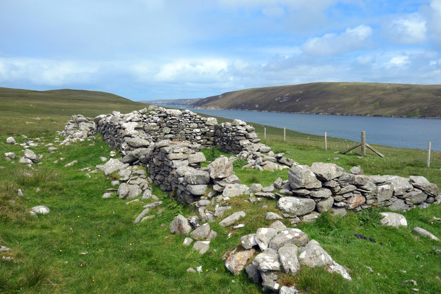
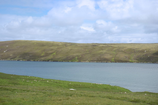
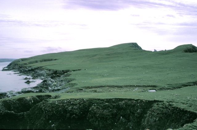
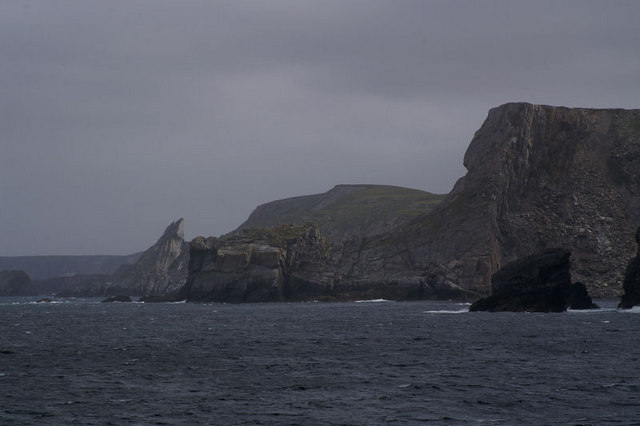
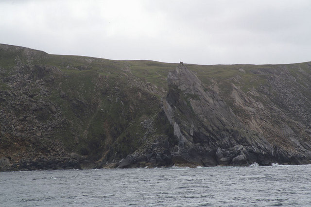
Stuis of Graveland is a prominent coastal feature located on the northern coast of the Shetland Islands in Scotland. It is a headland that extends into the North Sea, forming a distinctive point that marks the western entrance to the Yell Sound.

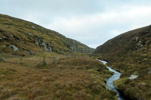
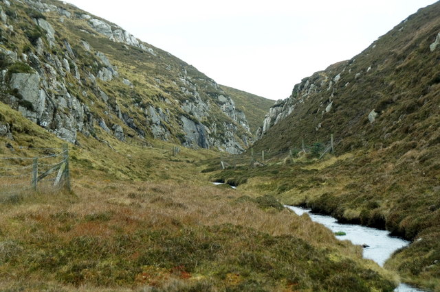
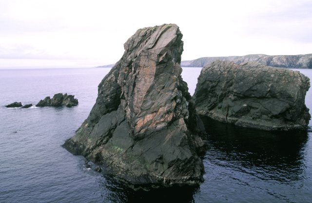
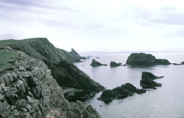
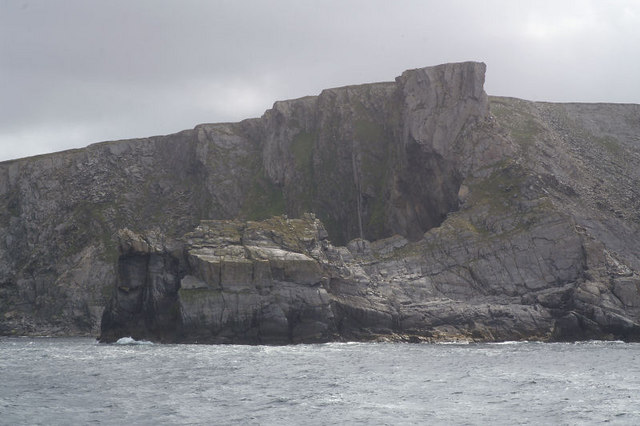
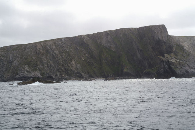
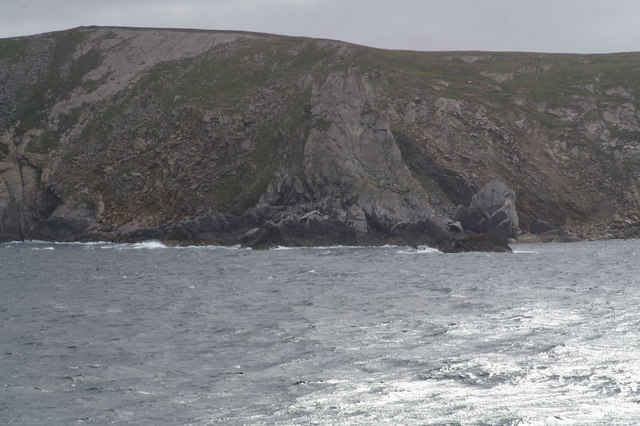
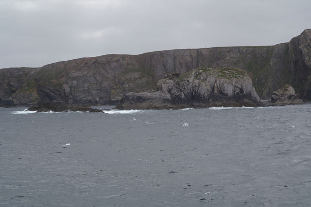
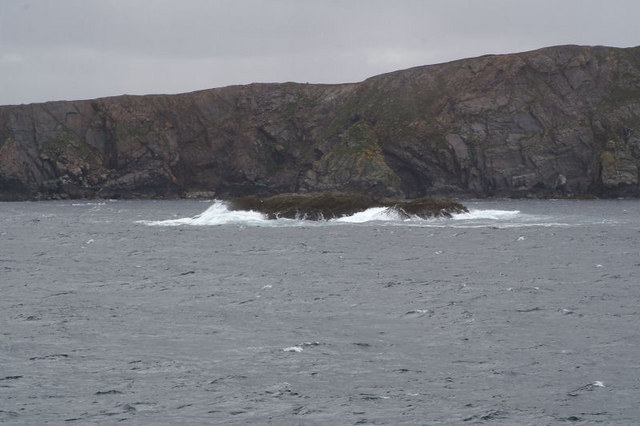
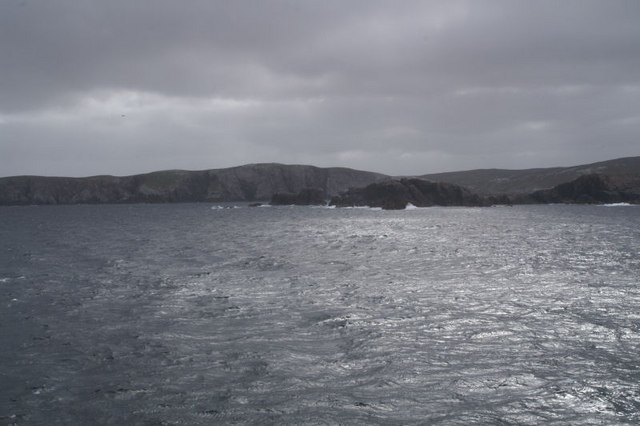
The Stuis of Graveland is characterized by its rugged and rocky terrain, with steep cliffs and jagged outcrops that rise up from the crashing waves below. The headland offers breathtaking panoramic views of the surrounding landscape, including the Yell Sound to the east and the open sea to the west.

The area surrounding Stuis of Graveland is known for its rich biodiversity. The cliffs provide nesting sites for various seabirds, including puffins, guillemots, and fulmars. It is also a popular spot for birdwatching enthusiasts who come to observe the diverse avian species that inhabit the region.

The headland is a popular destination for outdoor enthusiasts and nature lovers. Hikers and walkers can follow the coastal path that skirts along the edge of the cliffs, providing stunning vistas and opportunities to spot marine life such as seals and dolphins. Photographers are often drawn to Stuis of Graveland for its dramatic scenery and the interplay of light and shadow on the rugged landscape.

Overall, Stuis of Graveland is a captivating coastal feature that showcases the wild beauty of the Shetland Islands. Its unique geology, diverse wildlife, and breathtaking views make it a must-visit destination for anyone exploring the region.

If you have any feedback on the listing, please let us know in the comments section below.

Stuis of Graveland Images

Images are sourced within 2km of 60.648196/-1.1614018 or Grid Reference HU4596. Thanks to Geograph Open Source API. All images are credited.

Dale of Lumbister
Dale of Lumbister
Dale of Lumbister
Dale of Lumbister
Daalaskeo, beside Whale Firth This is the most northerly of a line of ruined crofts along the western side of Whale Firth.
Daalaskeo, beside Whale Firth
This is the most northerly of a line of ruined crofts along the western side of Whale Firth.
View over Whale Firth Taken from the deserted croft at Daalaskeo over to the bleak eastern side of Whale Firth. The western side of the firth is not so steep and formerly supported a crofting community. It still has a well fenced field system for sheep grazing. By contrast, the eastern side is moorland.
View over Whale Firth
Taken from the deserted croft at Daalaskeo over to the bleak eastern side of Whale Firth. The western side of the firth is not so steep and formerly supported a crofting community. It still has a well fenced field system for sheep grazing. By contrast, the eastern side is moorland.
Corner Wall at Graveland One of a line of ruined crofts along the west side of Whale Firth. The corner here must have been especially well built to stay standing.
Corner Wall at Graveland
One of a line of ruined crofts along the west side of Whale Firth. The corner here must have been especially well built to stay standing.
Blocked Doorway at Graveland Interior detail at the ruined croft of Graveland.
Blocked Doorway at Graveland
Interior detail at the ruined croft of Graveland.
Stacks of Stuis The coastline here is littered with loose stacks which provide plenty of nesting opportunities for the birds and resting spots for the seals.
Stacks of Stuis
The coastline here is littered with loose stacks which provide plenty of nesting opportunities for the birds and resting spots for the seals.
Stuis of Graveland This view is looking roughly south from the most northerly point on the headland.
Stuis of Graveland
This view is looking roughly south from the most northerly point on the headland.
Ern Stack A view from the landward side of Ern Stack looking towards the Ramna Stacks
Ern Stack
A view from the landward side of Ern Stack looking towards the Ramna Stacks
Coastline view towards Ern Stack A view along the western coastline of this square.  An image of the pasture in the easterly section of this grid square is available from grid HU4697 <a title="https://www.geograph.org.uk/photo/40051" href="https://www.geograph.org.uk/photo/40051">Link</a> .
Coastline view towards Ern Stack
A view along the western coastline of this square. An image of the pasture in the easterly section of this grid square is available from grid HU4697 Link .
The Eigg from the south-west With Ern Stack visible just to the right. Taken from one of the Yell Sound ferries on a North Isles cruise.
The Eigg from the south-west
With Ern Stack visible just to the right. Taken from one of the Yell Sound ferries on a North Isles cruise.
The Eigg from the west A finger of rock protruding from the cliff. Taken from one of the Yell Sound ferries on a North Isles cruise.
The Eigg from the west
A finger of rock protruding from the cliff. Taken from one of the Yell Sound ferries on a North Isles cruise.
The Eigg from the north-west Taken from one of the Yell Sound ferries on a North Isles cruise.
The Eigg from the north-west
Taken from one of the Yell Sound ferries on a North Isles cruise.
Ern Stack from the sea The extraordinary pale colouration on the landward side is invisible from the sea. Taken from one of the Yell Sound ferries on a North Isles cruise.
Ern Stack from the sea
The extraordinary pale colouration on the landward side is invisible from the sea. Taken from one of the Yell Sound ferries on a North Isles cruise.
Ern Stack from the sea Erne is the old Shetland name for the White-tailed Eagle, and this was the site of one of the last nests of native British sea eagles, last used early in the 20th century. Taken from one of the Yell Sound ferries on a North Isles cruise.
Ern Stack from the sea
Erne is the old Shetland name for the White-tailed Eagle, and this was the site of one of the last nests of native British sea eagles, last used early in the 20th century. Taken from one of the Yell Sound ferries on a North Isles cruise.
Aastack With the north tip of the Graveland peninsula beyond. Taken from one of the Yell Sound ferries on a North Isles cruise.
Aastack
With the north tip of the Graveland peninsula beyond. Taken from one of the Yell Sound ferries on a North Isles cruise.
Skerry off the coast of Graveland This un-named skerry off the north-west coast of Graveland is almost the only land in the square (the 1:25,000 map shows another much smaller rock and proves that the name Segil applies to a coastal feature on the Yell mainland). Taken from one of the Yell Sound ferries on a North Isles cruise.
Skerry off the coast of Graveland
This un-named skerry off the north-west coast of Graveland is almost the only land in the square (the 1:25,000 map shows another much smaller rock and proves that the name Segil applies to a coastal feature on the Yell mainland). Taken from one of the Yell Sound ferries on a North Isles cruise.
The tip of Graveland The very end of the Graveland peninsula, with Lumbister beyond that. Taken from one of the Yell Sound ferries on a North Isles cruise.
The tip of Graveland
The very end of the Graveland peninsula, with Lumbister beyond that. Taken from one of the Yell Sound ferries on a North Isles cruise.
Show me another place!

Stuis of Graveland is located at Grid Ref: HU4596 (Lat: 60.648196, Lng: -1.1614018)

Unitary Authority: Shetland Islands

Police Authority: Highlands and Islands

What 3 Words

///diagram.deciding.sunbeam. Near Gutcher, Shetland Islands

Related Wikis

Ern Stack

Ern Stack is a sea stack off Yell, in Shetland, Scotland. The word "ern" means an eagle (it is a cognate of, for example, Swedish "örn"), and it is said...

Yell, Shetland

Yell (Scots: Yell) is one of the North Isles of Shetland, Scotland. In the 2011 census it had a usually resident population of 966. It is the second largest...

Basta, Shetland

Basta is a hamlet on the island of Yell in the Shetland islands of Scotland. It is on the shores of Basta Voe and is in the parish of Yell. == References... ==

Mid Yell

Mid Yell is a coastal settlement on the island of Yell, the second largest of Shetland Islands, Scotland. Mid Yell, the largest settlement on the island...

Nearby Amenities

Located within 500m of 60.648196,-1.1614018
Hill of the Standing Stone
Natural: peak
Lat/Long: 60.6476456/-1.1654026
Ern Stack
Place: locality
Lat/Long: 60.64726/-1.1703256
South Fiski Geo
Place: locality
Lat/Long: 60.6502838/-1.1536101
The data included in this document is from www.openstreetmap.org. The data is made available under ODbL.

Have you been to Stuis of Graveland?

Leave your review of Stuis of Graveland below (or comments, questions and feedback).