Ness of Setter

Coastal Feature, Headland, Point in Shetland

Scotland

Ness of Setter

Setter, Gulberwick
Setter, Gulberwick Credit: Mike Pennington

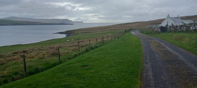
Ness of Setter is a prominent coastal feature located on the Shetland Islands, an archipelago in Scotland. It is a headland, or a narrow piece of land that juts out into the sea, forming a point. The headland is situated on the western coast of the Shetland Mainland, the largest island in the group.

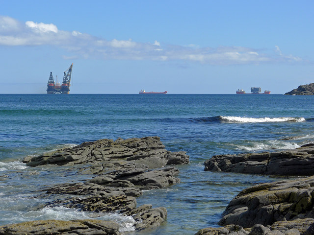
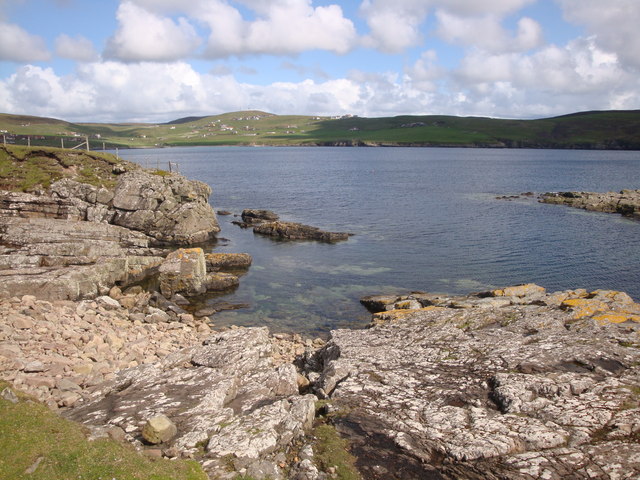
Ness of Setter is characterized by its rugged and dramatic cliffs, which rise steeply from the sea to a considerable height. The cliffs are composed of sedimentary rocks, displaying layers of different colors and textures, adding to the visual appeal of the headland. The exposure to the open Atlantic Ocean has shaped the cliffs, resulting in the formation of natural caves and arches that can be explored.

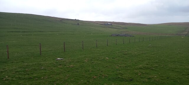
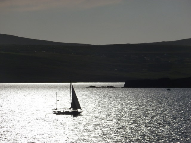
The headland offers breathtaking panoramic views of the surrounding coastline and the sea. On clear days, visitors can see the neighboring islands and even spot marine wildlife such as seals, dolphins, and seabirds. The area is a haven for birdwatchers, as it is home to numerous seabird colonies, including puffins, guillemots, and fulmars.

Ness of Setter is a popular destination for outdoor enthusiasts and nature lovers. It provides opportunities for coastal walks and hikes along its cliffs, offering stunning vistas and a chance to immerse oneself in the raw beauty of the Shetland Islands. The headland can be reached via a well-maintained footpath, which makes it accessible to visitors of all ages and abilities.

Overall, Ness of Setter is a remarkable coastal feature that showcases the rugged beauty of the Shetland Islands. It offers a unique experience for visitors, combining stunning scenery, geological wonders, and abundant wildlife.

If you have any feedback on the listing, please let us know in the comments section below.

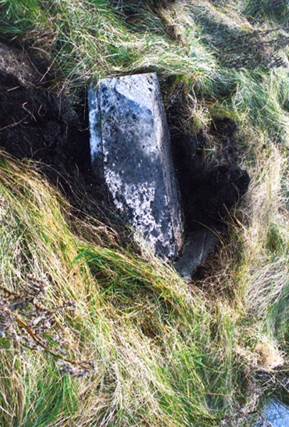
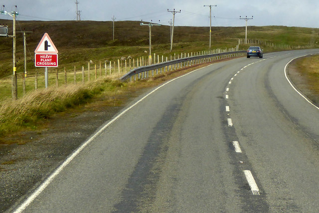
Ness of Setter Images

Images are sourced within 2km of 60.11786/-1.1957564 or Grid Reference HU4437. Thanks to Geograph Open Source API. All images are credited.

Setter, Gulberwick
Setter, Gulberwick
Crogagarth, Brindister
House at East Brindister
Gulberwick from the air
Marine activity in Gulber Wick A reminder that despite the problems in the oil industry there is still activity in Shetland's waters.
Marine activity in Gulber Wick
A reminder that despite the problems in the oil industry there is still activity in Shetland's waters.
Bus Stop on the A970 near Gulberwick The A970 runs for 71 miles across most of the length of the "Mainland" in the Shetland Islands. It is a good-quality single-carriageway road for most of its route. Travelling from south to north, the road begins at Grutness near Sumburgh Airport and winds around the many hills and inlets passing close to a number of small villages without going through any large ones before Lerwick. After looping around Lerwick, a short spur runs to Scalloway whilst the main route continues northwards towards Brae where it crosses the narrow isthmus of Mavis Grind. At Sandy Lochs the road splits and a four-mile spur goes through Urafirth to Hillswick. The main route continuing to the right towards its northern terminus at Isbister. This last part of the route tends to be narrower with passing places.

<span class="nowrap"><a title="https://www.sabre-roads.org.uk/wiki/index.php?title=A970" rel="nofollow ugc noopener" href="https://www.sabre-roads.org.uk/wiki/index.php?title=A970">Link</a><img style="margin-left:2px;" alt="External link" title="External link - shift click to open in new window" src="https://s1.geograph.org.uk/img/external.png" width="10" height="10"/></span>  SABRE
Bus Stop on the A970 near Gulberwick
The A970 runs for 71 miles across most of the length of the "Mainland" in the Shetland Islands. It is a good-quality single-carriageway road for most of its route. Travelling from south to north, the road begins at Grutness near Sumburgh Airport and winds around the many hills and inlets passing close to a number of small villages without going through any large ones before Lerwick. After looping around Lerwick, a short spur runs to Scalloway whilst the main route continues northwards towards Brae where it crosses the narrow isthmus of Mavis Grind. At Sandy Lochs the road splits and a four-mile spur goes through Urafirth to Hillswick. The main route continuing to the right towards its northern terminus at Isbister. This last part of the route tends to be narrower with passing places. LinkExternal link SABRE
A970, Brindister The A970 runs for 71 miles across most of the length of the "Mainland" in the Shetland Islands. It is a good-quality single-carriageway road for most of its route. Travelling from south to north, the road begins at Grutness near Sumburgh Airport and winds around the many hills and inlets passing close to a number of small villages without going through any large ones before Lerwick. After looping around Lerwick, a short spur runs to Scalloway whilst the main route continues northwards towards Brae where it crosses the narrow isthmus of Mavis Grind. At Sandy Lochs the road splits and a four-mile spur goes through Urafirth to Hillswick. The main route continuing to the right towards its northern terminus at Isbister. This last part of the route tends to be narrower with passing places.

<span class="nowrap"><a title="https://www.sabre-roads.org.uk/wiki/index.php?title=A970" rel="nofollow ugc noopener" href="https://www.sabre-roads.org.uk/wiki/index.php?title=A970">Link</a><img style="margin-left:2px;" alt="External link" title="External link - shift click to open in new window" src="https://s1.geograph.org.uk/img/external.png" width="10" height="10"/></span>  SABRE
A970, Brindister
The A970 runs for 71 miles across most of the length of the "Mainland" in the Shetland Islands. It is a good-quality single-carriageway road for most of its route. Travelling from south to north, the road begins at Grutness near Sumburgh Airport and winds around the many hills and inlets passing close to a number of small villages without going through any large ones before Lerwick. After looping around Lerwick, a short spur runs to Scalloway whilst the main route continues northwards towards Brae where it crosses the narrow isthmus of Mavis Grind. At Sandy Lochs the road splits and a four-mile spur goes through Urafirth to Hillswick. The main route continuing to the right towards its northern terminus at Isbister. This last part of the route tends to be narrower with passing places. LinkExternal link SABRE
Bus to Sandwick Leasks of Lerwick Volvo B7RLE/Plaxton Centro (T50 JLS) on route number 6 towards Sandwick.
Bus to Sandwick
Leasks of Lerwick Volvo B7RLE/Plaxton Centro (T50 JLS) on route number 6 towards Sandwick.
Old Milestone by old A970, Loch of Brindister, Lerwick Parish Shetland concrete by the Old A970, in parish of Lerwick (Mainland District), Loch of Brindister, on old road.

Surveyed

Milestone Society National ID: SH_LWSB06
Old Milestone by old A970, Loch of Brindister, Lerwick Parish
Shetland concrete by the Old A970, in parish of Lerwick (Mainland District), Loch of Brindister, on old road. Surveyed Milestone Society National ID: SH_LWSB06
A970 towards Lerwick The A970 runs for 71 miles across most of the length of the "Mainland" in the Shetland Islands. It is a good-quality single-carriageway road for most of its route. Travelling from south to north, the road begins at Grutness near Sumburgh Airport and winds around the many hills and inlets passing close to a number of small villages without going through any large ones before Lerwick. After looping around Lerwick, a short spur runs to Scalloway whilst the main route continues northwards towards Brae where it crosses the narrow isthmus of Mavis Grind. At Sandy Lochs the road splits and a four-mile spur goes through Urafirth to Hillswick. The main route continuing to the right towards its northern terminus at Isbister. This last part of the route tends to be narrower with passing places.

<span class="nowrap"><a title="https://www.sabre-roads.org.uk/wiki/index.php?title=A970" rel="nofollow ugc noopener" href="https://www.sabre-roads.org.uk/wiki/index.php?title=A970">Link</a><img style="margin-left:2px;" alt="External link" title="External link - shift click to open in new window" src="https://s1.geograph.org.uk/img/external.png" width="10" height="10"/></span>  SABRE
A970 towards Lerwick
The A970 runs for 71 miles across most of the length of the "Mainland" in the Shetland Islands. It is a good-quality single-carriageway road for most of its route. Travelling from south to north, the road begins at Grutness near Sumburgh Airport and winds around the many hills and inlets passing close to a number of small villages without going through any large ones before Lerwick. After looping around Lerwick, a short spur runs to Scalloway whilst the main route continues northwards towards Brae where it crosses the narrow isthmus of Mavis Grind. At Sandy Lochs the road splits and a four-mile spur goes through Urafirth to Hillswick. The main route continuing to the right towards its northern terminus at Isbister. This last part of the route tends to be narrower with passing places. LinkExternal link SABRE
Gulberwick from Hill of Shurton Lerwick's 'exclusive' suburb.
Gulberwick from Hill of Shurton
Lerwick's 'exclusive' suburb.
The bay of Gulber Wick from Lyoonigeo A lovely rocky stretch of coast at Setter.
The bay of Gulber Wick from Lyoonigeo
A lovely rocky stretch of coast at Setter.
Gulberwick: a yacht passes Punds Stack A yacht travels northbound past Punds Stack as we look into the evening sun towards it.
Gulberwick: a yacht passes Punds Stack
A yacht travels northbound past Punds Stack as we look into the evening sun towards it.
Gulberwick: postbox № ZE2 41 A small postbox, emptied at 10:30 on weekday and Saturday mornings.
Gulberwick: postbox № ZE2 41
A small postbox, emptied at 10:30 on weekday and Saturday mornings.
Moor Park Family Golf Centre Distances marked on the driving range.
Moor Park Family Golf Centre
Distances marked on the driving range.
Silt catcher, Brindister A reservoir which allows particles to precipitate out of water draining the Brindister Quarry.
Silt catcher, Brindister
A reservoir which allows particles to precipitate out of water draining the Brindister Quarry.
Gulber Wick The head of the wick, seen from the track above Trebister.
Gulber Wick
The head of the wick, seen from the track above Trebister.
Track on the Ness of Trebister A farm access track that runs along the spine of the point.
Track on the Ness of Trebister
A farm access track that runs along the spine of the point.
Show me another place!

Ness of Setter is located at Grid Ref: HU4437 (Lat: 60.11786, Lng: -1.1957564)

Unitary Authority: Shetland Islands

Police Authority: Highlands and Islands

What 3 Words

///bids.yesterday.zinc. Near Lerwick, Shetland Islands

Related Wikis

Brindister, South Mainland

Brindister is a village on South Mainland in Shetland, Scotland. Brindister is within the parish of Lerwick, and adjacent to the A970 south of Gulberwick...

Gulberwick

Gulberwick is a village on Mainland, 2.5 mi (4 km) southwest of Lerwick, Shetland, Scotland, which contains approximately 200 houses. In recent years the...

Lerwick Observatory

Lerwick Observatory (also known as Lerwick Magnetic Observatory) is a British meteorological observatory located near the port at Lerwick, Shetland Islands...

Quarff

Quarff is a small village on Mainland in the Shetland Islands in Scotland. It is located on the main A970 road, 5 miles (8.0 km) south of Shetland's only...

Have you been to Ness of Setter?

Leave your review of Ness of Setter below (or comments, questions and feedback).