Salta Ness

Coastal Feature, Headland, Point in Shetland

Scotland

Salta Ness

Trig point Known to the Ordnance Survey as White Ness
Trig point Credit: Iain Macaulay

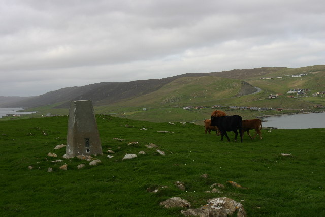
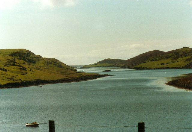
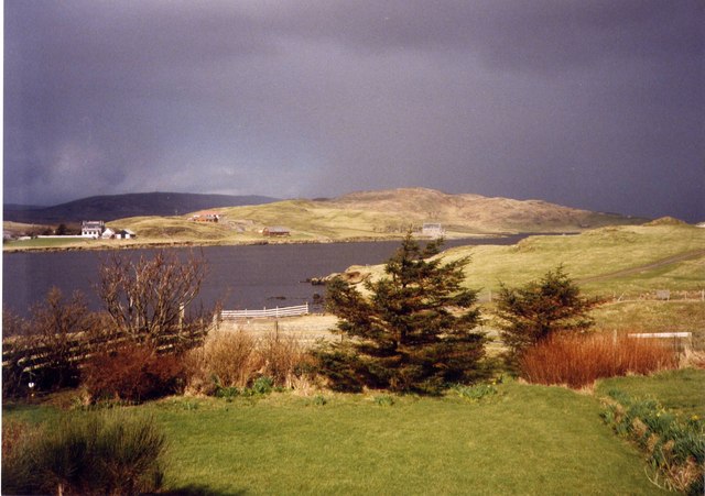
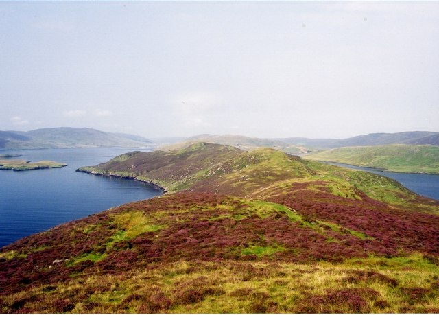
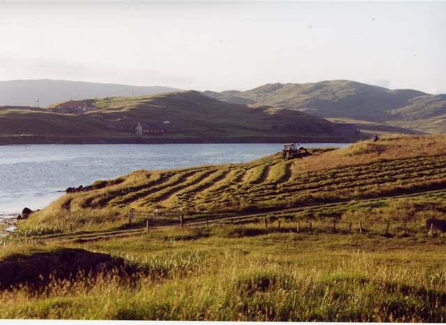
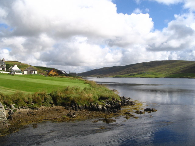
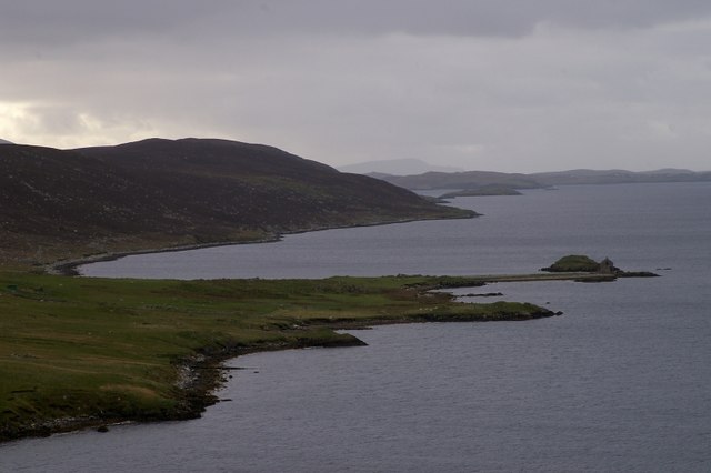
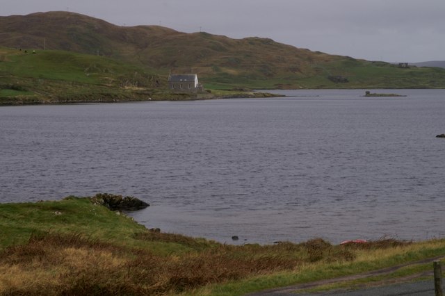
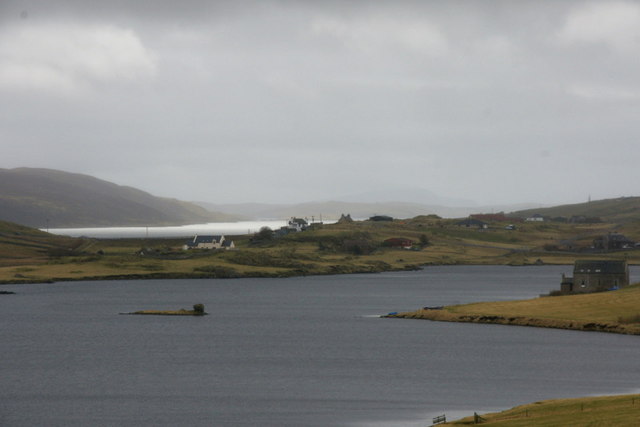
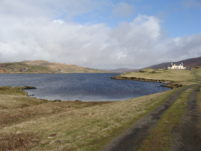
Salta Ness is a prominent coastal feature located on the island of Shetland, situated in the northernmost part of Scotland. It is a headland that projects out into the North Sea, forming a point that juts into the water. The name "Salta Ness" is derived from the Old Norse word "salt," meaning salt, and "ness," meaning headland, reflecting the historical influence of the Norse settlers in the area.

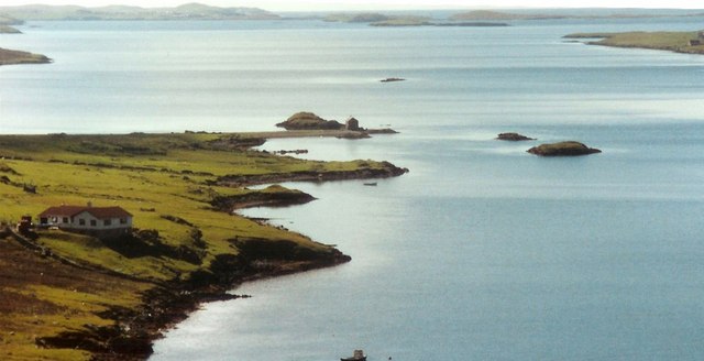
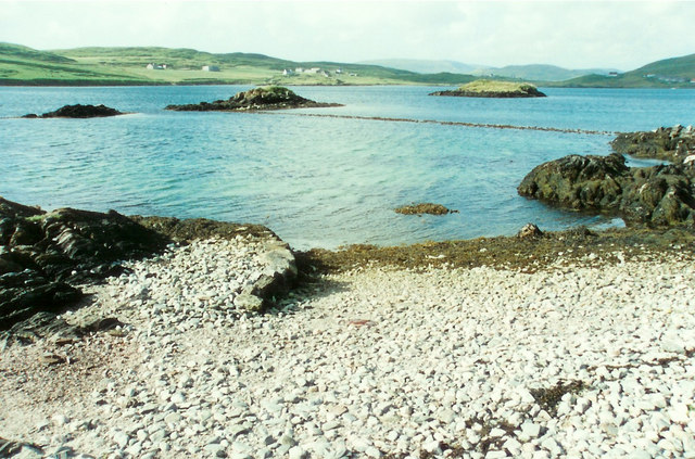
This coastal feature boasts stunning natural beauty, with its rugged cliffs and breathtaking views of the surrounding seascape. The headland is composed of sedimentary rocks, primarily sandstone and shale, which have been shaped by the relentless forces of erosion over thousands of years. As a result, Salta Ness features distinctive geological formations, including sea caves and stacks, which add to its allure.

The area surrounding Salta Ness is rich in wildlife, making it a popular spot for nature enthusiasts. The cliffs provide nesting sites for seabirds such as puffins, razorbills, and guillemots, while the surrounding waters are home to seals, dolphins, and various species of fish. The headland is also known for its diverse plant life, including heather, grasses, and wildflowers that thrive in the coastal environment.

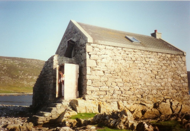
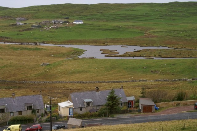
In addition to its natural wonders, Salta Ness has a significant historical and cultural heritage. The headland is dotted with archaeological sites, including Iron Age settlements and Viking remains, highlighting its importance as a strategic location throughout history. Today, Salta Ness serves as a popular destination for tourists and locals alike, offering opportunities for hiking, birdwatching, and exploring the area's rich history and natural beauty.

If you have any feedback on the listing, please let us know in the comments section below.
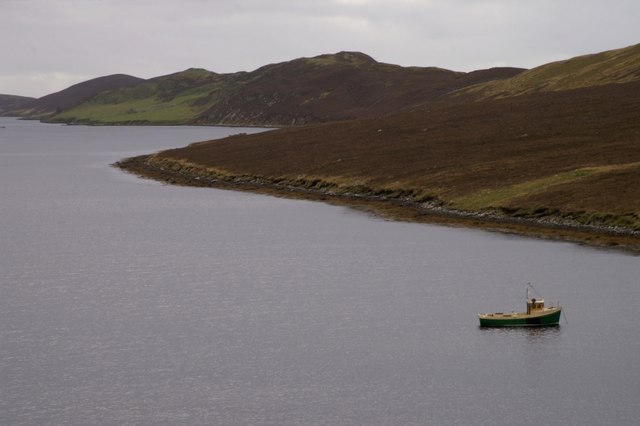
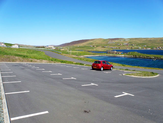
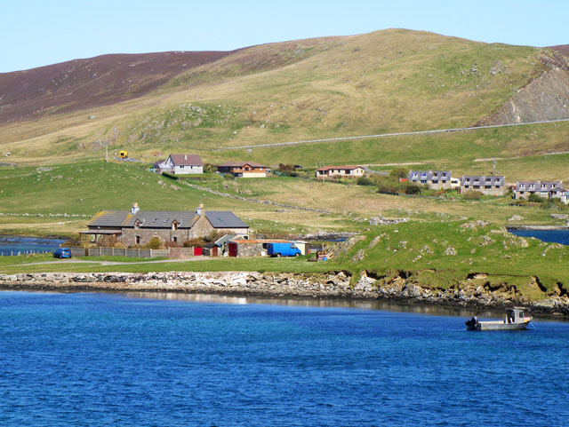
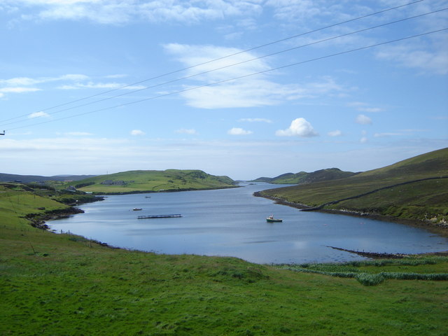
Salta Ness Images

Images are sourced within 2km of 60.195127/-1.2920133 or Grid Reference HU3945. Thanks to Geograph Open Source API. All images are credited.

Trig point Known to the Ordnance Survey as White Ness
Trig point
Known to the Ordnance Survey as White Ness
Bod of Nesbister The camping Bod at Nesbister, formerly a fishing station
Bod of Nesbister
The camping Bod at Nesbister, formerly a fishing station
Nesbister Nesbister looking out on the Bod of Nesbister, with Burra and the Scalloway isles in the distance. There is an ancient tidal Pictish causeway below the sea between the Bod isles and the land.
Nesbister
Nesbister looking out on the Bod of Nesbister, with Burra and the Scalloway isles in the distance. There is an ancient tidal Pictish causeway below the sea between the Bod isles and the land.
Pictish Causeway at Nesbister This ancient Pictish causeway near the Bod of Nesbister can only be seen at low tide.
Pictish Causeway at Nesbister
This ancient Pictish causeway near the Bod of Nesbister can only be seen at low tide.
Stromness Voe Stromness Voe with the Ness on the right. The house in the distance is Jackville, accessible only by foot or boat.
Stromness Voe
Stromness Voe with the Ness on the right. The house in the distance is Jackville, accessible only by foot or boat.
View over the Loch of Strom, Whiteness, Shetland Taken from a house (through the window, hence the streak on the left of the image) located at the south end of the Loch of Strom.  Hogaland is just off the right-hand side of the photo. There are a few more buildings now on the far side of the loch, but it has changed little other than that.
View over the Loch of Strom, Whiteness, Shetland
Taken from a house (through the window, hence the streak on the left of the image) located at the south end of the Loch of Strom. Hogaland is just off the right-hand side of the photo. There are a few more buildings now on the far side of the loch, but it has changed little other than that.
Strom Ness from Hill of Olligarth This ness is flanked by Stromness Voe (the water to the left of the picture) and the entrance to Weisdale Voe.  In the distance can be seen houses in the village of Hamnavoe. Don't be fooled into thinking you're in Orkney - this Strom Ness is definitely in Shetland!
Strom Ness from Hill of Olligarth
This ness is flanked by Stromness Voe (the water to the left of the picture) and the entrance to Weisdale Voe. In the distance can be seen houses in the village of Hamnavoe. Don't be fooled into thinking you're in Orkney - this Strom Ness is definitely in Shetland!
Making hay while the sun shines, Hogaland ...and never is that expression more apt than in Shetland!  The summer days are long, but the season is short, so there's plenty to be done on a bonny day.
Making hay while the sun shines, Hogaland
...and never is that expression more apt than in Shetland! The summer days are long, but the season is short, so there's plenty to be done on a bonny day.
Loch of Strom viewed from Strom Bridge The bridge crosses the narrows connecting the Loch of Strom to Stromness Voe. Visible in the loch are the three islands of the Holms of Hogaland and the ruins of a ruined island castle connected to the mainland by causeway.
Loch of Strom viewed from Strom Bridge
The bridge crosses the narrows connecting the Loch of Strom to Stromness Voe. Visible in the loch are the three islands of the Holms of Hogaland and the ruins of a ruined island castle connected to the mainland by causeway.
Nesbister The head of Whiteness Voe.
Nesbister
The head of Whiteness Voe.
The Vadill, Whiteness Voe A vadill is a place that is shallow enough to be waded across.
The Vadill, Whiteness Voe
A vadill is a place that is shallow enough to be waded across.
Loch of Strom This brackish water loch is tidal.
Loch of Strom
This brackish water loch is tidal.
Stromness Voe
Stromness Voe
Car park for the new burial ground
House by Mousa Ness In the distance can just be seen the A971 climbing the hill.
House by Mousa Ness
In the distance can just be seen the A971 climbing the hill.
Stromness Voe A classic Shetland voe - which is a drowned valley or inlet rather like a Norwegian fjord
Stromness Voe
A classic Shetland voe - which is a drowned valley or inlet rather like a Norwegian fjord
Loch of Strom The lochside kirk and the small home, with the ruins of a mysterious castle, about which I have discovered nothing.
Loch of Strom
The lochside kirk and the small home, with the ruins of a mysterious castle, about which I have discovered nothing.
Loch of Strom from the track to Hogaland
Show me another place!

Salta Ness is located at Grid Ref: HU3945 (Lat: 60.195127, Lng: -1.2920133)

Unitary Authority: Shetland Islands

Police Authority: Highlands and Islands

What 3 Words

///egging.removal.pegs. Near Scalloway, Shetland Islands

Related Wikis

Whiteness, Shetland

Whiteness (Old Norse: Hvitanes, white headland) is a village in Tingwall parish, Shetland Islands, Scotland, on Mainland. It is also an ancient civil parish...

Flotta, Shetland

Flotta (grid reference HU375462) is an island off the south west of Mainland, Shetland. The name may come from the Old Norse, flatey meaning flat island...

Hoy, Shetland

Hoy (Háey, Old Norse for 'high island') is a small island in Weisdale Voe, an arm of the sea in the Shetland islands, Scotland. Nearby are the smaller...

Tingwall Airport

Tingwall Airport (IATA: LWK, ICAO: EGET), also known as Lerwick/Tingwall Airport, is located in the Tingwall valley, near the village of Gott, 4 NM (7...

Nearby Amenities

Located within 500m of 60.195127,-1.2920133
Barrier: cattle_grid
Lat/Long: 60.1984949/-1.2868514
Power: pole
Lat/Long: 60.1958437/-1.2946366
Power: pole
Lat/Long: 60.196265/-1.2942262
Power: pole
Lat/Long: 60.1948185/-1.2956424
Power: pole
Lat/Long: 60.1953844/-1.2950791
Power: pole
Lat/Long: 60.1972723/-1.2932592
Power: pole
Lat/Long: 60.1993825/-1.2912563
Power: pole
Lat/Long: 60.1990839/-1.2901834
Power: pole
Lat/Long: 60.198784/-1.2891266
Power: pole
Lat/Long: 60.1984614/-1.2884614
Power: pole
Lat/Long: 60.1938767/-1.2965476
Power: pole
Lat/Long: 60.194226/-1.2962123
Power: pole
Lat/Long: 60.1938207/-1.2955284
Power: pole
Lat/Long: 60.1944046/-1.2968748
Power: pole
Lat/Long: 60.193766/-1.2966764
Power: pole
Lat/Long: 60.1938927/-1.2978163
Power: pole
Lat/Long: 60.194414/-1.2974891
Power: pole
Lat/Long: 60.1944193/-1.2980228
Barrier: cattle_grid
Lat/Long: 60.198722/-1.2875931
Power: pole
Lat/Long: 60.1974183/-1.2848307
Power: pole
Lat/Long: 60.1977405/-1.2859479
Power: pole
Lat/Long: 60.1980658/-1.2870717
Barrier: cattle_grid
Lat/Long: 60.1959048/-1.2835554
Power: pole
Lat/Long: 60.1925805/-1.2980049
Power: pole
Lat/Long: 60.1931225/-1.2973858
Power: pole
Lat/Long: 60.1938562/-1.2984946
Power: pole
Lat/Long: 60.1946967/-1.2967852
Power: pole
Lat/Long: 60.195017/-1.2966605
Power: pole
Lat/Long: 60.1966663/-1.2938181
Power: pole
Lat/Long: 60.197943/-1.2926296
Power: pole
Lat/Long: 60.1984975/-1.2921052
Power: pole
Lat/Long: 60.1989384/-1.2916917
Bus Stop
South Whiteness
Public Transport: platform
Lat/Long: 60.1924314/-1.2992379
The data included in this document is from www.openstreetmap.org. The data is made available under ODbL.

Have you been to Salta Ness?

Leave your review of Salta Ness below (or comments, questions and feedback).