South Head

Coastal Feature, Headland, Point in Shetland

Scotland

South Head

South Head, Lamba, Yell Sound
South Head, Lamba, Yell Sound Credit: Mike Pennington

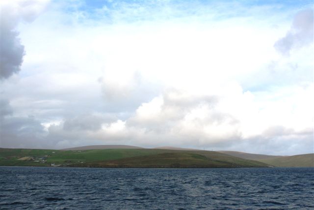
South Head is a prominent coastal feature located on the southernmost tip of the Shetland Islands, an archipelago in Scotland. Jutting out into the North Sea, it is classified as both a headland and a point, offering breathtaking views of the surrounding rugged coastline.

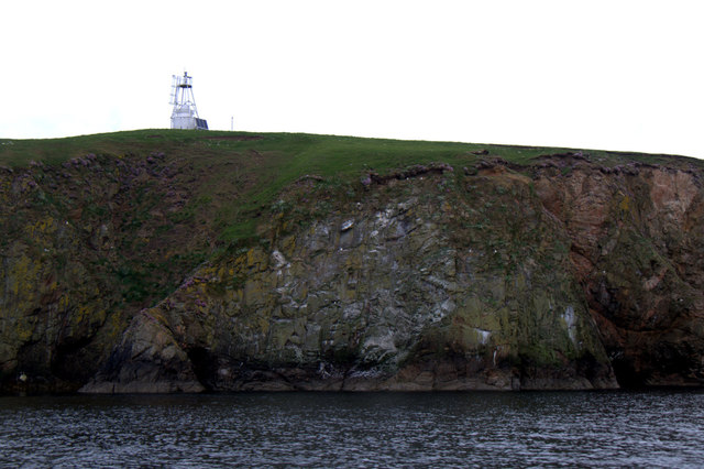
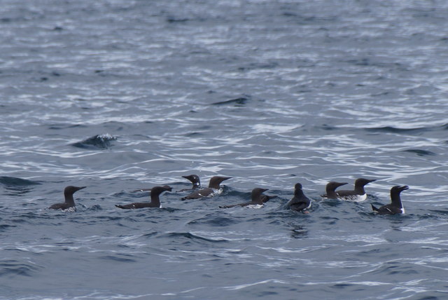
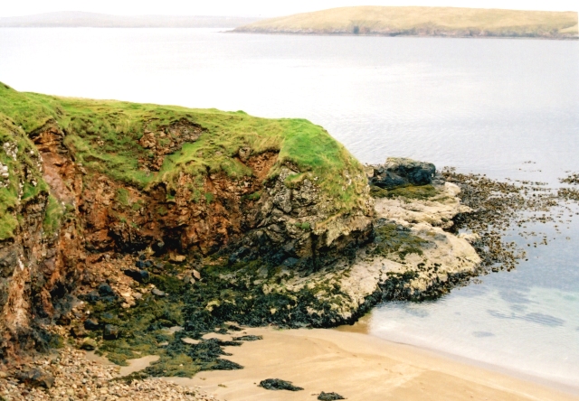
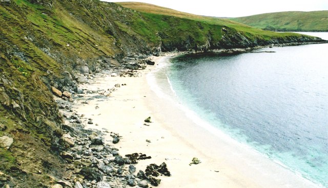
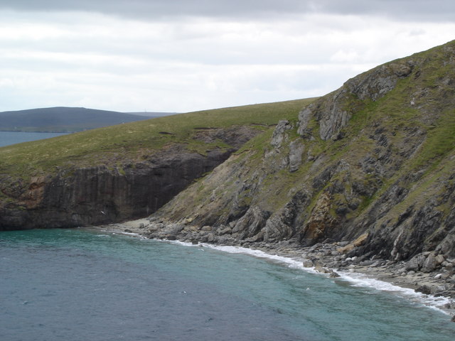
At approximately 120 meters (394 feet) in height, South Head is characterized by its steep cliffs, which are composed of rugged rock formations such as sandstone and quartzite. These cliffs provide nesting sites for a wide variety of seabirds, including puffins, guillemots, and razorbills. The area is also home to various species of marine life, such as seals and dolphins, which can often be spotted swimming in the nearby waters.

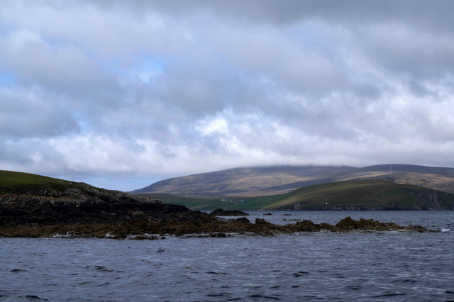
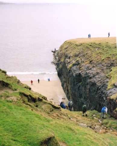
The headland is accessible by a well-maintained path, making it a popular destination for hikers and nature enthusiasts. Visitors can enjoy panoramic views of the surrounding seascape, with the distant horizon dotted by numerous smaller islands. On clear days, it is possible to see as far as Fair Isle, another inhabited island in the Shetland archipelago.

South Head is not only known for its natural beauty but also for its historical significance. The area is scattered with archaeological remains, including Iron Age brochs, which were ancient circular stone towers used for defensive purposes. These remnants serve as a reminder of the island's rich and fascinating past.

Overall, South Head in Shetland is a captivating coastal feature that offers visitors a unique blend of stunning natural landscapes, diverse wildlife, and glimpses into the region's history.

If you have any feedback on the listing, please let us know in the comments section below.

South Head Images

Images are sourced within 2km of 60.5123/-1.2961064 or Grid Reference HU3881. Thanks to Geograph Open Source API. All images are credited.

South Head, Lamba, Yell Sound
Beacon on Lamba, Yell Sound
Brei Geo, Lamba, Yell Sound
Auks off Lamba, Yell Sound All Guillemots, apart from one Razorbill on the far right and a Puffin fourth from the right.
Auks off Lamba, Yell Sound
All Guillemots, apart from one Razorbill on the far right and a Puffin fourth from the right.
North end of Lamba, Yell Sound
North end of Lamba, Yell Sound Ronas Hill in the clouds in the background.
North end of Lamba, Yell Sound
Ronas Hill in the clouds in the background.
Wick of Lamba, Lamba, Yell Sound
Common Seal (Phoca vitulina) with very young pup, Lamba, Yell Sound
Saberstone This spectacular cliff is part of the Walls Boundary Fault, which cuts Shetland from north to south and may be the continuation of the Great Glen Fault in Scotland.
Saberstone
This spectacular cliff is part of the Walls Boundary Fault, which cuts Shetland from north to south and may be the continuation of the Great Glen Fault in Scotland.
Otter Hadd The headland beyond Ollaberry
Otter Hadd
The headland beyond Ollaberry
Looking towards the Taing of Norwick The Taing is the headland beyond this fine but rather inaccessible beach.
Looking towards the Taing of Norwick
The Taing is the headland beyond this fine but rather inaccessible beach.
Ollaberry Fault An extension of the Great Glen Fault of Scotland, outcropping in Shetland. A must for all geologists.The cliff on the far side is granite; that on the nearside is schist.
Ollaberry Fault
An extension of the Great Glen Fault of Scotland, outcropping in Shetland. A must for all geologists.The cliff on the far side is granite; that on the nearside is schist.
Lamba with small natural arch at south end
Tanker Overseas Shirley being escorted into Sullom Voe oil terminal by tugs
Tirrick getting line aboard from Tanker Overseas Yellowstone
Back of Ollaberry
Back of Ollaberry
North end of Lamba
North end of Lamba
Show me another place!

South Head is located at Grid Ref: HU3881 (Lat: 60.5123, Lng: -1.2961064)

Unitary Authority: Shetland Islands

Police Authority: Highlands and Islands

What 3 Words

///bind.campfires.seats. Near Toft, Shetland Islands

Nearby Locations

Hesti Geo South Head Lamba

Related Wikis

Lamba, Shetland

Lamba is an uninhabited island in Yell Sound in Shetland. It lies 1.5 km (0.93 mi) north of the entrance to the Sullom Voe inlet and 1.4 kilometres (0...

Little Roe

Little Roe is an island in Yell Sound in the Shetland Islands == History == The island's name is Norse in origin, from Rauðey Litla, meaning "small red...

Ollaberry

Ollaberry (Old Norse: Olafrsberg, meaning Olaf's Hill) is a village on Mainland, Shetland, Scotland on the west shore of Yell Sound, 10.9 miles (17.5 km...

Brother Isle

Brother Isle (Old Norse: breiðare øy meaning broad beach island) is a small, uninhabited island in Shetland, Scotland. It lies between the islands of Yell...

Shetland Gas Plant

The Shetland Gas Plant is a natural-gas processing plant in the Shetland Islands, Scotland. == History == The Shetland Gas Plant is the collection and...

RAF Sullom Voe

Royal Air Force Sullom Voe or more simply RAF Sullom Voe is a former Royal Air Force station near the village of Brae, in the Shetland Isles of Scotland...

Sullom Voe Terminal

The Sullom Voe Terminal is an oil and gas terminal at Sullom Voe in the Shetland Islands of Scotland. It handles production from oilfields in the North...

Little Holm, Yell Sound

Little Holm is a small island in Yell Sound, in Shetland, Scotland. It lies between Northmavine and the island of Yell. There is a lighthouse here. In...

Nearby Amenities

Located within 500m of 60.5123,-1.2961064
Seamark Light 1 Character: Fl
Seamark Light 1 Colour: green
Seamark Light 1 Height: 30
Seamark Light 1 Period: 3
Seamark Light 1 Range: 5
Seamark Light 1 Sector End: 288
Seamark Light 1 Sector Start: 240
Seamark Light 1 Sequence: 0.3+(2.7)
Seamark Light 2 Character: Fl
Seamark Light 2 Colour: white
Seamark Light 2 Height: 30
Seamark Light 2 Period: 3
Seamark Light 2 Range: 8
Seamark Light 2 Sector End: 293
Seamark Light 2 Sector Start: 288
Seamark Light 2 Sequence: 0.3+(2.7)
Seamark Light 3 Character: Fl
Seamark Light 3 Colour: red
Seamark Light 3 Height: 30
Seamark Light 3 Period: 3
Seamark Light 3 Range: 5
Seamark Light 3 Sector End: 327
Seamark Light 3 Sector Start: 293
Seamark Light 3 Sequence: 0.3+(2.7)
Seamark Light 4 Character: Fl
Seamark Light 4 Colour: white
Seamark Light 4 Height: 30
Seamark Light 4 Period: 3
Seamark Light 4 Range: 8
Seamark Light 4 Sector End: 44
Seamark Light 4 Sector Start: 327
Seamark Light 4 Sequence: 0.3+(2.7)
Seamark Light 5 Character: Fl
Seamark Light 5 Colour: red
Seamark Light 5 Height: 30
Seamark Light 5 Period: 3
Seamark Light 5 Range: 5
Seamark Light 5 Sector End: 140
Seamark Light 5 Sector Start: 44
Seamark Light 5 Sequence: 0.3+(2.7)
Seamark Light 6 Character: Fl
Seamark Light 6 Colour: white
Seamark Light 6 Height: 30
Seamark Light 6 Period: 3
Seamark Light 6 Range: 8
Seamark Light 6 Sector End: 190
Seamark Light 6 Sector Start: 140
Seamark Light 6 Sequence: 0.3+(2.7)
Seamark Light Reference: A 3821
Seamark Name: South Head
Seamark Type: light_major
Source: US NGA Pub. 114. 2011-05-26.
Lat/Long: 60.512481/-1.2977332
The data included in this document is from www.openstreetmap.org. The data is made available under ODbL.

Have you been to South Head?

Leave your review of South Head below (or comments, questions and feedback).