Head of Calsta

Coastal Feature, Headland, Point in Shetland

Scotland

Head of Calsta

North Roe The shore of North Roe on a flight from Tingwall.
North Roe Credit: Gerald England

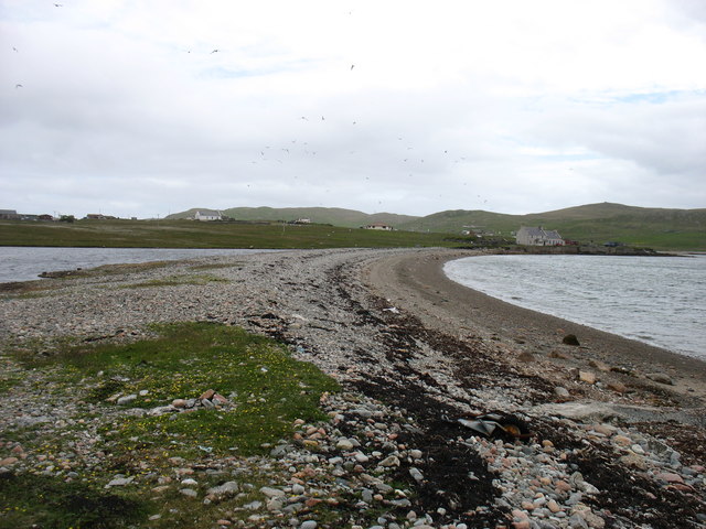
Head of Calsta is a prominent coastal feature located in the Shetland Islands, Scotland. It is a headland that juts out into the North Atlantic Ocean, forming a distinct point on the rugged coastline. Situated on the western coast of the mainland of Shetland, the Head of Calsta offers breathtaking panoramic views of the surrounding landscape.

The headland is characterized by its steep cliffs, which rise dramatically from the sea below. These cliffs are composed of layered rocks, showcasing the geological history of the area. The exposed layers reveal a variety of sedimentary rock formations, including sandstone and shale, providing valuable insight into the region's geological past.

The Head of Calsta is known for its rich biodiversity and serves as an important habitat for a variety of seabirds, including puffins, guillemots, and fulmars. The cliffs provide nesting sites for these birds, making it a haven for birdwatching enthusiasts and nature lovers alike.

In addition to its natural beauty, the Head of Calsta also holds historical significance. The area is home to ancient archaeological sites, including remnants of settlements and burial grounds dating back to the Iron Age. These sites offer a glimpse into the lives of early inhabitants of the Shetland Islands and provide valuable insights into the region's cultural heritage.

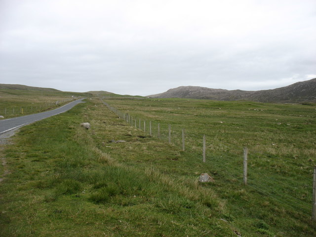
The Head of Calsta is a popular destination for hikers and outdoor enthusiasts, offering a range of walking trails that allow visitors to explore the stunning coastal scenery. Its rugged beauty, diverse wildlife, and historical importance make it a must-visit location for anyone seeking an authentic Shetland experience.

If you have any feedback on the listing, please let us know in the comments section below.

Head of Calsta Images

Images are sourced within 2km of 60.571518/-1.31757 or Grid Reference HU3787. Thanks to Geograph Open Source API. All images are credited.

North Roe The shore of North Roe on a flight from Tingwall.
North Roe
The shore of North Roe on a flight from Tingwall.
Track to Calsta, North Roe
Track on Billia Field, North Roe
Skelberry, North Roe, from the Colsta track
Track to Colsta on Billia Field, North Roe
Skelberry, North Roe
Purple saxifrage (Saxifraga oppositifolia), Skelberry, North Roe A very local plant in Shetland, only found in North Roe. It is however, widespread in northern latitudes and is Holarctic (found around the Arctic in Eurasia and America).
Purple saxifrage (Saxifraga oppositifolia), Skelberry, North Roe
A very local plant in Shetland, only found in North Roe. It is however, widespread in northern latitudes and is Holarctic (found around the Arctic in Eurasia and America).
The spit at Burra Voe I don't think this is a true tombolo, because on the left is just a small (and no doubt saline) lochan. But it is quite impressive that this low barrier has survived for many decades, or longer.
The spit at Burra Voe
I don't think this is a true tombolo, because on the left is just a small (and no doubt saline) lochan. But it is quite impressive that this low barrier has survived for many decades, or longer.
Burra Voe pier Not, perhaps, suitable for other than the smallest of vessels.
Burra Voe pier
Not, perhaps, suitable for other than the smallest of vessels.
The A970 heading south The A970 just comes to a dead stop about 3 km north of here (behind the camera), at Isbister. Looking south, for the next ten miles or so it is "single track with passing places", but there is so little traffic that it is hardly a problem. After that, and all the way to Sumburgh <a href="https://www.geograph.org.uk/gridref/HU4009">HU4009</a>, 80km away, it is a splendid road, upgraded (like other main routes on the Shetland Islands) when the oil money was at its peak.
The A970 heading south
The A970 just comes to a dead stop about 3 km north of here (behind the camera), at Isbister. Looking south, for the next ten miles or so it is "single track with passing places", but there is so little traffic that it is hardly a problem. After that, and all the way to Sumburgh HU4009, 80km away, it is a splendid road, upgraded (like other main routes on the Shetland Islands) when the oil money was at its peak.
The A970 heading south The A970 just comes to a dead stop about 4 km north of here (behind the camera), at Isbister. Looking south, for just under ten miles it is "single track with passing places", but there is so little traffic that it is hardly a problem. After that, and all the way to Sumburgh <a href="https://www.geograph.org.uk/gridref/HU4009">HU4009</a>, 80 km away, it is a splendid road, upgraded (like other main routes on the Shetland Islands) when the oil money was at its peak.
The A970 heading south
The A970 just comes to a dead stop about 4 km north of here (behind the camera), at Isbister. Looking south, for just under ten miles it is "single track with passing places", but there is so little traffic that it is hardly a problem. After that, and all the way to Sumburgh HU4009, 80 km away, it is a splendid road, upgraded (like other main routes on the Shetland Islands) when the oil money was at its peak.
A970 Road A970 road near Skelberry
A970 Road
A970 road near Skelberry
Pipework at North Roe May be the remains of old sewage systems when it was acceptable to discharge straight into the sea.
Pipework at North Roe
May be the remains of old sewage systems when it was acceptable to discharge straight into the sea.
A970 approaching North Roe
North Roe Methodist Church, South Haa Category C Listed 1878 Mission Chapel and Manse.  Its double cottage design is unusual in Shetland and more in keeping with school and schoolhouse arrangements on the mainland. It was reported in July 2014 that the church will receive £7,100 from the Heritage Lottery Fund to replace its windows, and help provide better facilities to make the church more suitable for wider community use.
North Roe Methodist Church, South Haa
Category C Listed 1878 Mission Chapel and Manse. Its double cottage design is unusual in Shetland and more in keeping with school and schoolhouse arrangements on the mainland. It was reported in July 2014 that the church will receive £7,100 from the Heritage Lottery Fund to replace its windows, and help provide better facilities to make the church more suitable for wider community use.
North Roe This small community is on the shores of one of the many Burra Voes in Shetland.
North Roe
This small community is on the shores of one of the many Burra Voes in Shetland.
The Wadill Is this a ruined croft house? If so it is one of many in the remoter parts of Shetland.
The Wadill
Is this a ruined croft house? If so it is one of many in the remoter parts of Shetland.
Houlland This shot shows the difference between the improved grazing land and the unimproved moorland beyond. This is one of several places in Shetland named Houlland; in this case it is a Burn of Houlland, not visible in the shot, which drains this area into Burra Voe beyond.
Houlland
This shot shows the difference between the improved grazing land and the unimproved moorland beyond. This is one of several places in Shetland named Houlland; in this case it is a Burn of Houlland, not visible in the shot, which drains this area into Burra Voe beyond.
Show me another place!

Head of Calsta is located at Grid Ref: HU3787 (Lat: 60.571518, Lng: -1.31757)

Unitary Authority: Shetland Islands

Police Authority: Highlands and Islands

What 3 Words

///marinated.recorders.strict. Near Ulsta, Shetland Islands

Related Wikis

North Roe

North Roe is a village, and protected area at the northern tip in the large Northmavine peninsula of the Mainland of Shetland, Scotland. It is a small...

Muckle Holm, Yell Sound

Muckle Holm is a small island in Shetland. It is in Yell Sound, near the Northmavine. It is 23 metres (75 ft) at its highest point. There is a lighthouse...

Yell Sound

Yell Sound is the strait running between Yell and Mainland, Shetland, Scotland. It is the boundary between the Mainland and the North Isles and it contains...

Little Holm, Yell Sound

Little Holm is a small island in Yell Sound, in Shetland, Scotland. It lies between Northmavine and the island of Yell. There is a lighthouse here. In...

Have you been to Head of Calsta?

Leave your review of Head of Calsta below (or comments, questions and feedback).