Tounafielie

Coastal Feature, Headland, Point in Shetland

Scotland

Tounafielie

Papa Stour from Huxter, Sandness
Papa Stour from Huxter, Sandness Credit: Mike Pennington

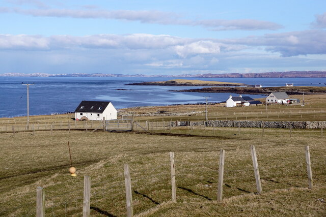
Tounafielie is a prominent coastal feature located on the island of Shetland, in the northernmost part of Scotland. It is a headland or point that juts out into the North Sea, offering breathtaking views of the surrounding landscape.

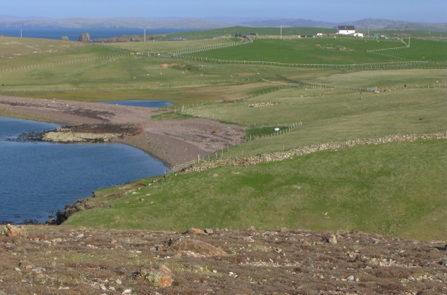
Situated on the western coast of Shetland, Tounafielie is known for its rugged cliffs, which rise dramatically from the sea and reach heights of up to 100 meters (328 feet). These cliffs are composed of red sandstone, which adds to the striking visual appeal of the area. The headland is also characterized by its steep slopes and rocky terrain, making it a popular spot for hikers and nature enthusiasts.

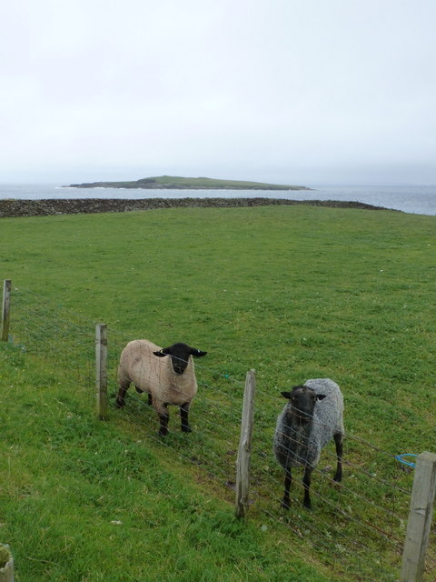
Tounafielie is home to a diverse range of flora and fauna, with seabirds nesting on its cliffs and marine life thriving in the surrounding waters. Visitors to the area may have the opportunity to spot species such as puffins, guillemots, and razorbills, as well as seals and dolphins swimming offshore.

The headland is easily accessible by foot, with several walking trails leading to Tounafielie from nearby villages. Its location on the western coast means that it is exposed to the prevailing winds, creating a wild and untamed atmosphere. On a clear day, visitors can enjoy panoramic views of the North Sea and the surrounding Shetland Isles.

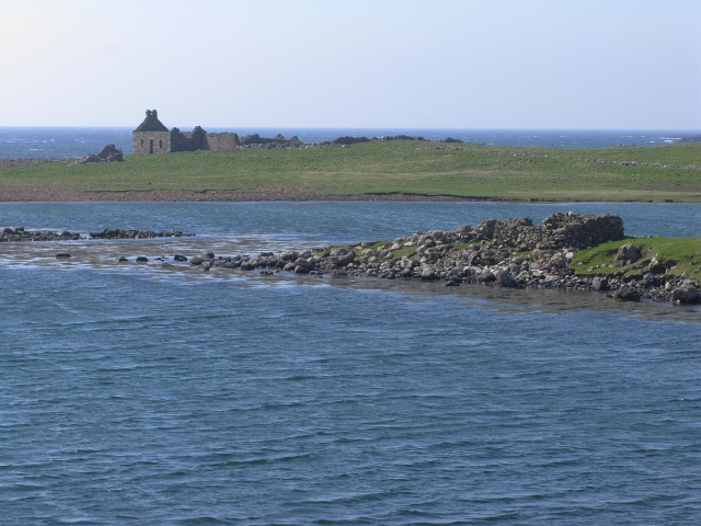
Tounafielie is not only a place of natural beauty but also of historical significance. The headland is dotted with ancient ruins and archaeological sites, providing insights into the island's rich history. Overall, Tounafielie is a captivating coastal feature that showcases the rugged beauty and natural wonders of Shetland.

If you have any feedback on the listing, please let us know in the comments section below.

Tounafielie Images

Images are sourced within 2km of 60.315443/-1.6940906 or Grid Reference HU1759. Thanks to Geograph Open Source API. All images are credited.

Papa Stour from Huxter, Sandness
Sandness from Huxter
Plantiecrub near Flaes Point A plantiecrub is a small walled enclosure in which cabbage seedlings are grown until they are big enough to plant out in croft gardens. They are usually built well away from the croft to protect the seedlings against the crofters' hens.
Plantiecrub near Flaes Point
A plantiecrub is a small walled enclosure in which cabbage seedlings are grown until they are big enough to plant out in croft gardens. They are usually built well away from the croft to protect the seedlings against the crofters' hens.
Ruined Meal Mills Several traditional mills straddle this little burn. Inside the building was a fixed lower millstone, and a rotating upper millstone driven by the water falling on to the paddles below, which were mounted at 45º to the vertical drive shaft.
Ruined Meal Mills
Several traditional mills straddle this little burn. Inside the building was a fixed lower millstone, and a rotating upper millstone driven by the water falling on to the paddles below, which were mounted at 45º to the vertical drive shaft.
Hurdibrack The last stretch of the footpath back from the west side of the island. In the middle distance is the wall which crosses the entire island, separating the arable land in the east from the pasture to the west.
Hurdibrack
The last stretch of the footpath back from the west side of the island. In the middle distance is the wall which crosses the entire island, separating the arable land in the east from the pasture to the west.
The Wall This is the wall which cuts across the whole island. The west side (left) has a steep face to prevent animals climbing over it. The east (right) side has a sloping face so that any animals which have managed to cross it can easily be driven back on to the pasture land.
The Wall
This is the wall which cuts across the whole island. The west side (left) has a steep face to prevent animals climbing over it. The east (right) side has a sloping face so that any animals which have managed to cross it can easily be driven back on to the pasture land.
Ruined House
Ruined House
Ruined house The number of ruined buildings on the island seem to far outnumber those still habitable or used.
Ruined house
The number of ruined buildings on the island seem to far outnumber those still habitable or used.
Road and ruins This is the main road for the island.  Even this close to the pier the ruins of abandoned crofts can be found just off the road.
Road and ruins
This is the main road for the island. Even this close to the pier the ruins of abandoned crofts can be found just off the road.
View towards Papa Stour Airstrip The cleared and smoothed ground in the upper right of the image is the airstrip for Papa Stour which is located in <a href="https://www.geograph.org.uk/gridref/HU1759">HU1759</a>.
View towards Papa Stour Airstrip
The cleared and smoothed ground in the upper right of the image is the airstrip for Papa Stour which is located in HU1759.
Unnamed Sea Stack Off Breigeo Head, Papa Stour (Big Isle of the Priests) At less than 20 metres high this little stack is not as impressive as it's compatriots such as a little down the coast <a href="https://www.geograph.org.uk/gridref/HU1461">HU1461</a>, but facing out onto the North Atlantic the situation is wild and imposing.

As with most sea stacks, this has probably formed and survived through being constituted from rock that is more solid and stable than that washed out from around them.  In many cases this results in providing ideal rock climbing routes in spectacular locations.  In this case, the rock visible in this image is of a good solid nature but as can be seen more clearly in <a href="https://www.geograph.org.uk/photo/798611">HU1560 : The problem with sea stacks...</a> it is overhanging and in addition lacks much in the way of cracks in which to place rock climbing protection.  Taken together these would make this an extremely difficult climb even if top roped.  The side of the stack facing away to the right of the image is also overhanging, albeit to a lesser extent, but the rock is somewhat green and slimy making it an unattractive ascent route.

Gaining access to the stack also presents some problems.  The water foaming around the stack prevents easy access by boat and even on a comparatively calm day such as that pictured here would make swimming to the stack a highly dangerous exercise.  The first visit to the top of the stack recorded by climbers is shown in the image <a href="https://www.geograph.org.uk/photo/798611">HU1560 : The problem with sea stacks...</a>.  For this, the only viable route to the stack was by Tyrolean traverse.
Unnamed Sea Stack Off Breigeo Head, Papa Stour (Big Isle of the Priests)
At less than 20 metres high this little stack is not as impressive as it's compatriots such as a little down the coast HU1461, but facing out onto the North Atlantic the situation is wild and imposing. As with most sea stacks, this has probably formed and survived through being constituted from rock that is more solid and stable than that washed out from around them. In many cases this results in providing ideal rock climbing routes in spectacular locations. In this case, the rock visible in this image is of a good solid nature but as can be seen more clearly in HU1560 : The problem with sea stacks... it is overhanging and in addition lacks much in the way of cracks in which to place rock climbing protection. Taken together these would make this an extremely difficult climb even if top roped. The side of the stack facing away to the right of the image is also overhanging, albeit to a lesser extent, but the rock is somewhat green and slimy making it an unattractive ascent route. Gaining access to the stack also presents some problems. The water foaming around the stack prevents easy access by boat and even on a comparatively calm day such as that pictured here would make swimming to the stack a highly dangerous exercise. The first visit to the top of the stack recorded by climbers is shown in the image HU1560 : The problem with sea stacks.... For this, the only viable route to the stack was by Tyrolean traverse.
The problem with sea stacks... The problem with sea stacks is how to get to them.

The sea conditions at the base of this one pretty much eliminate the possibilities of swimming.  One workable technique used here was to string a 100m abseil rope across the geo laying the rope on the top of the stack.  The rope can then be used for a tyrolean traverse to get over to the stack and back from it.
The problem with sea stacks...
The problem with sea stacks is how to get to them. The sea conditions at the base of this one pretty much eliminate the possibilities of swimming. One workable technique used here was to string a 100m abseil rope across the geo laying the rope on the top of the stack. The rope can then be used for a tyrolean traverse to get over to the stack and back from it.
Oystercatcher nest with eggs This nest was located in the pebbles at the high-point of the beach.  The eggs are camouflaged to be hard to see amongst the pebbles - although thankfully these were just noticeable enough to escape being trodden on.

The oystercatchers seem to be surviving relatively well on the island, whilst the previously abundant tern population has been largely destroyed by the skuas.
Oystercatcher nest with eggs
This nest was located in the pebbles at the high-point of the beach. The eggs are camouflaged to be hard to see amongst the pebbles - although thankfully these were just noticeable enough to escape being trodden on. The oystercatchers seem to be surviving relatively well on the island, whilst the previously abundant tern population has been largely destroyed by the skuas.
Ruined meal mill The image shows the rear of one of the two mills at this location.  The image was taken from channel, now waterless, which fed water into the mill.
Ruined meal mill
The image shows the rear of one of the two mills at this location. The image was taken from channel, now waterless, which fed water into the mill.
Ruined mill The image shows a view of the front of the mill shown in <a href="https://www.geograph.org.uk/photo/799075">HU1660 : Ruined meal mill</a>.
Ruined mill
The image shows a view of the front of the mill shown in HU1660 : Ruined meal mill.
Ruins beside Hamna Voe There are no inhabited buildings left on this side of the island
Ruins beside Hamna Voe
There are no inhabited buildings left on this side of the island
View towards Hurdiback
Sandness: two sheep and Holm of Melby These two skittish sheep seemed rather surprised to see me - anyone - joining them on this drab, drizzly Saturday morning. Having just gone through their field and now on the seaward side of the fence, we can look back towards them with Holm of Melby, a small island in the Sound of Papa, in the background.
Sandness: two sheep and Holm of Melby
These two skittish sheep seemed rather surprised to see me - anyone - joining them on this drab, drizzly Saturday morning. Having just gone through their field and now on the seaward side of the fence, we can look back towards them with Holm of Melby, a small island in the Sound of Papa, in the background.
Show me another place!

Tounafielie is located at Grid Ref: HU1759 (Lat: 60.315443, Lng: -1.6940906)

Unitary Authority: Shetland Islands

Police Authority: Highlands and Islands

What 3 Words

///concerned.voices.difficult. Near Walls, Shetland Islands

Related Wikis

Papa Stour Airstrip

Papa Stour Airstrip is a small airstrip in the village of Biggings on the island of Papa Stour. Shetland, Scotland. == History == Papa Stour Airstrip opened...

Biggings

Biggings is a village on the island of Papa Stour, in Shetland, Scotland. Papa Stour's church is situated at the south of Biggings. A homestead of Duke...

Forewick Holm

Forewick Holm is a 1-hectare (2.5-acre) island in the Sound of Papa in the Shetland islands, Scotland. Located between Papa Stour and the Sandness peninsula...

Papa Stour

Papa Stour (Scots: Papa Stour) is one of the Shetland Islands in Scotland, with a population of under fifteen people, some of whom immigrated after an...

Nearby Amenities

Located within 500m of 60.315443,-1.6940906
Power: pole
Lat/Long: 60.3195622/-1.6926324
The data included in this document is from www.openstreetmap.org. The data is made available under ODbL.

Have you been to Tounafielie?

Leave your review of Tounafielie below (or comments, questions and feedback).