Whiteland Head

Coastal Feature, Headland, Point in Kincardineshire

Scotland

Whiteland Head

House and fields north of Newtonhill
House and fields north of Newtonhill Credit: Mike Pennington

Whiteland Head is a prominent headland located in Kincardineshire, Scotland. Situated along the eastern coast of the country, it juts out into the North Sea, offering stunning views of the surrounding coastal landscape. The headland is characterized by its rugged cliffs, which rise sharply from the sea, reaching heights of up to 100 meters.

The geology of Whiteland Head is primarily composed of sandstone, which has been shaped by centuries of erosion from the strong ocean currents and fierce winds. This has resulted in the formation of dramatic sea caves, arches, and stacks that dot the coastline.

The headland is a haven for wildlife enthusiasts, as it is home to a variety of seabirds, including puffins, razorbills, and guillemots. Visitors can often spot these birds perched on the cliffs or soaring above the crashing waves. Additionally, seals can frequently be seen basking on the rocks or swimming in the crystal-clear waters surrounding Whiteland Head.

The area surrounding Whiteland Head offers opportunities for outdoor activities such as hiking and coastal walks. There are several well-marked trails that lead visitors along the cliff tops, providing breathtaking panoramic views of the North Sea. These paths also offer access to secluded beaches and coves, where visitors can relax and enjoy the tranquility of the area.

Whiteland Head is a popular destination for photographers and nature lovers alike, attracting visitors from all over the world. Its striking beauty, diverse wildlife, and dramatic coastal features make it a must-visit location for those exploring the Kincardineshire coastline.

If you have any feedback on the listing, please let us know in the comments section below.

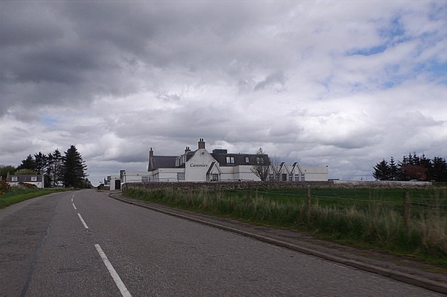
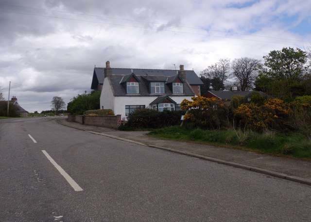
Whiteland Head Images

Images are sourced within 2km of 57.030652/-2.1436237 or Grid Reference NO9193. Thanks to Geograph Open Source API. All images are credited.

House and fields north of Newtonhill
Cammies Inn, Cammachmore Near Newtonhill, on the former main road from Stonehaven to Aberdeen (now bypassed by A90 dual carriageway).
Cammies Inn, Cammachmore
Near Newtonhill, on the former main road from Stonehaven to Aberdeen (now bypassed by A90 dual carriageway).
Bend in road, Cammachmore village
Fields and houses at Muchalls
Road into Cammachmore, near Newtonhill
Rocks at Grim Haven
Rocks at Grim Haven
Cliff girt coast at Muchalls
Junction at Cammachmore, near Portleithen
Windyedge, Newtonhill
Site of Newtonhill Station The station closed in 1956 although there is some talk of reopening it as Newtonhill has transformed from a fishing village to a commuter settlement.  Compare the photo from 2009 <a title="https://www.geograph.org.uk/photo/1454732" href="https://www.geograph.org.uk/photo/1454732">Link</a> for changes to track layout and signals.
Site of Newtonhill Station
The station closed in 1956 although there is some talk of reopening it as Newtonhill has transformed from a fishing village to a commuter settlement. Compare the photo from 2009 Link for changes to track layout and signals.
High Speed Train The 14:52 from Aberdeen to King's Cross passes the site of Newtonhill station.
High Speed Train
The 14:52 from Aberdeen to King's Cross passes the site of Newtonhill station.
Newtonhill parish church This modest structure dates from 1987.
Newtonhill parish church
This modest structure dates from 1987.
Newtonhill: walking to the harbour The cat was friendly...
Newtonhill: walking to the harbour
The cat was friendly...
Newtonhill Bay
Newtonhill Bay
Walking the coastal path The rugged Cran Hill (elev. 86 m) is in the background: could it be called a tor?
Walking the coastal path
The rugged Cran Hill (elev. 86 m) is in the background: could it be called a tor?
The Newton Arms, Newtonhill
A92, Nether Mains of Muchalls The A92 is a major highway that runs for 89 miles through Fife, Dundee, Angus, Aberdeenshire, and Aberdeen City in Scotland. From south to north, it runs from Dunfermline to Blackdog, just north of Aberdeen.
A92, Nether Mains of Muchalls
The A92 is a major highway that runs for 89 miles through Fife, Dundee, Angus, Aberdeenshire, and Aberdeen City in Scotland. From south to north, it runs from Dunfermline to Blackdog, just north of Aberdeen.
Northbound A92 at Muchalls The A92 is a major highway that runs for 89 miles through Fife, Dundee, Angus, Aberdeenshire, and Aberdeen City in Scotland. From south to north, it runs from Dunfermline to Blackdog, just north of Aberdeen.
Northbound A92 at Muchalls
The A92 is a major highway that runs for 89 miles through Fife, Dundee, Angus, Aberdeenshire, and Aberdeen City in Scotland. From south to north, it runs from Dunfermline to Blackdog, just north of Aberdeen.
Show me another place!

Whiteland Head is located at Grid Ref: NO9193 (Lat: 57.030652, Lng: -2.1436237)

Unitary Authority: Aberdeenshire

Police Authority: North East

What 3 Words

///slowness.shop.hurls. Near Newtonhill, Aberdeenshire

Related Wikis

Burn of Elsick

The Burn of Elsick is a coastal stream in Aberdeenshire, Scotland that discharges to the North Sea. This watercourse drains primarily agricultural lands...

Newtonhill railway station

Newtonhill railway station served the town of Newtonhill in Aberdeenshire, Scotland, United Kingdom from its opening in 1851 to its closure in 1956. Newtonhill...

Newtonhill

Newtonhill is a town in Kincardineshire, Scotland. It is popular due to its location, just six miles south of Aberdeen with easy reach of Stonehaven and...

May Craig (island)

May Craig is a rocky island situated along the North Sea coast of Aberdeenshire, Scotland. May Craig lies about one half mile (0.8 km) south of Newtonhill...

Nearby Amenities

Located within 500m of 57.030652,-2.1436237
Source: PGS
Lat/Long: 57.0267748/-2.1472371
Source: PGS
Lat/Long: 57.0266292/-2.1454775
Source: PGS
Lat/Long: 57.027254/-2.14544
Source: PGS
Lat/Long: 57.0274714/-2.145676
Source: PGS
Lat/Long: 57.027769/-2.145897
Source: PGS
Lat/Long: 57.0287077/-2.1473981
Source: PGS
Lat/Long: 57.0282397/-2.1454134
Source: PGS
Lat/Long: 57.0287448/-2.1451947
Source: PGS
Lat/Long: 57.0290259/-2.1449642
Source: PGS
Lat/Long: 57.029169/-2.14469
Source: PGS
Lat/Long: 57.0291948/-2.1429297
Source: PGS
Lat/Long: 57.0294505/-2.1423667
Source: PGS
Lat/Long: 57.0295457/-2.1422676
Source: PGS
Lat/Long: 57.0298486/-2.1425013
Source: PGS
Lat/Long: 57.0300034/-2.1423447
Source: PGS
Lat/Long: 57.0299076/-2.1418725
Source: PGS
Lat/Long: 57.0303365/-2.1418184
Source: PGS
Lat/Long: 57.0305002/-2.1416969
Source: PGS
Lat/Long: 57.0306886/-2.1417846
Source: PGS
Lat/Long: 57.0308562/-2.1418742
Source: PGS
Lat/Long: 57.0310573/-2.1416121
Source: PGS
Lat/Long: 57.0313606/-2.142119
Source: PGS
Lat/Long: 57.0314263/-2.1424455
Source: PGS
Lat/Long: 57.0316821/-2.1427467
Source: PGS
Lat/Long: 57.031846/-2.142986
Source: PGS
Lat/Long: 57.0319764/-2.1433475
Source: PGS
Lat/Long: 57.0320564/-2.1438468
Source: PGS
Lat/Long: 57.0323095/-2.1438779
Source: PGS
Lat/Long: 57.0326035/-2.1435946
Source: PGS
Lat/Long: 57.0328358/-2.1429441
Source: PGS
Lat/Long: 57.0328731/-2.1426008
Source: PGS
Lat/Long: 57.0326863/-2.1419141
Source: PGS
Lat/Long: 57.0323102/-2.1413758
Source: PGS
Lat/Long: 57.032211/-2.1402098
Source: PGS
Lat/Long: 57.0327007/-2.1395445
Source: PGS
Lat/Long: 57.032452/-2.138041
Source: PGS
Lat/Long: 57.032574/-2.137099
Source: PGS
Lat/Long: 57.032832/-2.137328
Source: PGS
Lat/Long: 57.033089/-2.137557
Barrier: bollard
Lat/Long: 57.0304244/-2.1483331
Newtonhill
Place: town
Population: 3000
Source: OS_OpenData_StreetView
Wikidata: Q1008929
Wikipedia: en:Newtonhill
Lat/Long: 57.0321018/-2.1503377
Bus Stop
Park Place
Bus: yes
Naptan AtcoCode: 630040671
Naptan Bearing: E
Naptan CommonName: Park Place
Naptan Indicator: opp
Naptan NaptanCode: 23626427
Naptan Street: Newtonhill Road
Naptan Verified: no
Public Transport: platform
Source: naptan;bing;naptan_compare_tool
Lat/Long: 57.0314626/-2.1506319
Telephone
Booth: KX100
Covered: booth
Fee: yes
Operator: BT
Payment Mastercard: yes
Payment Telephone Cards: yes
Payment Visa: yes
Payment Visa Debit: yes
Payment Visa Electron: yes
Lat/Long: 57.0331717/-2.1486264
Bus Stop
Skateraw Road
Bus: yes
Departures Board: yes
Naptan AtcoCode: 630040661
Naptan Bearing: W
Naptan CommonName: Skateraw Road
Naptan Indicator: opp 7
Naptan NaptanCode: 23626432
Naptan Street: Skateraw Road
Naptan Verified: no
Operator: Stagecoach
Public Transport: platform
Shelter: yes
Source: naptan;bing;naptan_compare_tool
Lat/Long: 57.0321323/-2.1488513
Generator Method: photovoltaic
Generator Output Electricity: yes
Generator Source: solar
Generator Type: solar_photovoltaic_panel
Location: roof
Power: generator
Lat/Long: 57.0286848/-2.1505818
Generator Method: photovoltaic
Generator Output Electricity: yes
Generator Source: solar
Generator Type: solar_photovoltaic_panel
Location: roof
Power: generator
Lat/Long: 57.0307765/-2.1460488
Generator Method: photovoltaic
Generator Output Electricity: yes
Generator Source: solar
Generator Type: solar_photovoltaic_panel
Location: roof
Power: generator
Lat/Long: 57.0312275/-2.1479318
Generator Method: photovoltaic
Generator Output Electricity: yes
Generator Source: solar
Generator Type: solar_photovoltaic_panel
Location: roof
Power: generator
Lat/Long: 57.0312217/-2.1478674
Generator Method: photovoltaic
Generator Output Electricity: yes
Generator Source: solar
Generator Type: solar_photovoltaic_panel
Location: roof
Power: generator
Lat/Long: 57.0313049/-2.1460167
Generator Method: photovoltaic
Generator Output Electricity: yes
Generator Source: solar
Generator Type: solar_photovoltaic_panel
Location: roof
Power: generator
Lat/Long: 57.0316304/-2.1456063
Bus Stop
Park Place
Bus: yes
Naptan AtcoCode: 630040672
Naptan Bearing: W
Naptan CommonName: Park Place
Naptan Indicator: at
Naptan NaptanCode: 23626426
Naptan Street: Newtonhill Road
Naptan Verified: no
Public Transport: platform
Source: naptan;bing;naptan_compare_tool
Lat/Long: 57.0313745/-2.150814
Generator Method: photovoltaic
Generator Output Electricity: yes
Generator Source: solar
Generator Type: solar_photovoltaic_panel
Location: roof
Power: generator
Lat/Long: 57.0290096/-2.1511772
Generator Method: photovoltaic
Generator Output Electricity: yes
Generator Source: solar
Generator Type: solar_photovoltaic_panel
Location: roof
Power: generator
Lat/Long: 57.0303817/-2.1435826
Generator Method: photovoltaic
Generator Output Electricity: yes
Generator Source: solar
Generator Type: solar_photovoltaic_panel
Location: roof
Power: generator
Lat/Long: 57.0309349/-2.143773
Generator Method: photovoltaic
Generator Output Electricity: yes
Generator Source: solar
Generator Type: solar_photovoltaic_panel
Location: roof
Power: generator
Lat/Long: 57.0331702/-2.1503927
Generator Method: photovoltaic
Generator Output Electricity: yes
Generator Source: solar
Generator Type: solar_photovoltaic_panel
Location: roof
Power: generator
Lat/Long: 57.0337467/-2.1453394
Newtonhill
Historic Railway: station
Railway: site
Wikidata: Q54869856
Wikipedia: en:Newtonhill railway station
Lat/Long: 57.0322768/-2.1494473
The data included in this document is from www.openstreetmap.org. The data is made available under ODbL.

Have you been to Whiteland Head?

Leave your review of Whiteland Head below (or comments, questions and feedback).