Garreg

Settlement in Flintshire

Wales

Garreg

Mynydd y Garreg Tower May have been a windmill and then converted to a Roman Pharos folly?
Mynydd y Garreg Tower Credit: Kevin Waterhouse

Garreg is a small village located in the county of Flintshire, Wales. Situated in the northeastern part of the country, it lies close to the border with England, just south of the River Dee. The village is surrounded by picturesque countryside and enjoys a peaceful and rural setting.

Garreg has a population of around 500 residents, making it a tight-knit community where neighbors often know each other well. The village is characterized by its charming stone cottages and traditional architecture, which add to its quaint and welcoming ambiance.

The local economy of Garreg is mainly driven by agriculture, with many residents involved in farming and livestock rearing. The fertile land surrounding the village supports a variety of crops and is ideal for grazing animals. This agricultural heritage is reflected in the annual village festival, where locals showcase their farming skills and celebrate the area's rural traditions.

Although Garreg is a small village, it offers essential amenities to both its residents and visitors. These include a village shop, a local pub, and a primary school, providing a convenient and close-knit community for families. Additionally, the village benefits from its proximity to larger towns and cities, such as Chester and Wrexham, which offer a wider range of services and employment opportunities.

Garreg is a delightful village that attracts nature lovers and outdoor enthusiasts due to its scenic surroundings. The nearby Clwydian Range, an Area of Outstanding Natural Beauty, offers stunning landscapes for hiking and walking trails. Additionally, the River Dee provides opportunities for fishing and boating activities.

Overall, Garreg is a serene and charming village that offers a tranquil lifestyle amidst beautiful natural landscapes, making it an idyllic place to reside or visit.

If you have any feedback on the listing, please let us know in the comments section below.
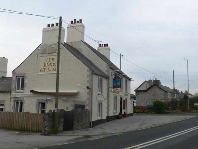
Garreg Images

Images are sourced within 2km of 53.282807/-3.3063683 or Grid Reference SJ1377. Thanks to Geograph Open Source API. All images are credited.

Mynydd y Garreg Tower May have been a windmill and then converted to a Roman Pharos folly?
Mynydd y Garreg Tower
May have been a windmill and then converted to a Roman Pharos folly?
Maen Achwyfan Wheel Cross
A55 eastbound near Gorsedd
Pant Y Wacco Welcome to Pant Y Wacco, just off the A5026 near Gorsedd.
Pant Y Wacco
Welcome to Pant Y Wacco, just off the A5026 near Gorsedd.
A55 westbound nears junction 31
Sign by the A55
Sign by the A55
A5026 at Holywell Tyres
Glol Woodland
Glol Woodland
Kissing gate for access to paths beside Glol woodland
Across fields towards Ty-newydd Farm Berthengam is in the distance
Across fields towards Ty-newydd Farm
Berthengam is in the distance
Across fields to Glol Farm
Track to Maen y Glol
I don't think this footpath is used very often! It runs from the A5151 to Glol Woodland.  Below the bindweed I negitiated a steep bank and at the bottom there was a very well hidden stile - take a machete if you wish to this way - the stile at the other end was even harder to find!  
Note: Within the Glol woodland on the horizon is the site of a pre-historic Round Barrow and also disused shafts from the lead mining industry which once thrived in this area.
I don't think this footpath is used very often!
It runs from the A5151 to Glol Woodland. Below the bindweed I negitiated a steep bank and at the bottom there was a very well hidden stile - take a machete if you wish to this way - the stile at the other end was even harder to find! Note: Within the Glol woodland on the horizon is the site of a pre-historic Round Barrow and also disused shafts from the lead mining industry which once thrived in this area.
Does the footpath really go through there! I eventually found this traditional stone stile behind shoulder high vegetation.  The small gap through the overhanging bushes was about half a metre high.  It would be very difficult to find from the adjoining footpath on the other side which goes around Glol Woodland.  Take a machete if you wish to go this way
Does the footpath really go through there!
I eventually found this traditional stone stile behind shoulder high vegetation. The small gap through the overhanging bushes was about half a metre high. It would be very difficult to find from the adjoining footpath on the other side which goes around Glol Woodland. Take a machete if you wish to go this way
Little used track round Glol woodland Within this woodland is the site of a pre-historic round barrow and also disused shafts from the lead mining industry which once thrived in this area
Little used track round Glol woodland
Within this woodland is the site of a pre-historic round barrow and also disused shafts from the lead mining industry which once thrived in this area
Stile into Glol woodland On a footpath leading from the A5151 near Llyn Helyg Wood.
Within this woodland is the site of a pre-historic round barrow and also disused shafts from the once thriving lead mining industry in this area
Stile into Glol woodland
On a footpath leading from the A5151 near Llyn Helyg Wood. Within this woodland is the site of a pre-historic round barrow and also disused shafts from the once thriving lead mining industry in this area
Stiles old and new On a footpath from Glol Woodland across a field towards a caravan site
Stiles old and new
On a footpath from Glol Woodland across a field towards a caravan site
Farmland surrounding Tan-yr-allt On the right is Llyn Helyg woodland to the south of the farm is Crown Wood and in the far distance are the Clwydian range of hills
Farmland surrounding Tan-yr-allt
On the right is Llyn Helyg woodland to the south of the farm is Crown Wood and in the far distance are the Clwydian range of hills
Show me another place!

Garreg is located at Grid Ref: SJ1377 (Lat: 53.282807, Lng: -3.3063683)

Unitary Authority: Flintshire

Police Authority: North Wales

What 3 Words

///scrapping.anchors.pills. Near Whitford, Flintshire

Related Wikis

Lloc

Lloc is a small village in Flintshire, north Wales. It is located within the community of Whitford. It lies north of the Clwydian Range, just east of the...
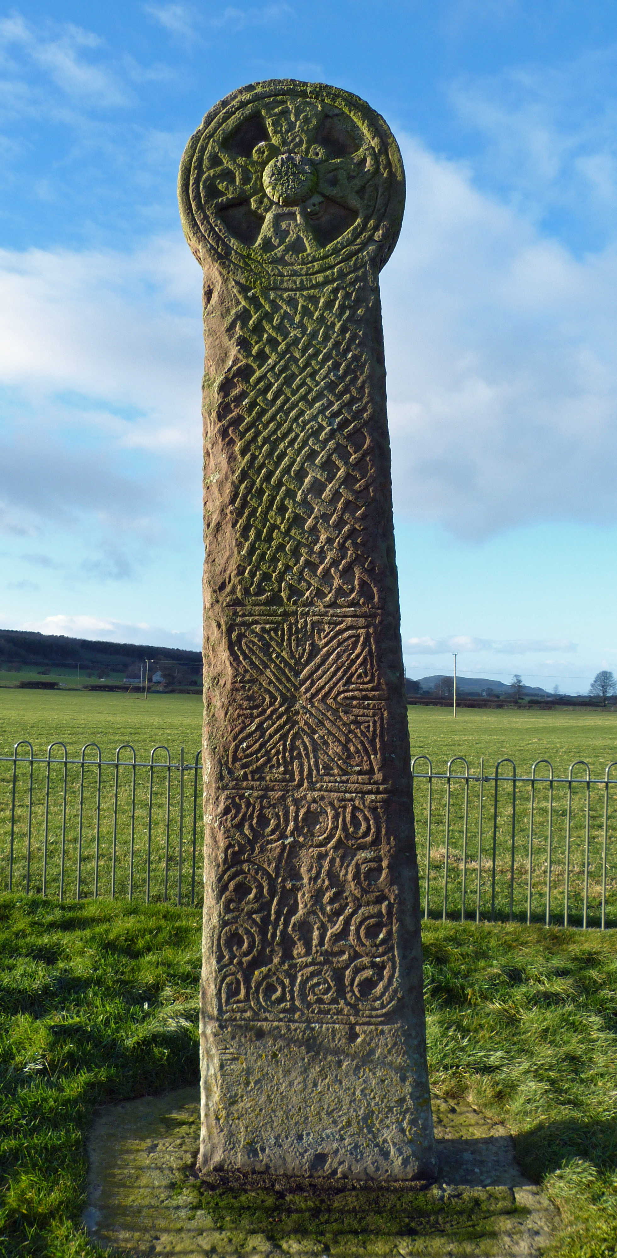
Maen Achwyfan Cross

Maen Achwyfan Cross (Welsh: Maen Achwyfan, Croes Maen Achwyfan), located near the village of Whitford, Flintshire, Wales, is a high cross dating from the...

Whitford, Flintshire

Whitford (Welsh: Chwitffordd) is a village, community and an electoral ward near Holywell in Flintshire, northeast Wales. The population of both the community...

Church of St Beuno and St Mary

The Church of St Beuno and St Mary is a Grade I listed church in Whitford, overlooking the estuary of the river Dee. The church has a well preserved late...

Nearby Amenities

Located within 500m of 53.282807,-3.3063683
Ref: 36
Lat/Long: 53.283959/-3.30135
Natural: spring
Lat/Long: 53.2838315/-3.3112828
Natural: spring
Lat/Long: 53.2838949/-3.3096696
Turning Circle
Lat/Long: 53.2797676/-3.3036926
Pen-ffordd-llan
Place: hamlet
Lat/Long: 53.285453/-3.3023124
Generator Method: wind_turbine
Generator Source: wind
Generator Type: horizontal_axis
Power: generator
Lat/Long: 53.2836356/-3.3068228
Man Made: mineshaft
Lat/Long: 53.2806718/-3.3123604
Brynabella Mound
Archaeological Site: tumulus
Historic: archaeological_site
Historic Civilization: prehistoric
Lat/Long: 53.2839173/-3.3064628
The data included in this document is from www.openstreetmap.org. The data is made available under ODbL.

Have you been to Garreg?

Leave your review of Garreg below (or comments, questions and feedback).