Barns Ness

Coastal Feature, Headland, Point in East Lothian

Scotland

Barns Ness

Dunbar Cement Works
Dunbar Cement Works Credit: John Darcy

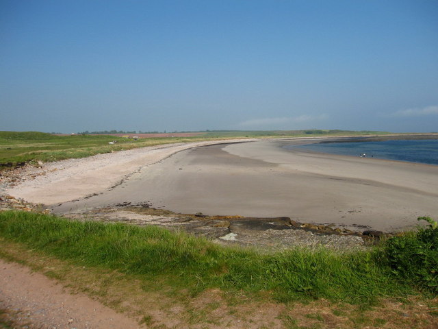
Barns Ness is a prominent headland located in East Lothian, Scotland. It is situated on the southern coast of the country, overlooking the North Sea. The headland is known for its rugged and dramatic cliffs, which reach heights of up to 30 meters in some areas. These cliffs are composed of sandstone and shale, giving them a distinctive reddish-brown color.

The coastline around Barns Ness is characterized by its rocky terrain, with numerous rock formations and caves carved out by the relentless wave action. This makes it a popular destination for geologists and nature enthusiasts who are interested in studying the local geological features.

One of the notable landmarks at Barns Ness is the Barns Ness Lighthouse, which was built in 1901. The lighthouse stands at approximately 31 meters tall and served as a navigational aid for ships traveling along the treacherous coastline. Although it is no longer in use, the lighthouse remains an iconic symbol of the area.

In addition to its geological and historical significance, Barns Ness is also home to a diverse array of wildlife. The headland provides a habitat for various bird species, including fulmars, kittiwakes, and puffins. Seals can often be spotted basking on the rocks, while dolphins and porpoises can occasionally be seen swimming offshore.

Overall, Barns Ness offers visitors a unique opportunity to explore a rugged and picturesque headland, rich in both natural and cultural heritage.

If you have any feedback on the listing, please let us know in the comments section below.

Barns Ness Images

Images are sourced within 2km of 55.986978/-2.4471277 or Grid Reference NT7277. Thanks to Geograph Open Source API. All images are credited.

Dunbar Cement Works
Dunbar Cement Works
Quarry, Dunbar cement works. The Lothians have a fair bit of limestone, a rock notable in Scotland by its relative scarcity.  Near Barns Ness there are sufficient quantities to feed a cement works.  The works are next door, but most of NT7077 is taken up by this vast, if not deep quarry.
Quarry, Dunbar cement works.
The Lothians have a fair bit of limestone, a rock notable in Scotland by its relative scarcity. Near Barns Ness there are sufficient quantities to feed a cement works. The works are next door, but most of NT7077 is taken up by this vast, if not deep quarry.
White Sands Behind the uglyness of the limestone quarries are a series of lovely beaches. As well as the white sands, there are limestone slabs here, backed by land used previously for quarrying and a strip of very attractive links. Its managed as a country park.
White Sands
Behind the uglyness of the limestone quarries are a series of lovely beaches. As well as the white sands, there are limestone slabs here, backed by land used previously for quarrying and a strip of very attractive links. Its managed as a country park.
Barns Ness lighthouse Built 1901
Barns Ness lighthouse
Built 1901
Bales near East Barns
Cement works at night
Chimney-stack at East Barns Farm, near Dunbar Derelict remains of East Barns Farm that includes a cart shed, granary, engine room and red brick chimney stack. The engine was likely to have been fuelled by coal as there were many coal mines in the Lothians at this time and it was used to power a threshing machine in the adjacent building.
Chimney-stack at East Barns Farm, near Dunbar
Derelict remains of East Barns Farm that includes a cart shed, granary, engine room and red brick chimney stack. The engine was likely to have been fuelled by coal as there were many coal mines in the Lothians at this time and it was used to power a threshing machine in the adjacent building.
Carthouse at East Barns Farm, near Dunbar Cart Shed at the derelict remains of East Barns Farm.<a href="https://www.geograph.org.uk/photo/146709">NT7176 : Chimney-stack at East Barns Farm, near Dunbar</a>
Carthouse at East Barns Farm, near Dunbar
Cart Shed at the derelict remains of East Barns Farm.NT7176 : Chimney-stack at East Barns Farm, near Dunbar
Farm Track at East Barns, near Dunbar View over farmland towards Barns Ness Lighthouse.
Farm Track at East Barns, near Dunbar
View over farmland towards Barns Ness Lighthouse.
Shingle Beach, Skateraw Part of the John Muir Way, heading towards Barns Ness
Shingle Beach, Skateraw
Part of the John Muir Way, heading towards Barns Ness
Mill Stone Neuk Peninsula of rocks protruding into the Firth of Forth at Whitesands.
Mill Stone Neuk
Peninsula of rocks protruding into the Firth of Forth at Whitesands.
Catcraig Limekilns The area around Dunbar was very important in the 18th and 19th centuries for making lime for spreading on the fields. Most was sent by cart to Berwickshire. These are a pair of mid 19th century kilns, one a 2-draw kiln, the other a 3-draw kiln. The kilns were associated with quarries, a power-house, and a track leading to a landing-place on the rocks and were closed in 1921, during the miners strike.
Catcraig Limekilns
The area around Dunbar was very important in the 18th and 19th centuries for making lime for spreading on the fields. Most was sent by cart to Berwickshire. These are a pair of mid 19th century kilns, one a 2-draw kiln, the other a 3-draw kiln. The kilns were associated with quarries, a power-house, and a track leading to a landing-place on the rocks and were closed in 1921, during the miners strike.
Red Hot Pokers Kniphofia uvaria in the dunes at Whitesands.
Red Hot Pokers
Kniphofia uvaria in the dunes at Whitesands.
White Sands View northwest towards Dunbar.
White Sands
View northwest towards Dunbar.
Water Tap Two of these at White Sands Beach, near Dunbar.
Water Tap
Two of these at White Sands Beach, near Dunbar.
Take a Rest Interesting seating on the John Muir Way at White Sands beach.
Take a Rest
Interesting seating on the John Muir Way at White Sands beach.
Ruined Building on Dunbar Golf Course Now marked on map as a sheepfold, shown on map of 1854 as a house.
Ruined Building on Dunbar Golf Course
Now marked on map as a sheepfold, shown on map of 1854 as a house.
White Sands The John Muir Way passes along the edge of Dunbar Golf Course and then along White Sands Beach.
White Sands
The John Muir Way passes along the edge of Dunbar Golf Course and then along White Sands Beach.
Show me another place!

Barns Ness is located at Grid Ref: NT7277 (Lat: 55.986978, Lng: -2.4471277)

Unitary Authority: East Lothian

Police Authority: The Lothians and Scottish Borders

What 3 Words

///poorly.stamp.nicer. Near Dunbar, East Lothian

Nearby Locations

Barns Ness

Related Wikis

Barns Ness Lighthouse

Barns Ness Lighthouse is 3.1 miles (5 km) from Dunbar and was constructed by the engineers and brothers David A. Stevenson and Charles Alexander Stevenson...

Battle of Dunbar (1650)

The Battle of Dunbar was fought between the English New Model Army, under Oliver Cromwell, and a Scottish army commanded by David Leslie on 3 September...

Skateraw (East Lothian)

Skateraw is a small settlement in East Lothian, Scotland, centred on the Georgian farmhouse of Skateraw House and Skateraw Farm. It was formerly the site...

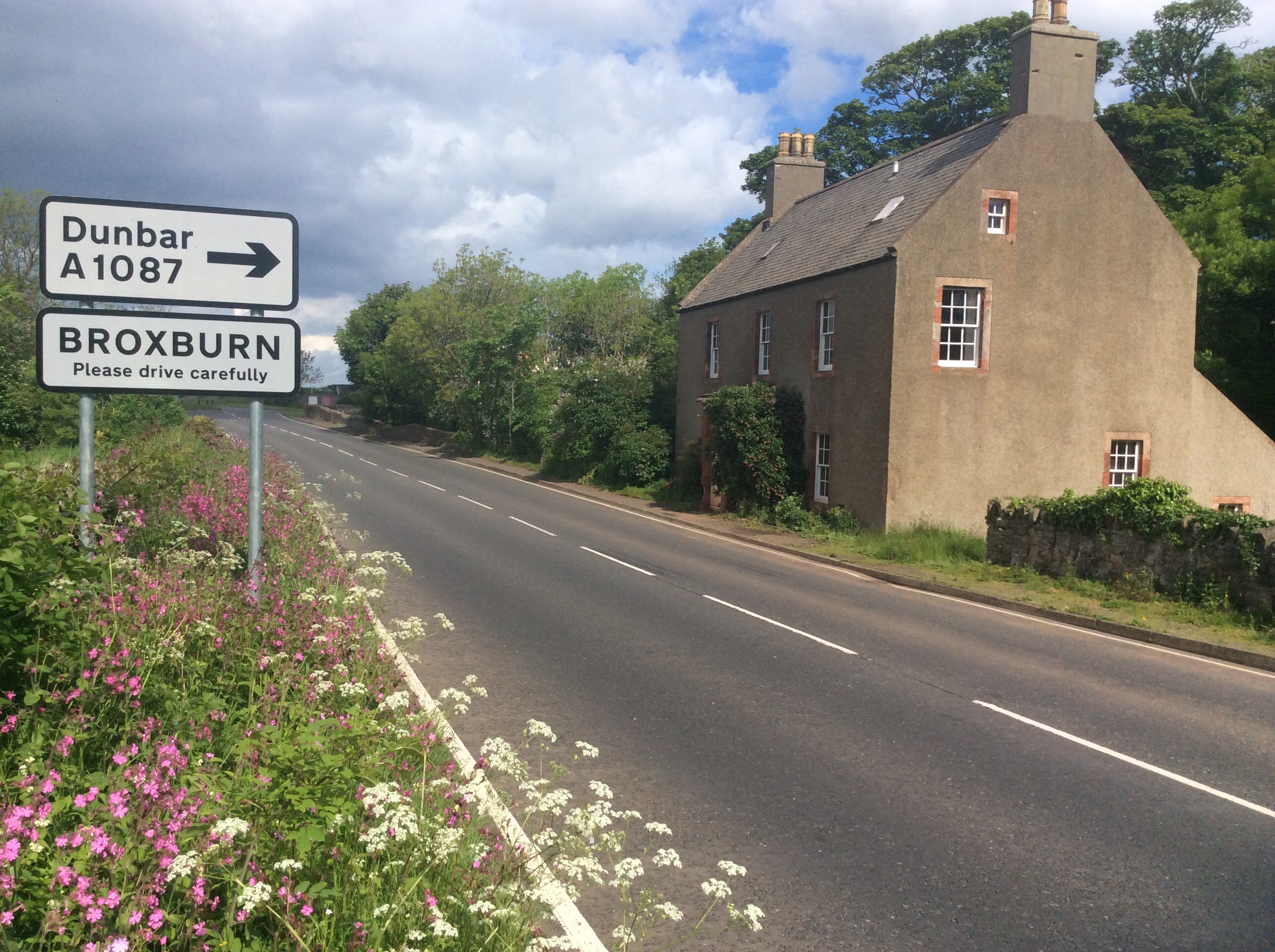
Broxburn, East Lothian

Broxburn is a hamlet consisting of a handful of scattered houses which serve the Broxmouth estate in East Lothian, Scotland. It is named after the stream...

Torness nuclear power station

Torness nuclear power station is a nuclear power station located approximately 30 miles (50 km) east of Edinburgh at Torness Point near Dunbar in East...

Innerwick

Innerwick (Scottish Gaelic: Inbhir Mhuice) is a coastal civil parish and small village, which lies in the east of East Lothian, five miles (eight kilometres...

Innerwick railway station

Innerwick railway station served the village of Innerwick, East Lothian, Scotland from 1848 to 1964 on the East Coast Main Line. == History == The station...

Innerwick Castle

Innerwick Castle is a ruined castle in East Lothian, Scotland, near the village of Innerwick, 5 miles (8.0 km) from Dunbar, on the Thornton Burn, and overlooking...

Nearby Amenities

Located within 500m of 55.986978,-2.4471277
Barns Ness
Disused: yes
Height: 37
Man Made: lighthouse
Source: Bing
Wikidata: Q4861875
Wikipedia: en:Barns Ness Lighthouse
Lat/Long: 55.9872805/-2.4452809
Geological Trail Whitesands to Barns Ness
Board Type: geology
Description: Geology, flora and fauna
Information: board
Source: Bing
Tourism: information
Lat/Long: 55.9867806/-2.4508799
Barrier: stile
Foot: yes
Material: wood
Motor Vehicle: no
Stile: stepover
Lat/Long: 55.9826907/-2.444796
Barrier: cattle_grid
Lat/Long: 55.9863749/-2.4546818
Power: pole
Lat/Long: 55.9860463/-2.4536694
Material: wood
Power: pole
Lat/Long: 55.9861307/-2.4524857
Material: wood
Power: pole
Lat/Long: 55.9862397/-2.4511051
Material: wood
Power: pole
Lat/Long: 55.9863425/-2.4496369
Material: wood
Power: pole
Lat/Long: 55.986433/-2.4483788
Material: wood
Power: pole
Lat/Long: 55.986531/-2.447042
Material: wood
Power: pole
Lat/Long: 55.9866338/-2.4456876
Bicycle Parking
Access: yes
Bicycle Parking: stands
Capacity: 8
Colour: silver
Covered: no
Fee: no
Indoor: no
Level: 0
Lit: no
Lat/Long: 55.9863886/-2.4515489
Bicycle Parking
Access: yes
Bicycle Parking: stands
Capacity: 8
Colour: silver
Covered: no
Fee: no
Indoor: no
Level: 0
Lit: no
Lat/Long: 55.9863486/-2.4515412
Board Type: map
Information: board
Level: 0
Operator: East Lothian Council
Tourism: information
Lat/Long: 55.986427/-2.4515582
Access: yes
Dog: yes
Man Made: water_tap
Lat/Long: 55.9868895/-2.4481168
Lit: no
Man Made: flagpole
Material: wood
Lat/Long: 55.987683/-2.4455989
John Muir Link
Hiking: yes
Information: guidepost
Material: metal
Operator: East Lothian Council
Tourism: information
Lat/Long: 55.986933/-2.4466295
The data included in this document is from www.openstreetmap.org. The data is made available under ODbL.

Have you been to Barns Ness?

Leave your review of Barns Ness below (or comments, questions and feedback).