Grim Ness

Coastal Feature, Headland, Point in Orkney

Scotland

Grim Ness

The Irene Part of the Engine Block from Irene.
She was the 'subject' of the gallant rescue attempt by the Longhope Lifeboat Crew, who lost their lives in 1969.
See here <span class="nowrap"><a title="http://news.stv.tv/scotland/82797-orkney-remembers-longhope-disaster/" rel="nofollow ugc noopener" href="http://news.stv.tv/scotland/82797-orkney-remembers-longhope-disaster/">Link</a><img style="margin-left:2px;" alt="External link" title="External link - shift click to open in new window" src="https://s1.geograph.org.uk/img/external.png" width="10" height="10"/></span>

More here <span class="nowrap"><a title="http://theramblinggardener.com/2014/11/28/the-longhope-lifeboat-disaster/comment-page-1/" rel="nofollow ugc noopener" href="http://theramblinggardener.com/2014/11/28/the-longhope-lifeboat-disaster/comment-page-1/">Link</a><img style="margin-left:2px;" alt="External link" title="External link - shift click to open in new window" src="https://s1.geograph.org.uk/img/external.png" width="10" height="10"/></span>
and this <a href="https://www.geograph.org.uk/photo/1066362">ND3389 : Longhope Lifeboat Memorial</a>
The Irene Credit: Derek Mayes

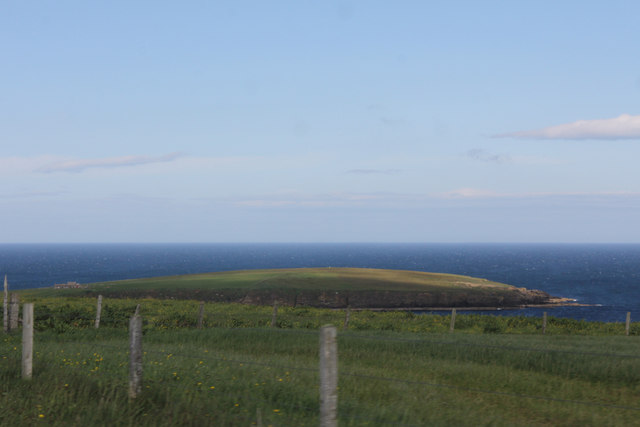
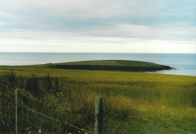
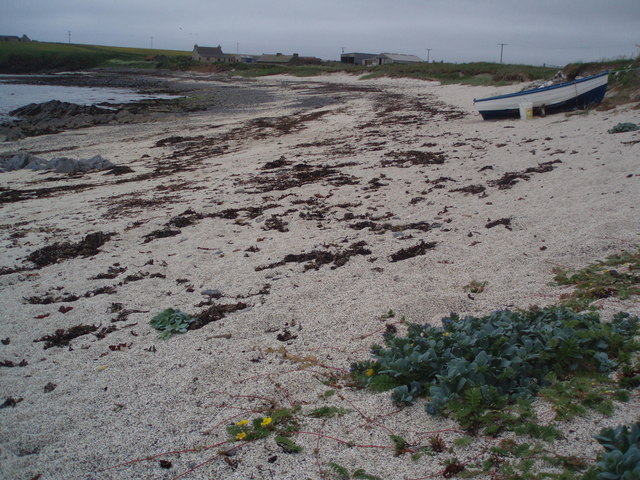
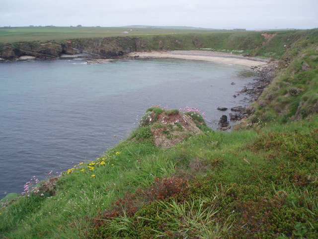
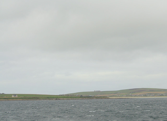
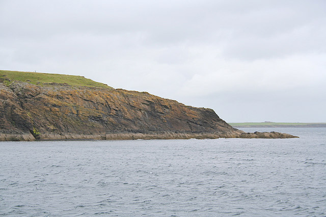
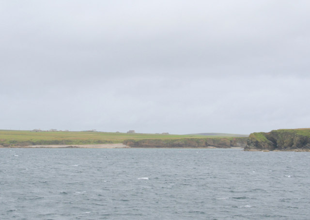
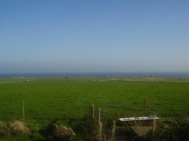
Grim Ness is a prominent coastal feature located on the northern coast of Orkney, an archipelago in Scotland. Situated at the northeastern tip of the Mainland island, Grim Ness is a headland that extends into the North Sea, forming a distinct point. This rugged and picturesque headland is known for its striking cliffs, dramatic coastline, and panoramic views.

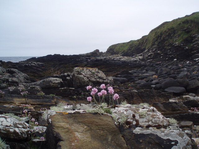
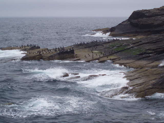
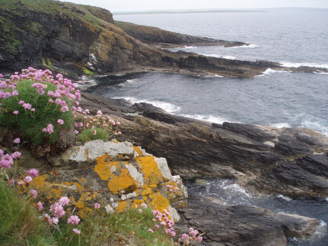
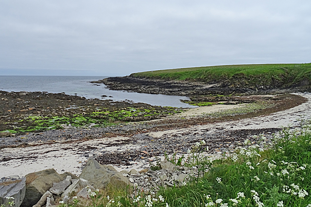
At Grim Ness, the coastline is characterized by towering cliffs, which reach heights of up to 50 meters (164 feet) in some areas. These cliffs, composed of sandstone and shale, have been shaped by the relentless pounding of the North Sea waves over thousands of years, resulting in impressive formations, sea stacks, and natural arches.

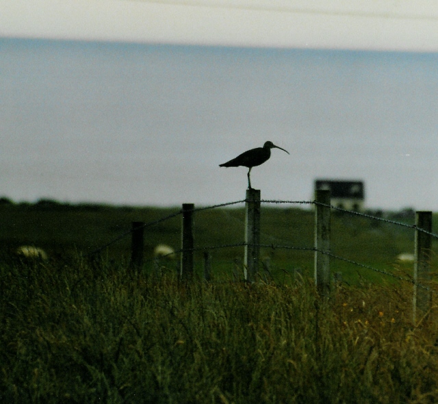
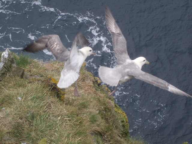
The headland offers visitors a unique vantage point to observe the surrounding coastal landscape. From Grim Ness, one can enjoy breathtaking views of the open sea, neighboring islands, and the Orkney mainland. On clear days, it is even possible to catch a glimpse of distant wildlife, including seabirds, seals, and occasionally even whales.

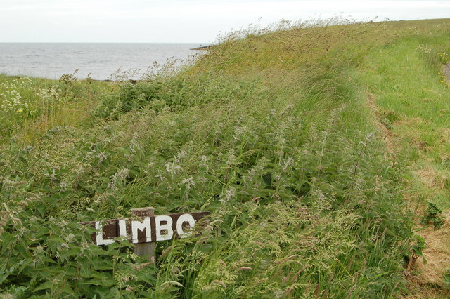
Grim Ness is a popular destination for outdoor enthusiasts, offering opportunities for hiking, birdwatching, and photography. There are several walking trails that guide visitors along the cliff edges, providing access to various viewpoints and offering a chance to appreciate the natural beauty of the area.

In summary, Grim Ness is a captivating headland located on the northern coast of Orkney. With its impressive cliffs, stunning views, and diverse wildlife, it is a must-visit destination for nature lovers and those seeking to experience the rugged beauty of the Scottish coastline.

If you have any feedback on the listing, please let us know in the comments section below.

Grim Ness Images

Images are sourced within 2km of 58.819789/-2.8831366 or Grid Reference ND4992. Thanks to Geograph Open Source API. All images are credited.

The Irene Part of the Engine Block from Irene.
She was the 'subject' of the gallant rescue attempt by the Longhope Lifeboat Crew, who lost their lives in 1969.
See here <span class="nowrap"><a title="http://news.stv.tv/scotland/82797-orkney-remembers-longhope-disaster/" rel="nofollow ugc noopener" href="http://news.stv.tv/scotland/82797-orkney-remembers-longhope-disaster/">Link</a><img style="margin-left:2px;" alt="External link" title="External link - shift click to open in new window" src="https://s1.geograph.org.uk/img/external.png" width="10" height="10"/></span>

More here <span class="nowrap"><a title="http://theramblinggardener.com/2014/11/28/the-longhope-lifeboat-disaster/comment-page-1/" rel="nofollow ugc noopener" href="http://theramblinggardener.com/2014/11/28/the-longhope-lifeboat-disaster/comment-page-1/">Link</a><img style="margin-left:2px;" alt="External link" title="External link - shift click to open in new window" src="https://s1.geograph.org.uk/img/external.png" width="10" height="10"/></span>
and this <a href="https://www.geograph.org.uk/photo/1066362">ND3389 : Longhope Lifeboat Memorial</a>
The Irene
Part of the Engine Block from Irene. She was the 'subject' of the gallant rescue attempt by the Longhope Lifeboat Crew, who lost their lives in 1969. See here LinkExternal link More here LinkExternal link and this ND3389 : Longhope Lifeboat Memorial
Fields near Lime Banks
The B9044 heading for South Cara
Minor road at South Cara Near the easternmost point of South Ronaldsay.
Minor road at South Cara
Near the easternmost point of South Ronaldsay.
Grimness View ENE from near the road to Dyke-end farm, in the Grimness area of South Ronaldsay, showing grassland running down to Grim Ness itself.
Grimness
View ENE from near the road to Dyke-end farm, in the Grimness area of South Ronaldsay, showing grassland running down to Grim Ness itself.
Curlew on farmland at Grimness Looking towards Brecks farmhouse in the distance
Curlew on farmland at Grimness
Looking towards Brecks farmhouse in the distance
Honeysgeo Farmstead of Honeysgeo and little bay east coast of South Ronaldsay, Orkney.
Honeysgeo
Farmstead of Honeysgeo and little bay east coast of South Ronaldsay, Orkney.
Sea Pink Armeria Maritima, also known as Sea Pink or Thrift on the foreshore at the headland of Grim Ness, South Ronaldsay, Orkney
Sea Pink
Armeria Maritima, also known as Sea Pink or Thrift on the foreshore at the headland of Grim Ness, South Ronaldsay, Orkney
Shags, Grim Ness I was reliably informed that these were Shags rather than Cormorants, though they are very hard to tell apart. There were hundreds of them on the rocks and headland of Grim Ness, South Ronaldsay, Orkney.
Shags, Grim Ness
I was reliably informed that these were Shags rather than Cormorants, though they are very hard to tell apart. There were hundreds of them on the rocks and headland of Grim Ness, South Ronaldsay, Orkney.
The Keys The long rock sticking out into the sea is called The Keys and has hundreds of Shags on it as do most of the rocks offshore here. The photograph is taken from Grey Chair and there is Thrift and yellow lichen in the foreground.
The Keys
The long rock sticking out into the sea is called The Keys and has hundreds of Shags on it as do most of the rocks offshore here. The photograph is taken from Grey Chair and there is Thrift and yellow lichen in the foreground.
Head Bay Not actually called anything on any maps, this little bay is near a dwelling called Head. Also in the picture is Skipi Geo, just to the left of the bay.
On South Ronaldsay, Orkney.
Head Bay
Not actually called anything on any maps, this little bay is near a dwelling called Head. Also in the picture is Skipi Geo, just to the left of the bay. On South Ronaldsay, Orkney.
Fulmarus glacialis A couple of Fulmars taking off from the Stack of Kame. The Stack of Kame isn't a proper stack but a narrow - as in a couple of feet wide at the top - headland sticking out into the sea. I was lucky enough to be above them without them realising and snapped them just as they sensed my presence a few feet above.
Fulmarus glacialis
A couple of Fulmars taking off from the Stack of Kame. The Stack of Kame isn't a proper stack but a narrow - as in a couple of feet wide at the top - headland sticking out into the sea. I was lucky enough to be above them without them realising and snapped them just as they sensed my presence a few feet above.
South of Croo Stone. Burray village can be seen beyond the causeway.
South of Croo Stone.
Burray village can be seen beyond the causeway.
Rounding Grim Ness on the northward journey.
Lime Banks to the west of Grim Ness.
Limbo, near Honeygeo
Grimness, St. Margaret's Hope Taken from behind the Orkney Marine Life Aquarium looking across fields at St. Margaret's Hope. The sea forms a band between land and sky.
Grimness, St. Margaret's Hope
Taken from behind the Orkney Marine Life Aquarium looking across fields at St. Margaret's Hope. The sea forms a band between land and sky.
Honeysgeo This inlet an beach are on the north side of Grim Ness.
Honeysgeo
This inlet an beach are on the north side of Grim Ness.
Show me another place!

Grim Ness is located at Grid Ref: ND4992 (Lat: 58.819789, Lng: -2.8831366)

Unitary Authority: Orkney Islands

Police Authority: Highlands and Islands

What 3 Words

///fail.cyclones.personal. Near St Margaret's Hope, Orkney Islands

Related Wikis

Grim Ness

Grimness is a cliff-girt headland on the island of South Ronaldsay, in the Orkney archipelago of Scotland. It is located between Honeysgeo and Skipi Geo...

St Margaret's Hope

St Margaret's Hope is a village in the Orkney Islands, off the north coast of Scotland. It is known locally as The Hope or The Hup. With a population...

Burray

Burray () is one of the Orkney Islands in Scotland. It lies to the east of Scapa Flow and is one of a chain of islands linked by the Churchill Barriers...

South Ronaldsay

South Ronaldsay (, also , Scots: Sooth Ronalshee) is one of the Orkney Islands off the north coast of Scotland. It is linked to the Orkney Mainland by...
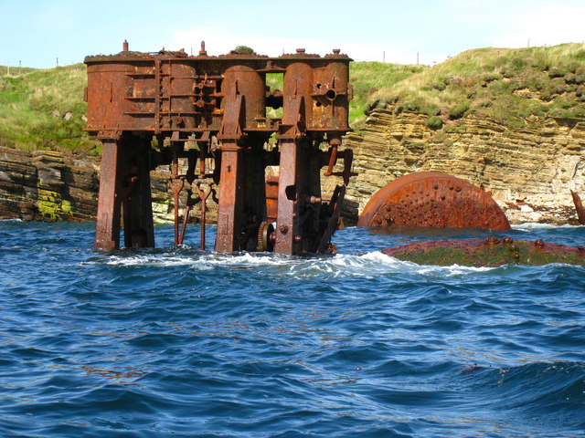
HMS Opal (1915)

HMS Opal was an Admiralty M-class destroyer of the Royal Navy. She served in the First World War following her construction at Sunderland in 1915. Attached...

Glimps Holm

Glimps Holm or Glims Holm (Old Norse: Glums Holm) is a small uninhabited islet in Orkney, Scotland. == Geography == Glimps Holm lies in Holm Sound, one...

Hunda

Hunda is an uninhabited island in the Orkney archipelago in Scotland. It is 100 hectares (0.39 sq mi) in extent and rises to 42 metres (138 ft) above sea...

Hoxa, Orkney

Hoxa is a small settlement on the island of South Ronaldsay in the Orkney Islands north of mainland Scotland. Hoxa is located 1+1⁄4 miles (2.0 km) west...

Nearby Amenities

Located within 500m of 58.819789,-2.8831366
Grim Ness
Place: locality
Source: OS7
Wikidata: Q12715146
Wikipedia: en:Grim Ness
Lat/Long: 58.8187117/-2.8797017
Power: pole
Lat/Long: 58.822195/-2.8899327
Power: pole
Lat/Long: 58.8218909/-2.8890663
Power: pole
Lat/Long: 58.8215423/-2.8881598
The data included in this document is from www.openstreetmap.org. The data is made available under ODbL.

Have you been to Grim Ness?

Leave your review of Grim Ness below (or comments, questions and feedback).