Scarf Taing

Coastal Feature, Headland, Point in Orkney

Scotland

Scarf Taing

The Irene Part of the Engine Block from Irene.
She was the 'subject' of the gallant rescue attempt by the Longhope Lifeboat Crew, who lost their lives in 1969.
See here <span class="nowrap"><a title="http://news.stv.tv/scotland/82797-orkney-remembers-longhope-disaster/" rel="nofollow ugc noopener" href="http://news.stv.tv/scotland/82797-orkney-remembers-longhope-disaster/">Link</a><img style="margin-left:2px;" alt="External link" title="External link - shift click to open in new window" src="https://s1.geograph.org.uk/img/external.png" width="10" height="10"/></span>

More here <span class="nowrap"><a title="http://theramblinggardener.com/2014/11/28/the-longhope-lifeboat-disaster/comment-page-1/" rel="nofollow ugc noopener" href="http://theramblinggardener.com/2014/11/28/the-longhope-lifeboat-disaster/comment-page-1/">Link</a><img style="margin-left:2px;" alt="External link" title="External link - shift click to open in new window" src="https://s1.geograph.org.uk/img/external.png" width="10" height="10"/></span>
and this <a href="https://www.geograph.org.uk/photo/1066362">ND3389 : Longhope Lifeboat Memorial</a>
The Irene Credit: Derek Mayes

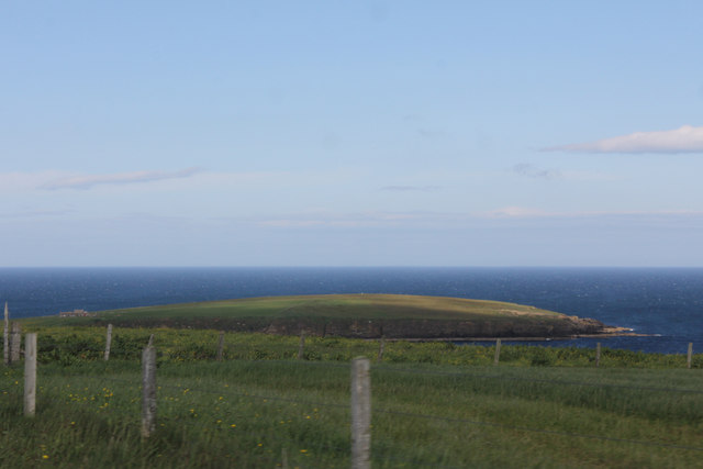
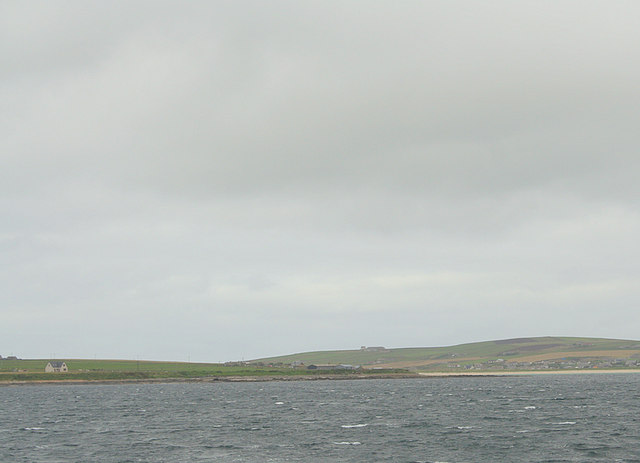
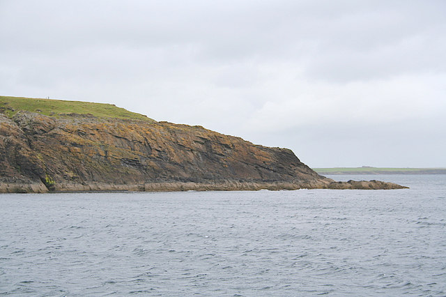
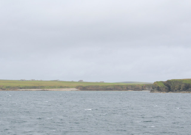
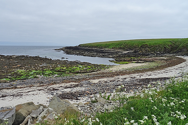
Scarf Taing is a prominent coastal feature located in the Orkney Islands, an archipelago situated off the northeastern coast of Scotland. It is classified as a headland, a high and prominent area of land that extends into the sea. Scarf Taing is positioned on the northeastern coast of the island of Mainland, the largest island in the Orkney group.

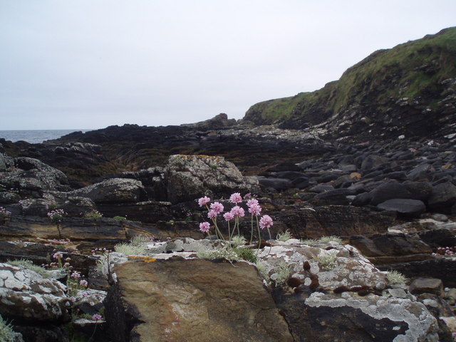
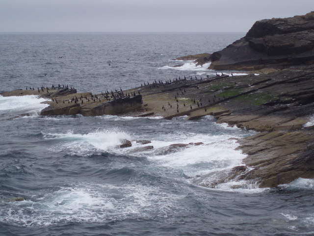
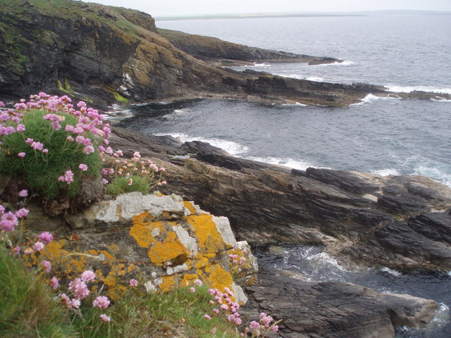
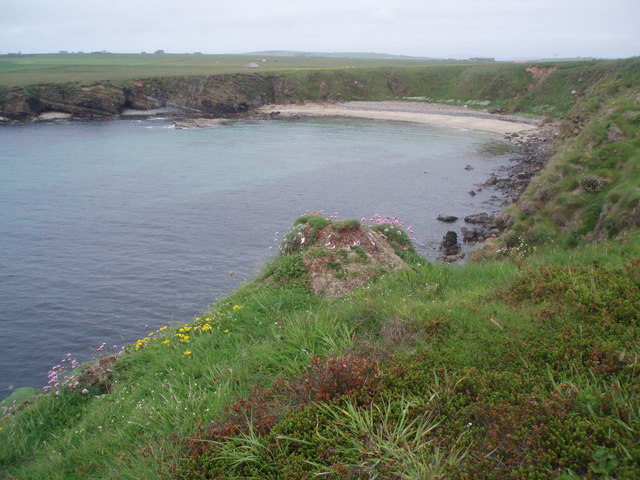
This headland is characterized by its steep cliffs, which rise dramatically from the surrounding sea. The cliffs are composed of sedimentary rocks, particularly sandstone and shale, which display layers of different colors and textures, adding to the visual appeal of the area. At the top of the headland, there is a flat plateau that offers breathtaking panoramic views of the surrounding coastline and the North Sea.

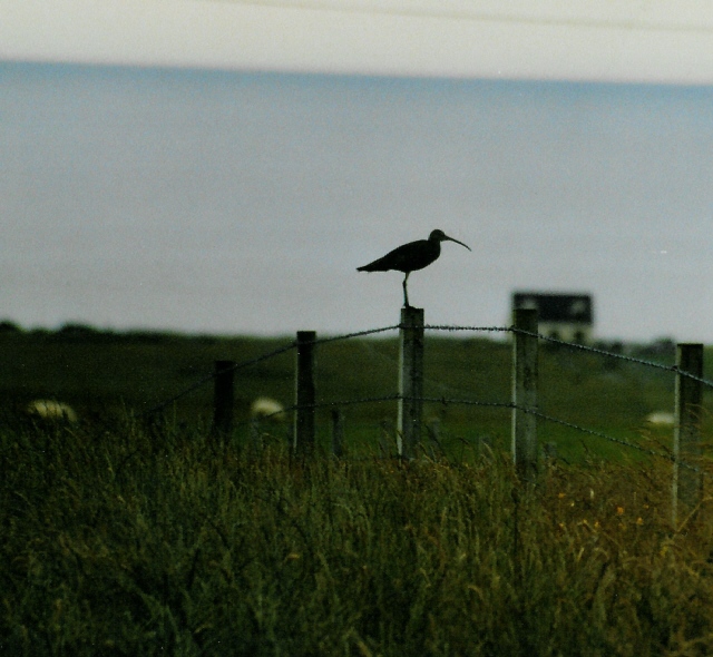
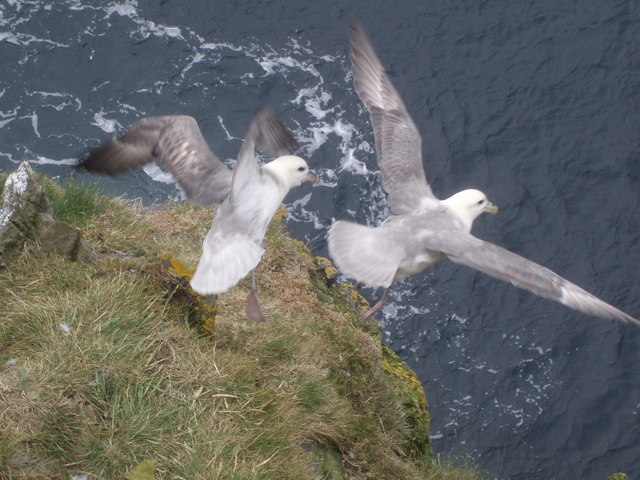
Scarf Taing is known for its natural beauty and is a popular destination for both locals and tourists. It is also an important site for birdwatching enthusiasts, as the cliffs provide nesting habitats for various seabird species, including puffins, guillemots, and fulmars. The surrounding waters are also home to a diverse array of marine life, making it a great spot for snorkeling and diving.

In addition to its natural attractions, Scarf Taing is also of historical significance. The headland is dotted with ancient archaeological sites, including burial mounds and stone circles, which highlight the rich cultural heritage of the Orkney Islands.

Overall, Scarf Taing is a remarkable coastal feature that combines stunning natural scenery with historical and archaeological importance. It continues to captivate visitors with its rugged cliffs, diverse wildlife, and glimpses into the past.

If you have any feedback on the listing, please let us know in the comments section below.
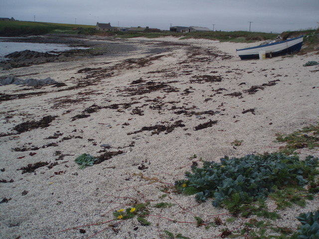
Scarf Taing Images

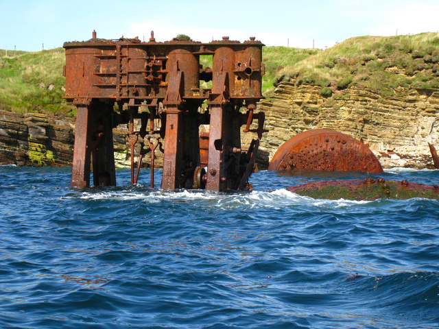
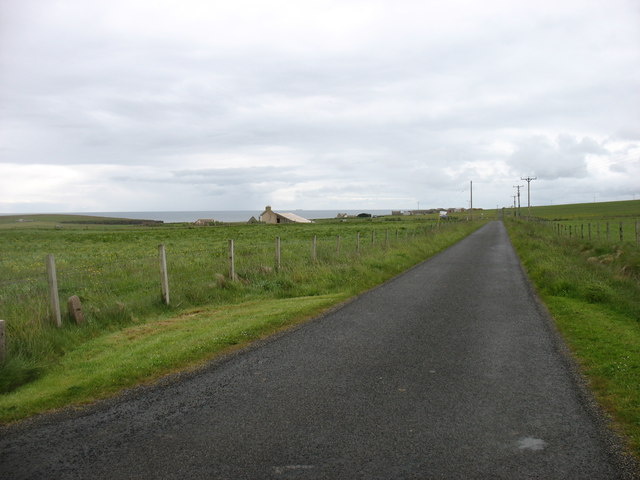
Images are sourced within 2km of 58.821294/-2.8784648 or Grid Reference ND4992. Thanks to Geograph Open Source API. All images are credited.

The Irene Part of the Engine Block from Irene.
She was the 'subject' of the gallant rescue attempt by the Longhope Lifeboat Crew, who lost their lives in 1969.
See here <span class="nowrap"><a title="http://news.stv.tv/scotland/82797-orkney-remembers-longhope-disaster/" rel="nofollow ugc noopener" href="http://news.stv.tv/scotland/82797-orkney-remembers-longhope-disaster/">Link</a><img style="margin-left:2px;" alt="External link" title="External link - shift click to open in new window" src="https://s1.geograph.org.uk/img/external.png" width="10" height="10"/></span>

More here <span class="nowrap"><a title="http://theramblinggardener.com/2014/11/28/the-longhope-lifeboat-disaster/comment-page-1/" rel="nofollow ugc noopener" href="http://theramblinggardener.com/2014/11/28/the-longhope-lifeboat-disaster/comment-page-1/">Link</a><img style="margin-left:2px;" alt="External link" title="External link - shift click to open in new window" src="https://s1.geograph.org.uk/img/external.png" width="10" height="10"/></span>
and this <a href="https://www.geograph.org.uk/photo/1066362">ND3389 : Longhope Lifeboat Memorial</a>
The Irene
Part of the Engine Block from Irene. She was the 'subject' of the gallant rescue attempt by the Longhope Lifeboat Crew, who lost their lives in 1969. See here LinkExternal link More here LinkExternal link and this ND3389 : Longhope Lifeboat Memorial
Fields near Lime Banks
The B9044 heading for South Cara
Minor road at South Cara Near the easternmost point of South Ronaldsay.
Minor road at South Cara
Near the easternmost point of South Ronaldsay.
Curlew on farmland at Grimness Looking towards Brecks farmhouse in the distance
Curlew on farmland at Grimness
Looking towards Brecks farmhouse in the distance
Honeysgeo Farmstead of Honeysgeo and little bay east coast of South Ronaldsay, Orkney.
Honeysgeo
Farmstead of Honeysgeo and little bay east coast of South Ronaldsay, Orkney.
Sea Pink Armeria Maritima, also known as Sea Pink or Thrift on the foreshore at the headland of Grim Ness, South Ronaldsay, Orkney
Sea Pink
Armeria Maritima, also known as Sea Pink or Thrift on the foreshore at the headland of Grim Ness, South Ronaldsay, Orkney
Shags, Grim Ness I was reliably informed that these were Shags rather than Cormorants, though they are very hard to tell apart. There were hundreds of them on the rocks and headland of Grim Ness, South Ronaldsay, Orkney.
Shags, Grim Ness
I was reliably informed that these were Shags rather than Cormorants, though they are very hard to tell apart. There were hundreds of them on the rocks and headland of Grim Ness, South Ronaldsay, Orkney.
The Keys The long rock sticking out into the sea is called The Keys and has hundreds of Shags on it as do most of the rocks offshore here. The photograph is taken from Grey Chair and there is Thrift and yellow lichen in the foreground.
The Keys
The long rock sticking out into the sea is called The Keys and has hundreds of Shags on it as do most of the rocks offshore here. The photograph is taken from Grey Chair and there is Thrift and yellow lichen in the foreground.
Head Bay Not actually called anything on any maps, this little bay is near a dwelling called Head. Also in the picture is Skipi Geo, just to the left of the bay.
On South Ronaldsay, Orkney.
Head Bay
Not actually called anything on any maps, this little bay is near a dwelling called Head. Also in the picture is Skipi Geo, just to the left of the bay. On South Ronaldsay, Orkney.
Fulmarus glacialis A couple of Fulmars taking off from the Stack of Kame. The Stack of Kame isn't a proper stack but a narrow - as in a couple of feet wide at the top - headland sticking out into the sea. I was lucky enough to be above them without them realising and snapped them just as they sensed my presence a few feet above.
Fulmarus glacialis
A couple of Fulmars taking off from the Stack of Kame. The Stack of Kame isn't a proper stack but a narrow - as in a couple of feet wide at the top - headland sticking out into the sea. I was lucky enough to be above them without them realising and snapped them just as they sensed my presence a few feet above.
South of Croo Stone. Burray village can be seen beyond the causeway.
South of Croo Stone.
Burray village can be seen beyond the causeway.
Rounding Grim Ness on the northward journey.
Lime Banks to the west of Grim Ness.
Limbo, near Honeygeo
Grimness, St. Margaret's Hope Taken from behind the Orkney Marine Life Aquarium looking across fields at St. Margaret's Hope. The sea forms a band between land and sky.
Grimness, St. Margaret's Hope
Taken from behind the Orkney Marine Life Aquarium looking across fields at St. Margaret's Hope. The sea forms a band between land and sky.
Honeysgeo This inlet an beach are on the north side of Grim Ness.
Honeysgeo
This inlet an beach are on the north side of Grim Ness.
Beach near Honeysgeo Honeysgeo is the farm at extreme right in this view. Grim Ness is at the far side of the bay.
Beach near Honeysgeo
Honeysgeo is the farm at extreme right in this view. Grim Ness is at the far side of the bay.
Show me another place!

Scarf Taing is located at Grid Ref: ND4992 (Lat: 58.821294, Lng: -2.8784648)

Unitary Authority: Orkney Islands

Police Authority: Highlands and Islands

What 3 Words

///timed.woodstove.owls. Near St Margaret's Hope, Orkney Islands

Related Wikis

Grim Ness

Grimness is a cliff-girt headland on the island of South Ronaldsay, in the Orkney archipelago of Scotland. It is located between Honeysgeo and Skipi Geo...

Burray

Burray () is one of the Orkney Islands in Scotland. It lies to the east of Scapa Flow and is one of a chain of islands linked by the Churchill Barriers...

St Margaret's Hope

St Margaret's Hope is a village in the Orkney Islands, off the north coast of Scotland. It is known locally as The Hope or The Hup. With a population...

South Ronaldsay

South Ronaldsay (, also , Scots: Sooth Ronalshee) is one of the Orkney Islands off the north coast of Scotland. It is linked to the Orkney Mainland by...

Nearby Amenities

Located within 500m of 58.821294,-2.8784648
Grim Ness
Place: locality
Source: OS7
Wikidata: Q12715146
Wikipedia: en:Grim Ness
Lat/Long: 58.8187117/-2.8797017
The data included in this document is from www.openstreetmap.org. The data is made available under ODbL.

Have you been to Scarf Taing?

Leave your review of Scarf Taing below (or comments, questions and feedback).