Hen of Gairsay

Coastal Feature, Headland, Point in Orkney

Scotland

Hen of Gairsay

View of Gairsay, from the ferry terminal at Tingwall
View of Gairsay, from the ferry terminal at Tingwall Credit: Christopher Hilton

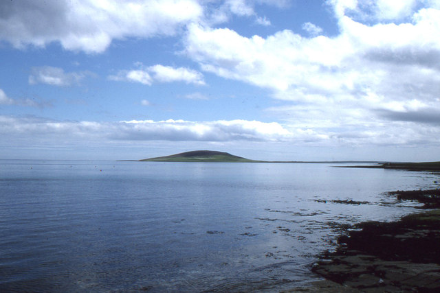
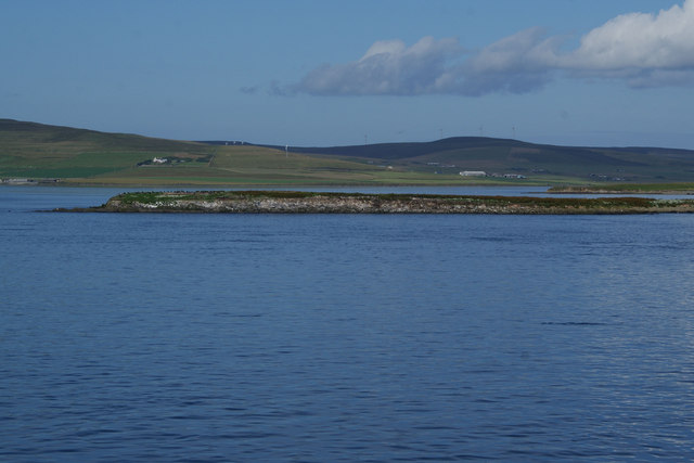
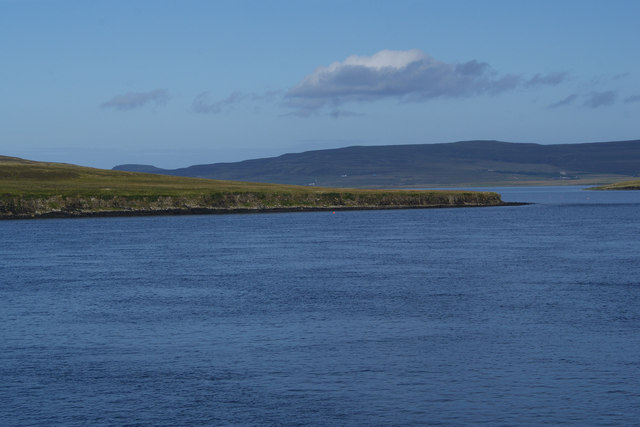
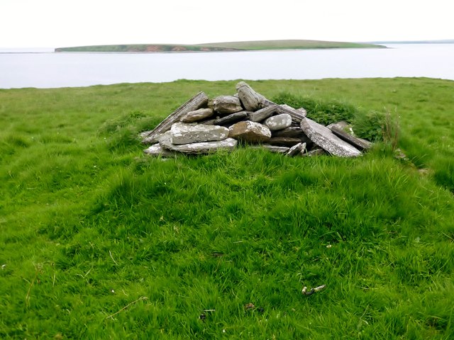
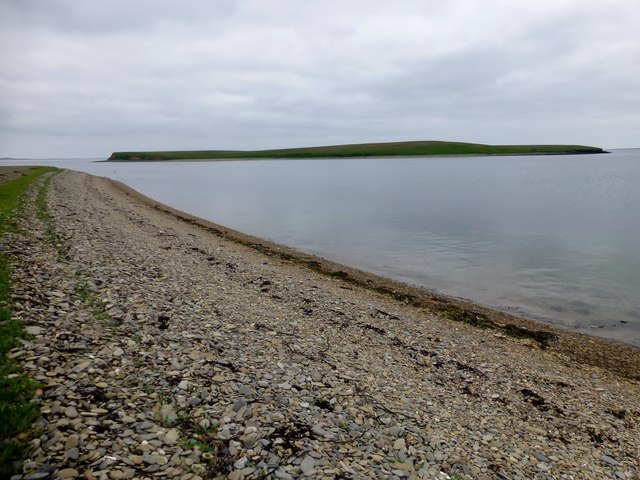
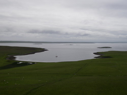
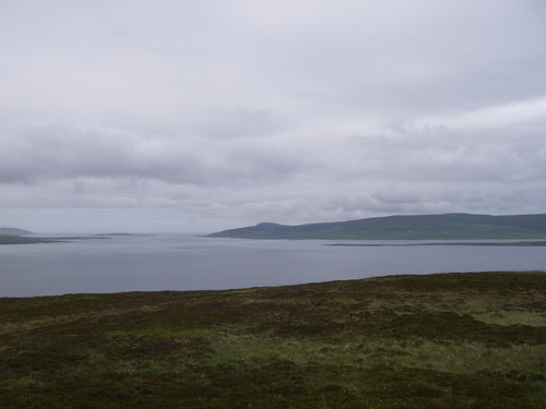
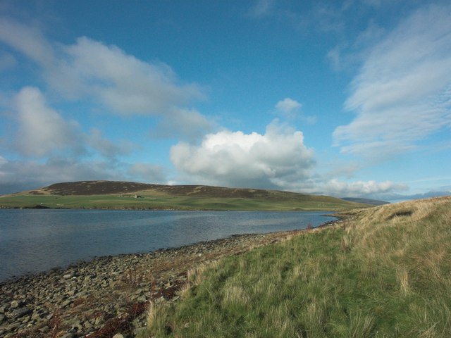
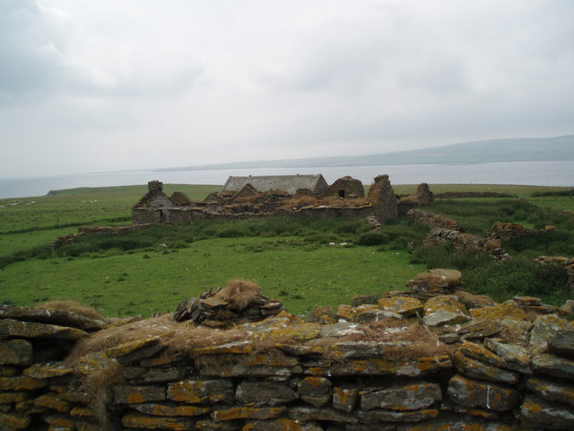
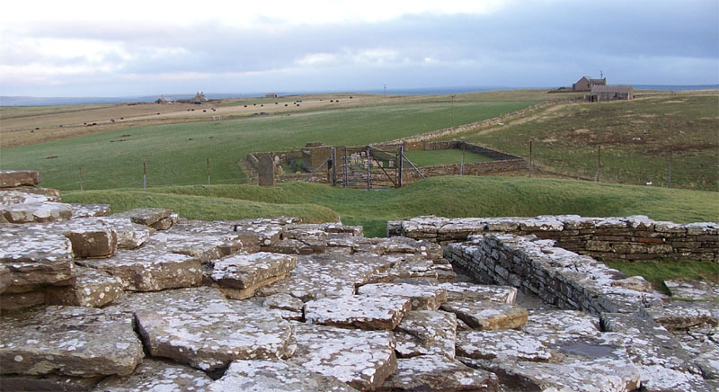
Hen of Gairsay is a prominent headland located on the western coast of Orkney, an archipelago situated in the northern part of Scotland. This coastal feature is characterized by its rugged cliffs, which rise sharply from the North Sea, offering breathtaking views of the surrounding area.

The Hen of Gairsay is known for its distinctive shape, resembling the profile of a hen, which is the origin of its name. Standing at an elevation of approximately 120 meters, it commands attention as a prominent landmark visible from miles away.

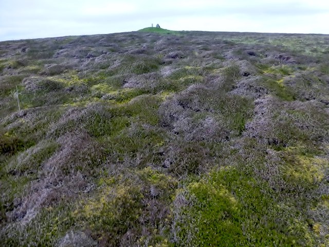
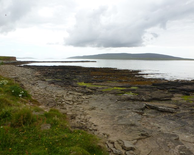
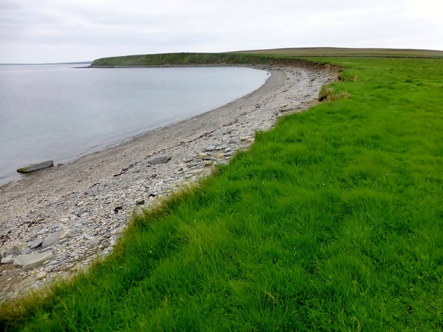
The headland is composed mainly of sandstone, giving it a unique reddish hue that contrasts with the deep blue of the sea. The cliffs are weathered by the relentless pounding of the waves, creating dramatic formations and sea stacks, adding to the allure of the area.

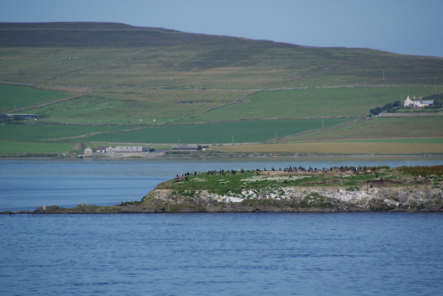
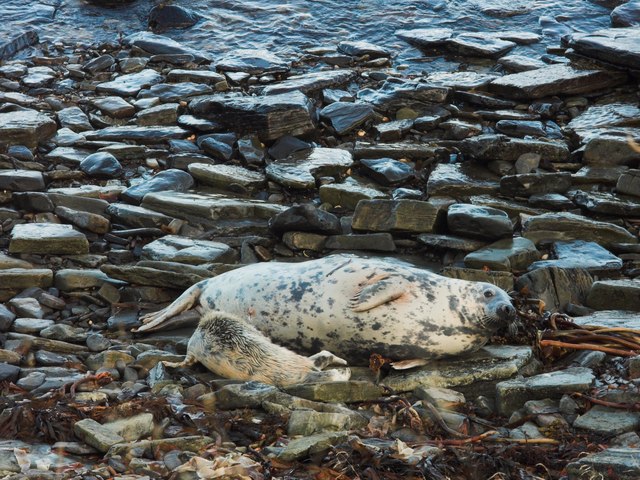
The Hen of Gairsay is also home to a wide variety of seabirds, including puffins, guillemots, and razorbills, making it a popular spot for birdwatchers. These birds nest in the crevices and ledges of the cliffs, adding a lively spectacle to the surroundings.

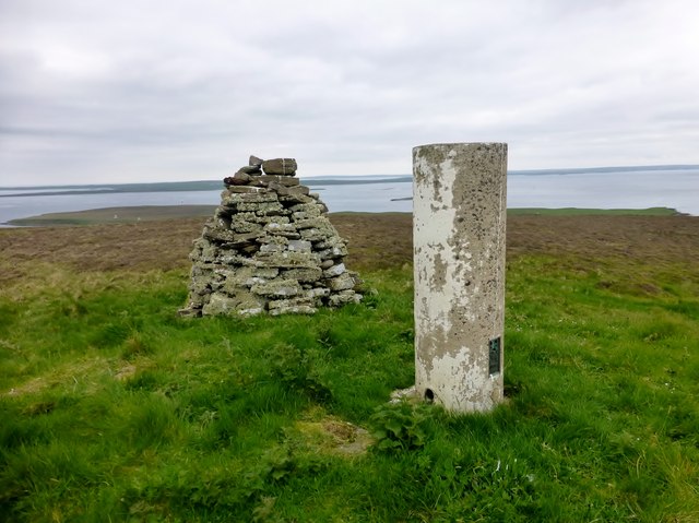
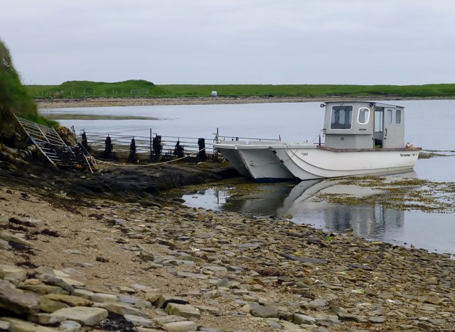
Access to the Hen of Gairsay is limited due to its remote location and the treacherous nature of the cliffs. However, boat tours are available for visitors who wish to explore the area and admire its natural beauty up close.

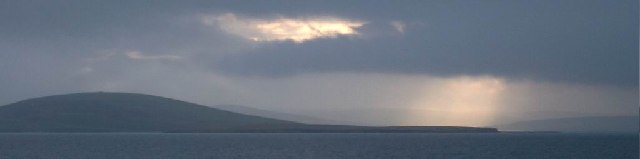
Overall, Hen of Gairsay is a captivating coastal feature that offers a glimpse into the raw and untamed beauty of Orkney's western coastline. Its unique shape, stunning cliffs, and abundant wildlife make it a must-visit destination for nature enthusiasts and those seeking a truly awe-inspiring experience.

If you have any feedback on the listing, please let us know in the comments section below.

Hen of Gairsay Images

Images are sourced within 2km of 59.077215/-2.9522837 or Grid Reference HY4521. Thanks to Geograph Open Source API. All images are credited.

View of Gairsay, from the ferry terminal at Tingwall
Holm of Boray As seen from the ferry to the Northern Isles. West Mainland stands behind.
Holm of Boray
As seen from the ferry to the Northern Isles. West Mainland stands behind.
Closer view of the Holm of Boray The southern end of the island showing the colony of cormorants.
Closer view of the Holm of Boray
The southern end of the island showing the colony of cormorants.
Hen of Gairsay As seen from the ferry to Westray, with Rousay standing behind.
Hen of Gairsay
As seen from the ferry to Westray, with Rousay standing behind.
North Head, Gairsay North Head, Gairsay with a view towards Sweyn Holm.
North Head, Gairsay
North Head, Gairsay with a view towards Sweyn Holm.
Ward of Gairsay Bagged this island on an Alan Holmes boat trip as a group of twelve via Harvey's boat the Charles Ann from Tingwall.
Name: Ward of Gairsay
Hill number: 4930
Height: 102m / 335ft
Parent (Ma/M): none
Area: 23: Orkney Islands
Class: Hu,1
Grid ref: HY441223 (est)
Drop: 102m
Col: Sea
Ward of Gairsay
Bagged this island on an Alan Holmes boat trip as a group of twelve via Harvey's boat the Charles Ann from Tingwall. Name: Ward of Gairsay Hill number: 4930 Height: 102m / 335ft Parent (Ma/M): none Area: 23: Orkney Islands Class: Hu,1 Grid ref: HY441223 (est) Drop: 102m Col: Sea
View Towards Ward of Gairsay A taste of the moorland on the island of Gairsay as I head towards its summit.
View Towards Ward of Gairsay
A taste of the moorland on the island of Gairsay as I head towards its summit.
Sweyn Holm Landing here, alone on a calm day, is a treat few would experience.
Looking North-west into the Sound of Eynhallow - Rousay on the right.
Sweyn Holm
Landing here, alone on a calm day, is a treat few would experience. Looking North-west into the Sound of Eynhallow - Rousay on the right.
Gravel Beach A view along the gravel beach on Gairsay towards Sweyn Holm.
Gravel Beach
A view along the gravel beach on Gairsay towards Sweyn Holm.
Hen of Gairsay A view along the northern edge of the Hen of Gairsay with its gravel beach.
Hen of Gairsay
A view along the northern edge of the Hen of Gairsay with its gravel beach.
Jetty At Millburn Bay, Gairsay
Gairsay, from the ferry No doubt a supplemental, as it's pretty sub-fusk.  It does, however, show pretty much all that's interesting in Gairsay, i.e. the cairn on the hill.
Gairsay, from the ferry
No doubt a supplemental, as it's pretty sub-fusk. It does, however, show pretty much all that's interesting in Gairsay, i.e. the cairn on the hill.
Millburn Bay, Gairsay Looking over Wide Firth to Shapinsay and Bay of Kirkwall
Millburn Bay, Gairsay
Looking over Wide Firth to Shapinsay and Bay of Kirkwall
Eynhallow Sound from Gairsay Mainland to left, Wyre and Rousay to right.
Eynhallow Sound from Gairsay
Mainland to left, Wyre and Rousay to right.
Millburn Bay from Hen of Gairsay
Atlantic Grey Seal with pup on Hen of Gairsay shore
Derelict farm, Gairsay
Caterpillar by old schoolhouse, Gairsay
Show me another place!

Hen of Gairsay is located at Grid Ref: HY4521 (Lat: 59.077215, Lng: -2.9522837)

Unitary Authority: Orkney Islands

Police Authority: Highlands and Islands

What 3 Words

///zone.landowner.depths. Near Balfour, Orkney Islands

Related Wikis

Gairsay

Gairsay (Old Norse: Gáreksey) is a small island in Orkney, Scotland, located in the parish of Rendall, 1.5 miles (2.4 km) off the coast, astride one of...

Sweyn Holm

Note: There is also a "Sweyn Holm" off St Ninian's Isle, Shetland Sweyn Holm is a small island in the Orkney Islands, next to Gairsay. It is thought to...

Vasa Loch

Vasa Loch is a brackish lagoon in southwestern Shapinsay, Orkney Islands. (Ordnance, 2002) This water body has been shown on early maps of the island...

Wyre, Orkney

Wyre (historically known as Viera and Veira) is one of the Orkney Islands, lying south-east of Rousay. It is 311 hectares (1.20 sq mi) and 32 metres (105...

Nearby Amenities

Located within 500m of 59.077215,-2.9522837
Created By: almien_coastlines mod
Lat/Long: 59.074981/-2.949469
Millburn - Gairsay
Leisure: marina
Lat/Long: 59.0781927/-2.9598481
Hen of Gairsay
Place: locality
Lat/Long: 59.0768285/-2.9519248
The data included in this document is from www.openstreetmap.org. The data is made available under ODbL.

Have you been to Hen of Gairsay?

Leave your review of Hen of Gairsay below (or comments, questions and feedback).