Tainga

Coastal Feature, Headland, Point in Orkney

Scotland

Tainga

Eastward House, A961 near Barswick, South Ronaldsay Built in 1873 by local residents for the Church of Scotland, it is now (2014) a home offering B & B.
Eastward House, A961 near Barswick, South Ronaldsay Credit: Jo and Steve Turner

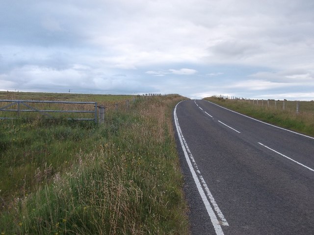
Tainga, Orkney is a prominent coastal feature located on the Orkney Islands, which are part of Scotland. Tainga is a headland or point that juts out into the North Sea, offering breathtaking views of the surrounding landscape. It is situated on the eastern coast of the island, not far from the town of Kirkwall.

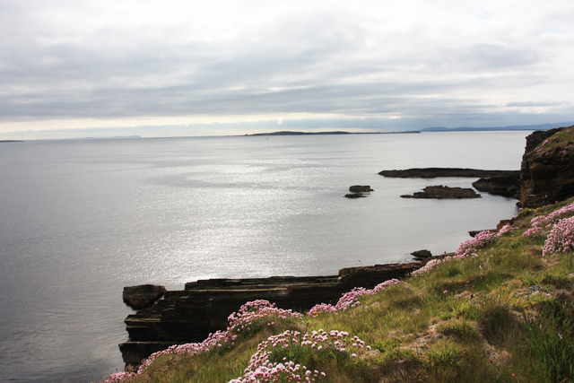
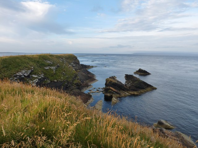
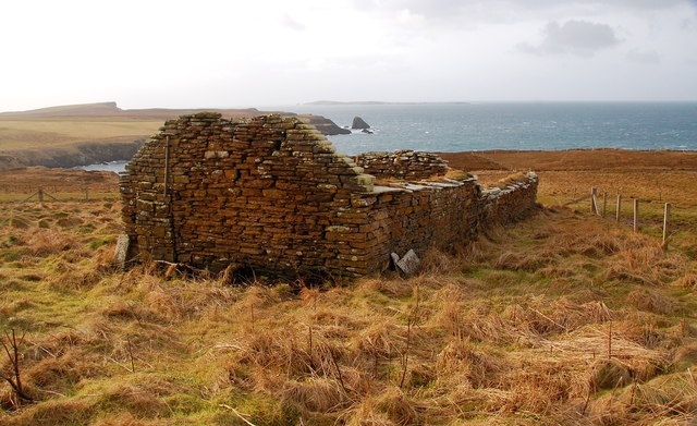
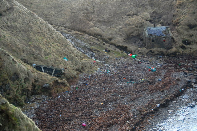
The headland is characterized by its rugged and rocky terrain, with steep cliffs that drop dramatically into the sea below. These cliffs are often buffeted by strong winds and crashing waves, creating a dramatic and awe-inspiring natural spectacle. The exposed nature of Tainga makes it a popular spot for birdwatching, as various seabirds nest and roost in the surrounding cliffs, including puffins, guillemots, and razorbills.

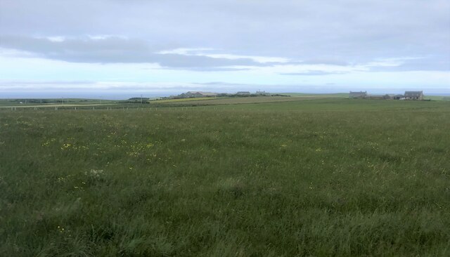
The headland is also home to a variety of plant life, with hardy grasses and wildflowers clinging to the rocky crevices. Depending on the season, visitors may be treated to colorful displays of sea thrift, sea campion, or yellow rattle. The area is a haven for nature lovers and photographers, offering countless opportunities to capture the beauty of the Scottish coastal landscape.

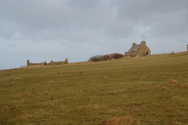
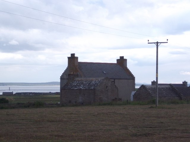
In addition to its natural beauty, Tainga is of historical significance. It is believed to have been a strategic location during Viking times, with evidence of a settlement and burial ground nearby. The headland's position provided a vantage point for monitoring ship movements and controlling access to the surrounding waters.

Overall, Tainga, Orkney is a captivating coastal feature that combines stunning natural scenery with a rich historical past. Whether visiting for its wildlife, geological formations, or cultural heritage, this headland offers a memorable experience for all who venture to its shores.

If you have any feedback on the listing, please let us know in the comments section below.
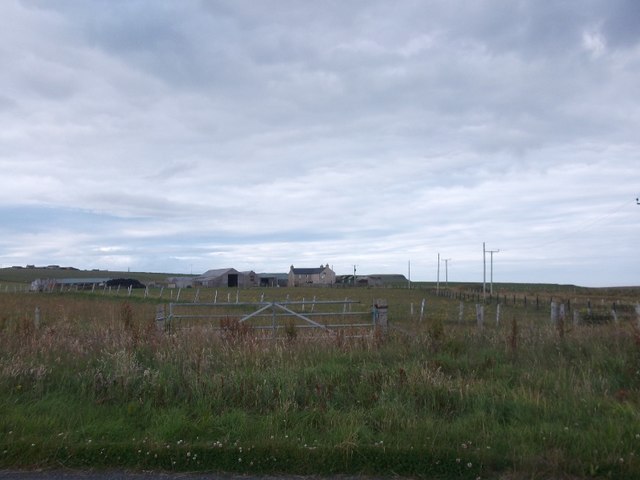
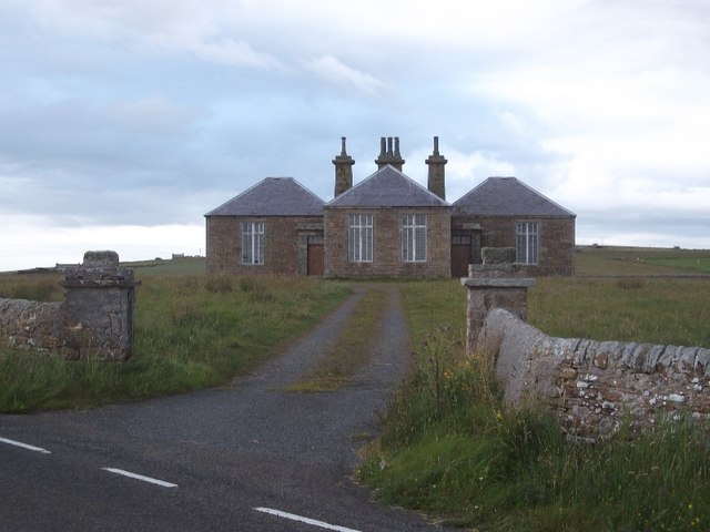
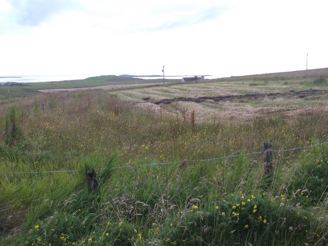
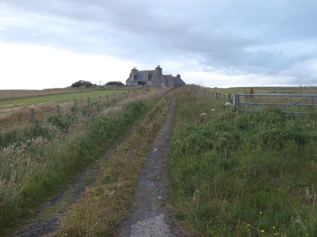
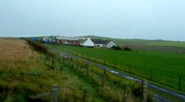
Tainga Images

Images are sourced within 2km of 58.758153/-2.9916273 or Grid Reference ND4286. Thanks to Geograph Open Source API. All images are credited.

Eastward House, A961 near Barswick, South Ronaldsay Built in 1873 by local residents for the Church of Scotland, it is now (2014) a home offering B & B.
Eastward House, A961 near Barswick, South Ronaldsay
Built in 1873 by local residents for the Church of Scotland, it is now (2014) a home offering B & B.
Farmland, Mossetter
Farmland, Mossetter
Loch of Lythe  Small loch near Ossquoy, the farm on the right
Loch of Lythe
Small loch near Ossquoy, the farm on the right
Tomison's Academy Founded under the will of William Tomison (1739-1829) of the Hudson's Bay Company. 
This former school is now empty and the adjacent buildings falling into dereliction
Tomison's Academy
Founded under the will of William Tomison (1739-1829) of the Hudson's Bay Company. This former school is now empty and the adjacent buildings falling into dereliction
Aerial view of southern South Ronaldsay Taken from a flight to Shetland via Orkney this is the southern end of the southernmost of the main islands of Orkney, South Ronaldsay.
Obviously aerial photos such as this cover many squares, so I have taken the subject reference as Barth Head, which is the little sticky-out point nearest the camera.
Aerial view of southern South Ronaldsay
Taken from a flight to Shetland via Orkney this is the southern end of the southernmost of the main islands of Orkney, South Ronaldsay. Obviously aerial photos such as this cover many squares, so I have taken the subject reference as Barth Head, which is the little sticky-out point nearest the camera.
Castle Skerry Castle Skerry seems to be the rocky area at the centre right of the photograph.

The flowers are "sea pink", or alternatively "thrift", and add a touch of warm colour to the greys and greens of the photograph.
Castle Skerry
Castle Skerry seems to be the rocky area at the centre right of the photograph. The flowers are "sea pink", or alternatively "thrift", and add a touch of warm colour to the greys and greens of the photograph.
Castle Skerry
Castle Skerry
The deserted croft of Greenvale Deserted and derelict.
The deserted croft of Greenvale
Deserted and derelict.
Inside Greenvale Looking into one of the rooms. A very similar atmosphere as in those on Swona, which Greenvale overlooks.
Inside Greenvale
Looking into one of the rooms. A very similar atmosphere as in those on Swona, which Greenvale overlooks.
Greenvale Possibly the original dwelling. Swona on the horizon in the background.
Greenvale
Possibly the original dwelling. Swona on the horizon in the background.
The Haven, Barswick On Sundays, the inhabitants of Swona used to cross to South Ronaldsay in an open boat and would land here. This building is where they would then change into "Sunday Best" before walking across the fields to the kirk (ND441856). After the service, the process was reversed. What people!
The Haven, Barswick
On Sundays, the inhabitants of Swona used to cross to South Ronaldsay in an open boat and would land here. This building is where they would then change into "Sunday Best" before walking across the fields to the kirk (ND441856). After the service, the process was reversed. What people!
Dunda House
Dunda House
Osquoy Farm on South Ronaldsay.
Osquoy
Farm on South Ronaldsay.
Old school, Cleat A former school building on South Ronaldsay.
Old school, Cleat
A former school building on South Ronaldsay.
Hay field, Lythe The deep muddy ruts illustrate what an appalling Summer it was in 2015.  Orkney had a particularly hard time and hay and straw had to be bought in for the Winter.
Hay field, Lythe
The deep muddy ruts illustrate what an appalling Summer it was in 2015. Orkney had a particularly hard time and hay and straw had to be bought in for the Winter.
Greenquoy
Greenquoy
A961 passing Lythe A fast and empty road, ideal for a calm evening.  Unfortunately it is extremely rare in Orkney for milages to be displayed and I had no idea how far it was to St Margaret's Hope.
A961 passing Lythe
A fast and empty road, ideal for a calm evening. Unfortunately it is extremely rare in Orkney for milages to be displayed and I had no idea how far it was to St Margaret's Hope.
Track to Beedies This has been a smithy and more recently operates as a Garden Furniture shop.
Track to Beedies
This has been a smithy and more recently operates as a Garden Furniture shop.
Show me another place!

Tainga is located at Grid Ref: ND4286 (Lat: 58.758153, Lng: -2.9916273)

Unitary Authority: Orkney Islands

Police Authority: Highlands and Islands

What 3 Words

///triangles.raced.papers. Near St Margaret's Hope, Orkney Islands

Related Wikis

Burwick, Orkney

Burwick () is a small harbour on the island of South Ronaldsay in the Orkney Islands, Scotland. It is the closest Orkney harbour to the Scottish mainland...

South Ronaldsay

South Ronaldsay (, also , Scots: Sooth Ronalshee) is one of the Orkney Islands off the north coast of Scotland. It is linked to the Orkney Mainland by...

HMS Opal (1915)

HMS Opal was an Admiralty M-class destroyer of the Royal Navy. She served in the First World War following her construction at Sunderland in 1915. Attached...

Swona

Swona is an uninhabited privately-owned island in the Pentland Firth off the north coast of Scotland. == Geography and geology == Swona is the more northerly...

Liddle Burnt Mound

Liddle Burnt Mound is a Bronze Age site on the island of South Ronaldsay, Orkney. The site consists of the remains of a building and a mound that surrounds...

Tomb of the Eagles

The Tomb of the Eagles, or Isbister Chambered Cairn, is a Neolithic chambered tomb located on a cliff edge at Isbister on South Ronaldsay in Orkney, Scotland...

Herston, Orkney

Herston is a village on South Ronaldsay, Orkney, Scotland, United Kingdom. Herston is historically a fishing village but its only industry to speak of...

Hoxa, Orkney

Hoxa is a small settlement on the island of South Ronaldsay in the Orkney Islands north of mainland Scotland. Hoxa is located 1+1⁄4 miles (2.0 km) west...

Nearby Amenities

Located within 500m of 58.758153,-2.9916273
North Barth Clivie
Place: locality
Lat/Long: 58.7546745/-2.9897509
The data included in this document is from www.openstreetmap.org. The data is made available under ODbL.

Have you been to Tainga?

Leave your review of Tainga below (or comments, questions and feedback).