Broad Shore

Coastal Feature, Headland, Point in Orkney

Scotland

Broad Shore

Standing stones, Warebeth, Orkney From <span class="nowrap"><a title="https://canmore.org.uk/site/1568/leafea" rel="nofollow ugc noopener" href="https://canmore.org.uk/site/1568/leafea">Link</a><img style="margin-left:2px;" alt="External link" title="External link - shift click to open in new window" src="https://s1.geograph.org.uk/img/external.png" width="10" height="10"/></span> : "These are two squared sandstone blocks 4 feet apart, their bases each earthfast in a heap of small stones. The larger is nearly 4 feet high, 2 feet 9 inches wide and 3½ inches thick; the smaller 3 feet 3 inches high, 2 feet 3 inches wide and 3¾ inches thick. The major axis of each is aligned N and S. At their bases are two granite boulders probably not associated with the monument, although the larger boulder now broken, once stood between the blocks with its axis E and W. The stones are perhaps the remnant of some larger construction, but not a circular setting. Allegedly human bones were unearthed by a dog at the bases of the stones."
Standing stones, Warebeth, Orkney Credit: Claire Pegrum

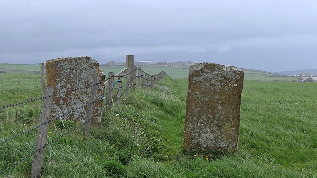
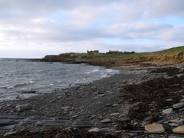
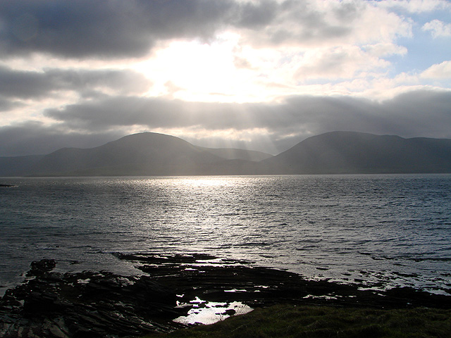
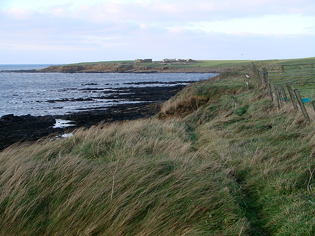
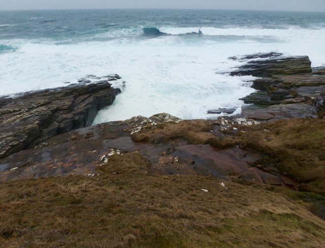
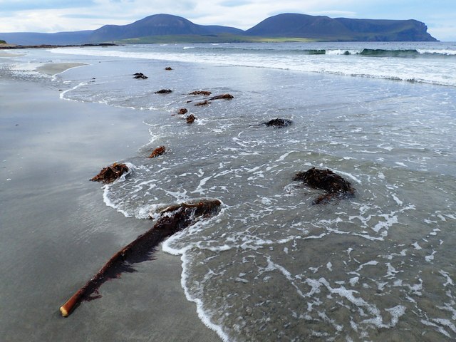
Broad Shore is a prominent coastal feature located on the northeastern coast of Orkney, an archipelago in Scotland. Positioned between the Brough of Birsay to the west and Skipi Geo to the east, this headland juts out into the North Sea, offering stunning views of the surrounding landscape.

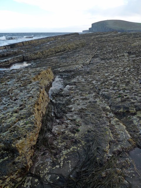
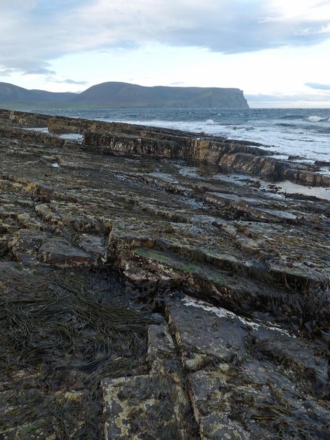
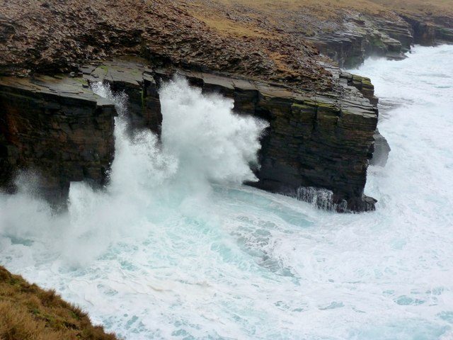
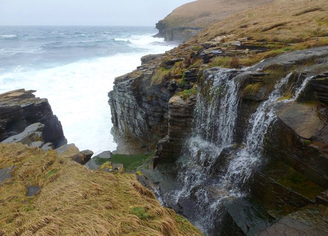
Characterized by its rugged cliffs, Broad Shore stands tall at an elevation of approximately 30 meters above sea level. The headland is composed of sandstone and shale, displaying layers of sedimentary rocks that have been shaped by the relentless forces of wind and waves over centuries. These cliffs provide a nesting ground for numerous seabird species, including puffins, guillemots, and fulmars, making it a popular spot for birdwatchers.

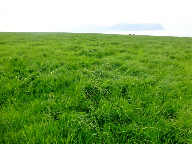
The headland is accessible via a narrow footpath that winds its way along the edge of the cliffs. This path offers adventurous visitors the opportunity to explore the area and experience the dramatic coastal scenery up close. On clear days, the view from Broad Shore stretches out towards the distant horizon, allowing observers to admire the vast expanse of the North Sea.

Broad Shore also holds historical significance, as it is believed to have been a landing point for Norse settlers during the Viking Age. The headland is thought to have served as a crucial access point for trade and communication between Orkney and the Nordic region.

Overall, Broad Shore is a captivating coastal feature that combines natural beauty, wildlife, and historical intrigue. It is a destination that offers a unique and immersive experience for nature enthusiasts and history buffs alike.

If you have any feedback on the listing, please let us know in the comments section below.

Broad Shore Images

Images are sourced within 2km of 58.969779/-3.3524042 or Grid Reference HY2209. Thanks to Geograph Open Source API. All images are credited.
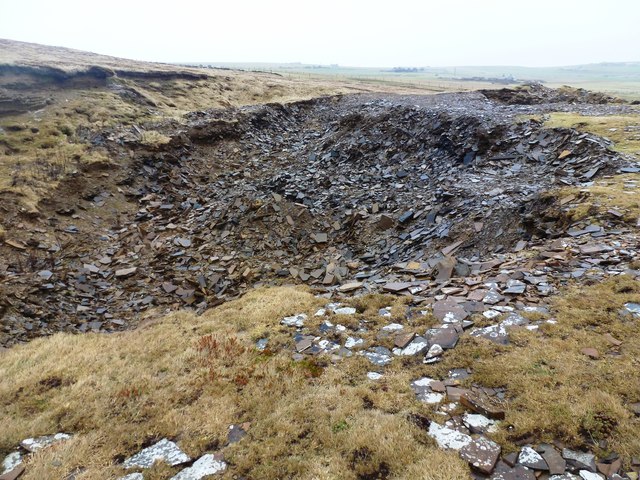
Standing stones, Warebeth, Orkney From <span class="nowrap"><a title="https://canmore.org.uk/site/1568/leafea" rel="nofollow ugc noopener" href="https://canmore.org.uk/site/1568/leafea">Link</a><img style="margin-left:2px;" alt="External link" title="External link - shift click to open in new window" src="https://s1.geograph.org.uk/img/external.png" width="10" height="10"/></span> : "These are two squared sandstone blocks 4 feet apart, their bases each earthfast in a heap of small stones. The larger is nearly 4 feet high, 2 feet 9 inches wide and 3½ inches thick; the smaller 3 feet 3 inches high, 2 feet 3 inches wide and 3¾ inches thick. The major axis of each is aligned N and S. At their bases are two granite boulders probably not associated with the monument, although the larger boulder now broken, once stood between the blocks with its axis E and W. The stones are perhaps the remnant of some larger construction, but not a circular setting. Allegedly human bones were unearthed by a dog at the bases of the stones."
Standing stones, Warebeth, Orkney
From LinkExternal link : "These are two squared sandstone blocks 4 feet apart, their bases each earthfast in a heap of small stones. The larger is nearly 4 feet high, 2 feet 9 inches wide and 3½ inches thick; the smaller 3 feet 3 inches high, 2 feet 3 inches wide and 3¾ inches thick. The major axis of each is aligned N and S. At their bases are two granite boulders probably not associated with the monument, although the larger boulder now broken, once stood between the blocks with its axis E and W. The stones are perhaps the remnant of some larger construction, but not a circular setting. Allegedly human bones were unearthed by a dog at the bases of the stones."
A view towards the ruin of Breckness House Some serious fencing work has been carried out here recently. Barbed and mesh fencing has been constructed along the edge of the beach and it appears to be no longer possible to access the ruin, all walkers being forced onto the beach, which I understand is impassable around the headland at most states of the tide. I don't know how this sits with the Scottish open access laws but it seems a great shortcoming of the local council not to come to an arrangement with the landowner in order to provide suitable walking around the coast, rather than giving the impression that visitors are definitely NOT WELCOME!
A view towards the ruin of Breckness House
Some serious fencing work has been carried out here recently. Barbed and mesh fencing has been constructed along the edge of the beach and it appears to be no longer possible to access the ruin, all walkers being forced onto the beach, which I understand is impassable around the headland at most states of the tide. I don't know how this sits with the Scottish open access laws but it seems a great shortcoming of the local council not to come to an arrangement with the landowner in order to provide suitable walking around the coast, rather than giving the impression that visitors are definitely NOT WELCOME!
A view towards Hoy from Warebeth
Footpath along Stennigor The ruin at Breck Ness is seen on the horizon.
Footpath along Stennigor
The ruin at Breck Ness is seen on the horizon.
Point of Spoil, Breck Ness, Orkney Looking towards Black Craig.

This rocky tip is the only land which lies within the grid square.
Point of Spoil, Breck Ness, Orkney
Looking towards Black Craig. This rocky tip is the only land which lies within the grid square.
Point of Spoil, Breck Ness, Orkney Looking towards the Kame of Hoy.

This rocky tip is the only land which lies within the grid square.
Point of Spoil, Breck Ness, Orkney
Looking towards the Kame of Hoy. This rocky tip is the only land which lies within the grid square.
Agla Bar - Billia Croo The protective arm of an imposing geo (Johnson's Cave) on an exposed day.
A narrow coastal path passes here but it is daunting on a day like this and not without some danger
Agla Bar - Billia Croo
The protective arm of an imposing geo (Johnson's Cave) on an exposed day. A narrow coastal path passes here but it is daunting on a day like this and not without some danger
Hole o' Row The end of the Burn of Dykeside as it tumbles into the sea.
A small pathway traverses the cliffs here, between Stromness and Yesnaby. A few places can be daunting on wet and windy days.
Hole o' Row
The end of the Burn of Dykeside as it tumbles into the sea. A small pathway traverses the cliffs here, between Stromness and Yesnaby. A few places can be daunting on wet and windy days.
Filled Quarry - Johnson's Hole Only on very old maps is this quarry marked.
Shales and mudstones seem to have been taken from here, possibly for roofing.
Most of what is seen is fairly recent backfill
Filled Quarry - Johnson's Hole
Only on very old maps is this quarry marked. Shales and mudstones seem to have been taken from here, possibly for roofing. Most of what is seen is fairly recent backfill
Whale Geo - Billia Croo A messy day at the seaside.
The footpath between Stromness and Yesnaby runs past here. On a wet and windy day it can be dangerous.
Whale Geo - Billia Croo
A messy day at the seaside. The footpath between Stromness and Yesnaby runs past here. On a wet and windy day it can be dangerous.
Sedimentary pavement at Billia Croo
Hill of Lynedardy Parked along the road from the private farm road which we used to gain the summit which was in a field off the track with Jim Bloomer and Tricky Speirs.  Great pasture and view towards Hoy.
Name: Hill of Lynedardy
Hill number: 12205
Height: 136m / 446ft
Parent (Ma/M): 1555  Milldoe - Mid Tooin
Area:23: Orkney Islands
Class: 1
Grid ref: HY233112 (est)
Drop: 32m
Col: 104m  HY236116
Hill of Lynedardy
Parked along the road from the private farm road which we used to gain the summit which was in a field off the track with Jim Bloomer and Tricky Speirs. Great pasture and view towards Hoy. Name: Hill of Lynedardy Hill number: 12205 Height: 136m / 446ft Parent (Ma/M): 1555 Milldoe - Mid Tooin Area:23: Orkney Islands Class: 1 Grid ref: HY233112 (est) Drop: 32m Col: 104m HY236116
Farm Buildings Near Feolquoy We used the private road up passed these large farm building on the way to bag the Hill of Lynedardy. The cattle seen on route looked very fit and well.
Farm Buildings Near Feolquoy
We used the private road up passed these large farm building on the way to bag the Hill of Lynedardy. The cattle seen on route looked very fit and well.
Warbeth Beach A gorgeous and often wild beach facing the north end of Hoy. Easily reached by car, or better by wandering through the superbly historic nearby graveyard.
Warbeth Beach
A gorgeous and often wild beach facing the north end of Hoy. Easily reached by car, or better by wandering through the superbly historic nearby graveyard.
Pulse Skerry Warbeth I will never stop admiring this view of Hoy's subarctic hills. I visit the bay as often as I can and photograph its many moods. This is a very exposed stretch of coast - facing the North Atlantic in all weathers.
Pulse Skerry Warbeth
I will never stop admiring this view of Hoy's subarctic hills. I visit the bay as often as I can and photograph its many moods. This is a very exposed stretch of coast - facing the North Atlantic in all weathers.
Stone seat on a wet day at Warebeth Bay Near Glook, a disused lead mine, see “Clook, Lead Mine | Canmore.” 2021. Canmore.org.uk <<span class="nowrap"><a title="https://canmore.org.uk/site/1571/clook-lead-mine" rel="nofollow ugc noopener" href="https://canmore.org.uk/site/1571/clook-lead-mine">Link</a><img style="margin-left:2px;" alt="External link" title="External link - shift click to open in new window" src="https://s1.geograph.org.uk/img/external.png" width="10" height="10"/></span> > [accessed 15 June 2021]
Stone seat on a wet day at Warebeth Bay
Near Glook, a disused lead mine, see “Clook, Lead Mine | Canmore.” 2021. Canmore.org.uk <LinkExternal link > [accessed 15 June 2021]
Warebeth Bay
Warebeth Bay
Track bend
Track bend
Show me another place!

Broad Shore is located at Grid Ref: HY2209 (Lat: 58.969779, Lng: -3.3524042)

Unitary Authority: Orkney Islands

Police Authority: Highlands and Islands

What 3 Words

///given.forces.lousy. Near Stromness, Orkney Islands

Related Wikis

Oyster wave energy converter

The Oyster was a hydro-electric wave energy device that used the motion of ocean waves to generate electricity. It was made up of a Power Connector Frame...

Breckness House

Breckness House, sometimes known as Breckness Castle, is the site of the 17th century mansion, chapel and burial ground, built by George Graham (1565–1643...

Hoy Sound

Hoy Sound is a body of salt water subject to tidal currents situated south of the town of Stromness in the Orkney archipelago of Scotland. The sound lies...

European Marine Energy Centre

The European Marine Energy Centre (EMEC) Ltd is a UKAS accredited test and research center focused on wave and tidal power development, based in the Orkney...

Nearby Amenities

Located within 500m of 58.969779,-3.3524042
Hole o' Row
Place: locality
Lat/Long: 58.9739485/-3.3519073
Billia Croo
Natural: bay
Lat/Long: 58.9725392/-3.3564782
Aquamarine Power Sub Station
Addr City: Stromness
Addr Postcode: KW16 3JP
Addr Street: Outertown Road
Power: substation
Lat/Long: 58.9715243/-3.3507409
Burnt Mound (Prehistoric)
Historic: archaeological_site
Lat/Long: 58.9727181/-3.3462087
The data included in this document is from www.openstreetmap.org. The data is made available under ODbL.

Have you been to Broad Shore?

Leave your review of Broad Shore below (or comments, questions and feedback).