Auldhouse

Settlement in Lanarkshire

Scotland

Auldhouse

Ardochrig Road approaching the junction with Millwell Road
Ardochrig Road approaching the junction with Millwell Road Credit: wrobison

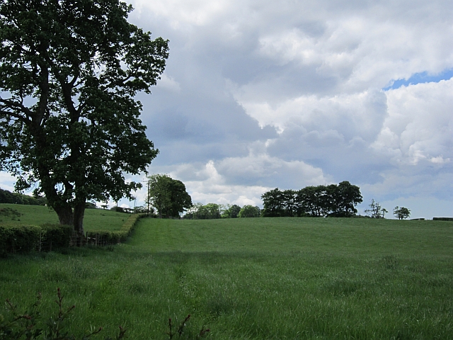
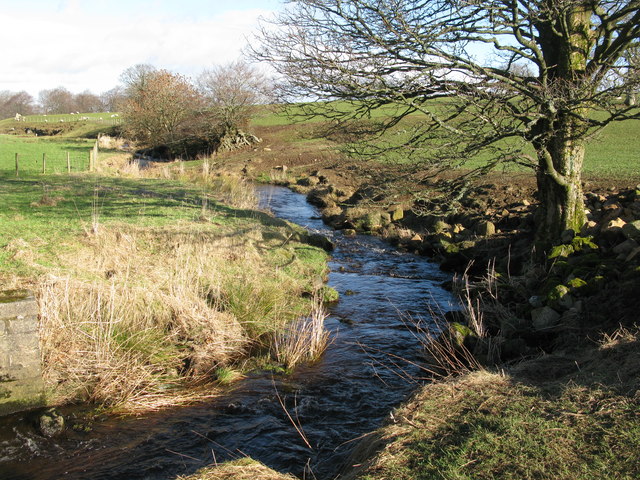
Auldhouse is a small village located in the South Lanarkshire council area of Scotland. Situated approximately 8 miles southeast of Glasgow, it falls within the historic county of Lanarkshire. The village is nestled amidst picturesque countryside and enjoys close proximity to the larger towns of East Kilbride and Hamilton.

Auldhouse is primarily a residential area, with a population of around 1,500 residents. The village is known for its tranquil surroundings and a strong sense of community. The housing stock consists mainly of traditional stone-built cottages, along with a few modern developments.

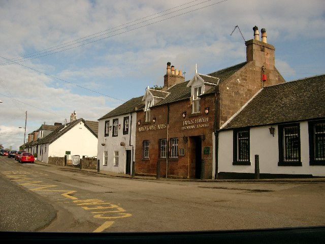
The village benefits from a range of local amenities, including a primary school, a community center, and a small convenience store. Auldhouse also boasts several parks and green spaces, providing ample opportunities for outdoor activities and leisurely walks.

Transport links in Auldhouse are relatively good, with regular bus services connecting the village to nearby towns and cities. The M74 motorway is easily accessible, providing convenient access to Glasgow and other major cities in the region.

For those seeking recreational opportunities, Auldhouse is ideally situated. The village is located within close proximity to various attractions, including Strathclyde Country Park, Calderglen Country Park, and the East Kilbride Shopping Centre.

Overall, Auldhouse offers a peaceful and picturesque setting, making it an attractive place to live for those seeking a quiet village lifestyle within easy reach of urban amenities.

If you have any feedback on the listing, please let us know in the comments section below.

Auldhouse Images

Images are sourced within 2km of 55.726195/-4.192329 or Grid Reference NS6250. Thanks to Geograph Open Source API. All images are credited.

Ardochrig Road approaching the junction with Millwell Road
Langlands golf course across the field The picture looks across from Hurlawcrook Road, a single-track road that runs south into farmland from East Kilbride.
Langlands golf course across the field
The picture looks across from Hurlawcrook Road, a single-track road that runs south into farmland from East Kilbride.
Grassland near Auldhouse The area is mainly under grass, grazed by dairy cattle.
Grassland near Auldhouse
The area is mainly under grass, grazed by dairy cattle.
Harvested silage Grass fields which had been recently cut for silage.
Harvested silage
Grass fields which had been recently cut for silage.
A watercourse off Cleughearn Road A wet area beside a grown out beech hedge. The land here is quite high.
A watercourse off Cleughearn Road
A wet area beside a grown out beech hedge. The land here is quite high.
Sleeping calves Still too early for the hordes of insect pests, a peaceful time for sleeping calves.
Sleeping calves
Still too early for the hordes of insect pests, a peaceful time for sleeping calves.
Damp woodland, Cleughearn Lodge A marshy woodland on heavy soils. Nearing the upper limit of improved farmland and to the south there are extensive forestry plantations.
Damp woodland, Cleughearn Lodge
A marshy woodland on heavy soils. Nearing the upper limit of improved farmland and to the south there are extensive forestry plantations.
Auldhouse Road at Harelaw It is unusual to see such a high and well-kept hedge at a roadside these days. The hedge was about 7 feet high. The road makes a quarter turn at the end of the hedge and becomes Craigend Road.
Auldhouse Road at Harelaw
It is unusual to see such a high and well-kept hedge at a roadside these days. The hedge was about 7 feet high. The road makes a quarter turn at the end of the hedge and becomes Craigend Road.
Stream between Laigh Huntlawrig Farm and Bethern Farm An unnamed drainage stream.
Stream between Laigh Huntlawrig Farm and Bethern Farm
An unnamed drainage stream.
Road Bridge over a burn on Burnhouse Road <a href="https://www.geograph.org.uk/photo/318408">NS6149 : Burn Near Burnhouse Road</a> is viewed from this bridge. The burn appears to be unnamed even though it is quite a substantial burn.
Road Bridge over a burn on Burnhouse Road
NS6149 : Burn Near Burnhouse Road is viewed from this bridge. The burn appears to be unnamed even though it is quite a substantial burn.
Millwell Road looking west
Millwell Road at Laigh Cleughearn
High Cleughearn Road at Burnhouse
Cleughearn Lodge driveway
Minor Road Junction south-west of Auldhouse Looking along Auldhouse Road with Burnhouse Road on the right and beyond that Millwell Road on the left.
Minor Road Junction south-west of Auldhouse
Looking along Auldhouse Road with Burnhouse Road on the right and beyond that Millwell Road on the left.
Cleughearn Burn Viewed from Millwell Road, south of East Kilbride, Cleughearn Burn is a tributary of the Calder Water.
Cleughearn Burn
Viewed from Millwell Road, south of East Kilbride, Cleughearn Burn is a tributary of the Calder Water.
Cleughearn Burn Looking north from a road bridge on High Cleughearn Road which runs very close to the burn at this point.
Cleughearn Burn
Looking north from a road bridge on High Cleughearn Road which runs very close to the burn at this point.
Bend on High Cleughearn Road The road makes a quarter turn at this point near High Cleughearn Farm.
Bend on High Cleughearn Road
The road makes a quarter turn at this point near High Cleughearn Farm.
Show me another place!

Auldhouse is located at Grid Ref: NS6250 (Lat: 55.726195, Lng: -4.192329)

Unitary Authority: South Lanarkshire

Police Authority: Lanarkshire

What 3 Words

///sweat.backed.actors. Near East Kilbride, South Lanarkshire

Nearby Locations

Auldhouse

Related Wikis

Auldhouse, South Lanarkshire

Auldhouse is a hamlet in South Lanarkshire, around 0.5 miles (0.80 km) to the south of the suburban edge of East Kilbride. == History == The first mention...

Lindsayfield

Lindsayfield is a residential area in the new town of East Kilbride, Scotland. The modern estate was constructed from the 1990s onwards. == Overview... ==

Whitehills, East Kilbride

Whitehills is an area of the Scottish new town East Kilbride, in South Lanarkshire. It is a residential area in the south-east of the town, adjacent to...

Greenhills, East Kilbride

Greenhills is an area within the Scottish new town of East Kilbride, South Lanarkshire in Greater Glasgow. Greenhills is a residential area on the south...

Crutherland

Crutherland is a new area of East Kilbride, backing onto Torrance House Golf Course (part of Calderglen Country Park). around 60 large houses were built...

Kelvin, South Lanarkshire

Kelvin is an area of the new town of East Kilbride, in South Lanarkshire, Scotland.The area is a large industrial estate in the south-east of the town...

Newlandsmuir

Newlandsmuir is an area of the Scottish new town East Kilbride, in South Lanarkshire. It is a relatively modern residential development in the southern...

Westwoodhill

Westwoodhill is an area of the Scottish new town East Kilbride in South Lanarkshire.Along with Murrayhill, it forms a boundary between Westwood and the...

Nearby Amenities

Located within 500m of 55.726195,-4.192329
Auldhouse
Name Sco: Auldhoose
Place: village
Wikidata: Q15059295
Lat/Long: 55.7261337/-4.1922786
St Mungo's Well
Description: A mineral spring entering into a stone basin of a type typically associated with Medieval holy wells, once stood as this site and has since been culverted underground. The site was dedicated to the Patron saint of Glasgow St Mungo )aka St Kentigern).
Natural: spring
Lat/Long: 55.729791/-4.1925888
Power: pole
Lat/Long: 55.7297149/-4.1885957
Power: pole
Lat/Long: 55.7224338/-4.1898657
Power: pole
Lat/Long: 55.7229317/-4.1906688
Power: pole
Lat/Long: 55.726298/-4.1904387
Power: pole
Lat/Long: 55.725899/-4.1893719
Power: pole
Lat/Long: 55.7254989/-4.1882509
Power: pole
Lat/Long: 55.7251187/-4.1872153
Power: pole
Lat/Long: 55.7247256/-4.1861109
Power: pole
Lat/Long: 55.7243114/-4.1871715
Power: pole
Lat/Long: 55.7241154/-4.1876695
Power: pole
Lat/Long: 55.723707/-4.1886801
Power: pole
Lat/Long: 55.7233169/-4.1897166
Power: pole
Lat/Long: 55.7224455/-4.1913555
Power: pole
Lat/Long: 55.7219373/-4.1921182
Power: pole
Lat/Long: 55.7267779/-4.1911993
Crosshill
Natural: peak
Lat/Long: 55.7289909/-4.1884624
The data included in this document is from www.openstreetmap.org. The data is made available under ODbL.

Have you been to Auldhouse?

Leave your review of Auldhouse below (or comments, questions and feedback).