Little Tor

Coastal Feature, Headland, Point in Glamorgan

Wales

Little Tor

View of the Pennard Pill from the cliff by the church ruins Looking west-southwest.
View of the Pennard Pill from the cliff by the church ruins Credit: Robert Lamb

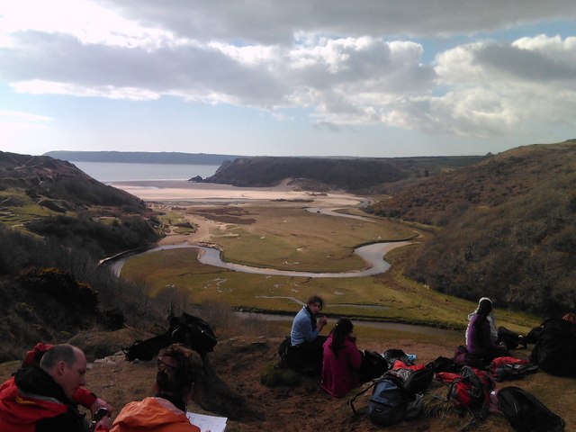
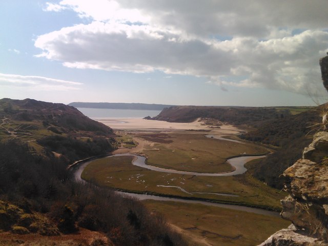
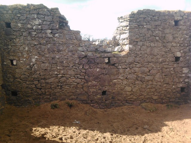
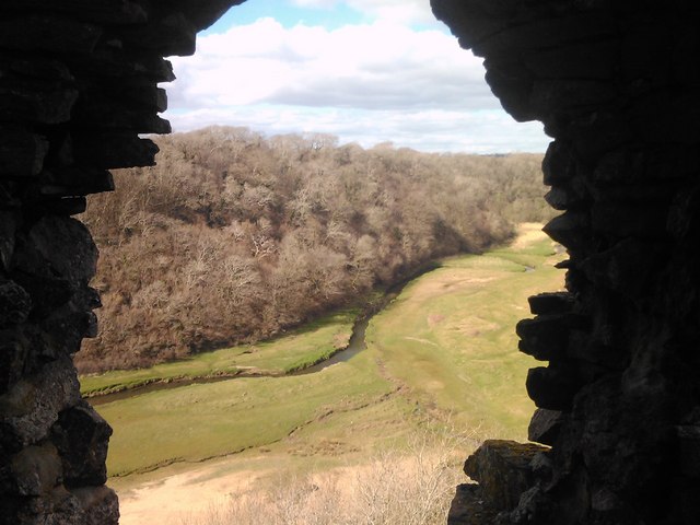
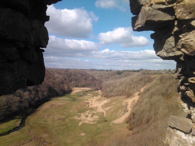
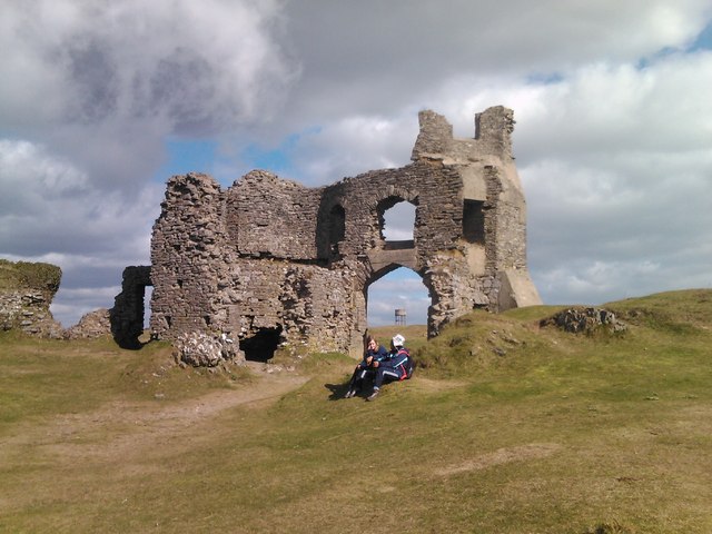
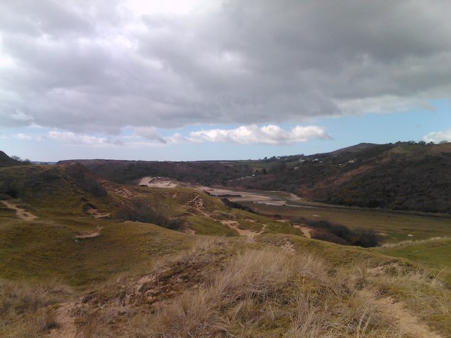
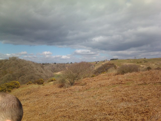
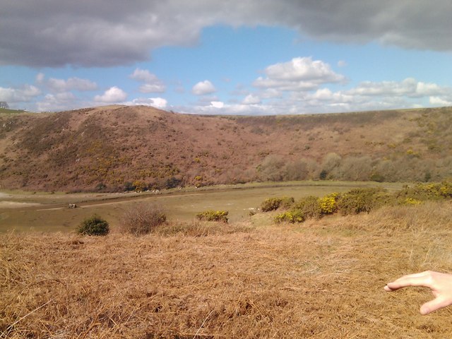
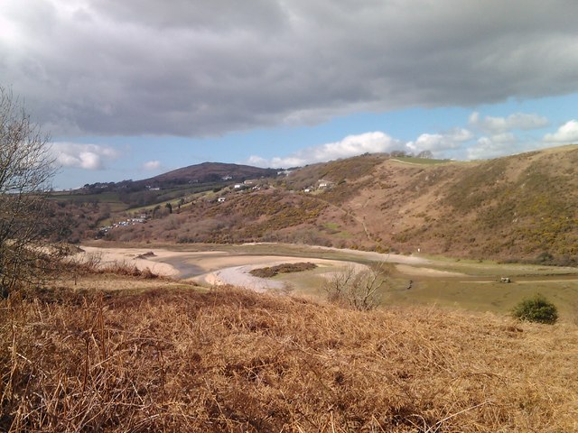
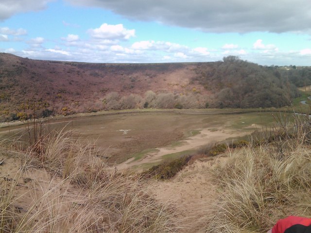
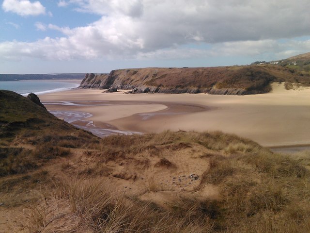
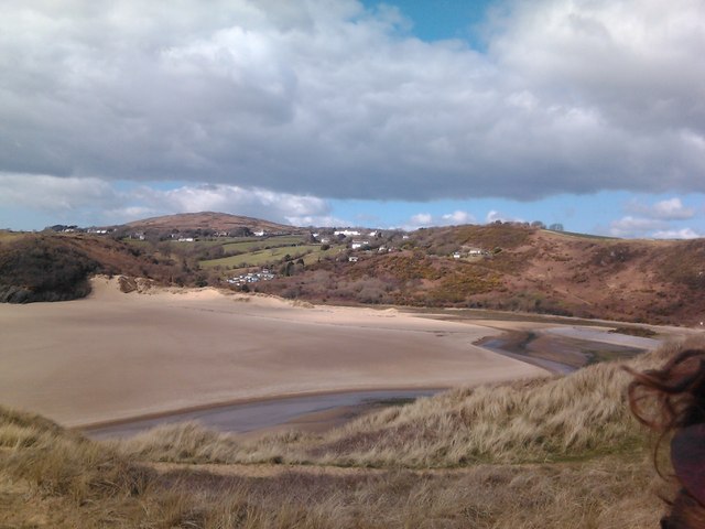
Little Tor is a small headland located in Glamorgan, Wales. It is situated along the rugged coastline of the Bristol Channel, offering stunning views of the surrounding cliffs and sea. The headland is characterized by its rocky terrain and steep cliffs that drop down to the sea below.

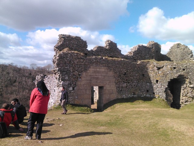
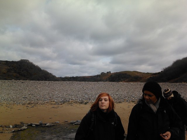
Little Tor is a popular destination for hikers and outdoor enthusiasts, as it provides a challenging terrain for exploration and offers breathtaking views of the Welsh coastline. The headland is also home to a variety of wildlife, including seabirds and marine life that can be spotted along the cliffs and in the waters below.

Visitors to Little Tor can enjoy a leisurely stroll along the coastal paths, taking in the fresh sea air and panoramic views of the surrounding area. The headland is also a great spot for birdwatching, with a variety of seabirds nesting in the cliffs and flying overhead.

Overall, Little Tor is a picturesque coastal feature that offers a unique opportunity to experience the natural beauty of Glamorgan's coastline.

If you have any feedback on the listing, please let us know in the comments section below.

Little Tor Images

Images are sourced within 2km of 51.570135/-4.1272717 or Grid Reference SS5287. Thanks to Geograph Open Source API. All images are credited.

View of the Pennard Pill from the cliff by the church ruins Looking west-southwest.
View of the Pennard Pill from the cliff by the church ruins
Looking west-southwest.
View of the Pennard Pill from the cliff by the church ruins #2 Looking southwest.
View of the Pennard Pill from the cliff by the church ruins #2
Looking southwest.
View of a section of the church ruins on top of the cliff above the Pennard Pill Looking west-southwest towards the Pennard Pill.
View of a section of the church ruins on top of the cliff above the Pennard Pill
Looking west-southwest towards the Pennard Pill.
View of the Pennard Pill and Northill Wood from the church ruins Looking west-northwest.
View of the Pennard Pill and Northill Wood from the church ruins
Looking west-northwest.
View of the Pennard Pill and Northill Wood from the church ruins #2 Looking north-northwest.
View of the Pennard Pill and Northill Wood from the church ruins #2
Looking north-northwest.
View of a section of the church ruins on top of the cliff above the Pennard Pill #2 Looking northwest.
View of a section of the church ruins on top of the cliff above the Pennard Pill #2
Looking northwest.
View of a section of the church ruins on top of the cliff above the Pennard Pill #3 Looking northwest.
View of a section of the church ruins on top of the cliff above the Pennard Pill #3
Looking northwest.
View of sand channels on the cliff face from the path leading to Pennard Looking west-southwest.
View of sand channels on the cliff face from the path leading to Pennard
Looking west-southwest.
View of the church ruins from the path leading to Three Cliffs Looking north.
View of the church ruins from the path leading to Three Cliffs
Looking north.
View of Northill Wood from the path leading to Three Cliffs Looking west-northwest.
View of Northill Wood from the path leading to Three Cliffs
Looking west-northwest.
Channel braiding in the Pennard Pill, viewed from the cliff top path Looking west-northwest.
Channel braiding in the Pennard Pill, viewed from the cliff top path
Looking west-northwest.
View of the Pennard Pill from the cliff top path Looking west-northwest.
View of the Pennard Pill from the cliff top path
Looking west-northwest.
View of Three Cliffs Bay from the cliff top Looking west-southwest.
View of Three Cliffs Bay from the cliff top
Looking west-southwest.
View of Three Cliffs Bay from the cliff top #2 Looking west-southwest.
View of Three Cliffs Bay from the cliff top #2
Looking west-southwest.
View of the Pennard Pill running through Three Cliffs Bay Looking west-southwest.
View of the Pennard Pill running through Three Cliffs Bay
Looking west-southwest.
View of a cliff arch on Three Cliffs Bay Looking southeast.
View of a cliff arch on Three Cliffs Bay
Looking southeast.
Cliff erosion on Three Cliffs Bay Looking east-southeast.
Cliff erosion on Three Cliffs Bay
Looking east-southeast.
View of the shingle berm on Three Cliffs Bay Looking east-northeast.
View of the shingle berm on Three Cliffs Bay
Looking east-northeast.
Show me another place!

Little Tor is located at Grid Ref: SS5287 (Lat: 51.570135, Lng: -4.1272717)

Unitary Authority: Swansea

Police Authority: South Wales

What 3 Words

///hires.refutes.diner. Near Southgate, Swansea

Nearby Locations

Little Tor

Related Wikis

Three Cliffs Bay

Three Cliffs Bay (Welsh: Bae y Tri Chlogwyn) (grid reference SS535876), otherwise Three Cliff Bay, is a bay on the south coast of the Gower Peninsula in...

Cefn Bryn

Cefn Bryn is an ancient ridge in Britain. It is a 5-mile-long Old Red Sandstone ridge in south Wales, in the heart of the Gower Peninsula, in the City...

Oxwich Bay

Oxwich Bay (Welsh: Bae Oxwich) is a bay on the south of the Gower Peninsula, Wales. Its landscape features sand dunes, salt marshes and woodland. Oxwich...

La Charrette

La Charrette was for several decades the smallest cinema in the UK. It closed in February 2008. A tiny, 23-seat venue, sited in a back garden in the town...

Nearby Amenities

Located within 500m of 51.570135,-4.1272717
Source: PGS
Lat/Long: 51.5697049/-4.1284984
Great Tor
Climbing: route_top
Created By: Potlatch 0.8a
Place: locality
Sport: climbing
Lat/Long: 51.568654/-4.1230237
Climbing: route_bottom
Created By: Potlatch 0.8a
Sport: climbing
Lat/Long: 51.5684857/-4.1227878
Little Star Wall
Climbing: crag
Climbing Trad: yes
Natural: cliff
Sport: climbing
Lat/Long: 51.5695177/-4.1275348
West Tor
Climbing: crag
Climbing Trad: yes
Natural: cliff
Sport: climbing
Lat/Long: 51.570126/-4.130102
Bench
Lat/Long: 51.571855/-4.122657
Description: Lime Kiln
Disused Man Made: kiln
Historic: ruins
Lat/Long: 51.5714624/-4.1240683
Tor Bay
Natural: bay
Tourism: attraction
Lat/Long: 51.5694545/-4.1251328
Odin's Wall
Climbing: crag
Climbing Trad: yes
Natural: cliff
Sport: climbing
Lat/Long: 51.5689669/-4.1217401
Little Tor
Climbing: crag
Climbing Trad: yes
Natural: cliff
Sport: climbing
Lat/Long: 51.56937/-4.12798
Odin's Cave
Climbing: crag
Climbing Trad: yes
Natural: cliff
Sport: climbing
Lat/Long: 51.568967/-4.121902
Bench
Backrest: yes
Material: wood
Seats: 2
Lat/Long: 51.571671/-4.1235026
Bicycle: no
Hiking: yes
Horse: no
Information: guidepost
Mtb: no
Ski: no
Tourism: information
Lat/Long: 51.571639/-4.122015
Bicycle: yes
Hiking: yes
Horse: yes
Information: guidepost
Mtb: no
Ski: no
Tourism: information
Lat/Long: 51.571781/-4.122783
Leather's Hole
Natural: cave_entrance
Lat/Long: 51.5686965/-4.1226134
The data included in this document is from www.openstreetmap.org. The data is made available under ODbL.

Have you been to Little Tor?

Leave your review of Little Tor below (or comments, questions and feedback).