Looking Glass

Coastal Feature, Headland, Point in Cornwall

England

Looking Glass

Frigate at Devonport Royal Navy Type 23 frigate HMS Somerset (F82) at HMNB Devonport No. 2 Dock.
Frigate at Devonport Credit: David Dixon

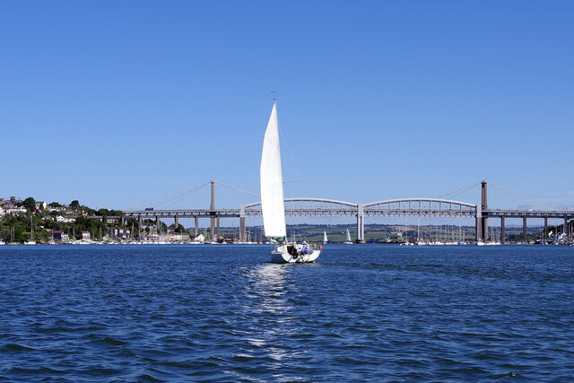
Looking Glass is a prominent coastal feature located in Cornwall, England. Situated on the southwestern tip of the country, it is a stunning headland that juts out into the Atlantic Ocean. The name "Looking Glass" is derived from the breathtaking panoramic views it offers, allowing visitors to gaze out onto the vast expanse of the sea.

This headland is characterized by rugged cliffs that provide a dramatic backdrop to the surrounding landscape. The cliffs are composed of granite, which adds to the overall beauty of the area. They stand tall and majestic, rising up to a considerable height above sea level. This elevation provides an ideal vantage point for observing the diverse marine life and the powerful waves crashing against the rocks below.

Looking Glass is also home to a variety of bird species, making it a popular spot for birdwatching enthusiasts. The headland provides nesting sites and feeding grounds for seabirds such as gannets, puffins, and razorbills. Their presence adds to the rich biodiversity of the area and offers a unique opportunity for nature lovers to observe these magnificent creatures in their natural habitat.

The headland is easily accessible to visitors, with well-maintained footpaths leading to the cliffs. These paths allow for leisurely walks along the coastline, providing ample opportunities for visitors to admire the stunning views and immerse themselves in the tranquility of the surroundings.

Looking Glass is a must-visit destination for those seeking natural beauty, breathtaking views, and a chance to connect with the wonders of the ocean and its wildlife.

If you have any feedback on the listing, please let us know in the comments section below.

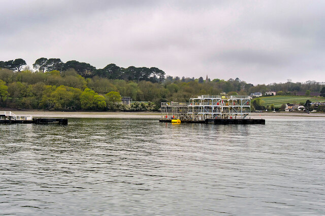
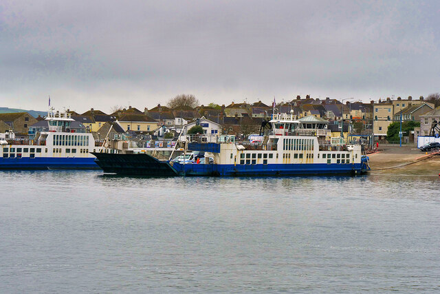
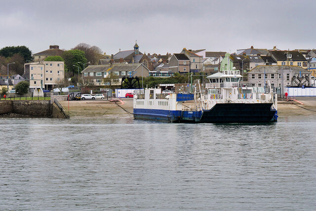
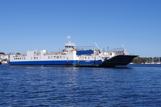
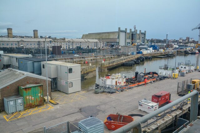
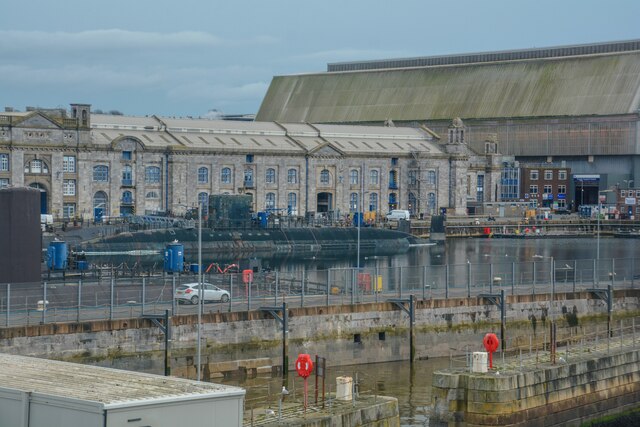
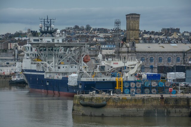
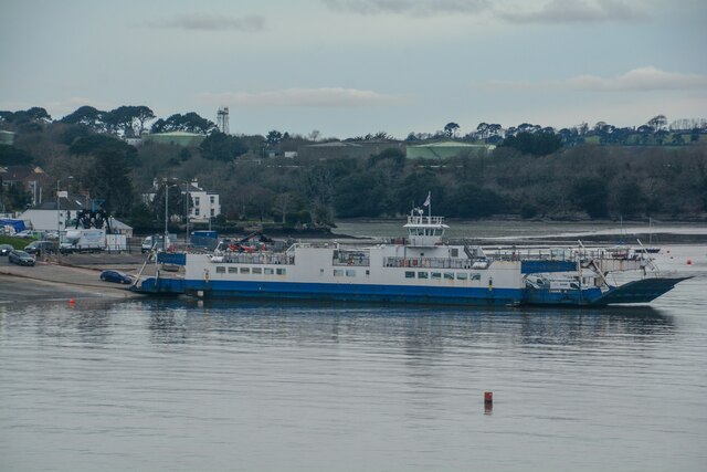
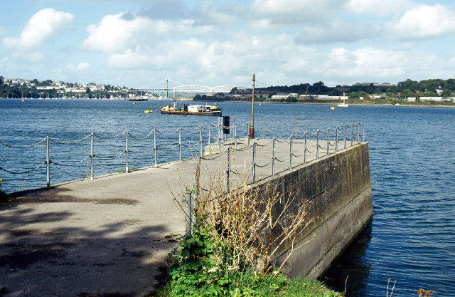
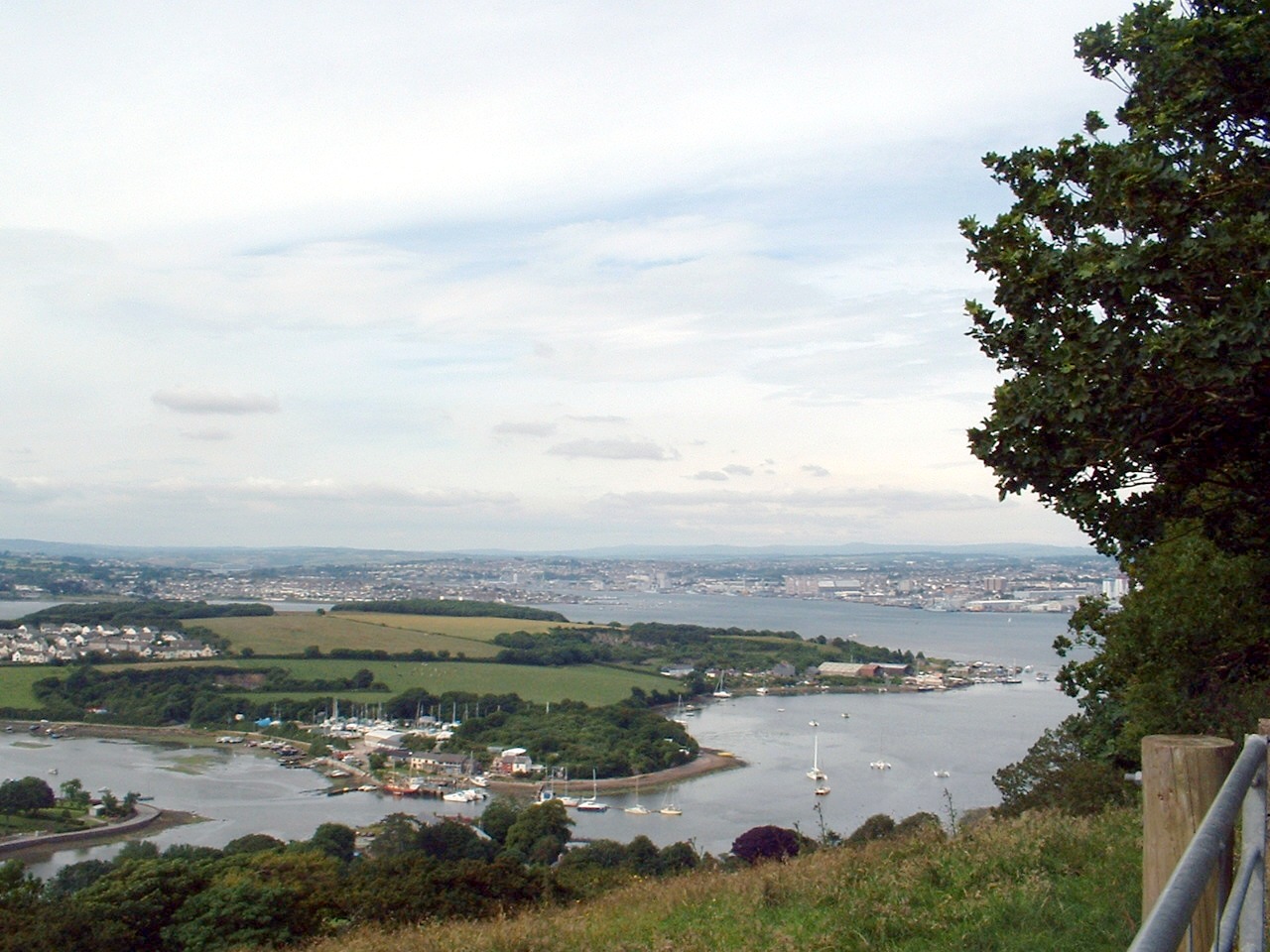
Looking Glass Images

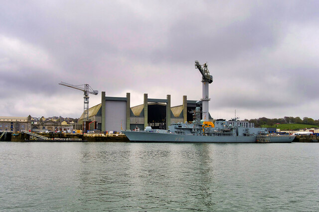
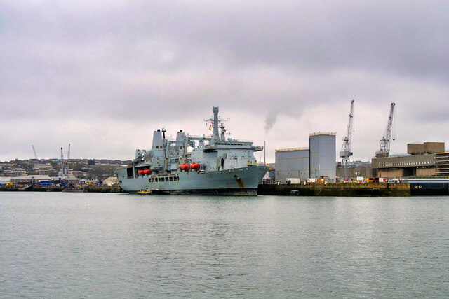
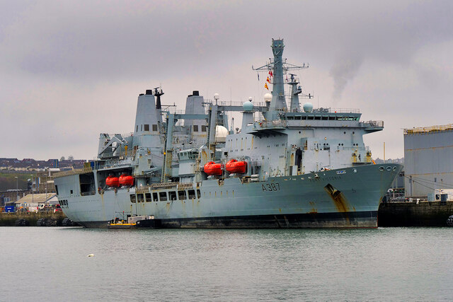
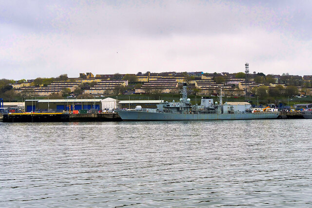
Images are sourced within 2km of 50.387624/-4.2013579 or Grid Reference SX4356. Thanks to Geograph Open Source API. All images are credited.

Frigate at Devonport Royal Navy Type 23 frigate HMS Somerset (F82) at HMNB Devonport No. 2 Dock.
Frigate at Devonport
Royal Navy Type 23 frigate HMS Somerset (F82) at HMNB Devonport No. 2 Dock.
HMNB Devonport Her Majesty's Naval Base, Devonport (HMNB Devonport), is one of three operating bases in the United Kingdom for the Royal Navy (the others being HMNB Clyde and HMNB Portsmouth). HMNB Devonport is located in Devonport, in the west of the city of Plymouth. Having begun as Royal Navy Dockyard in the late-17th century, it is now the largest naval base in Western Europe and is the sole nuclear repair and refuelling facility for the Royal Navy. Shipbuilding ceased at Devonport in the early 1970s, but ship maintenance work has continued: the now privatised maintenance facilities are operated by Babcock Marine who took over in 2007.
HM Naval Base Devonport is the home port of the Devonport Flotilla which includes the largest ship in the Royal Navy HMS Ocean and the Trafalgar-class submarines. Devonport will no longer be used as a base for attack submarines after these move to Faslane by 2017, and the Type 45 destroyers are based at Portsmouth. However, Devonport retains a long-term role as the dedicated home of the amphibious fleet, survey vessels and half the frigate fleet.
HMNB Devonport
Her Majesty's Naval Base, Devonport (HMNB Devonport), is one of three operating bases in the United Kingdom for the Royal Navy (the others being HMNB Clyde and HMNB Portsmouth). HMNB Devonport is located in Devonport, in the west of the city of Plymouth. Having begun as Royal Navy Dockyard in the late-17th century, it is now the largest naval base in Western Europe and is the sole nuclear repair and refuelling facility for the Royal Navy. Shipbuilding ceased at Devonport in the early 1970s, but ship maintenance work has continued: the now privatised maintenance facilities are operated by Babcock Marine who took over in 2007. HM Naval Base Devonport is the home port of the Devonport Flotilla which includes the largest ship in the Royal Navy HMS Ocean and the Trafalgar-class submarines. Devonport will no longer be used as a base for attack submarines after these move to Faslane by 2017, and the Type 45 destroyers are based at Portsmouth. However, Devonport retains a long-term role as the dedicated home of the amphibious fleet, survey vessels and half the frigate fleet.
RFA Fort Victoria at Devonport Royal Fleet Auxiliary combined fleet stores ship and tanker RFA Fort Victoria berthed at HMNB Devonport.
RFA Fort Victoria at Devonport
Royal Fleet Auxiliary combined fleet stores ship and tanker RFA Fort Victoria berthed at HMNB Devonport.
Frigate, HMS Argyll, at Devonport Royal Navy Type 23 Duke-class frigate HMS Argyll (F231) at HMNB Devonport.
Frigate, HMS Argyll, at Devonport
Royal Navy Type 23 Duke-class frigate HMS Argyll (F231) at HMNB Devonport.
River Tamar, The Hamoaze The Hamoaze is an estuarine stretch of the tidal River Tamar, between its confluence with the River Lynher and Plymouth Sound.
River Tamar, The Hamoaze
The Hamoaze is an estuarine stretch of the tidal River Tamar, between its confluence with the River Lynher and Plymouth Sound.
Torpoint Ferry The Torpoint Ferry is a car and pedestrian chain ferry which crosses the Hamoaze, a stretch of water at the mouth of the River Tamar, between Devonport in Plymouth and Torpoint in Cornwall. The route is currently served by three ferries, two of which can be seen in this photograph. They are named after three rivers in the area: Tamar II, Lynher II and Plym II. Each ferry carries 73 cars and operates using its own set of slipways and parallel chains.
Torpoint Ferry
The Torpoint Ferry is a car and pedestrian chain ferry which crosses the Hamoaze, a stretch of water at the mouth of the River Tamar, between Devonport in Plymouth and Torpoint in Cornwall. The route is currently served by three ferries, two of which can be seen in this photograph. They are named after three rivers in the area: Tamar II, Lynher II and Plym II. Each ferry carries 73 cars and operates using its own set of slipways and parallel chains.
Torpoint Ferry, Lynher II at Torpoint The Torpoint Ferry is a car and pedestrian chain ferry which crosses the Hamoaze, a stretch of water at the mouth of the River Tamar, between Devonport in Plymouth and Torpoint in Cornwall. The route is currently served by three ferries, which are named after three rivers in the area: Tamar II, Lynher II and Plym II. Each ferry carries 73 cars and operates using its own set of slipways and parallel chains.
Torpoint Ferry, Lynher II at Torpoint
The Torpoint Ferry is a car and pedestrian chain ferry which crosses the Hamoaze, a stretch of water at the mouth of the River Tamar, between Devonport in Plymouth and Torpoint in Cornwall. The route is currently served by three ferries, which are named after three rivers in the area: Tamar II, Lynher II and Plym II. Each ferry carries 73 cars and operates using its own set of slipways and parallel chains.
Torpoint Ferry The vehicle ferry provides a frequent service across the Hamoaze, linking Devonport and Torpoint. It is the busiest estuarial vehicular ferry crossing in the United Kingdom, carrying nearly two million vehicles per year in three vessels. There has been a ferry service here since 1791 but it was in 1831 that the first chain ferry was introduced and the same principle is still used. The current vessels date from the early 2000s and have a nominal capacity of 73 cars; they were built by Ferguson Shipbuilders Ltd on the Clyde. The length of the crossing depends on the state of the tide but can be up to 650 metres.
Torpoint Ferry
The vehicle ferry provides a frequent service across the Hamoaze, linking Devonport and Torpoint. It is the busiest estuarial vehicular ferry crossing in the United Kingdom, carrying nearly two million vehicles per year in three vessels. There has been a ferry service here since 1791 but it was in 1831 that the first chain ferry was introduced and the same principle is still used. The current vessels date from the early 2000s and have a nominal capacity of 73 cars; they were built by Ferguson Shipbuilders Ltd on the Clyde. The length of the crossing depends on the state of the tide but can be up to 650 metres.
Sailing on the River Tamar A yacht makes its way towards the Royal Albert Bridge and the Tamar Bridge up the tidal Tamar with Saltash in view on the left.
Sailing on the River Tamar
A yacht makes its way towards the Royal Albert Bridge and the Tamar Bridge up the tidal Tamar with Saltash in view on the left.
Maryfield Church (St Philip & St James)
Torpoint Ferry, Lynher II The Torpoint Ferry is a car and pedestrian chain ferry connecting the A374 which crosses the mouth of the River Tamar, between Devonport in Plymouth and Torpoint in Cornwall. The service was established in 1791 and chain ferry operations were introduced by James Meadows Rendel in 1832.
The route is currently served by The three ferries currently operating were brought into service in 2005;built by Ferguson Shipbuilders Ltd at Port Glasgow, they named after three rivers in the area: Tamar II, Lynher II and Plym II.
Torpoint Ferry, Lynher II
The Torpoint Ferry is a car and pedestrian chain ferry connecting the A374 which crosses the mouth of the River Tamar, between Devonport in Plymouth and Torpoint in Cornwall. The service was established in 1791 and chain ferry operations were introduced by James Meadows Rendel in 1832. The route is currently served by The three ferries currently operating were brought into service in 2005;built by Ferguson Shipbuilders Ltd at Port Glasgow, they named after three rivers in the area: Tamar II, Lynher II and Plym II.
Plymouth : Car Park A car park at Camels Head Dockyard.
Plymouth : Car Park
A car park at Camels Head Dockyard.
Plymouth : Devonport - HMS Enterprise HMS Enterprise at dock at Devonport. It will soon be decommissioned.
Plymouth : Devonport - HMS Enterprise
HMS Enterprise at dock at Devonport. It will soon be decommissioned.
Plymouth : Devonport - HMNB Devonport Looking across Devonport Dockyard and No.3 Basin.
Plymouth : Devonport - HMNB Devonport
Looking across Devonport Dockyard and No.3 Basin.
Plymouth : Devonport - HMNB Devonport Looking towards No.3 Basin at the dockyard.
Plymouth : Devonport - HMNB Devonport
Looking towards No.3 Basin at the dockyard.
Plymouth : Devonport - HMNB Devonport Looking towards No.4 Basin.
Plymouth : Devonport - HMNB Devonport
Looking towards No.4 Basin.
Plymouth : Torpoint Ferry The Torpoint Ferry crosses The Hamoaze.
Plymouth : Torpoint Ferry
The Torpoint Ferry crosses The Hamoaze.
Plymouth : Torpoint Scenery Looking across the Hamoaze to Torpoint.
Plymouth : Torpoint Scenery
Looking across the Hamoaze to Torpoint.
Show me another place!

Looking Glass is located at Grid Ref: SX4356 (Lat: 50.387624, Lng: -4.2013579)

Unitary Authority: Cornwall

Police Authority: Devon and Cornwall

What 3 Words

///list.hammer.statue. Near Torpoint, Cornwall

Related Wikis

Wilcove

Wilcove is a small coastal village in Cornwall, England, United Kingdom. It is situated one mile (1.6 km) north of Torpoint and one mile (1.6 km) west...

RM Tamar

Royal Marines Tamar or more commonly RM Tamar, is a Royal Marines military installation specialising in landing craft training and operations located on...

Hamoaze

The Hamoaze (; Cornish pronunciation: [ˈhɒmøz]) is an estuarine stretch of the English tidal River Tamar, between its confluence with the River Lynher...

Maryfield, Cornwall

Maryfield is a hamlet north of Torpoint and east of Antony House in southeast Cornwall, England. == References ==

Nearby Amenities

Located within 500m of 50.387624,-4.2013579
Created By: almien_coastlines
Source: PGS
Lat/Long: 50.3835821/-4.1996782
Created By: almien_coastlines
Source: PGS
Lat/Long: 50.3836279/-4.2007128
Created By: almien_coastlines
Source: PGS
Lat/Long: 50.3837284/-4.2022189
Created By: almien_coastlines
Source: PGS
Lat/Long: 50.3837424/-4.203134
Created By: almien_coastlines
Source: PGS
Lat/Long: 50.3838402/-4.2035995
Created By: almien_coastlines
Source: PGS
Lat/Long: 50.3846092/-4.2040793
Created By: almien_coastlines
Source: PGS
Lat/Long: 50.3849789/-4.2048962
Created By: almien_coastlines
Source: PGS
Lat/Long: 50.3852059/-4.2058302
Created By: almien_coastlines
Source: PGS
Lat/Long: 50.3853886/-4.2068533
Created By: almien_coastlines
Source: PGS
Lat/Long: 50.3868498/-4.2082967
Created By: almien_coastlines
Source: PGS
Lat/Long: 50.3871187/-4.2079591
Created By: almien_coastlines
Source: PGS
Lat/Long: 50.3872207/-4.2070932
Created By: almien_coastlines
Source: PGS
Lat/Long: 50.3872441/-4.2057716
Created By: almien_coastlines
Source: PGS
Lat/Long: 50.3869161/-4.2048002
Source: PGS
Lat/Long: 50.3870304/-4.2036842
Source: PGS
Lat/Long: 50.3870705/-4.2022031
Source: PGS
Lat/Long: 50.3873646/-4.2017976
Source: PGS
Lat/Long: 50.3874098/-4.2015621
Source: PGS
Lat/Long: 50.3877337/-4.2016474
Source: PGS
Lat/Long: 50.3879225/-4.2018153
Source: PGS
Lat/Long: 50.3881424/-4.2018153
Source: PGS
Lat/Long: 50.3883841/-4.202505
Source: PGS
Lat/Long: 50.3887542/-4.2038088
Created By: almien_coastlines
Source: PGS
Lat/Long: 50.3889602/-4.204154
Source: PGS
Lat/Long: 50.389018/-4.2048908
Source: PGS
Lat/Long: 50.3892486/-4.2048743
Source: PGS
Lat/Long: 50.3893467/-4.2056999
Source: PGS
Lat/Long: 50.389464/-4.206419
Source: PGS
Lat/Long: 50.3896124/-4.206585
Source: PGS
Lat/Long: 50.389973/-4.206855
Whitehall
Place: hamlet
Lat/Long: 50.3889903/-4.2071879
Source: PGS
Lat/Long: 50.3890932/-4.2059409
Source: PGS
Lat/Long: 50.3896076/-4.2062913
Source: PGS
Lat/Long: 50.3896544/-4.2063684
Generator Method: photovoltaic
Generator Output Electricity: yes
Generator Source: solar
Generator Type: solar_photovoltaic_panel
Location: roof
Power: generator
Lat/Long: 50.3877659/-4.207135
Generator Method: photovoltaic
Generator Output Electricity: yes
Generator Source: solar
Generator Type: solar_photovoltaic_panel
Location: roof
Power: generator
Lat/Long: 50.3878216/-4.2075277
Fire Hydrant
Emergency: fire_hydrant
Fire Hydrant Diameter: 75
Fire Hydrant Position: lane
Fire Hydrant Type: underground
Survey Date: 2022-04-10
Lat/Long: 50.3873776/-4.2083814
Life Ring
Emergency: life_ring
Survey Date: 2022-04-10
Lat/Long: 50.3891895/-4.2049724
Fire Hydrant
Emergency: fire_hydrant
Fire Hydrant Diameter: 75
Fire Hydrant Position: green
Fire Hydrant Type: underground
Survey Date: 2022-04-10
Lat/Long: 50.3884145/-4.2063808
Tourism: viewpoint
Lat/Long: 50.3892487/-4.2049315
The data included in this document is from www.openstreetmap.org. The data is made available under ODbL.

Have you been to Looking Glass?

Leave your review of Looking Glass below (or comments, questions and feedback).