Carrickcarlin Point

Coastal Feature, Headland, Point in Wigtownshire

Scotland

Carrickcarlin Point

Mull of Galloway Lighthouse The Mull of Galloway is the southernmost point on the mainland of Scotland

Mull of Galloway Lighthouse

Light Established: 1830
Engineer: Robert Stevenson
Position: Latitude 54° 38.1’N Longitude 04° 51.4’W
Character: Flashing White every 20 seconds
Elevation: 99 metres
Nominal Range: 28 miles
Structure: White round tower 26 metres high. There are 114 steps to the top of the tower.
Mull of Galloway Lighthouse Credit: Beth Loft

Carrickcarlin Point is a prominent coastal feature located in Wigtownshire, Scotland. It is a headland that juts out into the Irish Sea, forming a distinct point along the rugged coastline. The point is situated near the village of Port William and offers stunning panoramic views of the surrounding area.

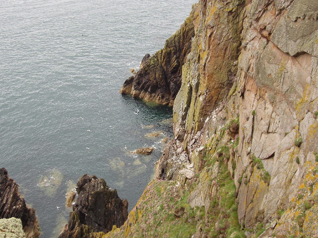
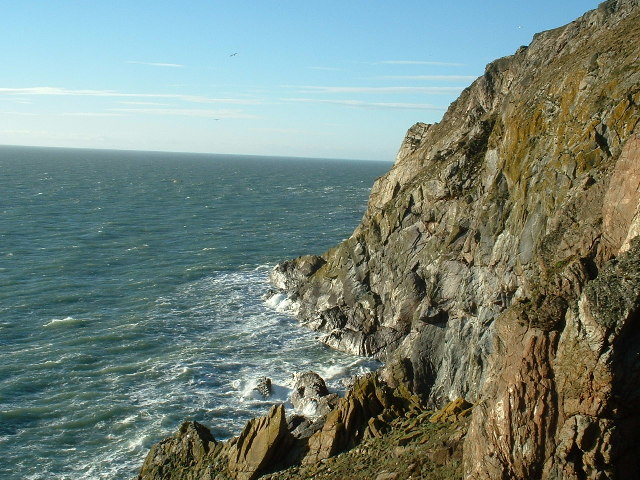
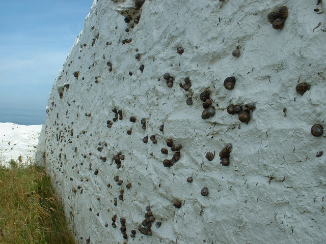
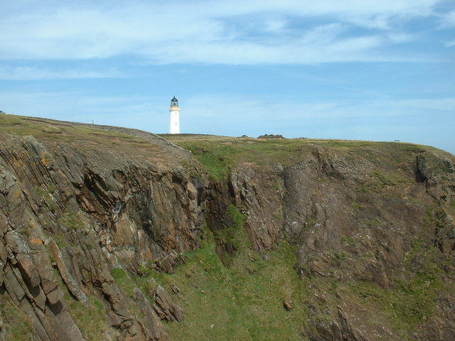
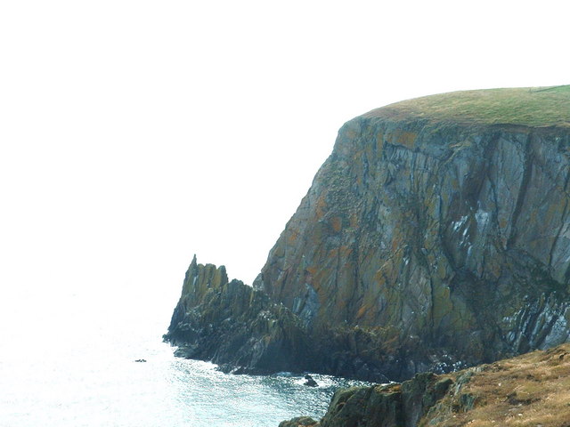
The geography of Carrickcarlin Point is characterized by steep cliffs that descend into the sea, creating a dramatic and picturesque landscape. The headland is composed of rocky outcrops and is home to a diverse range of flora and fauna, including various seabird species that nest along the cliffs.

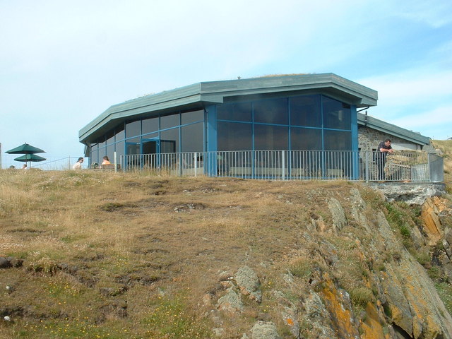
Carrickcarlin Point is a popular destination for outdoor enthusiasts and nature lovers. Its rugged terrain provides opportunities for hiking and exploring, with a network of walking trails that lead visitors through the headland and along the coastline. The point also offers excellent vantage points for birdwatching, with sightings of gannets, kittiwakes, and fulmars being common.

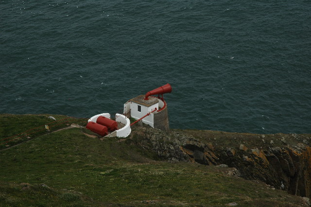
In addition to its natural beauty, Carrickcarlin Point is steeped in history. The headland is believed to have been used as a lookout point during times of war, with remnants of ancient fortifications still visible. These historical features, combined with the stunning natural scenery, make Carrickcarlin Point a popular tourist attraction in Wigtownshire.

Overall, Carrickcarlin Point is a striking coastal feature that showcases the natural beauty and rich history of Wigtownshire. Whether it's for hiking, birdwatching, or simply enjoying the breathtaking views, this headland offers a unique and memorable experience for visitors.

If you have any feedback on the listing, please let us know in the comments section below.

Carrickcarlin Point Images

Images are sourced within 2km of 54.634638/-4.8556767 or Grid Reference NX1530. Thanks to Geograph Open Source API. All images are credited.
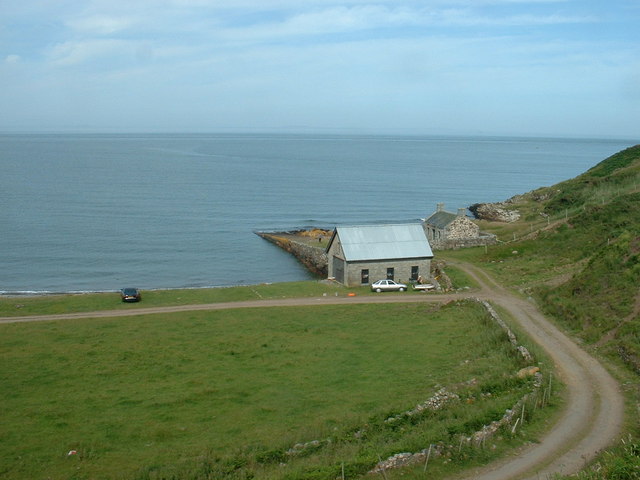
Mull of Galloway Lighthouse The Mull of Galloway is the southernmost point on the mainland of Scotland

Mull of Galloway Lighthouse

Light Established: 1830
Engineer: Robert Stevenson
Position: Latitude 54° 38.1’N Longitude 04° 51.4’W
Character: Flashing White every 20 seconds
Elevation: 99 metres
Nominal Range: 28 miles
Structure: White round tower 26 metres high. There are 114 steps to the top of the tower.
Mull of Galloway Lighthouse
The Mull of Galloway is the southernmost point on the mainland of Scotland Mull of Galloway Lighthouse Light Established: 1830 Engineer: Robert Stevenson Position: Latitude 54° 38.1’N Longitude 04° 51.4’W Character: Flashing White every 20 seconds Elevation: 99 metres Nominal Range: 28 miles Structure: White round tower 26 metres high. There are 114 steps to the top of the tower.
Southernmost point of Scotland Cliffs at the Mull of Galloway. This is as far as you can go, in a southerly direction in Scotland. Due East is Hartlepool!

On a better day, you can see the Isle of Man and Ireland from here.
Southernmost point of Scotland
Cliffs at the Mull of Galloway. This is as far as you can go, in a southerly direction in Scotland. Due East is Hartlepool! On a better day, you can see the Isle of Man and Ireland from here.
Cliffs by Gallie Craig and Carrick-Kee, Mull of Galloway These cliffs are at the southernmost point of Scotland. Many seabirds nest on the cliffs.
Cliffs by Gallie Craig and Carrick-Kee, Mull of Galloway
These cliffs are at the southernmost point of Scotland. Many seabirds nest on the cliffs.
Fog Horn, Mull of Galloway This is the now disused fog horn on the Mull of Galloway. Picture taken from the lighthouse.
Fog Horn, Mull of Galloway
This is the now disused fog horn on the Mull of Galloway. Picture taken from the lighthouse.
Mull of Galloway Lighthouse The Mull of Galloway is at the end of this peninsula in Scotland.  However, Carrick-kee, less than a mile to the west <a href="https://www.geograph.org.uk/photo/14826">NX1430 : Cliffs by Gallie Craig and Carrick-Kee, Mull of Galloway</a>, is actually the most southerly point in Scotland.
Mull of Galloway Lighthouse
The Mull of Galloway is at the end of this peninsula in Scotland. However, Carrick-kee, less than a mile to the west NX1430 : Cliffs by Gallie Craig and Carrick-Kee, Mull of Galloway, is actually the most southerly point in Scotland.
Wall This picture was taken looking SE from NX141313. The dry stone wall typical of this area is clearly shown. In the distance can be seen the Mull of Galloway Lighthouse.
Wall
This picture was taken looking SE from NX141313. The dry stone wall typical of this area is clearly shown. In the distance can be seen the Mull of Galloway Lighthouse.
Lythe Mead rocks, Mull of Galloway, Scotland's most South Westerly point. The stunning scenery and sea views at the Mull of Galloway. This is also an RSPB reserve where thousands of seabirds nest and breed each year.
Lythe Mead rocks, Mull of Galloway, Scotland's most South Westerly point.
The stunning scenery and sea views at the Mull of Galloway. This is also an RSPB reserve where thousands of seabirds nest and breed each year.
Foghorn, Mull of Galloway
Mull of Galloway Visitors' Centre Taken from the viewing platform at the top of the lighthouse.
Mull of Galloway Visitors' Centre
Taken from the viewing platform at the top of the lighthouse.
Mull of Galloway car park Taken looking westwards, from the viewing platform at the top of the lighthouse. The car park serves visitors to the light and to the nature reserve. The narrow neck of the Mull is visible in the middle distance - it is almost an island.
Mull of Galloway car park
Taken looking westwards, from the viewing platform at the top of the lighthouse. The car park serves visitors to the light and to the nature reserve. The narrow neck of the Mull is visible in the middle distance - it is almost an island.
Snail sanctuary? This is the northern wall of the lighthouse compound, and it's covered with snails, as was the eastern wall. Clearly they like the shade, but what else attracts them?  The colour?  The taste? The sense of history?  Or just being in a Nature Reserve?
Snail sanctuary?
This is the northern wall of the lighthouse compound, and it's covered with snails, as was the eastern wall. Clearly they like the shade, but what else attracts them? The colour? The taste? The sense of history? Or just being in a Nature Reserve?
Gallie Craig Cafe This is an interesting building, built into the rock a few metres from the cliff edge, with an earth, grass covered roof. Its large picture windows, looking south west, give fantastic exposure to the cliff scenery. And the coffee's good too.
Gallie Craig Cafe
This is an interesting building, built into the rock a few metres from the cliff edge, with an earth, grass covered roof. Its large picture windows, looking south west, give fantastic exposure to the cliff scenery. And the coffee's good too.
Mull of Galloway Lighthouse Taken from the viewing gallery at Gallie Craig Cafe.
Mull of Galloway Lighthouse
Taken from the viewing gallery at Gallie Craig Cafe.
Gallie Craig Cafe The gallery railings are right on the edge of the cliff.
Gallie Craig Cafe
The gallery railings are right on the edge of the cliff.
Gallie Craig rocks
Gallie Craig rocks
Cottage and Quay On the eastern, Luce Bay, side of the Mull of Galloway.  The cottage appears intact from this angle, but the other side of the roof is missing.
Cottage and Quay
On the eastern, Luce Bay, side of the Mull of Galloway. The cottage appears intact from this angle, but the other side of the roof is missing.
East Tarbet This is the 'neck' of the Mull of Galloway. A tarbet is a place where a boat could be dragged from one side of a headland or island to the other [which is probably not done much these days]. This side is on Luce Bay, the point on the other side of the headland is on the Irish Sea and is called, somewhat predictably, West Tarbet.
East Tarbet
This is the 'neck' of the Mull of Galloway. A tarbet is a place where a boat could be dragged from one side of a headland or island to the other [which is probably not done much these days]. This side is on Luce Bay, the point on the other side of the headland is on the Irish Sea and is called, somewhat predictably, West Tarbet.
East Tarbet Quay, Mull of Galloway A swimmer was rescued and treated for hypothermia after trying to swim out to his boat.  The currents hereabouts are notoriously treacherous.
East Tarbet Quay, Mull of Galloway
A swimmer was rescued and treated for hypothermia after trying to swim out to his boat. The currents hereabouts are notoriously treacherous.
Show me another place!

Carrickcarlin Point is located at Grid Ref: NX1530 (Lat: 54.634638, Lng: -4.8556767)

Unitary Authority: Dumfries and Galloway

Police Authority: Dumfries and Galloway

What 3 Words

///caressed.squeaking.every. Near Drummore, Dumfries & Galloway

Related Wikis

Mull of Galloway

The Mull of Galloway (Scottish Gaelic: Maol nan Gall, pronounced [mɯːlˠ̪ nəŋ ˈkaulˠ̪]; grid reference NX158303) is the southernmost point of Scotland....

Cairngaan

Cairngaan, Wigtownshire, is the southmost settlement in Scotland. The hamlet of Cairngaan lies just north of the Mull of Galloway (which contains Scotland...

Drummore

Drummore (drum-ORE; (from Gaelic An Druim Mòr meaning "the great ridge") is the southernmost village in Scotland, located at the southern end of the Rhins...

Pasages (steam trawler)

ST Pasages (FD 119) was originally a Canadian "Castle" – TR series minesweeping trawler built by the Dominion Shipbuilding Company, Toronto, in 1917 for...

Nearby Amenities

Located within 500m of 54.634638,-4.8556767
Source: PGS
Lat/Long: 54.6340012/-4.8631669
Source: PGS
Lat/Long: 54.6339391/-4.8628236
Source: PGS
Lat/Long: 54.6340757/-4.8621799
Source: PGS
Lat/Long: 54.6340633/-4.8618151
Source: PGS
Lat/Long: 54.6335913/-4.8612143
Source: PGS
Lat/Long: 54.6336783/-4.8595191
Source: PGS
Lat/Long: 54.6340881/-4.8572875
Source: PGS
Lat/Long: 54.633778/-4.856412
Source: PGS
Lat/Long: 54.633784/-4.855971
Source: PGS
Lat/Long: 54.633791/-4.855529
Source: PGS
Lat/Long: 54.633923/-4.855315
Source: PGS
Lat/Long: 54.634442/-4.854897
Source: PGS
Lat/Long: 54.63496/-4.854479
Source: PGS
Lat/Long: 54.635735/-4.854073
Source: PGS
Lat/Long: 54.635866/-4.853857
Source: PGS
Lat/Long: 54.635998/-4.853643
Source: PGS
Lat/Long: 54.6366092/-4.8532105
Source: PGS
Lat/Long: 54.6370066/-4.852996
Source: PGS
Lat/Long: 54.6371681/-4.8526527
Source: PGS
Lat/Long: 54.637491/-4.8528243
Source: PGS
Lat/Long: 54.6375903/-4.8535753
Source: PGS
Lat/Long: 54.6375903/-4.8541761
Source: PGS
Lat/Long: 54.6377021/-4.8547126
Source: PGS
Lat/Long: 54.6379256/-4.8554851
Source: PGS
Lat/Long: 54.6381864/-4.8566867
Source: PGS
Lat/Long: 54.638231/-4.8581451
Source: PGS
Lat/Long: 54.6384099/-4.8589183
Source: PGS
Lat/Long: 54.6384099/-4.8596049
Barrier: cattle_grid
Bicycle: yes
Foot: yes
Motorcar: yes
Motorcycle: yes
Lat/Long: 54.6354085/-4.8599149
Turning Circle
Lat/Long: 54.6358416/-4.8569925
Mull of Galloway
Name Gd: Maol nan Gall
Name Sco: Mull o Gallowa
Natural: cape
Wikidata: Q1853868
Wikipedia: en:Mull of Galloway
Lat/Long: 54.6362337/-4.8613092
Barrier: kissing_gate
Lat/Long: 54.6379517/-4.8587086
Power: pole
Lat/Long: 54.6360238/-4.8625598
Power: pole
Lat/Long: 54.635797/-4.8610231
Power: pole
Lat/Long: 54.6356195/-4.8598513
Power: pole
Lat/Long: 54.6354792/-4.8590344
Power: pole
Lat/Long: 54.6352726/-4.8577714
Seals Cave
Name Sco: Selch Co
Natural: cave_entrance
Lat/Long: 54.6342718/-4.8560352
Fog Horn
Emergency: fog_horn
Lat/Long: 54.6343566/-4.8555779
Defibrillator
Defibrillator Location: outside Museum Mull Of Galloway Lighthouse
Emergency: defibrillator
Indoor: no
Ref GB The Circuit: 4483FCD1-D377-42D2-A28A-ADEC01583B07
Lat/Long: 54.6348363/-4.8571198
Passing Place
Lat/Long: 54.6348978/-4.8622549
Street Lamp
Lamp Type: electric
Lat/Long: 54.6353717/-4.8603451
The data included in this document is from www.openstreetmap.org. The data is made available under ODbL.

Have you been to Carrickcarlin Point?

Leave your review of Carrickcarlin Point below (or comments, questions and feedback).