Auldearn

Settlement in Nairnshire

Scotland

Auldearn

Road south of Auldearn Passing what was once a manse and kirk on the way to Arr Woods and the climb of Brightmony Brae.
Road south of Auldearn Credit: Richard Webb

Auldearn is a small village located in Nairnshire, Scotland. Situated about 7 miles east of the town of Nairn, Auldearn is nestled in the picturesque Scottish Highlands. The village is known for its historical significance and charming atmosphere.

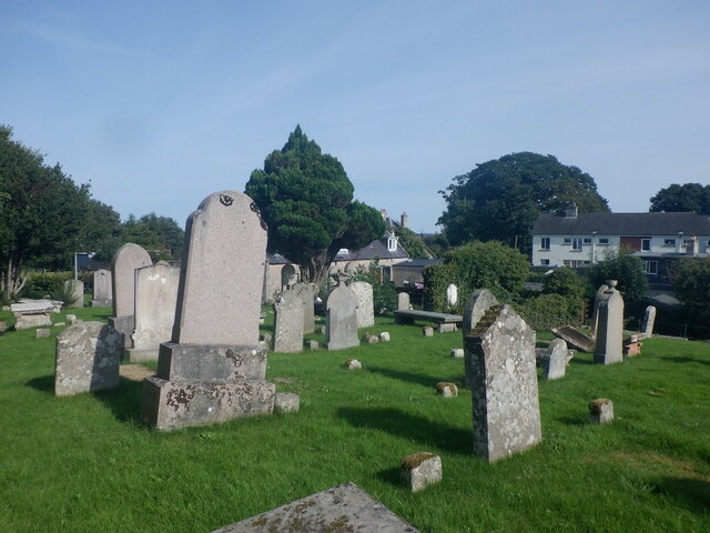
Auldearn boasts a rich history that dates back centuries. It gained prominence during the Battle of Auldearn in 1645, which was a significant event during the English Civil War. The village still retains some remnants of its past, including the Auldearn Parish Church, which was built in the 13th century and is a popular tourist attraction.

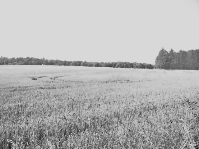
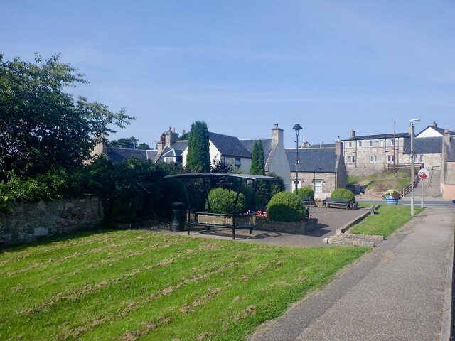
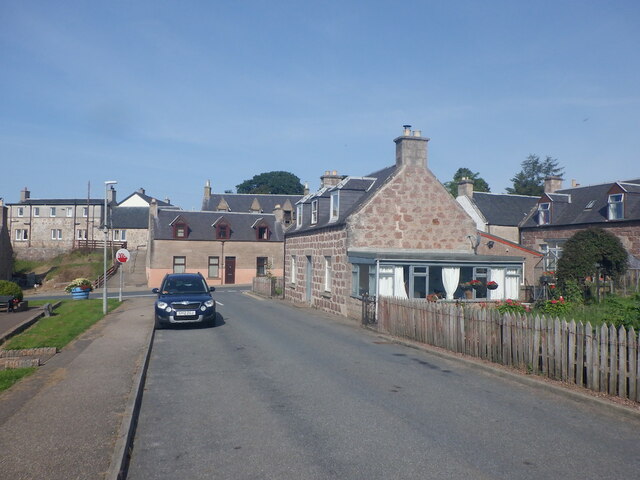
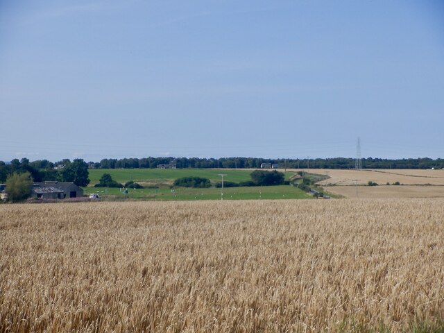
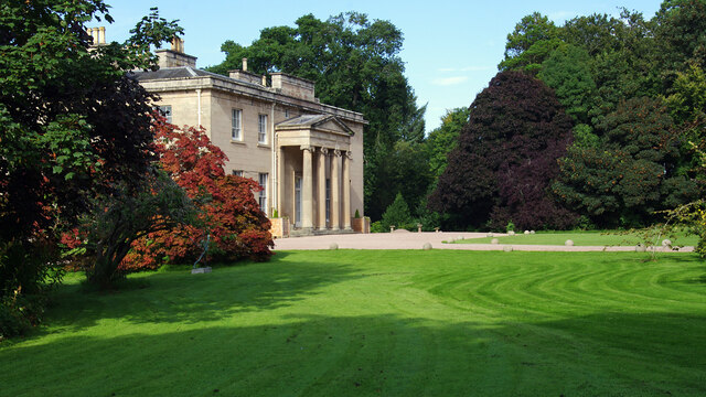
The village itself is characterized by its quaint, traditional Scottish architecture. It features a mix of stone houses and thatched cottages, giving it a charming and timeless allure. The surrounding countryside is breathtaking, with rolling hills and expansive fields.

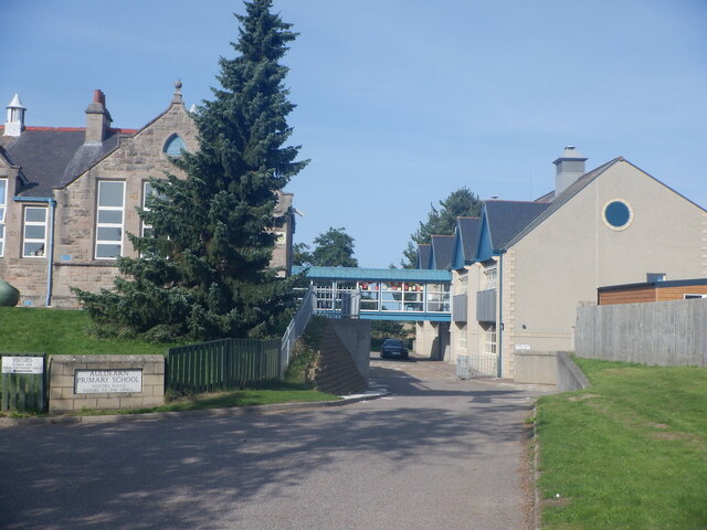
Despite its small size, Auldearn offers a range of amenities to its residents and visitors. There are a few local shops and pubs where one can experience the warm hospitality of the locals. The village also has a primary school and a community center, providing essential services to the residents.

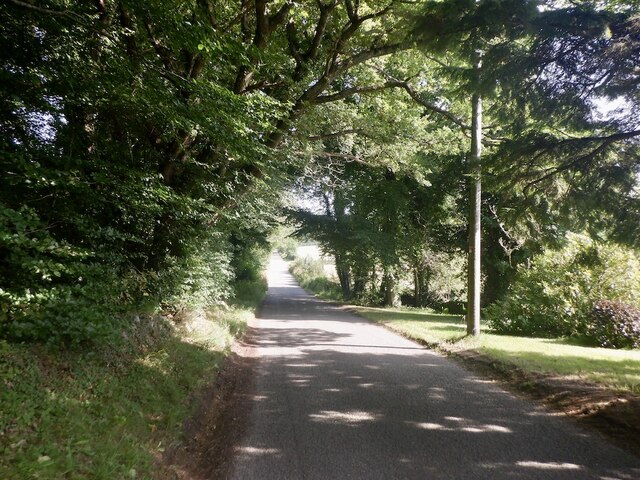
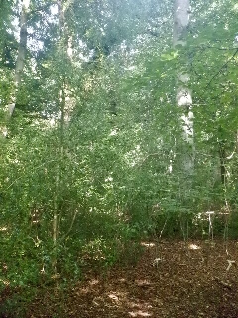
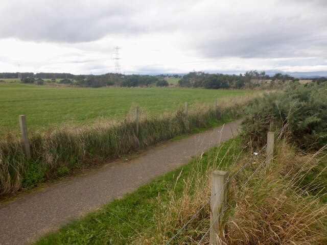
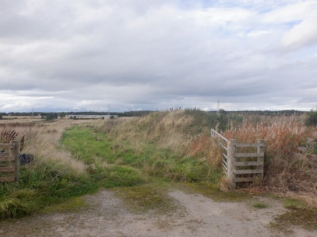
Auldearn is surrounded by natural beauty, making it an excellent destination for outdoor enthusiasts. The nearby countryside offers opportunities for hiking, cycling, and exploring the Scottish Highlands. The village is also in close proximity to the Moray Firth, which is known for its stunning coastline and diverse wildlife.

In conclusion, Auldearn is a charming village in Nairnshire, Scotland, known for its historical significance and breathtaking scenery. With its rich history, traditional architecture, and natural beauty, Auldearn offers a delightful experience for both residents and visitors alike.

If you have any feedback on the listing, please let us know in the comments section below.

Auldearn Images

Images are sourced within 2km of 57.576102/-3.807884 or Grid Reference NH9155. Thanks to Geograph Open Source API. All images are credited.

Road south of Auldearn Passing what was once a manse and kirk on the way to Arr Woods and the climb of Brightmony Brae.
Road south of Auldearn
Passing what was once a manse and kirk on the way to Arr Woods and the climb of Brightmony Brae.
Policy woodland, Kinsteary House
Barley, Newmill Arable land near Auldearn.
Barley, Newmill
Arable land near Auldearn.
Open space, Auldearn Off Lethen Road with a covered seating area.
Open space, Auldearn
Off Lethen Road with a covered seating area.
Lethen Road, Auldearn
Auldearn Primary School An hour or so after the school day had ended.
Auldearn Primary School
An hour or so after the school day had ended.
Kirkyard, Auldearn
Kirkyard, Auldearn
Barley, Boath
Barley, Boath
Drumduan
Drumduan
Minor road, Drumduan With a new layer of chipseal.
Minor road, Drumduan
With a new layer of chipseal.
Google Streetview, Bogheads Just been passed by one of their camera cars.
Google Streetview, Bogheads
Just been passed by one of their camera cars.
Minor road, Washingwells
Barley, Washingwells
Boath House Now a country house hotel.
Grade A listed building - <span class="nowrap"><a title="http://portal.historicenvironment.scot/designation/LB1649" rel="nofollow ugc noopener" href="http://portal.historicenvironment.scot/designation/LB1649">Link</a><img style="margin-left:2px;" alt="External link" title="External link - shift click to open in new window" src="https://s1.geograph.org.uk/img/external.png" width="10" height="10"/></span>
Boath House
Now a country house hotel. Grade A listed building - LinkExternal link
A new path, Auldearn A whindust bike/footpath beside the B9111
A new path, Auldearn
A whindust bike/footpath beside the B9111
Waterloo, Nairn Looking towards Nairn which is expanding in this direction.
Waterloo, Nairn
Looking towards Nairn which is expanding in this direction.
By Insloch
By Insloch
Minor road between Easterton and Bogheads Looking westward from the entrance to Washingwells Farm.
Minor road between Easterton and Bogheads
Looking westward from the entrance to Washingwells Farm.
Show me another place!

Auldearn is located at Grid Ref: NH9155 (Lat: 57.576102, Lng: -3.807884)

Unitary Authority: Highland

Police Authority: Highlands and Islands

What 3 Words

///hiking.kidney.earliest. Near Nairn, Highland

Related Wikis

Battle of Auldearn

The Battle of Auldearn was an engagement of the Wars of the Three Kingdoms. It took place on 9 May 1645, in and around the village of Auldearn in Nairnshire...

Auldearn

Auldearn (Scottish Gaelic: Allt Ăˆireann) is a village situated east of the River Nairn, just outside Nairn in the Highland council area of Scotland. It...

Kinsteary House

Kinsteary House is a manor house and site of a possible castle located south of Auldearn, Highland in Scotland. == History == The property passed by marriage...

Auldearn railway station

Auldearn was a railway station located near Nairn, in the Scottish administrative area of Highland. The station was on the line from Aberdeen to Inverness...

Brightmony House

Brightmony House is an 18th-century manor house located south of Auldearn, Highland in Scotland. It is a Category A listed building == History == The property...

Kingsteps

Kingsteps is a hamlet in Nairnshire about a mile east-north-east of Nairn, UK. It faces north to a wide sandy beach at low tide. == See also == Culbin...

Regoul

Regoul is a small rural hamlet, located 4.5 miles south of Nairn, in Nairnshire, Scottish Highlands and is in the Scottish council area of Highland....

River Nairn

The River Nairn (Scottish Gaelic: Narann / Abhainn Narann) is a 35 mile long river in the Scottish Highlands. == Etymology == The hydronym Nairn is Pictish...

Nearby Amenities

Located within 500m of 57.576102,-3.807884
Bus Stop
The 1645 Inn
Naptan AtcoCode: 6700731953
Naptan Bearing: E
Naptan CommonName: Covenanters
Naptan Landmark: opp Covenanters Inn
Naptan NaptanCode: 45329278
Naptan Street: High Street (B9101)
Naptan Verified: no
Source: naptan_import
Lat/Long: 57.5763025/-3.8113727
Bus Stop
The 1645 Inn
Naptan AtcoCode: 6700731953A
Naptan Bearing: W
Naptan CommonName: Covenanters Inn
Naptan Indicator: o/s Covenanters Inn
Naptan Landmark: Covenanters Inn
Naptan NaptanCode: 45342342
Naptan Street: High Street (B9101)
Naptan Verified: no
Source: naptan_import
Lat/Long: 57.57618/-3.811768
Bus Stop
School
Naptan AtcoCode: 670084908
Naptan Bearing: E
Naptan CommonName: School
Naptan Indicator: o/s
Naptan Landmark: School
Naptan NaptanCode: 45327262
Naptan Street: High Street (B9101)
Naptan Verified: no
Source: naptan_import
Lat/Long: 57.5758283/-3.8062148
Bus Stop
School
Naptan AtcoCode: 670084908A
Naptan Bearing: W
Naptan CommonName: School
Naptan Indicator: opp
Naptan Landmark: School
Naptan NaptanCode: 45327263
Naptan Street: High Street (B9101)
Naptan Verified: no
Source: naptan_import
Lat/Long: 57.5757102/-3.8063093
Auldearn War Memorial
Historic: memorial
Memorial: war_memorial
Lat/Long: 57.5753551/-3.7999434
The 1645 Inn
Brand: Inn - rooms bar and restaurant
Internet Access: wlan
Internet Access Fee: no
Rooms: 14
Tourism: hotel
Lat/Long: 57.5758359/-3.8116759
Auldearn
Name En: Auldearn
Name Gd: Allt Ăˆireann
Place: village
Population: 650
Wikidata: Q1985973
Wikipedia: en:Auldearn
Lat/Long: 57.5758079/-3.8085371
Barrier: bollard
Lat/Long: 57.5762529/-3.8095283
Post Box
Collection Times: Mo-Fr 17:30; Sa 11:45
Operator: Royal Mail
Operator Wikidata: Q638098
Post Box Type: pillar
Ref: IV12 24
Royal Cypher: EVIIR
Royal Cypher Wikidata: Q33102324
Source: survey
Lat/Long: 57.5756084/-3.8082989
Crossing
Crossing: uncontrolled
Lat/Long: 57.5756857/-3.8055506
Historic: monument
Source: survey
Lat/Long: 57.5750903/-3.8005705
Leisure: picnic_table
Lat/Long: 57.5769882/-3.8134361
Bench
Backrest: yes
Colour: green
Material: wood
Lat/Long: 57.577494/-3.8112828
Bench
Backrest: yes
Colour: green
Material: wood
Lat/Long: 57.577534/-3.8112836
Give Way
Direction: backward
Lat/Long: 57.5731108/-3.8073561
Give Way
Direction: backward
Lat/Long: 57.5734621/-3.8059571
Give Way
Direction: forward
Lat/Long: 57.5755178/-3.8082468
Power: pole
Lat/Long: 57.5753165/-3.8160166
Power: pole
Lat/Long: 57.5754243/-3.8148998
Power: pole
Lat/Long: 57.5755547/-3.813705
Power: pole
Lat/Long: 57.575706/-3.8121949
Power: pole
Lat/Long: 57.5795675/-3.8040531
Power: pole
Lat/Long: 57.5788673/-3.80384
Power: pole
Lat/Long: 57.5782122/-3.8035788
Power: pole
Lat/Long: 57.5778098/-3.8027592
Power: pole
Lat/Long: 57.5773913/-3.8019351
Power: pole
Lat/Long: 57.5770131/-3.8010075
Power: pole
Lat/Long: 57.5768408/-3.7998141
Power: pole
Lat/Long: 57.5774139/-3.8035968
Power: pole
Lat/Long: 57.5771402/-3.8041732
Power: pole
Lat/Long: 57.5767072/-3.8051519
Generator Method: photovoltaic
Generator Output Electricity: yes
Generator Source: solar
Generator Type: solar_photovoltaic_panel
Power: generator
Lat/Long: 57.5749693/-3.8110571
The data included in this document is from www.openstreetmap.org. The data is made available under ODbL.

Have you been to Auldearn?

Leave your review of Auldearn below (or comments, questions and feedback).