Ardnellan Point

Coastal Feature, Headland, Point in Argyllshire

Scotland

Ardnellan Point

River Kinglass enters Loch Etive After 20 miles of moorland, this was a pleasant change.
River Kinglass enters Loch Etive Credit: AlastairG

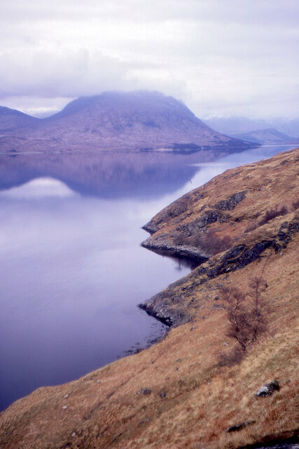
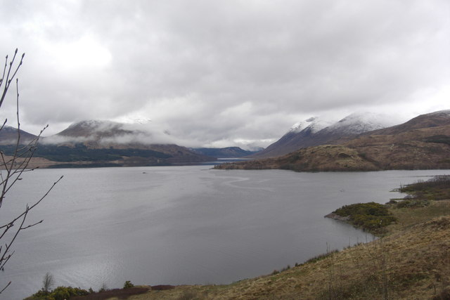
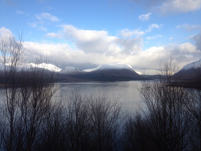
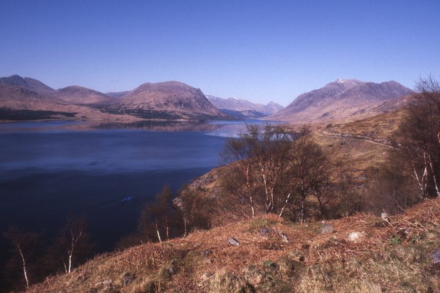
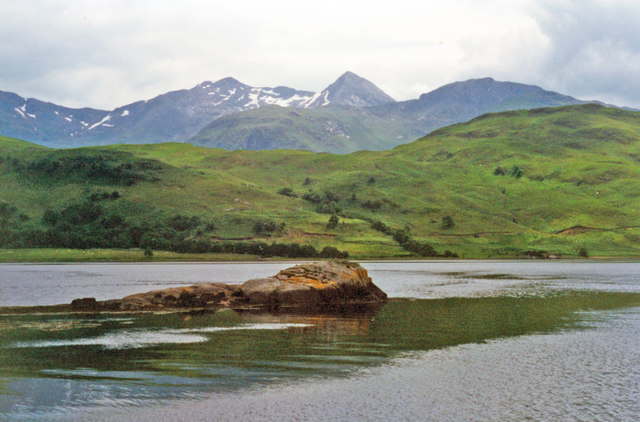
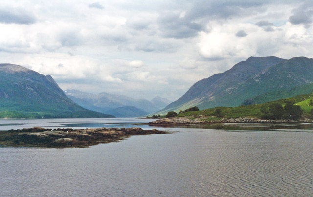
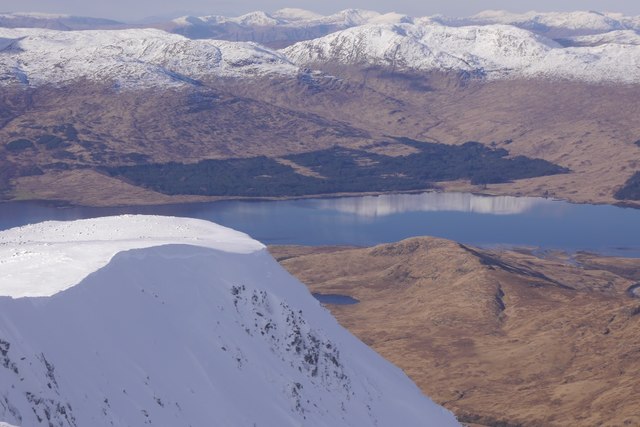
Ardnellan Point is a prominent coastal feature located in Argyllshire, Scotland. Situated on the western coast of the country, it is a picturesque headland that juts out into the Atlantic Ocean. The point offers stunning panoramic views of the surrounding rugged coastline and the vast expanse of the ocean.

The geography of Ardnellan Point is characterized by steep cliffs that rise majestically above the sea. These cliffs, composed of ancient rocks, provide a dramatic backdrop to the point and add to its visual appeal. The headland itself is mostly rocky, with some patches of grass and heather dotting the landscape.

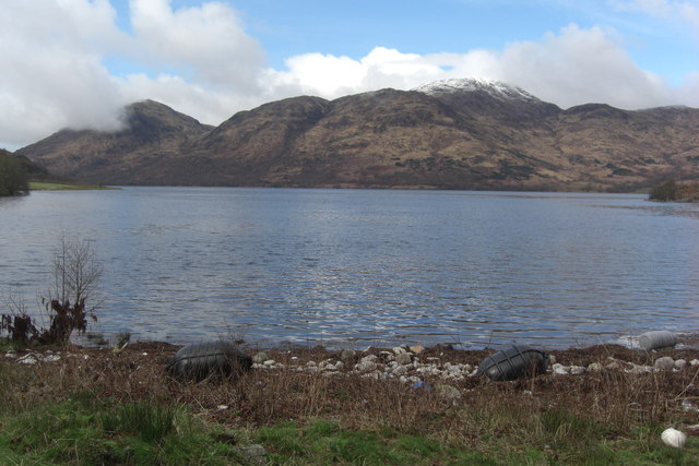
The point is a popular destination for nature enthusiasts and outdoor adventurers. It offers a variety of activities such as hiking, birdwatching, and photography. The surrounding waters are known for their rich marine life, making it an excellent spot for fishing and diving.

In addition to its natural beauty, Ardnellan Point also holds historical significance. It is said to have been a strategic lookout point during ancient times, providing a vantage point for early settlers and defenders. Today, remnants of old structures can still be found on the headland, adding an element of mystery and intrigue to the area.

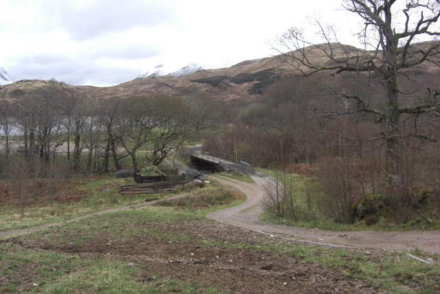
Access to Ardnellan Point is relatively easy, with a well-maintained path leading visitors to the headland. The point is also accessible by boat, allowing for a unique perspective of the rugged coastline. Overall, Ardnellan Point is a must-visit destination for those seeking stunning natural beauty and a glimpse into the history of Argyllshire.

If you have any feedback on the listing, please let us know in the comments section below.

Ardnellan Point Images

Images are sourced within 2km of 56.479561/-5.1416024 or Grid Reference NN0636. Thanks to Geograph Open Source API. All images are credited.

River Kinglass enters Loch Etive After 20 miles of moorland, this was a pleasant change.
River Kinglass enters Loch Etive
After 20 miles of moorland, this was a pleasant change.
Loch Etive sighted Afte almost 20 miles from leaving Bridge of Orchy, Loch Etive is finally sighted. It turns out to be a false dawn as there is still a lot of soul destroying work to be done before reaching Taynuilt and the train.  A shower blows down the loch, thankfully the first rain of the walk. The camera position is an estimate as the road on the left bank of the river is fairly new and is not shown on any of the OS maps.
Loch Etive sighted
Afte almost 20 miles from leaving Bridge of Orchy, Loch Etive is finally sighted. It turns out to be a false dawn as there is still a lot of soul destroying work to be done before reaching Taynuilt and the train. A shower blows down the loch, thankfully the first rain of the walk. The camera position is an estimate as the road on the left bank of the river is fairly new and is not shown on any of the OS maps.
Loch Etive Looking up the loch to Beinn Trilleachan from the track to Inverliver.
Loch Etive
Looking up the loch to Beinn Trilleachan from the track to Inverliver.
Loch Etive shoreline Foreground is shoreline of Loch Etive SE of Inverliver.
Loch Etive shoreline
Foreground is shoreline of Loch Etive SE of Inverliver.
Bridge at Inverliver Bridge over River Liver at Inverliver. The bridge has a lower level which presumably acts as a ford when the river water level is high. There is also an alternative higher level bridge.
Bridge at Inverliver
Bridge over River Liver at Inverliver. The bridge has a lower level which presumably acts as a ford when the river water level is high. There is also an alternative higher level bridge.
Shoreline north of Inverliver Shoreline close to Ardmaddy track. Sadly a lot of rubbish was left by the shore.
Shoreline north of Inverliver
Shoreline close to Ardmaddy track. Sadly a lot of rubbish was left by the shore.
Land south of mouth of River Kinglass Grassland between track to Ardmaddy and mouth of River Kinglass
Land south of mouth of River Kinglass
Grassland between track to Ardmaddy and mouth of River Kinglass
River Kinglass River Kinglass seen from bridge south of Ardmaddy
River Kinglass
River Kinglass seen from bridge south of Ardmaddy
Mouth of River Kinglass Mouth of River Kinglass seen from track to Inverliver. This was taken around 15:30. Around 11:30 only the island with the trees was visible.
Mouth of River Kinglass
Mouth of River Kinglass seen from track to Inverliver. This was taken around 15:30. Around 11:30 only the island with the trees was visible.
Loch Etive From the track up the eastern shore.
Loch Etive
From the track up the eastern shore.
View North up Loch Etive Photo taken on a warm day in late spring.
View North up Loch Etive
Photo taken on a warm day in late spring.
Loch Etive Between Glennoe and Inverliver.
Loch Etive
Between Glennoe and Inverliver.
Inverliver Bay and Ben Cruachan, from Loch Etive View eastward from a pleasure-launch from Taynuilt and back. Note the considerable amount of snow on the mountain - in July. (Cf. <a href="https://www.geograph.org.uk/photo/2040707">NN0636 : Sgeirean Inverliver, Loch Etive</a>).
Inverliver Bay and Ben Cruachan, from Loch Etive
View eastward from a pleasure-launch from Taynuilt and back. Note the considerable amount of snow on the mountain - in July. (Cf. NN0636 : Sgeirean Inverliver, Loch Etive).
NE up Loch Etive off Inverliver Bay View up the Loch taken at same time as <a href="https://www.geograph.org.uk/photo/4767634">NN0636 : Inverliver Bay and Ben Cruachan, from Loch Etive</a>. On the left are the slopes of Beinn Mheadhonach, on the right those of Monadh Liath; in the distance are the mountains of the Royal Forest (Glen Coe).
NE up Loch Etive off Inverliver Bay
View up the Loch taken at same time as NN0636 : Inverliver Bay and Ben Cruachan, from Loch Etive. On the left are the slopes of Beinn Mheadhonach, on the right those of Monadh Liath; in the distance are the mountains of the Royal Forest (Glen Coe).
Meall Inbhir and Loch Etive View from near the summit of Beinn a' Chochuill towards Loch Etive.
Meall Inbhir and Loch Etive
View from near the summit of Beinn a' Chochuill towards Loch Etive.
Loch Etive and Inverkinglass The mouth of Glen Kinglass and a very still Loch Etive seen from the near windless summit of Beinn a' Chochuill.
Loch Etive and Inverkinglass
The mouth of Glen Kinglass and a very still Loch Etive seen from the near windless summit of Beinn a' Chochuill.
Woodland, Glen Kinglass Oak woods near the mouth of the glen. Oaks survive here thanks to the iron industry, there are the remains of furnaces nearby.
Woodland, Glen Kinglass
Oak woods near the mouth of the glen. Oaks survive here thanks to the iron industry, there are the remains of furnaces nearby.
Old track, Glen Kinglass Near the site of an iron furnace.  The iron industry used charcoal, and iron smelting areas can often be identified by surviving woodland.
Old track, Glen Kinglass
Near the site of an iron furnace. The iron industry used charcoal, and iron smelting areas can often be identified by surviving woodland.
Show me another place!

Ardnellan Point is located at Grid Ref: NN0636 (Lat: 56.479561, Lng: -5.1416024)

Unitary Authority: Argyll and Bute

Police Authority: Argyll and West Dunbartonshire

What 3 Words

///eradicate.crass.strongman. Near Oban, Argyll & Bute

Related Wikis

Loch Etive

Loch Etive (Scottish Gaelic, Loch Eite) is a 30 km sea loch in Argyll and Bute, Scotland. It reaches the sea at Connel, 5 km north of Oban. It measures...
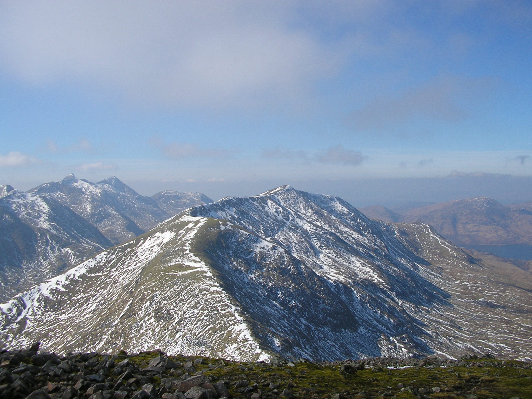
Beinn a' Chochuill

Beinn a' Chochuill (980 m) is a mountain in the Grampian Mountains of Scotland, located east of Loch Etive in Argyll and Bute. Somewhat hidden away by...

Ben Cruachan

Ben Cruachan (Scottish Gaelic: Cruachan Beann) is a mountain that rises to 1,126 metres (3,694 ft), the highest in Argyll and Bute, Scotland. It gives...

Bonawe

Bonawe (Scots pronunciation: [boˈnɔː]; Scottish Gaelic: Bun Abha [puˈna.ə]) is a village in Ardchattan Parish Argyll and Bute, Scotland opposite Taynuilt...

River Awe

The River Awe (Scottish Gaelic: Uisge Abha) is a short river in the Southwest Highlands of Scotland by which the freshwater Loch Awe empties into Loch...
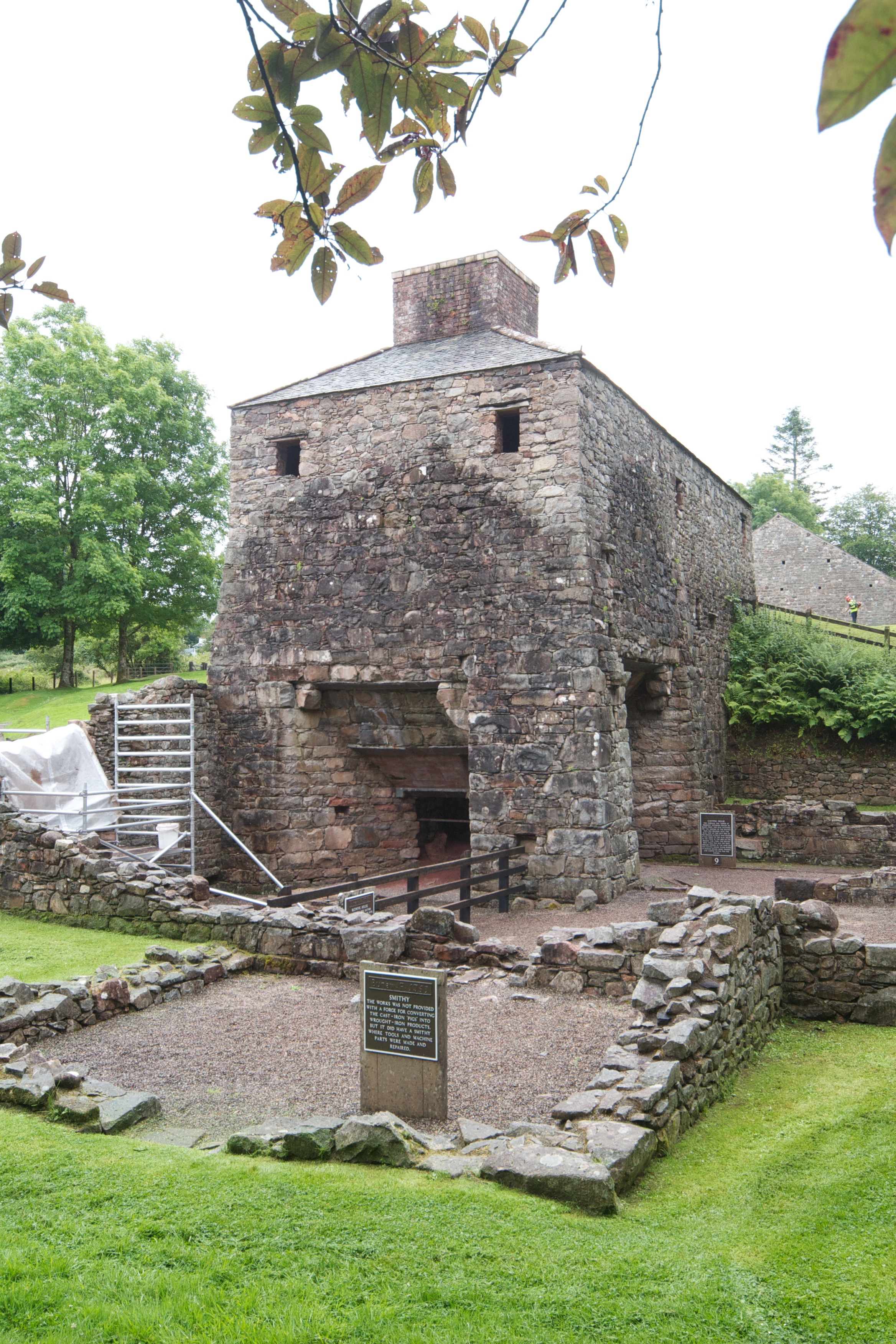
Bonawe Iron Furnace

The Bonawe Iron Furnace (also called the Lorn Furnace), was an industrial complex located in Bonawe, Lorn District, Scotland. It operated in the middle...

Creach Bheinn (Loch Creran)

Creach Bheinn (810 m) is a mountain in the Grampian Mountains of Scotland. It rises above the head Loch Creran in Argyll. A large and sprawling peak, a...

Bridge of Awe

The Bridge of Awe (Scottish Gaelic: Drochaid Abha) was a triple-spanned arch bridge near Taynuilt in Argyll, Scotland. == History == In 1753 the Bonawe...

Nearby Amenities

Located within 500m of 56.479561,-5.1416024
Source: PGS
Lat/Long: 56.4795283/-5.142771
Inverliver
Place: locality
Lat/Long: 56.4754585/-5.1391999
Power: pole
Lat/Long: 56.478786/-5.1338252
Power: pole
Lat/Long: 56.4792566/-5.1337842
Power: pole
Lat/Long: 56.4799246/-5.13369
The data included in this document is from www.openstreetmap.org. The data is made available under ODbL.

Have you been to Ardnellan Point?

Leave your review of Ardnellan Point below (or comments, questions and feedback).