Penrhyn Ychen

Coastal Feature, Headland, Point in Pembrokeshire

Wales

Penrhyn Ychen

Standing stone Stone pillar of unknown date. It is not marked or recorded as an  ancient site and may have been simply a gatepost, although now some yards from the current field boundary. It can be viewed from the gate on the road.
Standing stone Credit: Natasha Ceridwen de Chroustchoff

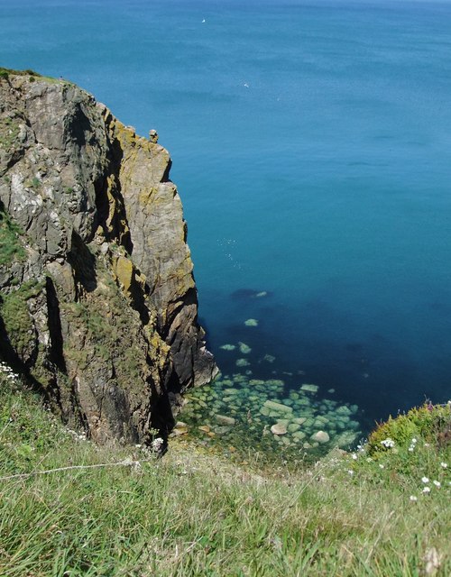
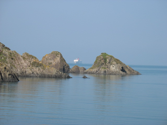
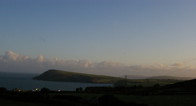
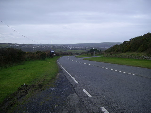
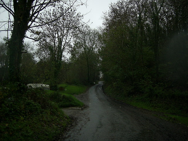
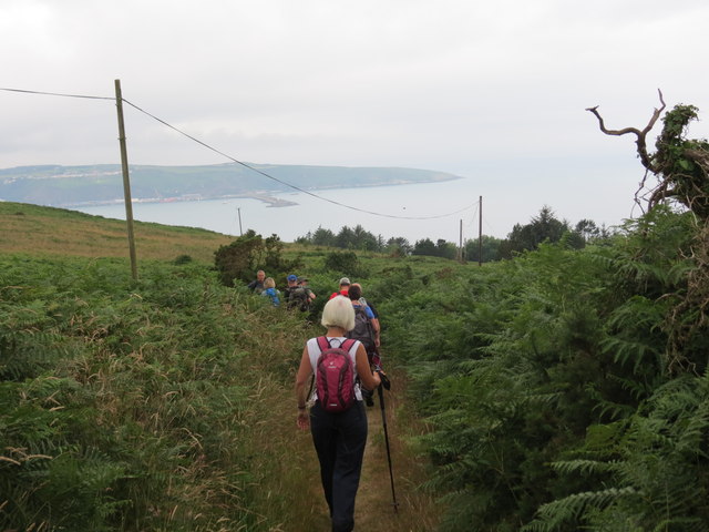
Penrhyn Ychen is a prominent headland located in Pembrokeshire, Wales. Situated on the western coast of the county, it juts out into the Celtic Sea, offering breathtaking views of the surrounding coastal landscape. Known for its rugged cliffs and dramatic rock formations, Penrhyn Ychen is a popular destination for nature enthusiasts and hikers seeking a challenging coastal trail.

The headland is characterized by its towering cliffs, reaching heights of up to 100 meters (330 feet) in some areas. These cliffs are composed of sedimentary rocks, such as sandstone and shale, which have been shaped over centuries by the relentless force of the ocean waves. The resulting jagged and weathered formations create a striking visual spectacle.

The point is also home to a diverse array of wildlife, both on land and in the sea. Seabirds such as gannets, puffins, and razorbills can be seen nesting on the cliffs, while seals and dolphins are often spotted swimming in the waters below. The surrounding coastal waters are rich in marine life, making it a popular spot for fishing and diving.

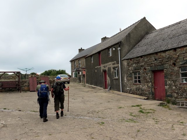
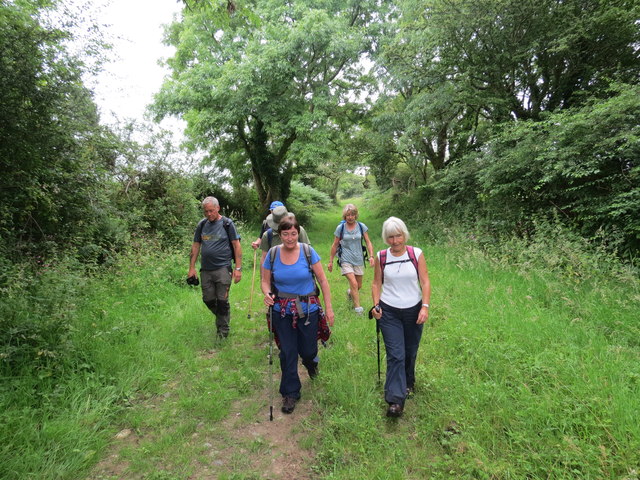
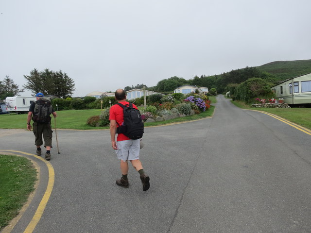
Visitors to Penrhyn Ychen can explore the headland by following the coastal path that winds its way along the cliff tops. This trail offers stunning panoramic views of the sea and surrounding countryside, as well as the opportunity to discover hidden coves and pristine beaches. With its rugged beauty and abundant wildlife, Penrhyn Ychen is a must-visit destination for nature lovers and outdoor enthusiasts alike.

If you have any feedback on the listing, please let us know in the comments section below.

Penrhyn Ychen Images

Images are sourced within 2km of 52.007634/-4.9404231 or Grid Reference SM9838. Thanks to Geograph Open Source API. All images are credited.

Standing stone Stone pillar of unknown date. It is not marked or recorded as an  ancient site and may have been simply a gatepost, although now some yards from the current field boundary. It can be viewed from the gate on the road.
Standing stone
Stone pillar of unknown date. It is not marked or recorded as an ancient site and may have been simply a gatepost, although now some yards from the current field boundary. It can be viewed from the gate on the road.
Fishguard Codd bottle (1) This broken bottle, found here, once contained ginger beer or a similar fizzy drink, using a method invented by Hiram Codd, a British engineer (1838-1887). His idea, which involved using the pressure of the carbonated water to push a glass ball against a rubber ring so creating a perfect seal, revolutionized the drinks trade world-wide. The invention was patented but bottle manufacturers could replicate it if they purchased the balls, the sealing rings and requisite tool. Mineral water firms had bottles made to their own specifications, with their names and trademarks. 
This example was no doubt broken years ago when children used routinely to smash the bottles to extract the marbles. It came from the local bottling factory of T. Lewis, Fishguard, which is still known as the Popworks and has recently been converted into a youth centre, see <a title="https://www.geograph.org.uk/photo/496156" href="https://www.geograph.org.uk/photo/496156">Link</a>
The trademark  which I have seen described as an iceberg, represents in fact, the rocky pinnacle known as Needle Rock which stands off the coast east of Fishguard. See <a title="https://www.geograph.org.uk/photo/758403" href="https://www.geograph.org.uk/photo/758403">Link</a>
(My thanks to Roy Lewis for this revelation!)
Fishguard Codd bottle (1)
This broken bottle, found here, once contained ginger beer or a similar fizzy drink, using a method invented by Hiram Codd, a British engineer (1838-1887). His idea, which involved using the pressure of the carbonated water to push a glass ball against a rubber ring so creating a perfect seal, revolutionized the drinks trade world-wide. The invention was patented but bottle manufacturers could replicate it if they purchased the balls, the sealing rings and requisite tool. Mineral water firms had bottles made to their own specifications, with their names and trademarks. This example was no doubt broken years ago when children used routinely to smash the bottles to extract the marbles. It came from the local bottling factory of T. Lewis, Fishguard, which is still known as the Popworks and has recently been converted into a youth centre, see Link The trademark which I have seen described as an iceberg, represents in fact, the rocky pinnacle known as Needle Rock which stands off the coast east of Fishguard. See Link (My thanks to Roy Lewis for this revelation!)
Fishguard Codd bottle (2) This is the second Codd bottle I have found, within a few weeks of the first, for which see here <a title="https://www.geograph.org.uk/photo/2332162" href="https://www.geograph.org.uk/photo/2332162">Link</a> for details. Like the first the bottle had its top broken to retrieve the desirable marble closure device from the neck.
Here, it has been washed and returned to its original finding place for the photograph, on a tumbledown wall in the woods close to the Afon Gwaun. 
It is bears the legend GWYNFA MINERAL WATER WORKS FISHGUARD. This was a small factory run by the Bateman family and located only a short distance away, as the crow flies, across the valley at Plas-y-fron on the edge of the town. The place has been closed for some time but is still standing, see <a title="https://www.geograph.org.uk/photo/2326322" href="https://www.geograph.org.uk/photo/2326322">Link</a> and <a title="https://www.geograph.org.uk/photo/2326331" href="https://www.geograph.org.uk/photo/2326331">Link</a>

(Thanks again to Roy Lewis for info.)
Fishguard Codd bottle (2)
This is the second Codd bottle I have found, within a few weeks of the first, for which see here Link for details. Like the first the bottle had its top broken to retrieve the desirable marble closure device from the neck. Here, it has been washed and returned to its original finding place for the photograph, on a tumbledown wall in the woods close to the Afon Gwaun. It is bears the legend GWYNFA MINERAL WATER WORKS FISHGUARD. This was a small factory run by the Bateman family and located only a short distance away, as the crow flies, across the valley at Plas-y-fron on the edge of the town. The place has been closed for some time but is still standing, see Link and Link (Thanks again to Roy Lewis for info.)
Coast rider on the road again Bob Jones the coastriding Geographer sets off on the next stage of his marathon after spending the night just outside Fishguard. Nice to meet you Bob!
See <span class="nowrap"><a title="http://www.coastrider.org.uk/" rel="nofollow ugc noopener" href="http://www.coastrider.org.uk/">Link</a><img style="margin-left:2px;" alt="External link" title="External link - shift click to open in new window" src="https://s1.geograph.org.uk/img/external.png" width="10" height="10"/></span>
Coast rider on the road again
Bob Jones the coastriding Geographer sets off on the next stage of his marathon after spending the night just outside Fishguard. Nice to meet you Bob! See LinkExternal link
View from the cliff top, near Needle Rock The name 'Needle Rock' appears on the map in two quite distinct places along this stretch of coastline, the other being in SN0140.  No Welsh name appears on the map, in either case.   Both localities are significant nesting sites for sea birds.
View from the cliff top, near Needle Rock
The name 'Needle Rock' appears on the map in two quite distinct places along this stretch of coastline, the other being in SN0140. No Welsh name appears on the map, in either case. Both localities are significant nesting sites for sea birds.
Buildings in the old farmyard at Cilshafe Fawr After dipping into RW Brunskill's 'Illustrated Handbook of Vernacular Architecture' I think I can identify this building (at the NW corner of the yard) as a cart-shed.  Round the corner at the far end of the building is an outside staircase giving access to the first floor, which - again according to Brunskill - would by tradition have been used as a granary.

This and other buildings around the farmyard - all of similar rugged build - are said to date back to the 18th century.
Buildings in the old farmyard at Cilshafe Fawr
After dipping into RW Brunskill's 'Illustrated Handbook of Vernacular Architecture' I think I can identify this building (at the NW corner of the yard) as a cart-shed. Round the corner at the far end of the building is an outside staircase giving access to the first floor, which - again according to Brunskill - would by tradition have been used as a granary. This and other buildings around the farmyard - all of similar rugged build - are said to date back to the 18th century.
Aber Bach (or Hescwm) cove On the horizon the Stena Line ferry nears the end of its voyage from Rosslare to Fishguard/Goodwick.
Although I did not realise it until much later, this photo was taken from the exact same spot as the photo on the title page of the National Trail Guide to the Pembrokeshire Coast Path. (A quick comparison will soon confirm this. To be precise, I am referring to my copy of the 2004 edition of the Guide.)
Aber Bach (or Hescwm) cove
On the horizon the Stena Line ferry nears the end of its voyage from Rosslare to Fishguard/Goodwick. Although I did not realise it until much later, this photo was taken from the exact same spot as the photo on the title page of the National Trail Guide to the Pembrokeshire Coast Path. (A quick comparison will soon confirm this. To be precise, I am referring to my copy of the 2004 edition of the Guide.)
Dinas Head and coastline beyond, from Castell Farm The prominent headland is Dinas Head; beyond it, to the right, in the far distance, is Cemaes Head, and on the right (closer to the camera) the land rising behind Newport Sands.  In the foreground, the Penrhyn caravan site.
Dinas Head and coastline beyond, from Castell Farm
The prominent headland is Dinas Head; beyond it, to the right, in the far distance, is Cemaes Head, and on the right (closer to the camera) the land rising behind Newport Sands. In the foreground, the Penrhyn caravan site.
Araf (Slow) bend ahead on the A487 heading for Dinas Cross The "Araf/Slow" signs indicate, there is a sharp bend and road junction ahead on the A487 approaching Dinas Cross.
Araf (Slow) bend ahead on the A487 heading for Dinas Cross
The "Araf/Slow" signs indicate, there is a sharp bend and road junction ahead on the A487 approaching Dinas Cross.
A487 road junction A view of the road junction heading for Fishguard from Dinas Cross. Turn right for the minor road to Fishguard Bay Caravan and Camping Park.
A487 road junction
A view of the road junction heading for Fishguard from Dinas Cross. Turn right for the minor road to Fishguard Bay Caravan and Camping Park.
Tree-lined road to Llanychaer A view of the tree-lined road to Llanychaer, near Cwm-onen.
Tree-lined road to Llanychaer
A view of the tree-lined road to Llanychaer, near Cwm-onen.
Ffarm Trewrach Farm Cerddwyr yn mynd heibio i Ffarm Trewrach.

Walkers passing Trewrach (witch homestead!?)
Ffarm Trewrach Farm
Cerddwyr yn mynd heibio i Ffarm Trewrach. Walkers passing Trewrach (witch homestead!?)
Llwybr Penrhyn Path Cerddwyr yn dilyn llwybr Cyhoeddus yn arwain i lawr at Benrhyn. Yn y pellter gellir gweld porthladd Abergwaun.

Walkers following a path descending to Penrhyn. In the distance one can see Fishguard Harbour.
Llwybr Penrhyn Path
Cerddwyr yn dilyn llwybr Cyhoeddus yn arwain i lawr at Benrhyn. Yn y pellter gellir gweld porthladd Abergwaun. Walkers following a path descending to Penrhyn. In the distance one can see Fishguard Harbour.
Llwybr Ceffyl Cilshafe Bridleway Cerddwyr yn dilyn llwybr Ceffyl o Ffermydd Cilshafe tuag at yr A487.

Walkers following a bridleway from the Cilshafe Farms in the direction of the A487.
Llwybr Ceffyl Cilshafe Bridleway
Cerddwyr yn dilyn llwybr Ceffyl o Ffermydd Cilshafe tuag at yr A487. Walkers following a bridleway from the Cilshafe Farms in the direction of the A487.
Maes Carafannau / Caravan Park Cerddwyr yn mynd heibio i Barc Carafannau.

Walkers passing through a Caravan Park.
Maes Carafannau / Caravan Park
Cerddwyr yn mynd heibio i Barc Carafannau. Walkers passing through a Caravan Park.
Pwll Gwylog Dinas Island can be seen in the distance.
Pwll Gwylog
Dinas Island can be seen in the distance.
Coast path near Castell Farm The path heading westward above Aber Richard. This is footpath PP20 32/1.
Coast path near Castell Farm
The path heading westward above Aber Richard. This is footpath PP20 32/1.
Coast at Aber Richard A similar view to <a href="https://www.geograph.org.uk/photo/689122">SM9738 : Coastline east of Fishguard</a>, taken on a gloomy New Year's Day. The dramatic Needle Rock, a stack pierced by a natural arch, is in <a href="https://www.geograph.org.uk/gridref/SM9737">SM9737</a> - see also <a href="https://www.geograph.org.uk/photo/758397">SM9737 : Needle Rock</a> and <a href="https://www.geograph.org.uk/photo/758403">SM9737 : Needle Rock with natural arch</a>.
Coast at Aber Richard
A similar view to SM9738 : Coastline east of Fishguard, taken on a gloomy New Year's Day. The dramatic Needle Rock, a stack pierced by a natural arch, is in SM9737 - see also SM9737 : Needle Rock and SM9737 : Needle Rock with natural arch.
Show me another place!

Penrhyn Ychen is located at Grid Ref: SM9838 (Lat: 52.007634, Lng: -4.9404231)

Unitary Authority: Pembrokeshire

Police Authority: Dyfed Powys

What 3 Words

///dreading.twisty.flat. Near Fishguard, Pembrokeshire

Related Wikis

Fishguard Bay

Fishguard Bay (Welsh: Bae Abergwaun) is a bay on the north Pembrokeshire coast, Wales. Much of the bay's coastline is within the Pembrokeshire Coast National...

Dinas Cross

Dinas Cross (Welsh: Dinas) is both a village, a community and a former parish in Pembrokeshire, Wales. Located between Fishguard and Newport in the Pembrokeshire...

River Gwaun

The River Gwaun (Welsh: Afon Gwaun, "Gwaun" meaning 'marsh, moor') is a river in Pembrokeshire, West Wales, which flows west to the sea at Fishguard (Welsh...

Pwllgwaelod

Pwllgwaelod (originally Y Pwll Gwaelod, Welsh for The Bottom Cove/Creek) is a small scattered hamlet centred on a bay on the south-western side of the...

Nearby Amenities

Located within 500m of 52.007634,-4.9404231
SA65 9ET
Tourism: camp_site
Lat/Long: 52.0049655/-4.9399418
Fishguard Bay Caravan and Camping Park
Tourism: caravan_site
Lat/Long: 52.0064125/-4.9397261
Barrier: kissing_gate
Lat/Long: 52.006177/-4.9349177
The data included in this document is from www.openstreetmap.org. The data is made available under ODbL.

Have you been to Penrhyn Ychen?

Leave your review of Penrhyn Ychen below (or comments, questions and feedback).