Corran a' Chaolais Mhòir

Coastal Feature, Headland, Point in Inverness-shire

Scotland

Corran a' Chaolais Mhòir

Beach of Loch Hourn beside Fraoch Eilean Fraoch Eilean is a tiny island on the south side of Loch Hourn; it's out of view to the right.
Ladhar Bheinn is the incomparable mountain beyond!
Beach of Loch Hourn beside Fraoch Eilean Credit: Trevor Littlewood

The requested URL returned error: 429 Too Many Requests

If you have any feedback on the listing, please let us know in the comments section below.

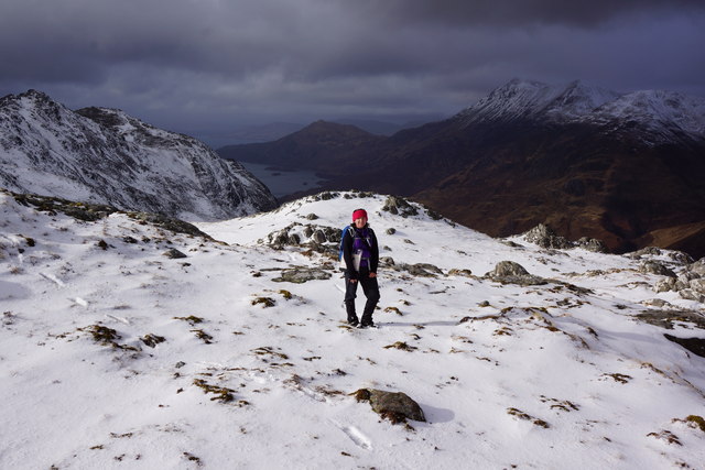
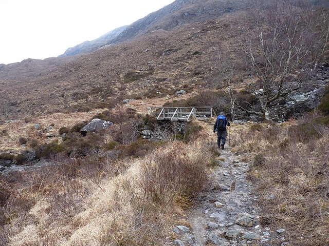
Corran a' Chaolais Mhòir Images

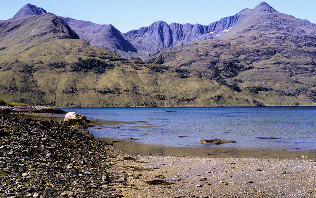
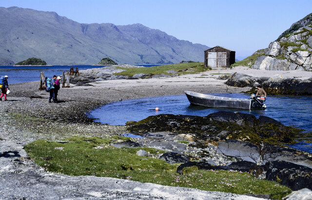
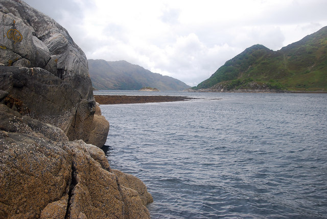
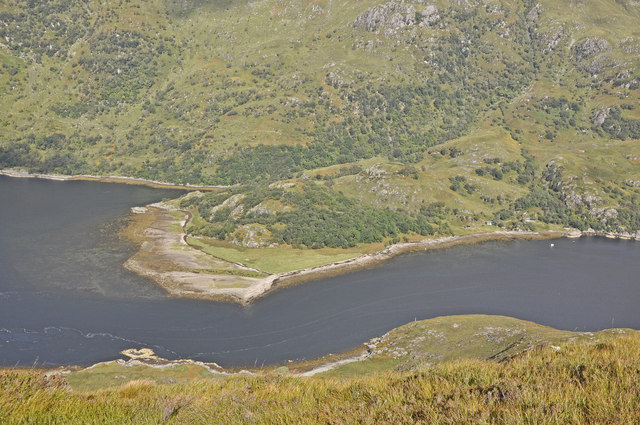
Images are sourced within 2km of 57.100364/-5.4815135 or Grid Reference NG8906. Thanks to Geograph Open Source API. All images are credited.

Beach of Loch Hourn beside Fraoch Eilean Fraoch Eilean is a tiny island on the south side of Loch Hourn; it's out of view to the right.
Ladhar Bheinn is the incomparable mountain beyond!
Beach of Loch Hourn beside Fraoch Eilean
Fraoch Eilean is a tiny island on the south side of Loch Hourn; it's out of view to the right. Ladhar Bheinn is the incomparable mountain beyond!
Isthmus at Fraoch Eilean Fraoch Eilean is across the isthmus where there's the boathouse. The boat on the water to the right of the beach was manned by David Mackenzie, a keeper or ghillie at Barrisdale. He was to carry out passengers - some can be seen - to Kinloch Hourn.
Isthmus at Fraoch Eilean
Fraoch Eilean is across the isthmus where there's the boathouse. The boat on the water to the right of the beach was manned by David Mackenzie, a keeper or ghillie at Barrisdale. He was to carry out passengers - some can be seen - to Kinloch Hourn.
Eilean Mhogh-sgeir The eastern side of this Loch Hourn islet lies in this grid square.  A boat is useful!
Eilean Mhogh-sgeir
The eastern side of this Loch Hourn islet lies in this grid square. A boat is useful!
Eilean Mhogh-sgeir This islet is covered by trees and makes an ideal habitat for a heronry. In the centre of the photo by the dead branch a heron was observed sitting on its nest.
Eilean Mhogh-sgeir
This islet is covered by trees and makes an ideal habitat for a heronry. In the centre of the photo by the dead branch a heron was observed sitting on its nest.
Eilean Mhogh-sgeir The western tip of the islet looking towards the remote dwelling and ruin of Runival.
Eilean Mhogh-sgeir
The western tip of the islet looking towards the remote dwelling and ruin of Runival.
Caolasmor Cottage A rather remote spot on the north bank of inner Loch Hourn. There is no sign of a path so approach is dependent on boat travel.
Caolasmor Cottage
A rather remote spot on the north bank of inner Loch Hourn. There is no sign of a path so approach is dependent on boat travel.
Caolas Mor Shingly beach on the west side of this promontory which gives rise to the narrows of the same name.
Caolas Mor
Shingly beach on the west side of this promontory which gives rise to the narrows of the same name.
Loch Hourn From Fraoch Eilean a view west with Barrisdale Bay off to the left of the photo.
Loch Hourn
From Fraoch Eilean a view west with Barrisdale Bay off to the left of the photo.
The Caolas Mor from the slopes of Meall nan Eun
Unnamed lochan above the corrie of the Allt Ban, Druim Fada Beinn Sgritheall lies to the west.
Unnamed lochan above the corrie of the Allt Ban, Druim Fada
Beinn Sgritheall lies to the west.
Druim Fada ridge Beinn Sgritheall in the background
Druim Fada ridge
Beinn Sgritheall in the background
Crag on Loch Hourn south side
Runival, Loch Hourn
Runival, Loch Hourn
Track from Barrisdale to Kinlochhourn The first part of a bit of a trek back from the Barrisdale area along the southern shore of Loch Hourn. The ruin on the left is not, as it first appears, a former croft house, but is mapped in the 1870s as a Quoad Sacra church - the expression essentially means it belonged to a parish with ecclesiastical function, but no civil government operation. This one is recorded by Canmore, the Scottish National Records of Historic Environment service, at <span class="nowrap"><a title="https://canmore.org.uk/site/87557/quoad-sacra-church" rel="nofollow ugc noopener" href="https://canmore.org.uk/site/87557/quoad-sacra-church">Link</a><img style="margin-left:2px;" alt="External link" title="External link - shift click to open in new window" src="https://s1.geograph.org.uk/img/external.png" width="10" height="10"/></span>
Track from Barrisdale to Kinlochhourn
The first part of a bit of a trek back from the Barrisdale area along the southern shore of Loch Hourn. The ruin on the left is not, as it first appears, a former croft house, but is mapped in the 1870s as a Quoad Sacra church - the expression essentially means it belonged to a parish with ecclesiastical function, but no civil government operation. This one is recorded by Canmore, the Scottish National Records of Historic Environment service, at LinkExternal link
Stalkers' track above Loch Hourn This section is well drained and stony. Not so all the way back to Kinlochhourn, much of which is rather less attractive as a bike ride.
Stalkers' track above Loch Hourn
This section is well drained and stony. Not so all the way back to Kinlochhourn, much of which is rather less attractive as a bike ride.
Stalkers' path above Loch Hourn One of the boggier sections of the path; this length would be a bit of a thankless struggle on a bike, especially uphill.
Stalkers' path above Loch Hourn
One of the boggier sections of the path; this length would be a bit of a thankless struggle on a bike, especially uphill.
Stalkers' path above Loch Hourn A narrow and well-drained section on the descent of the hillside approaching Caolas Mòr.
Stalkers' path above Loch Hourn
A narrow and well-drained section on the descent of the hillside approaching Caolas Mòr.
Footbridge over the Allt a' Chaolas Bhig The bridge referred to in <a href="https://www.geograph.org.uk/photo/1044241">NG8806 : Allt a' Chaolas Bhig</a>. On the occasion of our visit, the water was low and slow, making it easy to refill a drink bottle.
Footbridge over the Allt a' Chaolas Bhig
The bridge referred to in NG8806 : Allt a' Chaolas Bhig. On the occasion of our visit, the water was low and slow, making it easy to refill a drink bottle.
Show me another place!

Corran a' Chaolais Mhòir is located at Grid Ref: NG8906 (Lat: 57.100364, Lng: -5.4815135)

Unitary Authority: Highland

Police Authority: Highlands and Islands

What 3 Words

///tangling.plump.solo. Near Glenelg, Highland

Related Wikis

Druim Fada (Loch Hourn)

Druim Fada (711 m) is a mountain in the Northwest Highlands of Scotland. Located on the northern shore of Loch Hourn in Ross and Cromarty. A long, craggy...

Sgùrr nan Eugallt

Sgùrr nan Eugallt is the highest of a well defined group of mountains that lie south of Loch Hourn, stretching from Barrisdale to Loch Quoich. Although...

Sgùrr a' Choire-bheithe

Sgùrr a' Choire-bleithe is a 913-m mountain in the remote Knoydart area of Lochaber, Northwest Highlands, Scotland. It is one of highest Corbetts at 913...

Corran, Loch Hourn

Corran (Scottish Gaelic: An Corran) is a hamlet on the northern shore of Loch Hourn, in Lochalsh in Inverness-shire in the Highlands of Scotland. It is...

Nearby Amenities

Located within 500m of 57.100364,-5.4815135
Source: PGS
Lat/Long: 57.1017796/-5.489255
Source: PGS
Lat/Long: 57.1008834/-5.4881429
Source: PGS
Lat/Long: 57.1009385/-5.4868972
Source: PGS
Lat/Long: 57.1015919/-5.4866395
Source: PGS
Lat/Long: 57.1024022/-5.4853655
Source: PGS
Lat/Long: 57.1030612/-5.4848065
Source: PGS
Lat/Long: 57.1034398/-5.4845438
Source: PGS
Lat/Long: 57.1037062/-5.4838129
Source: PGS
Lat/Long: 57.1041411/-5.4832394
Source: PGS
Lat/Long: 57.1045327/-5.4825045
Source: PGS
Lat/Long: 57.1046846/-5.4819391
Source: PGS
Lat/Long: 57.1047341/-5.4813432
Source: PGS
Lat/Long: 57.1012732/-5.4735732
Source: PGS
Lat/Long: 57.100968/-5.4741816
Source: PGS
Lat/Long: 57.1008598/-5.4749696
Source: PGS
Lat/Long: 57.1009653/-5.4788315
Source: PGS
Lat/Long: 57.1011281/-5.4811706
Source: PGS
Lat/Long: 57.1009861/-5.4832504
Source: PGS
Lat/Long: 57.1007428/-5.4838205
Source: PGS
Lat/Long: 57.1005226/-5.4840731
Source: PGS
Lat/Long: 57.0996442/-5.4847966
Source: PGS
Lat/Long: 57.0991806/-5.4862325
Source: PGS
Lat/Long: 57.0992786/-5.4873373
Source: PGS
Lat/Long: 57.0994202/-5.4876734
Created By: almien_coastlines
Source: PGS
Lat/Long: 57.099315/-5.487995
Source: PGS
Lat/Long: 57.0989855/-5.4880993
Source: PGS
Lat/Long: 57.098823/-5.4881934
Leac an Aiseig
Ele: 82
Natural: peak
Source: Scottish Popular Edition
Lat/Long: 57.0993231/-5.4808016
Ford: yes
Lat/Long: 57.1004428/-5.4761209
Ford: yes
Lat/Long: 57.1006772/-5.4747956
Ford: yes
Lat/Long: 57.100538/-5.4780531
Ford: yes
Lat/Long: 57.0990856/-5.4859656
The data included in this document is from www.openstreetmap.org. The data is made available under ODbL.

Have you been to Corran a' Chaolais Mhòir?

Leave your review of Corran a' Chaolais Mhòir below (or comments, questions and feedback).