Rubha na Sain

Coastal Feature, Headland, Point in Argyllshire

Scotland

Rubha na Sain

A83 at Ballimore
A83 at Ballimore Credit: Alpin Stewart

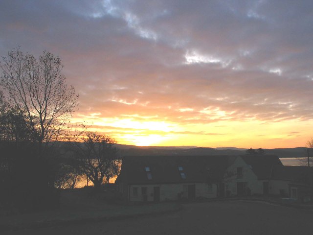
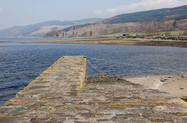
Rubha na Sain is a coastal headland located in Argyllshire, Scotland. It is situated on the west coast of the Kintyre Peninsula, overlooking the Sound of Jura. The headland is characterized by rugged cliffs, rocky shores, and stunning sea views.

Rubha na Sain is a popular spot for hikers and nature enthusiasts, offering breathtaking views of the surrounding landscape and the opportunity to spot various seabirds and marine life. The headland is also known for its historic significance, with several ancient ruins and archaeological sites scattered throughout the area.

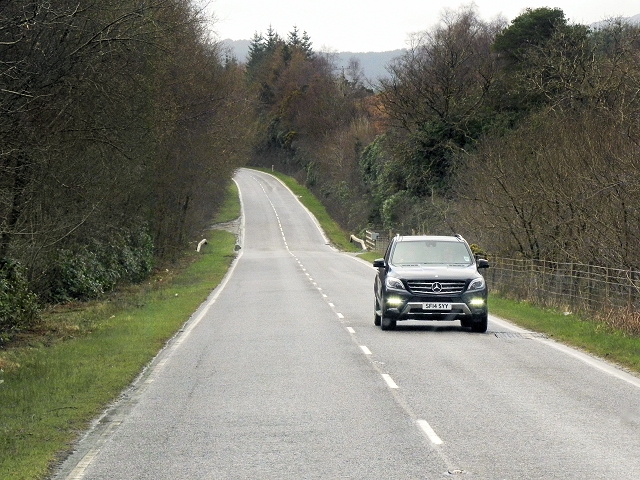
Visitors to Rubha na Sain can explore the coastal paths that lead to the headland, taking in the natural beauty of the Scottish coastline. The area is also a popular destination for birdwatching, particularly during the breeding season when seabirds flock to the cliffs to nest.

Overall, Rubha na Sain is a picturesque and tranquil coastal feature that offers visitors a chance to experience the raw beauty of Scotland's rugged coastline.

If you have any feedback on the listing, please let us know in the comments section below.

Rubha na Sain Images

Images are sourced within 2km of 56.003806/-5.3841 or Grid Reference NR8984. Thanks to Geograph Open Source API. All images are credited.

A83 at Ballimore
A83 at Ballimore
A83 near Ballibeg
A83 near Ballibeg
A83 eastbound
A83 eastbound
Looking across Port Ann bay to Glas Eilean
Triangulation pillar on Silver Craigs 59m Looking across Loch Fyne towards the general direction of Otter Ferry
Triangulation pillar on Silver Craigs 59m
Looking across Loch Fyne towards the general direction of Otter Ferry
Benchmark on the trig point of Silver Craigs S8755
Sunrise over Achnaba Cottages by the A83.
Achnaba Cottages overlooking Loch Fyne.
The A83 heading for Lochgilphead in Argyll.
New house, Ballibeg off A83
Shoreline near Silvercraigs
Westbound A83 The A83 is a major road which links two of the most remote areas of mainland Britain, Cowal and Kintyre, with the rest of Scotland. 

The A83 runs for 98 miles from Tarbet, on the western shore of Loch Lomond where it splits from the A82, to Campbeltown. On the way, it runs along the shore of Loch Fyne and almost the entire length of the Kintyre peninsula.
Westbound A83
The A83 is a major road which links two of the most remote areas of mainland Britain, Cowal and Kintyre, with the rest of Scotland. The A83 runs for 98 miles from Tarbet, on the western shore of Loch Lomond where it splits from the A82, to Campbeltown. On the way, it runs along the shore of Loch Fyne and almost the entire length of the Kintyre peninsula.
A83 crossing Allt Oigh The A83 is a major road which links two of the most remote areas of mainland Britain, Cowal and Kintyre, with the rest of Scotland. 

The A83 runs for 98 miles from Tarbet, on the western shore of Loch Lomond where it splits from the A82, to Campbeltown. On the way, it runs along the shore of Loch Fyne and almost the entire length of the Kintyre peninsula.
A83 crossing Allt Oigh
The A83 is a major road which links two of the most remote areas of mainland Britain, Cowal and Kintyre, with the rest of Scotland. The A83 runs for 98 miles from Tarbet, on the western shore of Loch Lomond where it splits from the A82, to Campbeltown. On the way, it runs along the shore of Loch Fyne and almost the entire length of the Kintyre peninsula.
A83, Ballimore The A83 is a major road which links two of the most remote areas of mainland Britain, Cowal and Kintyre, with the rest of Scotland. 

The A83 runs for 98 miles from Tarbet, on the western shore of Loch Lomond where it splits from the A82, to Campbeltown. On the way, it runs along the shore of Loch Fyne and almost the entire length of the Kintyre peninsula.
A83, Ballimore
The A83 is a major road which links two of the most remote areas of mainland Britain, Cowal and Kintyre, with the rest of Scotland. The A83 runs for 98 miles from Tarbet, on the western shore of Loch Lomond where it splits from the A82, to Campbeltown. On the way, it runs along the shore of Loch Fyne and almost the entire length of the Kintyre peninsula.
Field access opposite The Barr
Minor road to Garbhard
New drainage in fields at Ballimore.
Trees by the A83 at Castleton.
Show me another place!

Rubha na Sain is located at Grid Ref: NR8984 (Lat: 56.003806, Lng: -5.3841)

Unitary Authority: Argyll and Bute

Police Authority: Argyll and West Dunbartonshire

What 3 Words

///thus.chop.vandalism. Near Ardrishaig, Argyll & Bute

Nearby Locations

Rubha na Sain

Related Wikis

Loch Gilp

Loch Gilp (Scottish Gaelic: Loch Gilb) is a small inlet on Loch Fyne which gives its name to Lochgilphead. The Crinan Canal extends from the loch across...
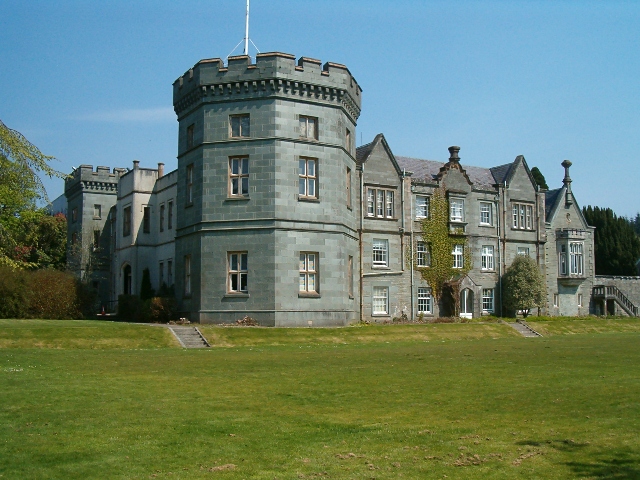
Kilmory Castle

Kilmory Castle, also known as Kilmory House, is a large 19th century house located just to the south of Lochgilphead, in old county Argyll, on the west...

Otter Ferry

Otter Ferry (Scottish Gaelic: An Oitir) is a settlement on the Cowal peninsula in Argyll and Bute, Scotland, formerly the site of a ferry across Loch Fyne...

Ardrishaig

Ardrishaig (Scottish Gaelic: Àird Driseig) is a coastal village on Loch Gilp, at the southern (eastern) entrance to the Crinan Canal in Argyll and Bute...

Nearby Amenities

Located within 500m of 56.003806,-5.3841
Source: PGS
Lat/Long: 56.0001433/-5.3862285
Created By: dmgroom_coastlines
Source: PGS
Lat/Long: 56.001073/-5.385853
Source: PGS
Lat/Long: 56.0024427/-5.3846397
Source: PGS
Lat/Long: 56.0025277/-5.3844711
Source: PGS
Lat/Long: 56.0027492/-5.3843015
Source: PGS
Lat/Long: 56.003421/-5.3838769
Source: PGS
Lat/Long: 56.0035368/-5.3837354
Source: PGS
Lat/Long: 56.0039386/-5.3834646
Source: PGS
Lat/Long: 56.0040962/-5.3827694
Source: PGS
Lat/Long: 56.0041972/-5.3824066
Source: PGS
Lat/Long: 56.0043835/-5.3818486
Source: PGS
Lat/Long: 56.004497/-5.3815777
Source: PGS
Lat/Long: 56.0048168/-5.3808592
Source: PGS
Lat/Long: 56.0054321/-5.3802661
Source: PGS
Lat/Long: 56.0057597/-5.3798873
Created By: dmgroom_coastlines
Source: PGS
Lat/Long: 56.00593/-5.379752
Source: PGS
Lat/Long: 56.0061876/-5.3796291
Created By: dmgroom_coastlines
Source: PGS
Lat/Long: 56.006583/-5.379107
Source: PGS
Lat/Long: 56.0067873/-5.3789335
Source: PGS
Lat/Long: 56.0070287/-5.3784883
Source: PGS
Lat/Long: 56.004936/-5.391464
Source: PGS
Lat/Long: 56.0043138/-5.3915402
Source: PGS
Lat/Long: 56.0042842/-5.3911587
Source: PGS
Lat/Long: 56.0044896/-5.3906074
Source: PGS
Lat/Long: 56.0045124/-5.3903332
Source: PGS
Lat/Long: 56.0045652/-5.3901007
Source: PGS
Lat/Long: 56.0047637/-5.3898446
Source: PGS
Lat/Long: 56.0049212/-5.3895969
Source: PGS
Lat/Long: 56.0050941/-5.3893665
Source: PGS
Lat/Long: 56.0052581/-5.3891369
Source: PGS
Lat/Long: 56.0053641/-5.3888707
Source: PGS
Lat/Long: 56.0056813/-5.3880744
Source: PGS
Lat/Long: 56.0059836/-5.3875756
Source: PGS
Lat/Long: 56.006094/-5.3871968
Source: PGS
Lat/Long: 56.0063888/-5.386753
Source: PGS
Lat/Long: 56.0063336/-5.385847
Source: PGS
Lat/Long: 56.0062305/-5.3856503
Source: PGS
Lat/Long: 56.0060251/-5.3848129
Source: PGS
Lat/Long: 56.006028/-5.384462
Source: PGS
Lat/Long: 56.0053837/-5.3842831
Source: PGS
Lat/Long: 56.0049548/-5.3844292
Source: PGS
Lat/Long: 56.00443/-5.3844943
Source: PGS
Lat/Long: 56.0038584/-5.3849157
Source: PGS
Lat/Long: 56.0029195/-5.3850105
Source: PGS
Lat/Long: 56.0025449/-5.385167
Created By: dmgroom_coastlines
Source: PGS
Lat/Long: 56.001316/-5.386554
Source: PGS
Lat/Long: 56.0011554/-5.3870531
Source: PGS
Lat/Long: 56.0011087/-5.3872444
Source: PGS
Lat/Long: 56.0008036/-5.3873403
Source: PGS
Lat/Long: 56.0008035/-5.387515
Power: pole
Lat/Long: 56.0081833/-5.3839445
Power: pole
Lat/Long: 56.0078354/-5.3835207
Power: pole
Lat/Long: 56.0074927/-5.3831023
The data included in this document is from www.openstreetmap.org. The data is made available under ODbL.

Have you been to Rubha na Sain?

Leave your review of Rubha na Sain below (or comments, questions and feedback).