Rickets Head

Coastal Feature, Headland, Point in Pembrokeshire

Wales

Rickets Head

Flower-decked drystone wall Note the windswept bush!
Flower-decked drystone wall Credit: Marion Phillips

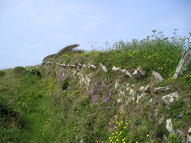
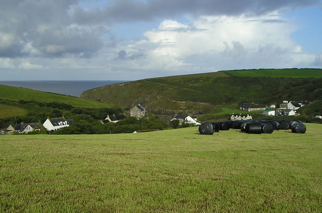
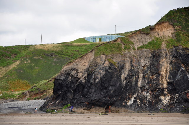
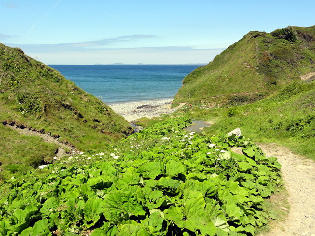
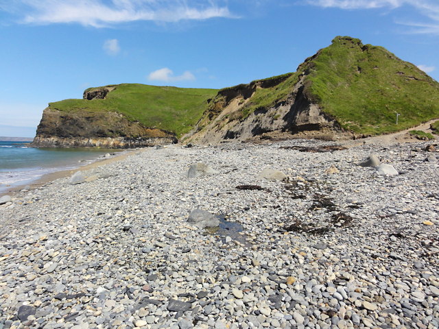
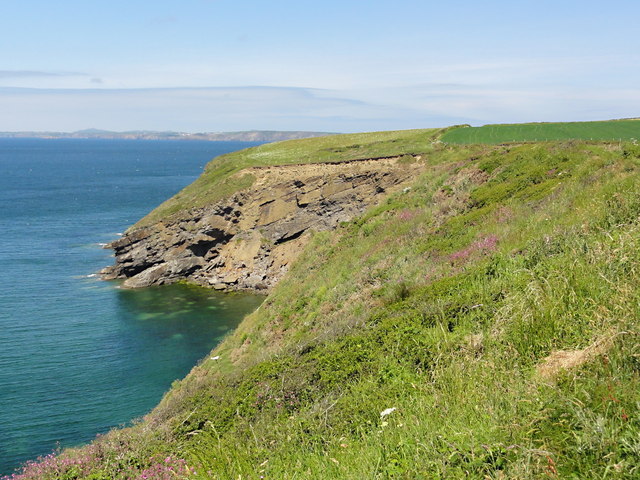
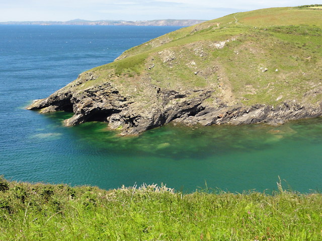
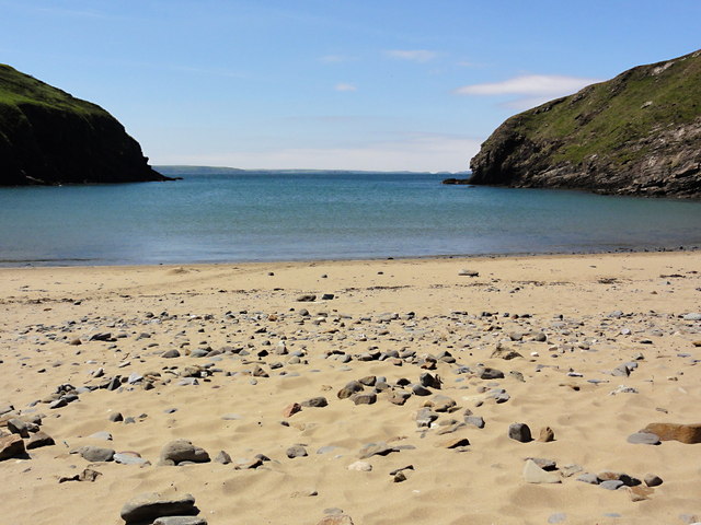
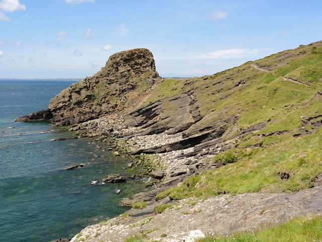
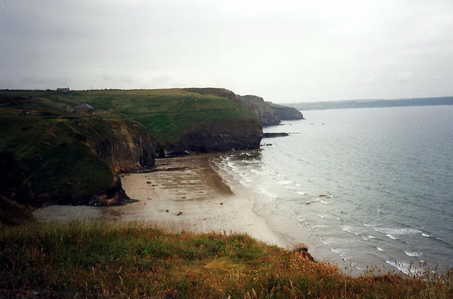
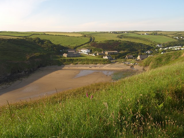
Rickets Head is a prominent headland located on the west coast of Pembrokeshire in Wales. It is known for its rugged cliffs, stunning views, and unique geological formations. The headland juts out into the Celtic Sea, offering panoramic vistas of the surrounding coastline and the open ocean.

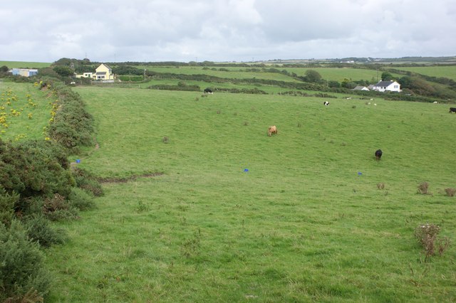
The cliffs of Rickets Head are composed of layers of sedimentary rock, which have been shaped by the relentless forces of erosion over millions of years. The headland is home to a variety of plant and animal species, including seabirds, wildflowers, and marine life.

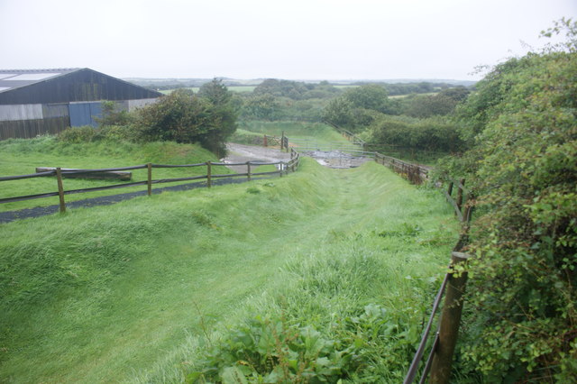
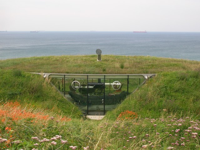
Visitors to Rickets Head can enjoy hiking along the coastal paths, birdwatching, and exploring the tidal pools at low tide. The headland is also a popular spot for fishing, photography, and simply taking in the natural beauty of the Pembrokeshire coast.

Overall, Rickets Head is a must-visit destination for nature lovers, outdoor enthusiasts, and anyone looking to experience the rugged beauty of the Welsh coastline. Its dramatic cliffs, diverse wildlife, and breathtaking views make it a truly special place to explore.

If you have any feedback on the listing, please let us know in the comments section below.

Rickets Head Images

Images are sourced within 2km of 51.82796/-5.1155825 or Grid Reference SM8518. Thanks to Geograph Open Source API. All images are credited.

Flower-decked drystone wall Note the windswept bush!
Flower-decked drystone wall
Note the windswept bush!
Silage bales and storm clouds Silage bales safely wrapped before the summer storm.
Silage bales and storm clouds
Silage bales safely wrapped before the summer storm.
Sewage pumping station and tramway The tramway leads down to the remains of a brickworks. The finished bricks could be transshipped by sea.
Sewage pumping station and tramway
The tramway leads down to the remains of a brickworks. The finished bricks could be transshipped by sea.
Zorbing run at Nolton Stables
Farmland near Little Folly, Nolton Haven Looking east from the stile where the public footpath meets the coast road.
Farmland near Little Folly, Nolton Haven
Looking east from the stile where the public footpath meets the coast road.
Malator House Another view of this earth covered, eco-house, from Druidston Haven beach
Malator House
Another view of this earth covered, eco-house, from Druidston Haven beach
Underground house at Druidston Haven Looking west from the coast road, with tankers moored in St Bride's Bay visible on the horizon.
Underground house at Druidston Haven
Looking west from the coast road, with tankers moored in St Bride's Bay visible on the horizon.
Ordnance Survey Flush Bracket 11522 This can be found on the wall of Saddlers Cottage.
For more detail see : <span class="nowrap"><a title="http://www.bench-marks.org.uk/bm22534" rel="nofollow ugc noopener" href="http://www.bench-marks.org.uk/bm22534">Link</a><img style="margin-left:2px;" alt="External link" title="External link - shift click to open in new window" src="https://s1.geograph.org.uk/img/external.png" width="10" height="10"/></span>
Ordnance Survey Flush Bracket 11522
This can be found on the wall of Saddlers Cottage. For more detail see : LinkExternal link
Path to the Beach The coast path, coming back to the coast from its excursion around the back of the Druidston Hotel, swings down the valley to the beach here at Druidston Haven.
Path to the Beach
The coast path, coming back to the coast from its excursion around the back of the Druidston Hotel, swings down the valley to the beach here at Druidston Haven.
The Beach at Druidston Haven This is not a haven in the sense of a harbour, it's just a sandy beach below a shingle ridge but you could beach a boat here on the tide.
The Beach at Druidston Haven
This is not a haven in the sense of a harbour, it's just a sandy beach below a shingle ridge but you could beach a boat here on the tide.
The Cliffside near Madoc's Haven
The Entrance to Nolton Haven Clear water and a high tide.
The Entrance to Nolton Haven
Clear water and a high tide.
Nolton Haven United Reformed Church Still in use as a church, at the time of photographing, with regular services.
Nolton Haven United Reformed Church
Still in use as a church, at the time of photographing, with regular services.
Nolton Haven An empty beach, a calm blue sea and a warm June afternoon. I want to stop walking now and just lie here all afternoon.
Nolton Haven
An empty beach, a calm blue sea and a warm June afternoon. I want to stop walking now and just lie here all afternoon.
Rickets Head Rickets Head, a prominent promontory north of Nolton Haven.
Rickets Head
Rickets Head, a prominent promontory north of Nolton Haven.
The Coastline at Trefrane Cliff The dark partially vegetated slope in the foreground gives away the fact that this was the location of mining activity. It is the end of the spoil heap from Trefrane Cliff Anthracite Mine.
The Coastline at Trefrane Cliff
The dark partially vegetated slope in the foreground gives away the fact that this was the location of mining activity. It is the end of the spoil heap from Trefrane Cliff Anthracite Mine.
Old Mine Chimney Just the foundations of an engine house are still here under the vegetation in front of the chimney. This used to be the site of the Trefrane Anthracite Mine.
Old Mine Chimney
Just the foundations of an engine house are still here under the vegetation in front of the chimney. This used to be the site of the Trefrane Anthracite Mine.
Druidston Haven Edrych ar draws Traeth Druidston o lwybr yr arfordir.

Looking across Druidston Haven from the coastal path.
Druidston Haven
Edrych ar draws Traeth Druidston o lwybr yr arfordir. Looking across Druidston Haven from the coastal path.
Show me another place!

Rickets Head is located at Grid Ref: SM8518 (Lat: 51.82796, Lng: -5.1155825)

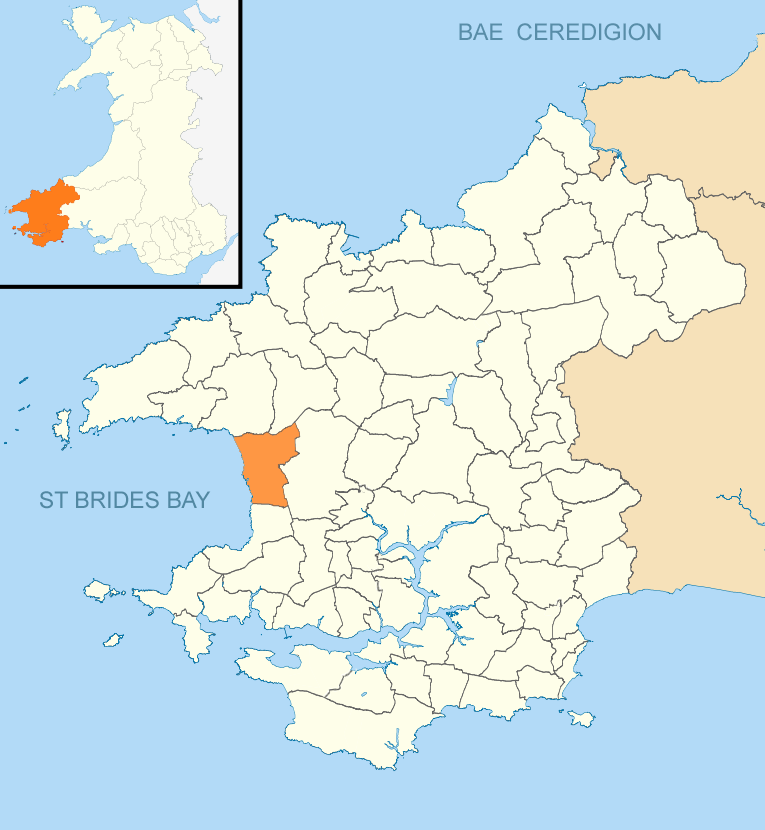
Unitary Authority: Pembrokeshire

Police Authority: Dyfed Powys

What 3 Words

///entry.refreshed.throats. Near Broad Haven, Pembrokeshire

Related Wikis

Nolton Haven

Nolton Haven is a hamlet halfway along the coast of St Bride's Bay in Pembrokeshire, Wales. It is included within the Pembrokeshire Coast National Park...

Nolton and Roch

Nolton and Roch (Welsh: Nolton a'r Garn) is a community in the Hundred of Roose, Pembrokeshire, Wales. The community consists essentially of the villages...

Pembrokeshire Coast National Park

Pembrokeshire Coast National Park (Welsh: Parc Cenedlaethol Arfordir Penfro) is a national park along the Pembrokeshire coast in west Wales. It was established...

Druidston

Druidston is a hamlet within the community of Nolton and Roch on the St Brides Bay coast of Pembrokeshire, Wales. Druidston Cross is an eastern outlier...

Nearby Amenities

Located within 500m of 51.82796,-5.1155825
The data included in this document is from www.openstreetmap.org. The data is made available under ODbL.

Have you been to Rickets Head?

Leave your review of Rickets Head below (or comments, questions and feedback).