Rubha nan Sasan
Coastal Feature, Headland, Point in Ross-shire
Scotland
Rubha nan Sasan
Rubha nan Sasan is a prominent coastal feature located in Ross-shire, Scotland. It is commonly referred to as a headland or point due to its distinctive shape and geographical characteristics. Situated on the western coast of Scotland, Rubha nan Sasan offers breathtaking views of the surrounding landscape and the vast Atlantic Ocean.
The headland is characterized by its steep cliffs, which reach heights of up to 200 meters in some areas. These cliffs are composed of rugged, weathered rocks, creating a dramatic and picturesque scene that attracts visitors from near and far. The headland is also home to a diverse range of flora and fauna, with nesting seabirds such as gannets and fulmars being a common sight.
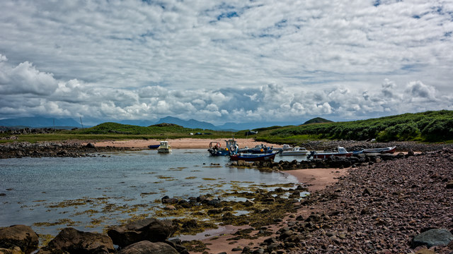
Rubha nan Sasan is a popular spot for outdoor enthusiasts, offering opportunities for hiking, birdwatching, and photography. Several walking trails crisscross the headland, allowing visitors to explore its unique geological formations and enjoy panoramic views of the surrounding coastal scenery. On a clear day, the headland provides a stunning vantage point to observe the waves crashing against the cliffs and the distant islands on the horizon.
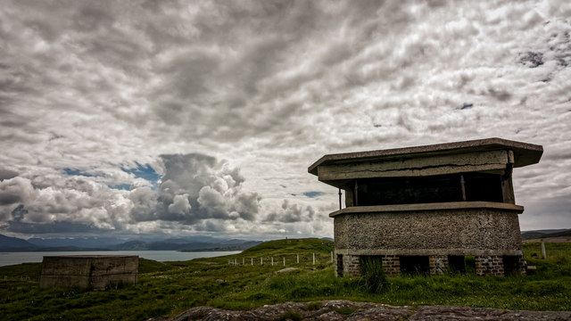
Furthermore, the headland has historical significance, with remnants of ancient settlements and structures still visible in some areas. These archaeological remains offer a glimpse into the lives of early inhabitants and add an additional layer of intrigue to the site.
In summary, Rubha nan Sasan is a captivating and picturesque headland located in Ross-shire, Scotland. Its towering cliffs, diverse wildlife, and historical significance make it a must-visit destination for nature lovers and history enthusiasts alike.
If you have any feedback on the listing, please let us know in the comments section below.
Rubha nan Sasan Images
Images are sourced within 2km of 57.864273/-5.6842953 or Grid Reference NG8192. Thanks to Geograph Open Source API. All images are credited.
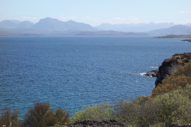
![Sgeir Gorma The coastline at Caolas an Fhuraidh with the reef of Sgeir Gorma in the foreground and the islet of Eilean Furadh Beag further out. Along the horizon are an array of diatant mountains, including [l-r] Arkle, Quinag, Suilven, canisp, Stac Pollaidh, Cul Mor and Ben Mor Coigach.](https://s2.geograph.org.uk/photos/92/70/927022_e6012895.jpg)
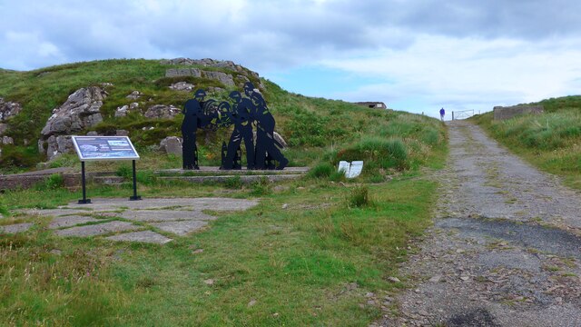
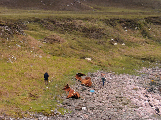
![Shipwreck memorial A memorial to the crew of the USS William H Welch which foundered on nearby rocks in the early hours of Saturday 26th February 1944. The ship was caught in a fierce northerly gale and blizzard, missed the entrance to Loch Ewe and hit rocks on Eilean Furadh Mor [the island seen offshore]. Of a crew of 74, only 12 survived, the lucky ones being swept ashore by huge seas. The memorial also list those who came to help, including local people who walked across open boggy moorland with blankets, hot drinks etc for the survivors.](https://s3.geograph.org.uk/photos/92/72/927215_e5ba4882.jpg)


Rubha nan Sasan is located at Grid Ref: NG8192 (Lat: 57.864273, Lng: -5.6842953)
Unitary Authority: Highland
Police Authority: Highlands and Islands
What 3 Words
///ridge.pitch.workloads. Near Gairloch, Highland
Nearby Locations
Related Wikis

Cove, Highland
Cove is a remote hamlet located on the northwestern shore of the sea loch Loch Ewe, and 8 mi (13 km) northwest of Poolewe in Ross-shire, Scottish Highlands...

Mellon Charles
Mellon Charles (Scottish Gaelic: Meallan Theàrlaich) is a remote crofting village on the north east shore of Loch Ewe near Gairloch in Wester Ross, in...

Ormiscaig
Ormiscaig (Scottish Gaelic: Ormasgaig) is a remote crofting village on the north east shore of Loch Ewe in Achnasheen, Ross-shire, Scottish Highlands and...

Loch Ewe
Loch Ewe (Scottish Gaelic: Loch Iùbh) is a sea loch in the region of Wester Ross in the Northwest Highlands of Scotland. The shores are inhabited by a...
Nearby Amenities
Located within 500m of 57.864273,-5.6842953Have you been to Rubha nan Sasan?
Leave your review of Rubha nan Sasan below (or comments, questions and feedback).