Dùn a' Ghaill

Coastal Feature, Headland, Point in Argyllshire

Scotland

Dùn a' Ghaill

Eilean Dubh Beag & Eilean Dubh Mòr from Easdale Taken from atop Easdale's hill the two Eilean Dubh islands rather merge with the smaller Eilean Dubh Beag in front of its bigger brother.
Eilean Dubh Beag & Eilean Dubh Mòr from Easdale Credit: Rob Farrow

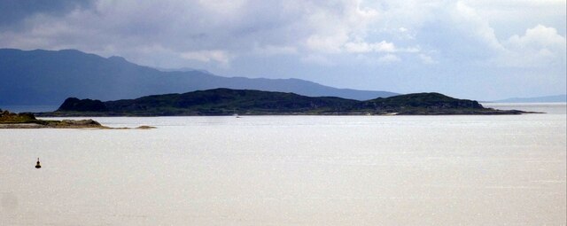
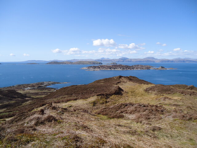
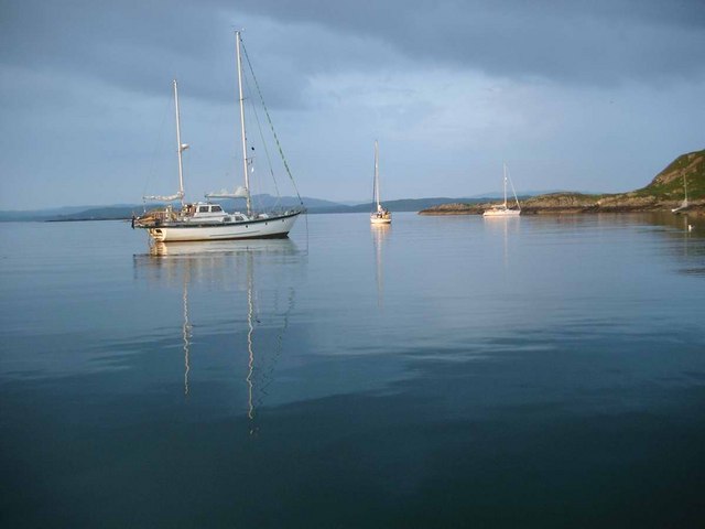
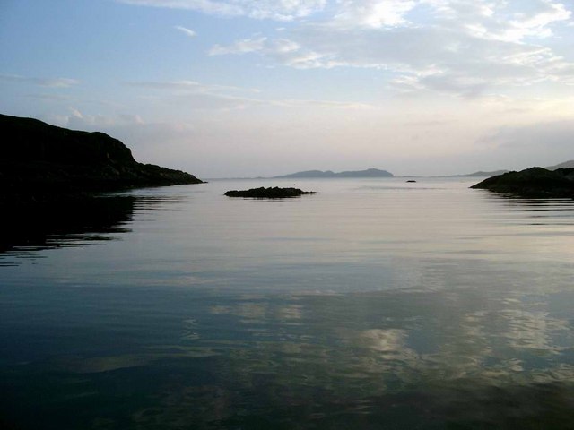
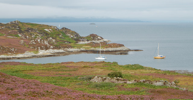
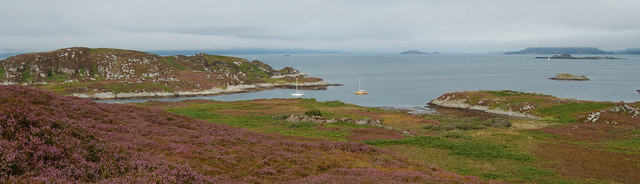
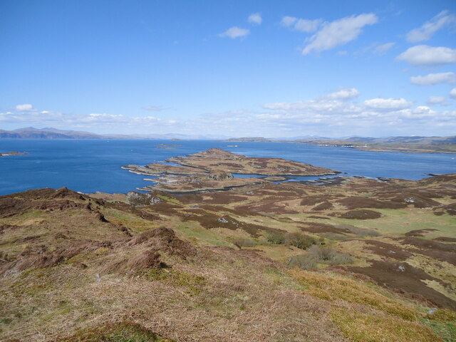
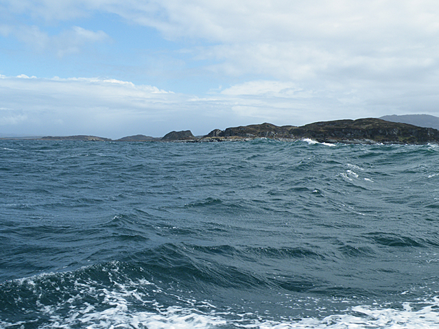
Dùn a' Ghaill is a prominent coastal feature located in Argyllshire, Scotland. It is an impressive headland that juts out into the Atlantic Ocean, offering breathtaking views of the surrounding landscape. Situated on the western coast of Scotland, this point is known for its rugged beauty and historical significance.

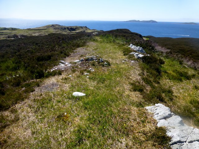
The name "Dùn a' Ghaill" translates to "Fort of the Stranger" in Gaelic, hinting at its rich history. The headland is home to the ruins of an ancient fort, which dates back to the Iron Age. This fort was strategically positioned to provide a vantage point for observing and defending against potential threats from the sea.

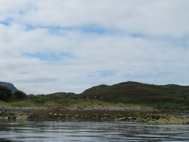
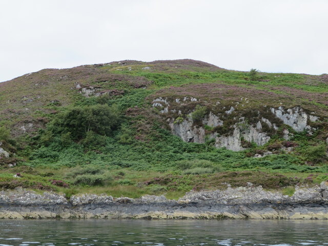
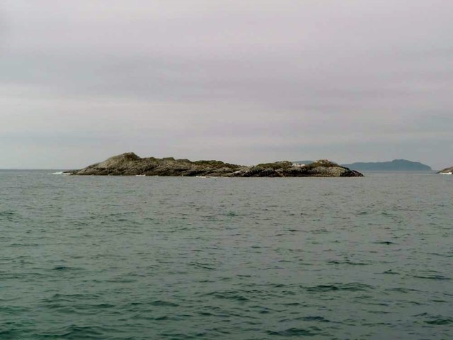
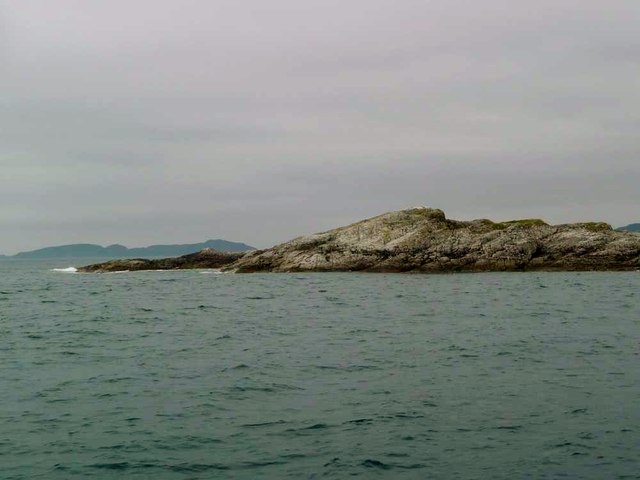
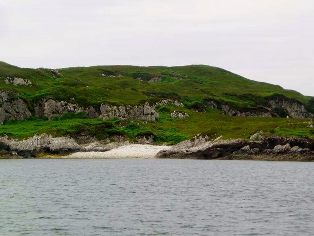
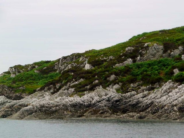
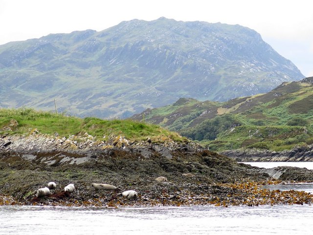
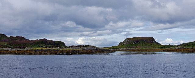
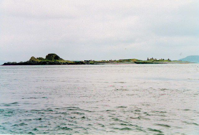
The headland itself is composed of rugged cliffs, rising up to approximately 100 meters in height. These cliffs are interspersed with grassy slopes and rocky outcrops, creating a diverse and visually stunning landscape. The area is also abundant in wildlife, with various seabirds nesting on the cliffs, including puffins, guillemots, and razorbills.

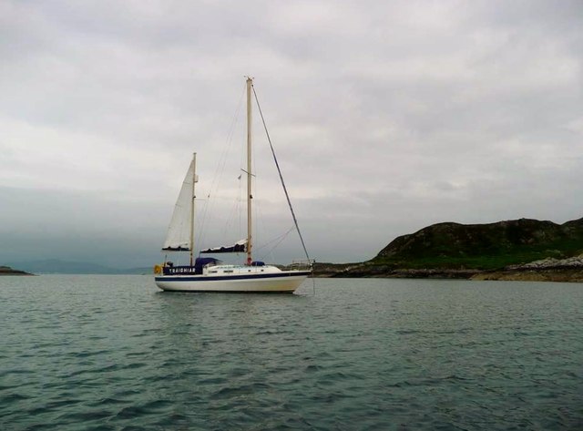
From Dùn a' Ghaill, visitors can enjoy panoramic views of the Atlantic Ocean, the surrounding coastline, and the neighboring islands. On clear days, the distant peaks of the Inner Hebrides can be seen in the horizon, adding to the allure of the site.

Access to Dùn a' Ghaill is relatively easy, with a well-maintained path leading to the headland. The site is popular among hikers, nature enthusiasts, and history buffs, who are drawn to its natural beauty and historical significance.

If you have any feedback on the listing, please let us know in the comments section below.

Dùn a' Ghaill Images

Images are sourced within 2km of 56.233101/-5.7118919 or Grid Reference NM7010. Thanks to Geograph Open Source API. All images are credited.

Eilean Dubh Beag & Eilean Dubh Mòr from Easdale Taken from atop Easdale's hill the two Eilean Dubh islands rather merge with the smaller Eilean Dubh Beag in front of its bigger brother.
Eilean Dubh Beag & Eilean Dubh Mòr from Easdale
Taken from atop Easdale's hill the two Eilean Dubh islands rather merge with the smaller Eilean Dubh Beag in front of its bigger brother.
Eilean Dubh Mor and Garbh Eileach from Lunga Garbh Eileach is the largest of the Garvellachs, which stretch away to the left in the Firth of Lorn. The Isle of Mull is in the distance, with Ben More (a favourite 'Final Munro') almost in the exact centre.
Eilean Dubh Mor and Garbh Eileach from Lunga
Garbh Eileach is the largest of the Garvellachs, which stretch away to the left in the Firth of Lorn. The Isle of Mull is in the distance, with Ben More (a favourite 'Final Munro') almost in the exact centre.
The anchorage, Black Isles This anchorage lies tucked in between Eilean Dubh Mor (Big Black Isle) and Eilean Dubh Beag (Wee Black Isle).  It's only really tenable for an overnight stay in settled weather (which we had).
The anchorage, Black Isles
This anchorage lies tucked in between Eilean Dubh Mor (Big Black Isle) and Eilean Dubh Beag (Wee Black Isle). It's only really tenable for an overnight stay in settled weather (which we had).
The anchorage, Black Isles Eilean Dubh Mor to port, Eilean Dubh Beag to starboard.  Fishing boats are reputed to use the channel to the right of the skerry ahead, so an anchor light is recommended if overnighting in this delightful anchorage.
The anchorage, Black Isles
Eilean Dubh Mor to port, Eilean Dubh Beag to starboard. Fishing boats are reputed to use the channel to the right of the skerry ahead, so an anchor light is recommended if overnighting in this delightful anchorage.
The Anchorage, Eilean Dubh Mor/Beag Looking from Eilean Dubh Mor across the anchorage to Eilean Dubh Beag.  The bay looks deceptively small when entered from the north, and its size is only really appreciated from the islands.  The holding is good (sand), and we anchored there for two nights in a westerly F5, with a bit of six.  Although open to the sea in the west, there was very little swell, the reef between the islands sufficiently breaking up the waves.

There are two caves on Eilean Dubh Mor.  We found one of them, a "room and kitchen" with comfortable well sheltered sleeping accommodation.
The Anchorage, Eilean Dubh Mor/Beag
Looking from Eilean Dubh Mor across the anchorage to Eilean Dubh Beag. The bay looks deceptively small when entered from the north, and its size is only really appreciated from the islands. The holding is good (sand), and we anchored there for two nights in a westerly F5, with a bit of six. Although open to the sea in the west, there was very little swell, the reef between the islands sufficiently breaking up the waves. There are two caves on Eilean Dubh Mor. We found one of them, a "room and kitchen" with comfortable well sheltered sleeping accommodation.
The Anchorage, Eilean Dubh Mòr/Beag Although it has the reputation for being an "occasional" anchorage, it is regularly used overnight, very often by boats waiting for a favourable tide for the Sound of Luing, or the Corryvreckan.  It is well sheltered from, clockwise, the SE to NW.  We found the holding to be good.
The Anchorage, Eilean Dubh Mòr/Beag
Although it has the reputation for being an "occasional" anchorage, it is regularly used overnight, very often by boats waiting for a favourable tide for the Sound of Luing, or the Corryvreckan. It is well sheltered from, clockwise, the SE to NW. We found the holding to be good.
Seals on Eilean nan Ceann Both Atlantic Grey seals and Common seals were hauled out.
Seals on Eilean nan Ceann
Both Atlantic Grey seals and Common seals were hauled out.
Barr Sligeig, on Lunga At 49 m, one of the higher points of Lunga; Bidein na h-Iolaire, at 100 m, is the highest. The rock would appear to be relatively soft - note the undercut at what would be the high tide mark?
Barr Sligeig, on Lunga
At 49 m, one of the higher points of Lunga; Bidein na h-Iolaire, at 100 m, is the highest. The rock would appear to be relatively soft - note the undercut at what would be the high tide mark?
Looking north from Lunga island summit In the foreground are two separate, but tidal islands, Eilean Iosal and Rubha Fiola. Further away can be seen Inch Island in the Firth of Lorn, and Seil to its right.
Looking north from Lunga island summit
In the foreground are two separate, but tidal islands, Eilean Iosal and Rubha Fiola. Further away can be seen Inch Island in the Firth of Lorn, and Seil to its right.
Liath Sgeir A skerry lying off the Black Isles.
Liath Sgeir
A skerry lying off the Black Isles.
Liath Sgeir A skerry lying off the Black Isles.
Liath Sgeir
A skerry lying off the Black Isles.
Little beach on Eilean Dubh Beag "Wee Black Isle" and one of "The Black Isles";  the other is Eilean Dubh Mor - "Big Black Isle".
Little beach on Eilean Dubh Beag
"Wee Black Isle" and one of "The Black Isles"; the other is Eilean Dubh Mor - "Big Black Isle".
Rock formations on Eilean Dubh Beag "Wee Black Isle" and one of "The Black Isles"; the other is Eilean Dubh Mor - "Big Black Isle".  Note the post in the centre - purpose unknown.
Rock formations on Eilean Dubh Beag
"Wee Black Isle" and one of "The Black Isles"; the other is Eilean Dubh Mor - "Big Black Isle". Note the post in the centre - purpose unknown.
Ketch Traigh Iar at anchor in the Black Isles The gap between the two islands makes a good anchorage in settled conditions and is named Port Ailean.
Ketch Traigh Iar at anchor in the Black Isles
The gap between the two islands makes a good anchorage in settled conditions and is named Port Ailean.
Eilean Dubh Beag The Gaelic name translates as Little Dark Island, which seems to fit the bill quite well. The more distant higher land is on the Isle of Scarba.
Eilean Dubh Beag
The Gaelic name translates as Little Dark Island, which seems to fit the bill quite well. The more distant higher land is on the Isle of Scarba.
Eilean Dubh Mòr Dropped off by Farsain Cruises from Craobh Haven, then Eilean Dubh Mòr before Dun a'Ghaill on a sunny day.
Name: Eilean Dubh Mòr
Hill number: 11529
Height: 54m / 177ft
Parent (Ma/M): none
Section: 20A: Jura, Scarba and Colonsay
County/UA: Argyll and Bute (UA)
Maritime Area: Scarba, Slate Islands & Firth of Lorn
Class: Tump (0-99m), SIB
Grid ref: NM695104 (est)
Drop: 54m
Col: Sea
Eilean Dubh Mòr
Dropped off by Farsain Cruises from Craobh Haven, then Eilean Dubh Mòr before Dun a'Ghaill on a sunny day. Name: Eilean Dubh Mòr Hill number: 11529 Height: 54m / 177ft Parent (Ma/M): none Section: 20A: Jura, Scarba and Colonsay County/UA: Argyll and Bute (UA) Maritime Area: Scarba, Slate Islands & Firth of Lorn Class: Tump (0-99m), SIB Grid ref: NM695104 (est) Drop: 54m Col: Sea
Seals on Eilean nan Ceann and Lunga Eilean nan Ceann is a small rocky island situated in the sound of Luing a short distance east from the east end of 'Caolas na Bratham'. The island is in the parish of Jura and its name signifies, 'Island of the heads'.
<span class="nowrap"><a title="http://scotlandsplaces.gov.uk/digital-volumes/ordnance-survey-name-books/argyll-os-name-books-1868-1878/argyll-volume-66?display=transcription" rel="nofollow ugc noopener" href="http://scotlandsplaces.gov.uk/digital-volumes/ordnance-survey-name-books/argyll-os-name-books-1868-1878/argyll-volume-66?display=transcription">Link</a><img style="margin-left:2px;" alt="External link" title="External link - shift click to open in new window" src="https://s1.geograph.org.uk/img/external.png" width="10" height="10"/></span>
Seals on Eilean nan Ceann and Lunga
Eilean nan Ceann is a small rocky island situated in the sound of Luing a short distance east from the east end of 'Caolas na Bratham'. The island is in the parish of Jura and its name signifies, 'Island of the heads'. LinkExternal link
North end of Lunga Looking west from the Sound of Luing through the narrow strait between Lunga (left) and Fiola Meadhonach (extreme right), to Fiola an Droma (centre right).
North end of Lunga
Looking west from the Sound of Luing through the narrow strait between Lunga (left) and Fiola Meadhonach (extreme right), to Fiola an Droma (centre right).
Show me another place!

Dùn a' Ghaill is located at Grid Ref: NM7010 (Lat: 56.233101, Lng: -5.7118919)

Unitary Authority: Argyll and Bute

Police Authority: Argyll and West Dunbartonshire

What 3 Words

///turntable.stress.dabbling. Near Lochbuie, Argyll & Bute

Related Wikis

Eilean Dubh Mòr

Eilean Dubh Mòr (Scottish Gaelic: big black island) is an uninhabited island in the Inner Hebrides of Scotland. It lies at the mouth of the Firth of Lorn...

Lunga, Firth of Lorn

Lunga is one of the Slate Islands in the Firth of Lorn in Argyll and Bute, Scotland. The "Grey Dog" tidal race, which runs in the sea channel to the south...

Scarba, Lunga and the Garvellachs National Scenic Area

Scarba, Lunga and the Garvellachs is the name of one of the 40 national scenic areas of Scotland. The designated area covers the islands of Scarba, Lunga...

Belnahua

Belnahua is one of the Slate Islands, in the Firth of Lorn in Scotland, known for its deserted slate quarries. The bedrock that underpins its human history...

Have you been to Dùn a' Ghaill?

Leave your review of Dùn a' Ghaill below (or comments, questions and feedback).