Gallowsgreen

Settlement in Monmouthshire

Wales

Gallowsgreen

NCN492 in Pen-y-lan Woods, using old railway line
NCN492 in Pen-y-lan Woods, using old railway line Credit: David Smith

Gallowsgreen is a small village located in Monmouthshire, Wales. It is situated near the town of Abergavenny and is known for its picturesque countryside and charming rural setting. The village is surrounded by rolling hills and lush green fields, making it an ideal destination for those seeking a peaceful and tranquil retreat.

Gallowsgreen is home to a close-knit community of residents who take pride in their village and its history. The village has a few amenities, including a local pub and a small convenience store, providing residents with the essentials they need without having to travel far.

The surrounding area offers plenty of opportunities for outdoor activities such as hiking, cycling, and fishing, making it a popular destination for nature lovers and outdoor enthusiasts. The village is also well-connected to nearby towns and cities, making it easy for residents to access additional amenities and services.

Overall, Gallowsgreen is a charming village with a strong sense of community and a beautiful natural setting, making it a desirable place to live or visit for those seeking a peaceful and idyllic retreat in the Welsh countryside.

If you have any feedback on the listing, please let us know in the comments section below.
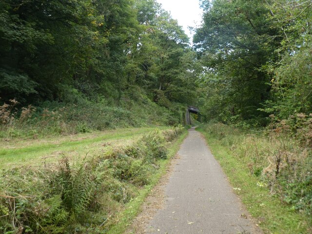
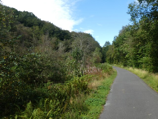
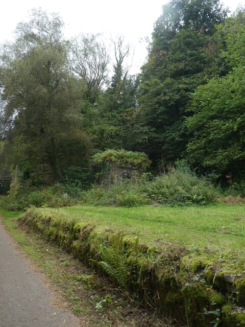
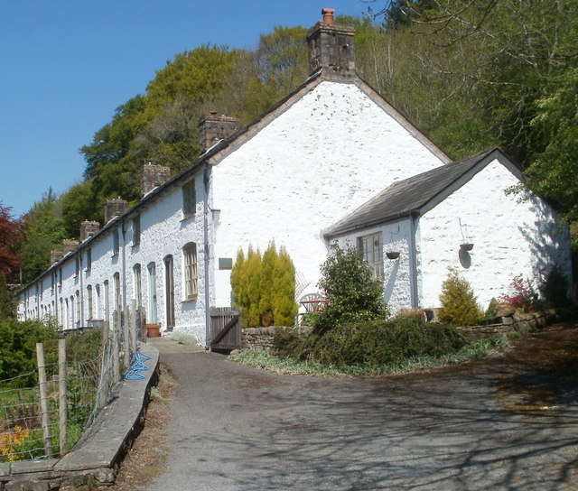
Gallowsgreen Images

Images are sourced within 2km of 51.755232/-3.061048 or Grid Reference SO2606. Thanks to Geograph Open Source API. All images are credited.

NCN492 in Pen-y-lan Woods, using old railway line
Bridge over NCN492 The National Cycle Network is a network of cycle routes. It was created by the charity Sustrans <span class="nowrap"><a title="http://www.sustrans.org.uk/what-we-do/national-cycle-network" rel="nofollow ugc noopener" href="http://www.sustrans.org.uk/what-we-do/national-cycle-network">Link</a><img style="margin-left:2px;" alt="External link" title="External link - shift click to open in new window" src="https://s1.geograph.org.uk/img/external.png" width="10" height="10"/></span>  (Sustainable Transport), aided by a National Lottery grant.

Many routes aim to minimise contact with motor traffic, though 70% of them are on roads. In some cases the NCN uses pedestrian routes, disused railways, minor roads, canal towpaths, or traffic-calmed routes in towns and cities.
Bridge over NCN492
The National Cycle Network is a network of cycle routes. It was created by the charity Sustrans LinkExternal link (Sustainable Transport), aided by a National Lottery grant. Many routes aim to minimise contact with motor traffic, though 70% of them are on roads. In some cases the NCN uses pedestrian routes, disused railways, minor roads, canal towpaths, or traffic-calmed routes in towns and cities.
NCN492 passing former Varteg railway station The National Cycle Network is a network of cycle routes. It was created by the charity Sustrans <span class="nowrap"><a title="http://www.sustrans.org.uk/what-we-do/national-cycle-network" rel="nofollow ugc noopener" href="http://www.sustrans.org.uk/what-we-do/national-cycle-network">Link</a><img style="margin-left:2px;" alt="External link" title="External link - shift click to open in new window" src="https://s1.geograph.org.uk/img/external.png" width="10" height="10"/></span>  (Sustainable Transport), aided by a National Lottery grant.

Many routes aim to minimise contact with motor traffic, though 70% of them are on roads. In some cases the NCN uses pedestrian routes, disused railways, minor roads, canal towpaths, or traffic-calmed routes in towns and cities.
NCN492 passing former Varteg railway station
The National Cycle Network is a network of cycle routes. It was created by the charity Sustrans LinkExternal link (Sustainable Transport), aided by a National Lottery grant. Many routes aim to minimise contact with motor traffic, though 70% of them are on roads. In some cases the NCN uses pedestrian routes, disused railways, minor roads, canal towpaths, or traffic-calmed routes in towns and cities.
NCN492 in woodland near Gallowsgreen The National Cycle Network is a network of cycle routes. It was created by the charity Sustrans <span class="nowrap"><a title="http://www.sustrans.org.uk/what-we-do/national-cycle-network" rel="nofollow ugc noopener" href="http://www.sustrans.org.uk/what-we-do/national-cycle-network">Link</a><img style="margin-left:2px;" alt="External link" title="External link - shift click to open in new window" src="https://s1.geograph.org.uk/img/external.png" width="10" height="10"/></span>  (Sustainable Transport), aided by a National Lottery grant.

Many routes aim to minimise contact with motor traffic, though 70% of them are on roads. In some cases the NCN uses pedestrian routes, disused railways, minor roads, canal towpaths, or traffic-calmed routes in towns and cities.
NCN492 in woodland near Gallowsgreen
The National Cycle Network is a network of cycle routes. It was created by the charity Sustrans LinkExternal link (Sustainable Transport), aided by a National Lottery grant. Many routes aim to minimise contact with motor traffic, though 70% of them are on roads. In some cases the NCN uses pedestrian routes, disused railways, minor roads, canal towpaths, or traffic-calmed routes in towns and cities.
Overgrown railway platform and building, former Varteg station
Bridge over NCN492 with retaining wall The National Cycle Network is a network of cycle routes. It was created by the charity Sustrans <span class="nowrap"><a title="http://www.sustrans.org.uk/what-we-do/national-cycle-network" rel="nofollow ugc noopener" href="http://www.sustrans.org.uk/what-we-do/national-cycle-network">Link</a><img style="margin-left:2px;" alt="External link" title="External link - shift click to open in new window" src="https://s1.geograph.org.uk/img/external.png" width="10" height="10"/></span>  (Sustainable Transport), aided by a National Lottery grant.

Many routes aim to minimise contact with motor traffic, though 70% of them are on roads. In some cases the NCN uses pedestrian routes, disused railways, minor roads, canal towpaths, or traffic-calmed routes in towns and cities.
Bridge over NCN492 with retaining wall
The National Cycle Network is a network of cycle routes. It was created by the charity Sustrans LinkExternal link (Sustainable Transport), aided by a National Lottery grant. Many routes aim to minimise contact with motor traffic, though 70% of them are on roads. In some cases the NCN uses pedestrian routes, disused railways, minor roads, canal towpaths, or traffic-calmed routes in towns and cities.
Subway under Afon Lwyd Trail, NCR 492 Eastern side of tunnel under the former LNWR branch line; the public footpath appears to be little used.
Subway under Afon Lwyd Trail, NCR 492
Eastern side of tunnel under the former LNWR branch line; the public footpath appears to be little used.
Snail Creep Bridge over cycle track The bridge carries a bridleway over NCR 492, the former LNWR branch line. The bridleway <a href="https://www.geograph.org.uk/photo/7108355">SO2606 : Bridleway up to Snail Creep Bridge</a> can be reached via a metal stile at the cycle route information board.
Snail Creep Bridge over cycle track
The bridge carries a bridleway over NCR 492, the former LNWR branch line. The bridleway SO2606 : Bridleway up to Snail Creep Bridge can be reached via a metal stile at the cycle route information board.
Bridleway up to Snail Creep Bridge Walled path to bridge <a href="https://www.geograph.org.uk/photo/7108343">SO2606 : Snail Creep Bridge over cycle track</a> over former railway, NCR 492, and then access down to former Varteg Station just north of bridge.
Bridleway up to Snail Creep Bridge
Walled path to bridge SO2606 : Snail Creep Bridge over cycle track over former railway, NCR 492, and then access down to former Varteg Station just north of bridge.
Afon Lwyd Trail at Varteg Railway Station To the left of the cycle track, NCR 492, is the overgrown platform of the defunct station, viewed from Snail Creep Bridge.
Afon Lwyd Trail at Varteg Railway Station
To the left of the cycle track, NCR 492, is the overgrown platform of the defunct station, viewed from Snail Creep Bridge.
Shop Road Bridge over Afon Lwyd Trail Metal road bridge over former LNWR branch line, now cycle track, NCR 492.
Shop Road Bridge over Afon Lwyd Trail
Metal road bridge over former LNWR branch line, now cycle track, NCR 492.
Stiles between cycle route and Shop Road The bilingual sign give distances to Blaenavon and to Pontypool via NCR 492 on the former railway line. In the distance an abutment of the demolished bridge of the Varteg Incline tramway is just visible.
Stiles between cycle route and Shop Road
The bilingual sign give distances to Blaenavon and to Pontypool via NCR 492 on the former railway line. In the distance an abutment of the demolished bridge of the Varteg Incline tramway is just visible.
Remains of Varteg Railway Station The overgrown platform and derelict building <a href="https://www.geograph.org.uk/photo/7108955">SO2606 : Derelict building, former Varteg Railway Station</a> are on the right of the former LNWR trackbed, now part of the Afon Lwyd Trail, NCR 492. Viewed from Shop Road Bridge.
Remains of Varteg Railway Station
The overgrown platform and derelict building SO2606 : Derelict building, former Varteg Railway Station are on the right of the former LNWR trackbed, now part of the Afon Lwyd Trail, NCR 492. Viewed from Shop Road Bridge.
Shop Road Bridge Looking at roadway, in poor condition on bridge over former LNWR trackbed <a href="https://www.geograph.org.uk/photo/7108625">SO2606 : Shop Road Bridge over Afon Lwyd Trail</a>, in direction of Cwmavon.
Shop Road Bridge
Looking at roadway, in poor condition on bridge over former LNWR trackbed SO2606 : Shop Road Bridge over Afon Lwyd Trail, in direction of Cwmavon.
Derelict building, former Varteg Railway Station Sole remaining building at derelict LNWR station on former branch line.
Derelict building, former Varteg Railway Station
Sole remaining building at derelict LNWR station on former branch line.
Cwmavon House & Forge Row Cwmavon House (top left) is a late Georgian house built for the ironmaster of Varteg Forge. Forge Row of six grade II* listed cottages, originally twelve built in the early 1800s for ironworkers, is the finest surviving in situ terrace of industrial housing in South Wales. Viewed from NCR 492.
Cwmavon House & Forge Row
Cwmavon House (top left) is a late Georgian house built for the ironmaster of Varteg Forge. Forge Row of six grade II* listed cottages, originally twelve built in the early 1800s for ironworkers, is the finest surviving in situ terrace of industrial housing in South Wales. Viewed from NCR 492.
Footpath crossing the Afon Lwyd Trail, NCR 492 The former LNWR trackbed and its verges are part of the linear Cwmavon Local Nature Reserve.
Footpath crossing the Afon Lwyd Trail, NCR 492
The former LNWR trackbed and its verges are part of the linear Cwmavon Local Nature Reserve.
Byway crossing the Afon Lwyd Trail The former LNWR trackbed and its verges are part of the Cwmavon Local Nature Reserve.
Byway crossing the Afon Lwyd Trail
The former LNWR trackbed and its verges are part of the Cwmavon Local Nature Reserve.
Show me another place!

Gallowsgreen is located at Grid Ref: SO2606 (Lat: 51.755232, Lng: -3.061048)

Unitary Authority: Torfaen

Police Authority: Gwent

What 3 Words

///requiring.supported.arranger. Near Blaenavon, Torfaen

Nearby Locations

Gallowsgreen Cwm Afon

Related Wikis

Cwmavon, Torfaen

Cwmavon (Welsh spelling: Cwmafon; translation: "river valley") is a hamlet about 2 miles south of Blaenavon and 4 miles north of Pontypool. The hamlet...

Varteg

Varteg is a village in the county borough of Torfaen in Wales. == Location == It lies near Abersychan on the hills above the valley of the Afon Llwyd,...

Varteg railway station

Varteg railway station was a railway station which served the village of Varteg, in the county of Monmouthshire, on the Brynmawr and Blaenavon Railway...

Dog Stone, Mynydd Varteg

The Dog Stone (or Pillar Stone), on Mynydd Farteg, a subsidiary top of Coity Mountain, near the village of Abersychan, Torfaen, Wales, is a memorial, dating...

Nearby Amenities

Located within 500m of 51.755232,-3.061048
Gallowsgreen
Place: village
Lat/Long: 51.7555191/-3.0618141
Power: pole
Lat/Long: 51.7521073/-3.0611797
Power: pole
Lat/Long: 51.7521421/-3.0622244
Power: pole
Lat/Long: 51.7521812/-3.0629204
Power: pole
Lat/Long: 51.7522301/-3.0643742
Power: pole
Lat/Long: 51.75183/-3.0652593
Power: portal
Lat/Long: 51.7547523/-3.0676411
Power: portal
Lat/Long: 51.7557527/-3.0673152
Power: portal
Lat/Long: 51.7565413/-3.0667707
The data included in this document is from www.openstreetmap.org. The data is made available under ODbL.

Have you been to Gallowsgreen?

Leave your review of Gallowsgreen below (or comments, questions and feedback).