Rubha Mhic Neill

Coastal Feature, Headland, Point in Argyllshire

Scotland

Rubha Mhic Neill

Road junction near Newton of Ardtoe
Road junction near Newton of Ardtoe Credit: Steven Brown

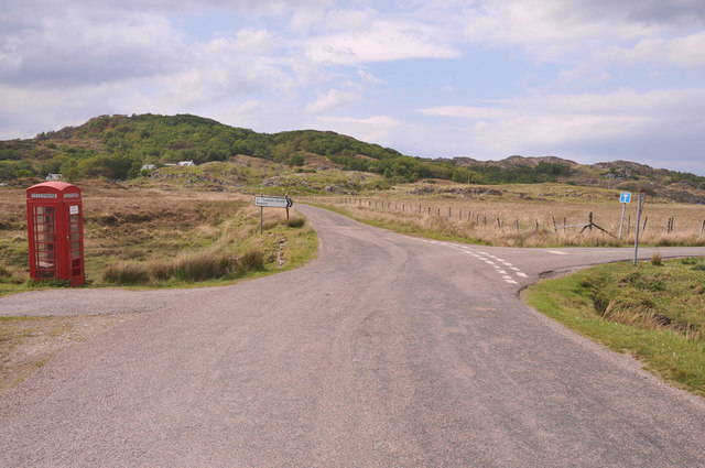
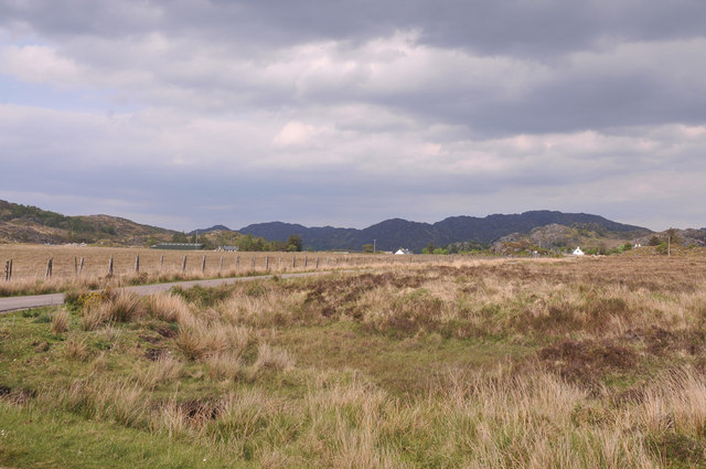
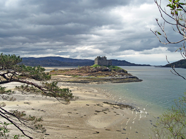
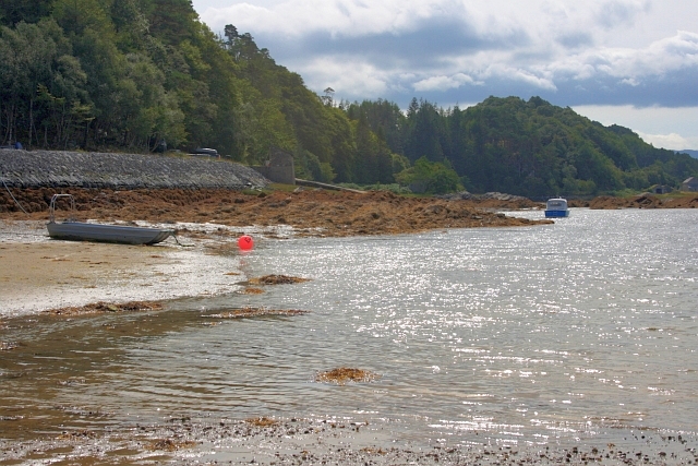
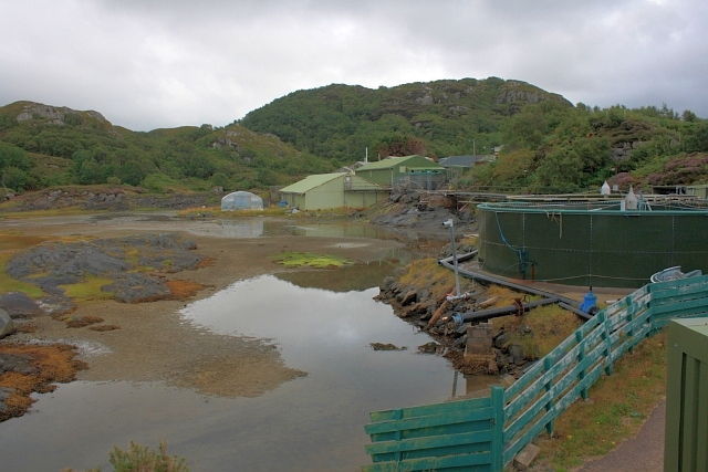
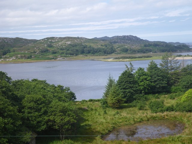
Rubha Mhic Neill is a prominent headland located in Argyllshire, Scotland. Situated on the western coast, this coastal feature extends into the Atlantic Ocean, offering panoramic views of the surrounding area. With its rugged cliffs, rocky outcrops, and picturesque landscape, Rubha Mhic Neill is a popular spot for nature enthusiasts and photographers.

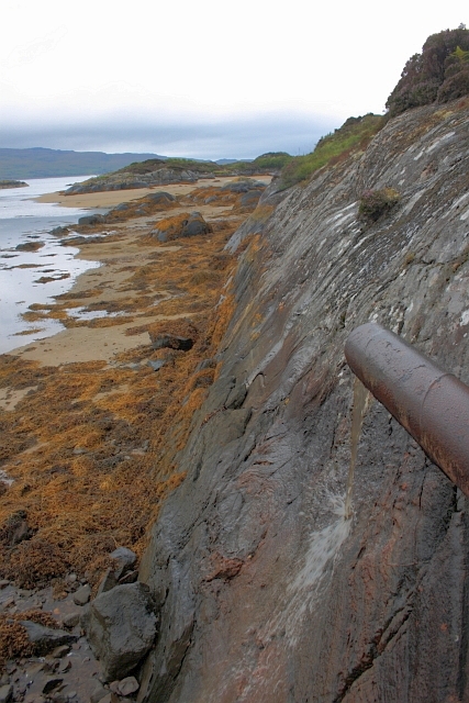
The headland is characterized by its distinctive shape, jutting out into the sea and providing a natural barrier against the crashing waves. The cliffs that line the coast are composed of ancient rock formations, showcasing layers of sediment and revealing the area's geological history.

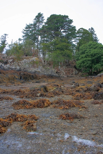
The vegetation on Rubha Mhic Neill is diverse, with hardy plants and grasses clinging to the rocky terrain. Seabirds such as gulls and cormorants can be seen nesting on the cliffs, while seals and dolphins occasionally swim near the shore.

In addition to its natural beauty, Rubha Mhic Neill is steeped in history. The headland is home to the ruins of an ancient fort, believed to have been occupied during the Iron Age. These remnants serve as a reminder of the area's rich cultural heritage and provide a glimpse into the lives of the people who once inhabited this rugged coastline.

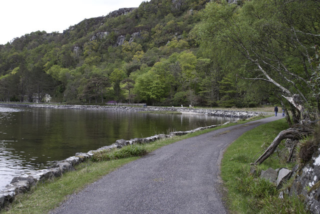
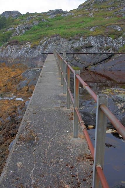
Accessible by foot, Rubha Mhic Neill offers a tranquil escape from the bustling city life. Walking along the coastal path, visitors can immerse themselves in the stunning scenery and enjoy the peacefulness of the surrounding environment. Whether it's for a leisurely stroll, birdwatching, or simply to take in the breathtaking views, Rubha Mhic Neill is a must-visit destination for those exploring the Argyllshire coastline.

If you have any feedback on the listing, please let us know in the comments section below.

Rubha Mhic Neill Images

Images are sourced within 2km of 56.777631/-5.8543746 or Grid Reference NM6471. Thanks to Geograph Open Source API. All images are credited.

Road junction near Newton of Ardtoe
Across Kentra Moss to Newton of Ardtoe
Castle Tioram This most exposed corner which was in danger of collapse has now been saved by the owner being granted permission at long last to restore the castle to its former habitable state.
Castle Tioram
This most exposed corner which was in danger of collapse has now been saved by the owner being granted permission at long last to restore the castle to its former habitable state.
Castle Tioram
Castle Tioram
Castle Tioram from the Silver Walk At low water the beach between the island and the headland is exposed.
Castle Tioram from the Silver Walk
At low water the beach between the island and the headland is exposed.
Road by the Loch Side
Castle Tioram - High Tide
Castle Tioram - 1987 Or Castle Tiorlair on the largest scale OS maps. A view from just south of the causeway that connects the castle with the mainland when the tide is out. Behind is Eilean Shona.
Castle Tioram - 1987
Or Castle Tiorlair on the largest scale OS maps. A view from just south of the causeway that connects the castle with the mainland when the tide is out. Behind is Eilean Shona.
Eilean Shona and Castle Tioram A view northwest from near the causeway that allows access to the castle at low tide.
Eilean Shona and Castle Tioram
A view northwest from near the causeway that allows access to the castle at low tide.
Shoreline near Eilean Shona House At low tide.
Shoreline near Eilean Shona House
At low tide.
Oyster Cages I think these are disused cages used for cultivating oysters. Near Eilean Shona House.
Oyster Cages
I think these are disused cages used for cultivating oysters. Near Eilean Shona House.
Shoreline below Cnoc a'Chrochaidh
Caisteal Tioram From Riska Island The Dry Castle. Due to the fact that it can be reached by a sandy strand. not quite an island.

The castle was first recorded in 1373 and was intentionally burnt down in 1715 by Alan, the 14th chief, who was off to join the Jacobite Rebellion and had a premonition of his own death.
Caisteal Tioram From Riska Island
The Dry Castle. Due to the fact that it can be reached by a sandy strand. not quite an island. The castle was first recorded in 1373 and was intentionally burnt down in 1715 by Alan, the 14th chief, who was off to join the Jacobite Rebellion and had a premonition of his own death.
Remains of Small Building at Caisteal Tioram Containing human excrement. Not a nice sight for the many tourists exploring the castle.
Remains of Small Building at Caisteal Tioram
Containing human excrement. Not a nice sight for the many tourists exploring the castle.
Fish Pond Originally used to conduct research into fish farming.
Fish Pond
Originally used to conduct research into fish farming.
Discharge Pipe Possibly to divert fresh water away from the nearby fish pond where research into fish farming was carried out.
Discharge Pipe
Possibly to divert fresh water away from the nearby fish pond where research into fish farming was carried out.
Dam Wall Constructed to provide a fish pond in which research into fish farming was conducted.
Dam Wall
Constructed to provide a fish pond in which research into fish farming was conducted.
Pond in the clearing of a mixed woodland The larger body of water in the background is the River Shiel.
Pond in the clearing of a mixed woodland
The larger body of water in the background is the River Shiel.
Show me another place!

Rubha Mhic Neill is located at Grid Ref: NM6471 (Lat: 56.777631, Lng: -5.8543746)

Unitary Authority: Highland

Police Authority: Highlands and Islands

What 3 Words

///undertook.underline.unroll. Near Arisaig, Highland

Related Wikis

Newton of Ardtoe

Newton of Ardtoe is a scattered crofting hamlet near Acharacle in Lochaber, Scottish Highlands and is in the council area of Highland.
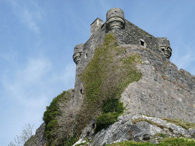
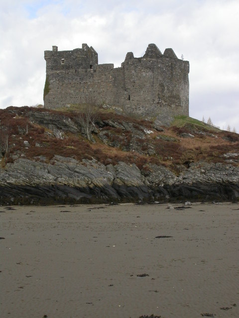
Castle Tioram

Castle Tioram (; Scottish Gaelic: Caisteal Tioram, meaning "dry castle") is a ruined castle that sits on the tidal island Eilean Tioram in Loch Moidart...

Ardtoe

Ardtoe (Scottish Gaelic: Àird Tobha) is a place on the coast of Ardnamurchan, Lochaber, in the Highland council area of Scotland. It has sandy beaches...

Eilean Shona

Eilean Shona (Scottish Gaelic: Eilean Seòna) is a tidal island in Loch Moidart, Scotland. The modern name may be from the Old Norse for "sea island". The...

Nearby Amenities

Located within 500m of 56.777631,-5.8543746
Source: PGS
Lat/Long: 56.7799284/-5.8491146
Source: PGS
Lat/Long: 56.7799133/-5.849626
Source: PGS
Lat/Long: 56.7797736/-5.8497309
Source: PGS
Lat/Long: 56.7797084/-5.8497552
Source: PGS
Lat/Long: 56.7796442/-5.8497617
Source: PGS
Lat/Long: 56.7793682/-5.8497057
Source: PGS
Lat/Long: 56.7789558/-5.8496746
Source: PGS
Lat/Long: 56.7786468/-5.849569
Source: PGS
Lat/Long: 56.7785323/-5.8495835
Source: PGS
Lat/Long: 56.7785922/-5.8495675
Source: PGS
Lat/Long: 56.7786095/-5.8500528
Source: PGS
Lat/Long: 56.7787534/-5.8502302
Source: PGS
Lat/Long: 56.7789408/-5.8503906
Source: PGS
Lat/Long: 56.7789898/-5.8504672
Source: PGS
Lat/Long: 56.7790052/-5.8505279
Source: PGS
Lat/Long: 56.7790055/-5.8505957
Source: PGS
Lat/Long: 56.7789899/-5.8506711
Source: PGS
Lat/Long: 56.7789379/-5.8508271
Source: PGS
Lat/Long: 56.7789349/-5.8508643
Source: PGS
Lat/Long: 56.7789437/-5.8508926
Source: PGS
Lat/Long: 56.7789943/-5.8509272
Source: PGS
Lat/Long: 56.7791988/-5.8509815
Source: PGS
Lat/Long: 56.7792548/-5.8510197
Source: PGS
Lat/Long: 56.7793078/-5.8510768
Source: PGS
Lat/Long: 56.7798199/-5.8521383
Source: PGS
Lat/Long: 56.7794842/-5.8529689
Source: PGS
Lat/Long: 56.7792925/-5.8530925
Source: PGS
Lat/Long: 56.777475/-5.8551121
Source: PGS
Lat/Long: 56.778023/-5.855087
Source: PGS
Lat/Long: 56.7779724/-5.8550974
Source: PGS
Lat/Long: 56.7767374/-5.8548418
Source: PGS
Lat/Long: 56.7765203/-5.8547652
Source: PGS
Lat/Long: 56.7773361/-5.8550936
Source: PGS
Lat/Long: 56.7771266/-5.8550269
Source: PGS
Lat/Long: 56.7777782/-5.8550886
Source: PGS
Lat/Long: 56.7780874/-5.8550117
Source: PGS
Lat/Long: 56.7780803/-5.8543716
Source: PGS
Lat/Long: 56.778259/-5.8537009
Source: PGS
Lat/Long: 56.7783659/-5.8535656
Source: PGS
Lat/Long: 56.7787841/-5.8533217
Source: PGS
Lat/Long: 56.778575/-5.8534563
Source: PGS
Lat/Long: 56.7781816/-5.8538847
Source: PGS
Lat/Long: 56.7781572/-5.8542951
Source: PGS
Lat/Long: 56.7796729/-5.8528226
Source: PGS
Lat/Long: 56.778104/-5.8549451
Source: PGS
Lat/Long: 56.7781984/-5.8541418
Source: PGS
Lat/Long: 56.7797989/-5.8526315
Source: PGS
Lat/Long: 56.7798227/-5.8524762
Source: PGS
Lat/Long: 56.7798034/-5.852038
Source: PGS
Lat/Long: 56.7795197/-5.8515487
Source: PGS
Lat/Long: 56.7794921/-5.8514833
Source: PGS
Lat/Long: 56.7794286/-5.8512774
Source: PGS
Lat/Long: 56.7796436/-5.8517211
Source: PGS
Lat/Long: 56.7797737/-5.8519588
Source: PGS
Lat/Long: 56.7798268/-5.8523037
Source: PGS
Lat/Long: 56.7797501/-5.85274
Source: PGS
Lat/Long: 56.7780602/-5.8550592
Source: PGS
Lat/Long: 56.7762928/-5.8546573
Source: PGS
Lat/Long: 56.775546/-5.8544647
Source: PGS
Lat/Long: 56.775846/-5.8545919
Source: PGS
Lat/Long: 56.7754815/-5.85446
Source: PGS
Lat/Long: 56.7754021/-5.8544733
Source: PGS
Lat/Long: 56.7753734/-5.8545277
Source: PGS
Lat/Long: 56.7752836/-5.8545615
The data included in this document is from www.openstreetmap.org. The data is made available under ODbL.

Have you been to Rubha Mhic Neill?

Leave your review of Rubha Mhic Neill below (or comments, questions and feedback).