Aughertree
Settlement in Cumberland Allerdale
England
Aughertree

Aughertree is a small village located in the county of Cumberland in North West England. It is situated approximately 6 miles southeast of the town of Brampton and 12 miles southwest of the city of Carlisle. The village is nestled between the rolling hills and picturesque countryside of the Eden Valley.
With a population of around 150 residents, Aughertree is a close-knit and tight community. The village mainly consists of traditional stone cottages and farmhouses, adding to its rustic charm. The surrounding area is predominantly agricultural, with lush green fields and farmland stretching as far as the eye can see.
Aughertree benefits from its peaceful and tranquil setting, making it an ideal retreat for those seeking a quieter way of life. The village is well-connected to nearby towns and cities, with good road links to both Brampton and Carlisle.
While Aughertree itself does not have many amenities, residents have easy access to a range of facilities and services in nearby towns. The village is within reach of schools, shops, healthcare facilities, and leisure activities.
The picturesque countryside surrounding Aughertree offers numerous opportunities for outdoor activities such as hiking, cycling, and horse riding. The area is also rich in history, with several historical landmarks and sites of interest nearby, including Naworth Castle and Lanercost Priory.
In summary, Aughertree is a small rural village in Cumberland, offering a peaceful and idyllic lifestyle amidst stunning natural beauty.
If you have any feedback on the listing, please let us know in the comments section below.
Aughertree Images
Images are sourced within 2km of 54.735493/-3.159348 or Grid Reference NY2538. Thanks to Geograph Open Source API. All images are credited.


![The national park boundary, south of Dale Side Also a civil parish boundary. The fell [south, beyond the trees] is in Ireby & Uldale, within the Lake District National Park. The flat sheep pasture in the foreground is in Boltons, outside the park.](https://s0.geograph.org.uk/geophotos/05/01/62/5016200_ef330228.jpg)


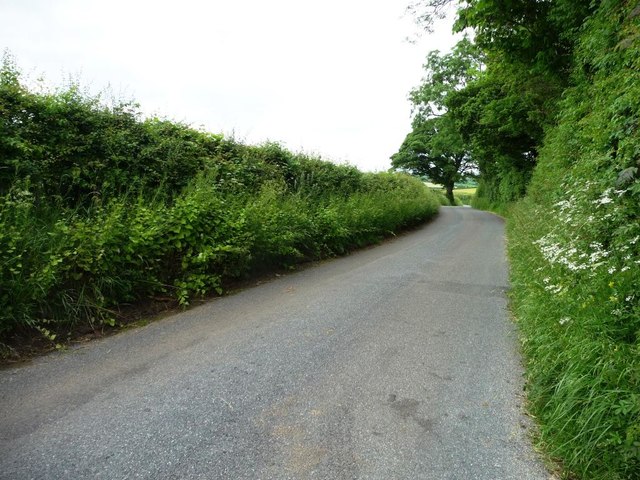
![The B5299 heading north-west near Snowhill Cottage There is a 28 metre spot height on the summit [by the distant tree].](https://s0.geograph.org.uk/geophotos/05/01/63/5016304_504ab156.jpg)
![Farmland south of the B5299, near Snowhill Cottage The drystone wall running across the centre of the picture forms at least three boundaries. The open access land in the national park to the south [far side] is in Caldbeck parish, the private farmland outside the park [near side] is in Boltons.](https://s1.geograph.org.uk/geophotos/05/01/63/5016321_cfc0a12c.jpg)


Aughertree is located at Grid Ref: NY2538 (Lat: 54.735493, Lng: -3.159348)
Administrative County: Cumbria
District: Allerdale
Police Authority: Cumbria
What 3 Words
///driven.lime.negotiators. Near Wigton, Cumbria
Nearby Locations
Related Wikis

Aughertree
Aughertree ( AF-ər-tree) is a village in northern Cumbria, England. It is situated near to the villages of Caldbeck and Torpenhow, but closer to the main...

Ireby and Uldale
Ireby and Uldale is a civil parish in the English county of Cumbria forming part of the district of Allerdale. The population, including Bewaldeth and...

Ireby, Cumbria
Ireby is a village in Cumbria, England with a population of around 180. Between 1974 and 2023, it was in Allerdale district, Cumbria. Since April 2023...
Uldale
Uldale is a small village and former civil parish in the Cumberland district, in the ceremonial county of Cumbria, England. It is about 5 miles (8 km)...
Related Videos

Great Sca Fell : Labelled Summit View Panorama : Lake District Hikes & Walking - Northern Fells
A slow 360 degree panorama from the summit of Great Sca Fell in the Uldale region of the Lake District. All main view points ...

Longlands Fell: A Misty wainwright walk in the Lake District
Created with Wondershare Filmora.
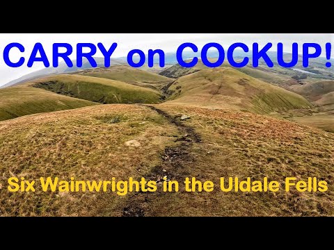
Carry On Cockup! A Six Wainwright Horseshoe in the Uldale Fells.
FREE parking at Longlands, I head up to the first of 6 Wainwrights around the Uldale Fells - Great Cockup! Swiftly realising my first ...

Life
Be prepared for changes noting remains the same #dublin #ireland #trinitycollege #trinitycollegedublin #travel #trinity #library ...
Nearby Amenities
Located within 500m of 54.735493,-3.159348Have you been to Aughertree?
Leave your review of Aughertree below (or comments, questions and feedback).