Rubha Gholl Shûil

Coastal Feature, Headland, Point in Ross-shire

Scotland

Rubha Gholl Shûil

The shoreline looking west into Loch Sealg
The shoreline looking west into Loch Sealg Credit: Mike Dunn

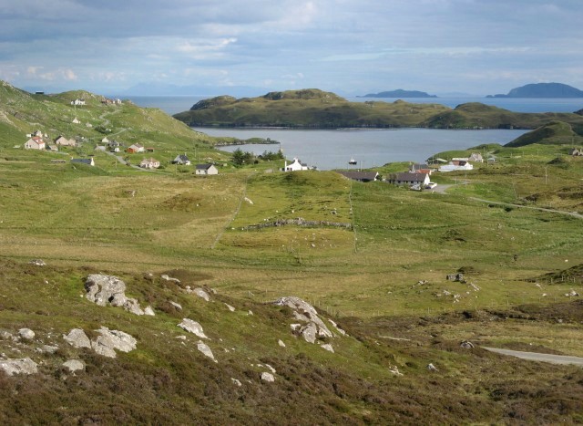
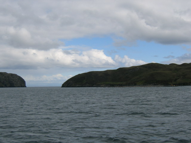
Rubha Gholl Shûil is a prominent coastal feature located in Ross-shire, Scotland. It is a headland or point that extends out into the waters of the North Atlantic Ocean. The name "Rubha Gholl Shûil" is derived from Gaelic, with "Rubha" meaning "point" or "headland," "Gholl" meaning "white," and "Shûil" meaning "eye." This name likely refers to the distinctive appearance of the headland.

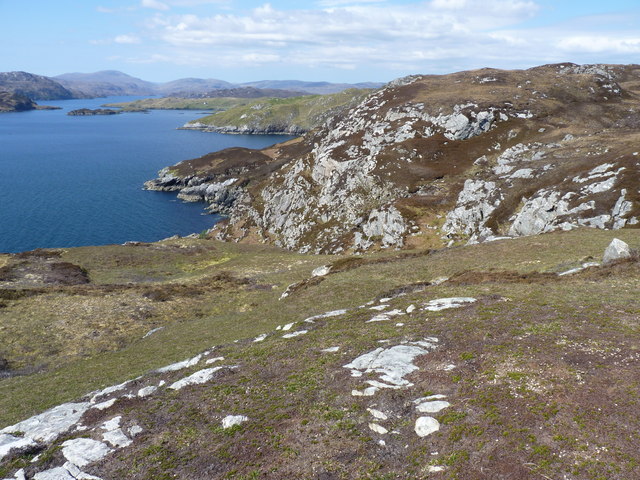
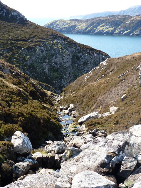
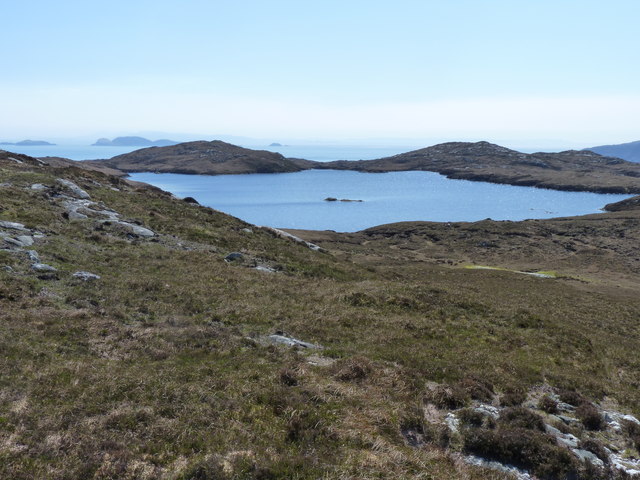
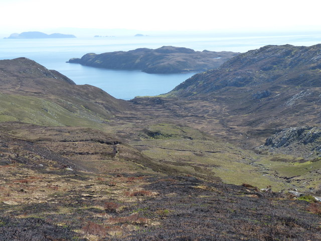
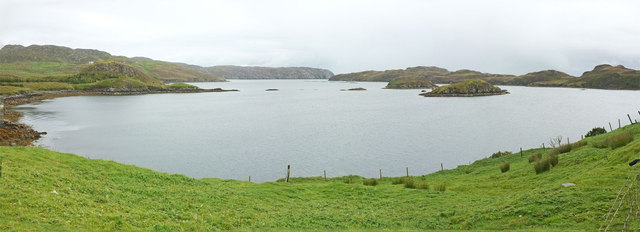
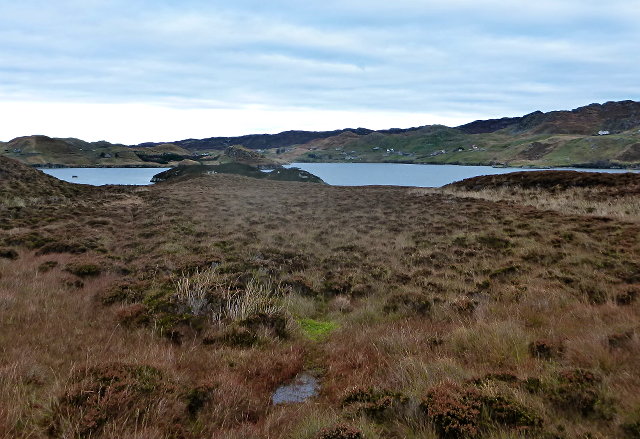
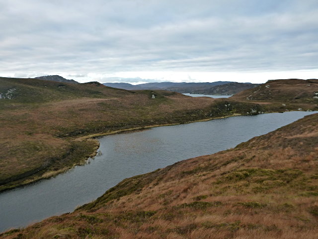
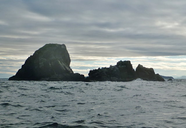
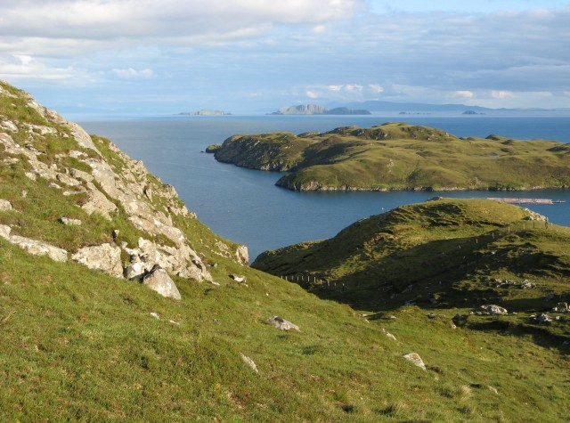
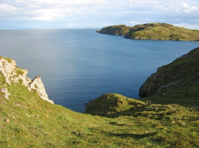
This coastal feature is characterized by its rugged and rocky terrain, which is typical of the Scottish coastline. The headland is composed of ancient and weathered rocks, which have been shaped by the relentless forces of wind and waves over time. The cliffs along the headland offer breathtaking views of the surrounding ocean and nearby coastal areas.

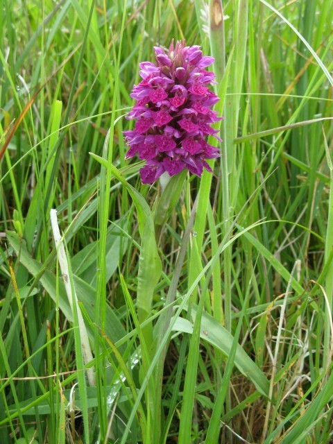
Rubha Gholl Shûil is also known for its diverse wildlife. The surrounding waters are home to a variety of marine species, including seals, dolphins, and seabirds. It is not uncommon to spot these creatures while exploring the headland.

Due to its picturesque scenery and natural beauty, Rubha Gholl Shûil is a popular destination for outdoor enthusiasts, nature lovers, and photographers. The headland offers opportunities for hiking, birdwatching, and wildlife spotting. Visitors can also enjoy the tranquil atmosphere and the sound of crashing waves along the coast.

In conclusion, Rubha Gholl Shûil is a stunning coastal feature in Ross-shire, Scotland, known for its rugged landscape, diverse wildlife, and breathtaking views. It is a must-visit destination for anyone seeking to experience the beauty of the Scottish coastline.

If you have any feedback on the listing, please let us know in the comments section below.

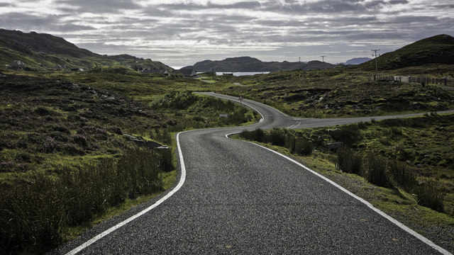
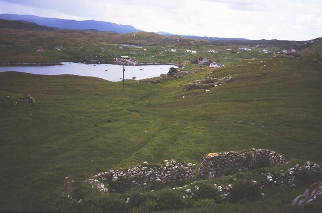
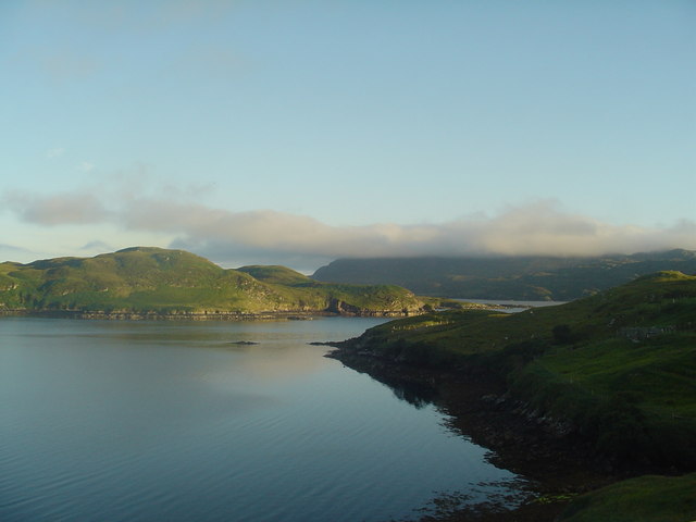
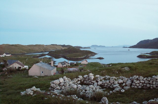
Rubha Gholl Shûil Images

Images are sourced within 2km of 58.010905/-6.438047 or Grid Reference NB3711. Thanks to Geograph Open Source API. All images are credited.

The shoreline looking west into Loch Sealg
Looking down a gully towards Eilean Liubhaird
Moorland with Lochan Tobhta Ruairidh Dhuibh
Looking down Gleann Ceann Eastail with Eilean Liubhaird beyond
Caolas a Tuath A panoramic view down the length of the channel.
Caolas a Tuath
A panoramic view down the length of the channel.
Eilean Liubhaird Eilean Liubhaird is a small island south of Lemreway - the village in the background of this view.
Eilean Liubhaird
Eilean Liubhaird is a small island south of Lemreway - the village in the background of this view.
Loch na Buaile This is the largest body of fresh water on Eilean Liubhaird.
Loch na Buaile
This is the largest body of fresh water on Eilean Liubhaird.
Stac a' Bhàigh A small rocky islet just off Eilean Liubhaird.
Stac a' Bhàigh
A small rocky islet just off Eilean Liubhaird.
B8060 nearing Leumrabhagh
Leumrabhagh Crofting/fishing community in Pairc. ruin of old house in foreground. The crofters here are currently pusueing a buyout of the land they work.
Leumrabhagh
Crofting/fishing community in Pairc. ruin of old house in foreground. The crofters here are currently pusueing a buyout of the land they work.
Leumrabhagh A pretty port in a sheltered inlet of Loch Sealg.
Leumrabhagh
A pretty port in a sheltered inlet of Loch Sealg.
Lemreway Island - Eilean Iubhaird A stunning view from the road end at Aird a' Chaolais looking across the sea loch to Eilean Iubhaird
Lemreway Island - Eilean Iubhaird
A stunning view from the road end at Aird a' Chaolais looking across the sea loch to Eilean Iubhaird
Orasaigh with view of Shiant Islands
Evening near Leumrabhagh View from a small hill to the east of the village of Leumrabhagh.  A fish farm can be seen just in front of Eilean Liubhaird, and in the far distance the cliffs of the Shiant Islands catch the evening sun.
Evening near Leumrabhagh
View from a small hill to the east of the village of Leumrabhagh. A fish farm can be seen just in front of Eilean Liubhaird, and in the far distance the cliffs of the Shiant Islands catch the evening sun.
Northern Marsh Orchid (Dactylorhiza purpurella) Northern Marsh Orchids are commonly found in the Outer Hebrides, where the wet peaty conditions suit it.
Northern Marsh Orchid (Dactylorhiza purpurella)
Northern Marsh Orchids are commonly found in the Outer Hebrides, where the wet peaty conditions suit it.
Looking down Gleann Chinn Eastall This glen, on croft land to the east of Leumrabhagh, descends very steeply to the sea.
Looking down Gleann Chinn Eastall
This glen, on croft land to the east of Leumrabhagh, descends very steeply to the sea.
Near Leumrabhagh Looking towards the village of Leumrabhagh from a vantage point to the north of the village.
Near Leumrabhagh
Looking towards the village of Leumrabhagh from a vantage point to the north of the village.
Eilean Liubhaird This Island in Loch Shell is so called after Prince Charles Edward Stuart. Edward's Island. Srianach Head prominent to left of frame.
Eilean Liubhaird
This Island in Loch Shell is so called after Prince Charles Edward Stuart. Edward's Island. Srianach Head prominent to left of frame.
Show me another place!

Rubha Gholl Shûil is located at Grid Ref: NB3711 (Lat: 58.010905, Lng: -6.438047)

Unitary Authority: Na h-Eileanan an Iar

Police Authority: Highlands and Islands

What 3 Words

///renew.monorail.pats. Near Leurbost, Na h-Eileanan Siar

Related Wikis

Eilean Liubhaird

Eilean Liubhaird or Eilean Iubhard is an island in the Outer Hebrides, to the east of Lewis. == Geography and geology == The rock is "gneiss bedrock with...

Orinsay

Orinsay (Scottish Gaelic: Orasaigh) is a crofting village on the Isle of Lewis in the district of Pairc, in the Outer Hebrides, Scotland. The settlement...

Stiomrabhaig

Stiomrabhaig is an abandoned crofter's village on the Isle of Lewis in the Outer Hebrides. == History == The United Kingdom Census 1851 shows that the...

Gravir

Gravir (Scottish Gaelic: Grabhair), is a village on the shore of Loch Odhairn (a sea loch) in the Park district of the Isle of Lewis. Gravir is within...

Calbost

Calbost (Scottish Gaelic: Calabost) is a village on the Isle of Lewis in the Outer Hebrides, Scotland. Calbost is within the parish of Lochs, and within...

Park, Lewis

Park (Scottish Gaelic: A' Phàirc), also known as South Lochs, is a huge area of land connected to the rest of Lewis only by a narrow neck between Loch...

Cabharstadh

Cabharstadh or Caversta (Scottish Gaelic: Cabharstaigh) is a village on the Isle of Lewis in the Outer Hebrides, Scotland. Caversta is situated in the...

Nearby Amenities

Located within 500m of 58.010905,-6.438047
Created By: dmgroom_coastlines
Lat/Long: 58.01344/-6.4323
Passing Place
Lat/Long: 58.0111263/-6.4435758
Turning Circle
Lat/Long: 58.0129083/-6.4404087
Passing Place
Lat/Long: 58.0139606/-6.4412758
Passing Place
Lat/Long: 58.012105/-6.4430568
Tòb Leumrabhaigh
Name En: Tob Lemreway
Name Gd: Tòb Leumrabhaigh
Natural: bay
Lat/Long: 58.0128175/-6.4346645
Power: pole
Lat/Long: 58.010133/-6.4449987
Power: pole
Lat/Long: 58.0103849/-6.4448363
Power: pole
Lat/Long: 58.0107824/-6.4442987
Power: pole
Lat/Long: 58.0112515/-6.4437835
Power: pole
Lat/Long: 58.0115905/-6.4435168
Power: pole
Lat/Long: 58.0121081/-6.4431596
Power: pole
Lat/Long: 58.0125026/-6.4429809
Power: pole
Lat/Long: 58.0128503/-6.4424507
Power: pole
Lat/Long: 58.0135457/-6.4418288
Power: pole
Lat/Long: 58.0138944/-6.4417033
Power: pole
Lat/Long: 58.0145721/-6.4415948
Power: pole
Lat/Long: 58.0148872/-6.4415999
Power: pole
Lat/Long: 58.0112527/-6.4442488
Power: pole
Lat/Long: 58.0119348/-6.4424488
Power: pole
Lat/Long: 58.0136081/-6.4410463
Power: pole
Lat/Long: 58.0131291/-6.4405753
Power: pole
Lat/Long: 58.0127753/-6.440264
Power: pole
Lat/Long: 58.0145498/-6.4405534
Generator Method: photovoltaic
Generator Output Electricity: small_installation
Generator Source: solar
Generator Type: solar_photovoltaic_panel
Power: generator
Lat/Long: 58.0148838/-6.4412901
Man Made: tower
Tower Construction: lattice
Tower Type: communication
Lat/Long: 58.012959/-6.4448521
Turning Circle
Lat/Long: 58.0101378/-6.4451619
Passing Place
Lat/Long: 58.0125785/-6.4421143
Rhubha Gholl Shuil
Natural: cape
Lat/Long: 58.010266/-6.4380504
The data included in this document is from www.openstreetmap.org. The data is made available under ODbL.

Have you been to Rubha Gholl Shûil?

Leave your review of Rubha Gholl Shûil below (or comments, questions and feedback).