Àird Dhughaill

Coastal Feature, Headland, Point in Argyllshire

Scotland

Àird Dhughaill

Beinn a'Chaol-airigh Walked along the track through the organic farm with the Highland cows and Hebridean sheep on a wet day with Jim Bloomer. Summit is just rather flat and featureless moorland.
Name: Beinn a'Chaol-airigh
Hill number: 4813
Height: 127m / 417ft
Area: 17E: Mull and Nearby Islands
Class: Hu,1
Grid ref: NM 35511 18443
Summit feature: no feature
Drop: 103m
Col: 24m  NM406197
Beinn a'Chaol-airigh Credit: Rude Health

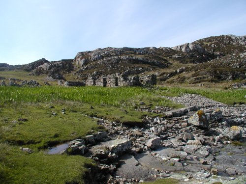
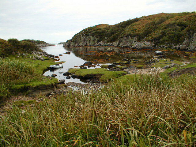
Àird Dhughaill is a prominent coastal feature located in Argyllshire, Scotland. It is classified as a headland, stretching out into the sea and forming a distinct point along the coastline. The headland is situated in a picturesque area, known for its rugged beauty and stunning views.

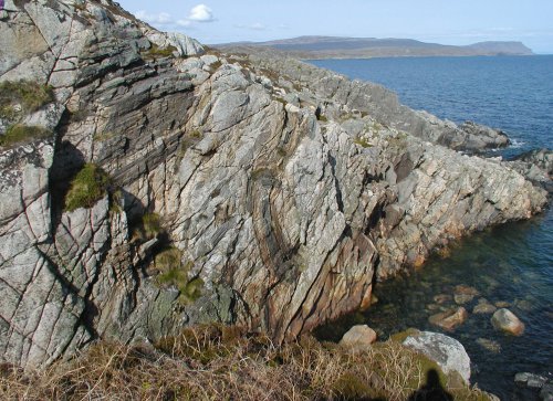
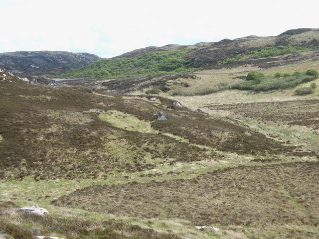
The geography of Àird Dhughaill is characterized by steep cliffs that drop dramatically into the sea. These cliffs are made up of a mix of sedimentary rocks, creating a unique and diverse landscape. The headland itself is covered in lush vegetation, with patches of heather, grasses, and wildflowers adding to its natural charm.

The surrounding waters of Àird Dhughaill are teeming with marine life, making it a popular spot for fishing and wildlife enthusiasts. The area is known for its diverse range of seabirds, including gannets, fulmars, and puffins, which can often be seen nesting on the cliffs. Dolphins and seals are also frequently spotted in the waters, making it a haven for nature lovers.

Access to Àird Dhughaill is relatively easy, with a well-maintained path that leads visitors to the headland. From there, one can enjoy stunning panoramic views of the surrounding coastline and the distant mountains. The headland is also a great spot for hiking, offering a variety of trails that cater to different skill levels.

Overall, Àird Dhughaill is a captivating coastal feature that showcases the natural beauty and biodiversity of Argyllshire. Whether it's exploring the cliffs, observing the wildlife, or simply enjoying the breathtaking views, this headland offers a memorable experience for all who visit.

If you have any feedback on the listing, please let us know in the comments section below.

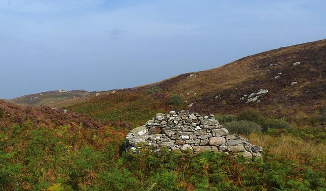
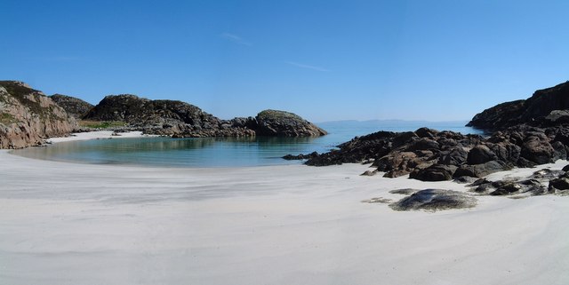
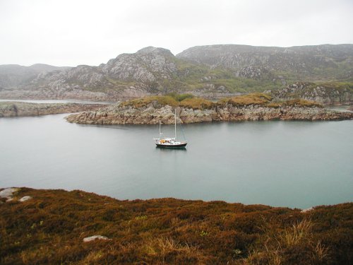
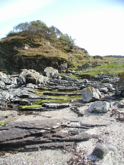
Àird Dhughaill Images

Images are sourced within 2km of 56.272709/-6.2884662 or Grid Reference NM3417. Thanks to Geograph Open Source API. All images are credited.

Beinn a'Chaol-airigh Walked along the track through the organic farm with the Highland cows and Hebridean sheep on a wet day with Jim Bloomer. Summit is just rather flat and featureless moorland.
Name: Beinn a'Chaol-airigh
Hill number: 4813
Height: 127m / 417ft
Area: 17E: Mull and Nearby Islands
Class: Hu,1
Grid ref: NM 35511 18443
Summit feature: no feature
Drop: 103m
Col: 24m  NM406197
Beinn a'Chaol-airigh
Walked along the track through the organic farm with the Highland cows and Hebridean sheep on a wet day with Jim Bloomer. Summit is just rather flat and featureless moorland. Name: Beinn a'Chaol-airigh Hill number: 4813 Height: 127m / 417ft Area: 17E: Mull and Nearby Islands Class: Hu,1 Grid ref: NM 35511 18443 Summit feature: no feature Drop: 103m Col: 24m NM406197
Ruined building by the Allt na Tràighe Gile, Isle of Mull The RCAHMS record for this building ( <span class="nowrap"><a title="http://canmore.rcahms.gov.uk/en/site/86733/details/mull+breac+achadh/" rel="nofollow ugc noopener" href="http://canmore.rcahms.gov.uk/en/site/86733/details/mull+breac+achadh/">Link</a><img style="margin-left:2px;" alt="External link" title="External link - shift click to open in new window" src="https://s1.geograph.org.uk/img/external.png" width="10" height="10"/></span> ) describes it as a cruck framed cottage.  However, there is also a suggestion that it might have been a mill (page 5, <span class="nowrap"><a title="http://www.highlandrenewal.org/assets/files/Tireragan_History.pdf" rel="nofollow ugc noopener" href="http://www.highlandrenewal.org/assets/files/Tireragan_History.pdf">Link</a><img style="margin-left:2px;" alt="External link" title="External link - shift click to open in new window" src="https://s1.geograph.org.uk/img/external.png" width="10" height="10"/></span> ).
Ruined building by the Allt na Tràighe Gile, Isle of Mull
The RCAHMS record for this building ( LinkExternal link ) describes it as a cruck framed cottage. However, there is also a suggestion that it might have been a mill (page 5, LinkExternal link ).
Lochan below Àird Mòr, Isle of Mull The lochan lies on a burn that flows down to the beach at Port na Luing on the western coast of the Ross of Mull.
Lochan below Àird Mòr, Isle of Mull
The lochan lies on a burn that flows down to the beach at Port na Luing on the western coast of the Ross of Mull.
Ruined building, An Cholarich, Isle of Mull The 1st edition OS six map, which was surveyed in 1878, shows an unroofed building here and also a nearby field wall, which can still be identified on the ground.
Ruined building, An Cholarich, Isle of Mull
The 1st edition OS six map, which was surveyed in 1878, shows an unroofed building here and also a nearby field wall, which can still be identified on the ground.
View towards Eilean Mòr, Isle of Mull
Breac-achadh The settlement at Breac-achadh was deserted during the nineteenth century as a result of the Highland Clearances. Sheep farming was more profitable to the landlords than small collections of subsistence farmers ekeing a living on marginal land.
Breac-achadh
The settlement at Breac-achadh was deserted during the nineteenth century as a result of the Highland Clearances. Sheep farming was more profitable to the landlords than small collections of subsistence farmers ekeing a living on marginal land.
Traigh Gheal The path to the beach leads down through birch and scrub willow woodland.
Traigh Gheal
The path to the beach leads down through birch and scrub willow woodland.
Traigh Gheal A view taken at the eastern end of this beautiful, remote beach.
Traigh Gheal
A view taken at the eastern end of this beautiful, remote beach.
The anchorage at  Rubh  Ardalanish A wild, remote spot on the Ross of Mull. The rock here is all granite but nearby there is metamorphic rock where garnets can be found on the beach. A lonely place now but there is much of evidence of former habitation around the bay.
The anchorage at Rubh Ardalanish
A wild, remote spot on the Ross of Mull. The rock here is all granite but nearby there is metamorphic rock where garnets can be found on the beach. A lonely place now but there is much of evidence of former habitation around the bay.
Rubh' Ardalanish Some interesting geology here - this part of the Headland of Rubh' Ardalanish is in the contact zone between the Ross of Mull granite to the west and an area of schist to the east. The landscape is rugged and spectacular. Remote now, there is much evidence of former habitation.
Rubh' Ardalanish
Some interesting geology here - this part of the Headland of Rubh' Ardalanish is in the contact zone between the Ross of Mull granite to the west and an area of schist to the east. The landscape is rugged and spectacular. Remote now, there is much evidence of former habitation.
Xenoliths The patches of darker rock set into the pinkish Ross of Mull granite are 'Xenoliths' - lumps of the surrounding rock which broke off and fell into the molten granite while it was deep underground. It has since solidified and been exposed on the surface by erosion.
Xenoliths
The patches of darker rock set into the pinkish Ross of Mull granite are 'Xenoliths' - lumps of the surrounding rock which broke off and fell into the molten granite while it was deep underground. It has since solidified and been exposed on the surface by erosion.
Ruined Cottage A sad reminder that people once lived and worked in this beautiful place. There are piles of stones cleared from the ground to show that the land was cultivated and several other cottages in the vicinity saying that it was a good place to make a living.
Ruined Cottage
A sad reminder that people once lived and worked in this beautiful place. There are piles of stones cleared from the ground to show that the land was cultivated and several other cottages in the vicinity saying that it was a good place to make a living.
Creek north of Rubh Ardalanish Coastal land between Torr na Sealga and Beinn a Chaol-airigh to the north of the anchorage on Rubh Ardalanish
Creek north of Rubh Ardalanish
Coastal land between Torr na Sealga and Beinn a Chaol-airigh to the north of the anchorage on Rubh Ardalanish
View towards Loch an Sgalain Looking down the route of the Abhainn a Glinne Mhoir towards the Loch,
View towards Loch an Sgalain
Looking down the route of the Abhainn a Glinne Mhoir towards the Loch,
Loch an Sgalain - a bit closer for a better view.
Slight detour required to navigate past boggy pond. Small pond fed by stream uphill to the left
Slight detour required to navigate past boggy pond.
Small pond fed by stream uphill to the left
Impressively weathered steps In the back-ground remnants of buildings, part of the Breac achadh settlement?
Impressively weathered steps
In the back-ground remnants of buildings, part of the Breac achadh settlement?
View of the four abandoned houses.
Show me another place!

Àird Dhughaill is located at Grid Ref: NM3417 (Lat: 56.272709, Lng: -6.2884662)

Unitary Authority: Argyll and Bute

Police Authority: Argyll and West Dunbartonshire

What 3 Words

///fronted.member.absorbing. Near Fionnphort, Argyll & Bute

Related Wikis

Ardalanish

Ardalanish (Scottish Gaelic: Àird Dealanais) is a village on the Isle of Mull in Argyll and Bute, Scotland. It is now an organic farm and weaving mill...

Knocknafenaig

Knocknafenaig (Scottish Gaelic: Cnoc na Fennaig) is a ruined township on the Isle of Mull, Scotland. Located in the south-western portion of the island...

Ross of Mull

The Ross of Mull (Scottish Gaelic: An Ros Mhuileach) is the largest peninsula of the Isle of Mull, about 28 kilometres (17 mi) long, and makes up the south...

Uisken

Uisken (Scottish Gaelic: Uisgean, meaning "water-bay") is a settlement on a sandy bay on the Ross of Mull in the south of the Isle of Mull, on the west...

Nearby Amenities

Located within 500m of 56.272709,-6.2884662
Created By: dmgroom_coastlines
Source: PGS
Lat/Long: 56.27038/-6.29482
Source: PGS
Lat/Long: 56.2705758/-6.2950507
Created By: dmgroom_coastlines
Source: PGS
Lat/Long: 56.27064/-6.29526
Created By: dmgroom_coastlines
Source: PGS
Lat/Long: 56.27076/-6.29479
Created By: dmgroom_coastlines
Source: PGS
Lat/Long: 56.27075/-6.29433
Created By: dmgroom_coastlines
Source: PGS
Lat/Long: 56.27059/-6.29296
Created By: dmgroom_coastlines
Source: PGS
Lat/Long: 56.27033/-6.29275
Created By: dmgroom_coastlines
Source: PGS
Lat/Long: 56.27007/-6.29231
Created By: dmgroom_coastlines
Source: PGS
Lat/Long: 56.26954/-6.29188
Created By: dmgroom_coastlines
Source: PGS
Lat/Long: 56.26928/-6.29144
Created By: dmgroom_coastlines
Source: PGS
Lat/Long: 56.26876/-6.29148
Source: PGS
Lat/Long: 56.2731979/-6.2806721
Created By: dmgroom_coastlines
Source: PGS
Lat/Long: 56.27289/-6.28106
Created By: dmgroom_coastlines
Source: PGS
Lat/Long: 56.27239/-6.28155
Created By: dmgroom_coastlines
Source: PGS
Lat/Long: 56.27214/-6.28157
Created By: dmgroom_coastlines
Source: PGS
Lat/Long: 56.27188/-6.28136
Source: PGS
Lat/Long: 56.2715847/-6.2817351
Source: PGS
Lat/Long: 56.2712981/-6.2818975
Source: PGS
Lat/Long: 56.2710734/-6.281925
Source: PGS
Lat/Long: 56.2709553/-6.2824672
Source: PGS
Lat/Long: 56.2708216/-6.2828551
Source: PGS
Lat/Long: 56.2707224/-6.283243
Created By: dmgroom_coastlines
Source: PGS
Lat/Long: 56.27064/-6.28351
Source: PGS
Lat/Long: 56.2706635/-6.2839525
Source: PGS
Lat/Long: 56.2697836/-6.284673
Source: PGS
Lat/Long: 56.269705/-6.2850424
Source: PGS
Lat/Long: 56.269626/-6.2853194
Source: PGS
Lat/Long: 56.2696121/-6.2855286
Source: PGS
Lat/Long: 56.2696495/-6.2856946
Source: PGS
Lat/Long: 56.269801/-6.2861092
Source: PGS
Lat/Long: 56.2698305/-6.2863033
Created By: dmgroom_coastlines
Source: PGS
Lat/Long: 56.26981/-6.28657
Source: PGS
Lat/Long: 56.2701129/-6.2866865
Source: PGS
Lat/Long: 56.2705186/-6.2855245
Created By: dmgroom_coastlines
Source: PGS
Lat/Long: 56.27045/-6.28652
Source: PGS
Lat/Long: 56.2704916/-6.2872349
Source: PGS
Lat/Long: 56.2706/-6.2877662
Source: PGS
Lat/Long: 56.2701974/-6.2878004
Source: PGS
Lat/Long: 56.2701263/-6.2882818
Source: PGS
Lat/Long: 56.2701002/-6.2886605
Source: PGS
Lat/Long: 56.2702545/-6.2897669
Source: PGS
Lat/Long: 56.2703368/-6.2898278
Source: PGS
Lat/Long: 56.2709785/-6.2898365
Created By: dmgroom_coastlines
Source: PGS
Lat/Long: 56.27067/-6.29066
Created By: dmgroom_coastlines
Source: PGS
Lat/Long: 56.27068/-6.29111
Created By: dmgroom_coastlines
Source: PGS
Lat/Long: 56.2707/-6.29203
Created By: dmgroom_coastlines
Source: PGS
Lat/Long: 56.27083/-6.29226
Created By: dmgroom_coastlines
Source: PGS
Lat/Long: 56.27109/-6.29246
Created By: dmgroom_coastlines
Source: PGS
Lat/Long: 56.27107/-6.29154
Source: PGS
Lat/Long: 56.2713943/-6.2911282
Created By: dmgroom_coastlines
Source: PGS
Lat/Long: 56.27147/-6.29198
Created By: dmgroom_coastlines
Source: PGS
Lat/Long: 56.27179/-6.29518
Created By: dmgroom_coastlines
Source: PGS
Lat/Long: 56.27193/-6.2954
Created By: dmgroom_coastlines
Source: PGS
Lat/Long: 56.27206/-6.29562
Created By: dmgroom_coastlines
Source: PGS
Lat/Long: 56.27219/-6.29584
Created By: dmgroom_coastlines
Source: PGS
Lat/Long: 56.27232/-6.29606
Source: PGS
Lat/Long: 56.2726066/-6.2960892
Created By: dmgroom_coastlines
Source: PGS
Lat/Long: 56.27297/-6.29647
Source: PGS
Lat/Long: 56.2718936/-6.2952985
Source: PGS
Lat/Long: 56.2715296/-6.2958886
The data included in this document is from www.openstreetmap.org. The data is made available under ODbL.

Have you been to Àird Dhughaill?

Leave your review of Àird Dhughaill below (or comments, questions and feedback).