Àird Dhubh
Coastal Feature, Headland, Point in Ross-shire
Scotland
Àird Dhubh

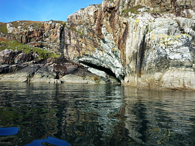
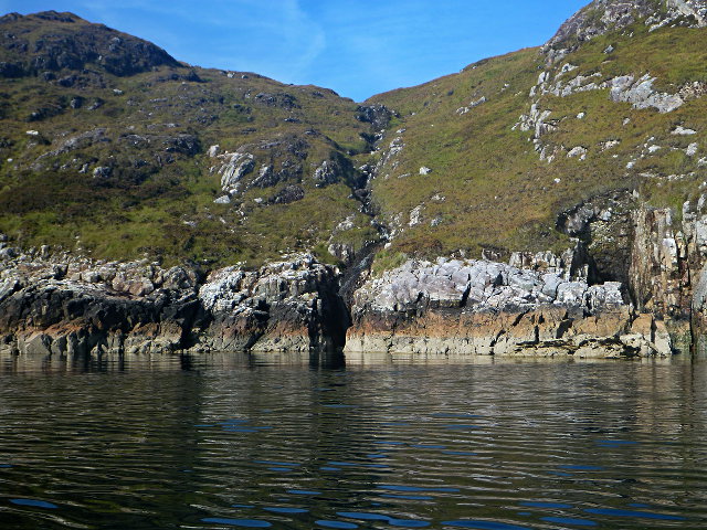
Àird Dhubh, located in Ross-shire, Scotland, is a stunning coastal feature known for its picturesque headland and dramatic cliffs. Situated along the rugged coastline of the North Atlantic Ocean, it offers breathtaking views and a sense of unspoiled natural beauty.
The headland of Àird Dhubh is characterized by its rugged terrain, with steep cliffs that jut out into the sea. These cliffs, made of ancient rock formations, are a testament to the geological history of the region and provide a habitat for a variety of bird species, such as puffins and guillemots. The crashing waves and strong ocean currents around the headland create a powerful and awe-inspiring atmosphere.
The point at Àird Dhubh is a popular spot for nature lovers and photographers, who come to capture the raw beauty of the Scottish coast. The panoramic views of the surrounding sea, the distant mountains, and the nearby islands are truly unforgettable. The area is also rich in flora, with wildflowers and grasses clinging to the cliffs, adding vibrant splashes of color to the landscape.
Access to Àird Dhubh is relatively easy, with a well-maintained path leading visitors to the headland. However, caution is advised when exploring the cliffs, as they can be treacherous and slippery, especially during inclement weather. Visitors are advised to wear appropriate footwear and stay within designated paths for safety.
Overall, Àird Dhubh is a captivating coastal feature that showcases the raw and untamed beauty of the Scottish coastline. With its dramatic cliffs, breathtaking views, and diverse flora and fauna, it is a must-visit destination for nature enthusiasts and those seeking a truly unforgettable coastal experience.
If you have any feedback on the listing, please let us know in the comments section below.
Àird Dhubh Images
Images are sourced within 2km of 57.935394/-6.5273886 or Grid Reference NB3202. Thanks to Geograph Open Source API. All images are credited.


Àird Dhubh is located at Grid Ref: NB3202 (Lat: 57.935394, Lng: -6.5273886)
Unitary Authority: Na h-Eileanan an Iar
Police Authority: Highlands and Islands
What 3 Words
///second.barbarian.success. Near Tarbert, Na h-Eileanan Siar
Nearby Locations
Related Wikis

Park, Lewis
Park (Scottish Gaelic: A' Phàirc), also known as South Lochs, is a huge area of land connected to the rest of Lewis only by a narrow neck between Loch...

Stiomrabhaig
Stiomrabhaig is an abandoned crofter's village on the Isle of Lewis in the Outer Hebrides. == History == The United Kingdom Census 1851 shows that the...

Eilean Liubhaird
Eilean Liubhaird or Eilean Iubhard is an island in the Outer Hebrides, to the east of Lewis. == Geography and geology == The rock is "gneiss bedrock with...

Rèinigeadal
Rèinigeadal (or Rhenigidale) is a small settlement in Harris, in the Western Isles in Scotland. It is situated on the east coast of Harris 8 kilometres...
Nearby Amenities
Located within 500m of 57.935394,-6.5273886Have you been to Àird Dhubh?
Leave your review of Àird Dhubh below (or comments, questions and feedback).