Colbost Point

Coastal Feature, Headland, Point in Inverness-shire

Scotland

Colbost Point

Old Road Looking north west along the old straight road that has been replaced by a new road with a big bend to avoid the boggy land.
Old Road Credit: John Allan

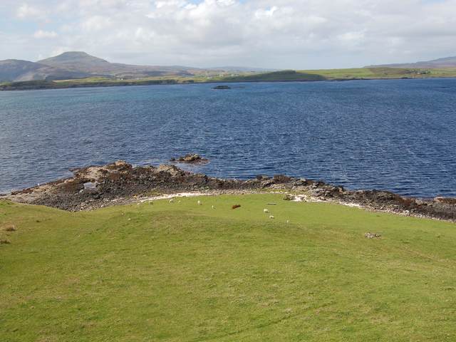
Colbost Point is a prominent coastal feature located in Inverness-shire, Scotland. Situated on the west coast of the Isle of Skye, this headland juts out into the waters of Loch Dunvegan, offering stunning panoramic views of the surrounding landscape.

At approximately 100 meters in height, Colbost Point is a commanding presence along the coast, attracting both locals and tourists alike. Its rugged cliffs and rocky terrain make it a popular destination for hikers and nature enthusiasts seeking a challenging and rewarding experience.

The headland is known for its diverse and abundant wildlife. Visitors may spot various seabirds, including fulmars and gannets, soaring above the cliffs, while seals and otters can often be seen basking in the nearby waters. The area is also home to a variety of wildflowers and grasses, adding a splash of color to the dramatic scenery.

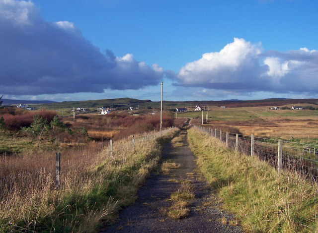
Colbost Point is easily accessible by road, with a car park nearby providing convenient parking for visitors. From there, a well-marked trail leads to the headland, allowing visitors to explore the area at their own pace. The path offers breathtaking views of the surrounding coastline, with the Cuillin Hills and the Isle of Harris visible in the distance on clear days.

Whether it's capturing the beauty of the Scottish coast through photography, enjoying a leisurely walk, or simply immersing oneself in the tranquility of nature, Colbost Point offers a captivating experience for all who venture to this remarkable headland.

If you have any feedback on the listing, please let us know in the comments section below.

Colbost Point Images

Images are sourced within 2km of 57.366314/-6.4794692 or Grid Reference NG3039. Thanks to Geograph Open Source API. All images are credited.

Old Road Looking north west along the old straight road that has been replaced by a new road with a big bend to avoid the boggy land.
Old Road
Looking north west along the old straight road that has been replaced by a new road with a big bend to avoid the boggy land.
House at Eabost Looking SW across Loch Bracadale. In the distance is the island of Wiay.
House at Eabost
Looking SW across Loch Bracadale. In the distance is the island of Wiay.
Mobile Bank Looks to be ready to end its days on this fairly remote farm. I wonder if the Clydesdale know it's here?
Mobile Bank
Looks to be ready to end its days on this fairly remote farm. I wonder if the Clydesdale know it's here?
Ose Farm A recently dug pit, and assorted farming equipment, on the land of Ose Farm.
Ose Farm
A recently dug pit, and assorted farming equipment, on the land of Ose Farm.
Ullinish Looking north at the houses of Ullinish on the shore of Loch Bracadale.
Ullinish
Looking north at the houses of Ullinish on the shore of Loch Bracadale.
Sheep on the Old Road South of Gearymore.
Sheep on the Old Road
South of Gearymore.
Colbost Point Looking across the rough grazings above Colbost Point, near Eabost. The islands visible in Loch Bracadale are Tarner and Harlosh.
Colbost Point
Looking across the rough grazings above Colbost Point, near Eabost. The islands visible in Loch Bracadale are Tarner and Harlosh.
Grazings at Eabost West Croft land with sheep grazing. The view is across Loch Bracadale to the mouth of Loch Caroy.
Grazings at Eabost West
Croft land with sheep grazing. The view is across Loch Bracadale to the mouth of Loch Caroy.
Ben Toirlean The trig point on the low summit of Ben Toirlean, looking towards a hazy Black Cuillin.
Ben Toirlean
The trig point on the low summit of Ben Toirlean, looking towards a hazy Black Cuillin.
Mouth of the River Ose Looking downstream towards where the river reaches the sea at Loch Bracadale.
Mouth of the River Ose
Looking downstream towards where the river reaches the sea at Loch Bracadale.
Ose Ose is a large but scattered township. The road in the picture is the A863.
On the horizon are the Cuillin Mountains.
Ose
Ose is a large but scattered township. The road in the picture is the A863. On the horizon are the Cuillin Mountains.
Gearymore Gearymore seems to be just a 'no through road' to just a few cottages.
Gearymore
Gearymore seems to be just a 'no through road' to just a few cottages.
Old road through Ose The old single track roads on Skye have mostly been replaced by modern highways often built alongside the original route.
Old road through Ose
The old single track roads on Skye have mostly been replaced by modern highways often built alongside the original route.
New bridge from the old The old and narrow stone bridge is now unused. The new bridge carries the A863 over the River Ose.
New bridge from the old
The old and narrow stone bridge is now unused. The new bridge carries the A863 over the River Ose.
River Ose Looking up Glen Ose towards Osdal Lodge.
River Ose
Looking up Glen Ose towards Osdal Lodge.
The old bridge over River Ose Now disused. A new and wider bridge has replaced this one.
The old bridge over River Ose
Now disused. A new and wider bridge has replaced this one.
The old road from the old bridge The cluster of buildings in the picture are the tiny township of Gearymore.
The old road from the old bridge
The cluster of buildings in the picture are the tiny township of Gearymore.
Building site? There seems to be builder round here with a novel approach to house construction. See <a href="https://www.geograph.org.uk/photo/1029468">NG3141 : Something missing?</a> .
The Cuillin are prominent in the background.
Building site?
There seems to be builder round here with a novel approach to house construction. See NG3141 : Something missing? . The Cuillin are prominent in the background.
Show me another place!

Colbost Point is located at Grid Ref: NG3039 (Lat: 57.366314, Lng: -6.4794692)

Unitary Authority: Highland

Police Authority: Highlands and Islands

What 3 Words

///inspected.formed.parent. Near Dunvegan, Highland

Nearby Locations

Colbost Point Sgeir Bheag

Related Wikis

Tarner Island

Tarner Island is a triangular shaped island in Loch Bracadale just off the coast off the Harlosh peninsula of Skye in Scotland. It is about 28 hectares...

Ose, Skye

Ose (Scottish Gaelic: Òs) is a small coastal settlement of Loch Bracadale, in the Scottish Highland area. It lies on the west coast of the Isle of Skye...

Struan, Skye

Struan (Scottish Gaelic: An Sruthan) is a small village on the west coast of the island of Skye, on the shores of Loch Beag, itself an inlet of Loch Bracadale...

Ullinish

Ullinish (Gaelic: Uilfhinis) is a crofting township on Loch Bracadale, on the southwest coast of Skye, Scotland. The only promontory fort on Skye is located...

Nearby Amenities

Located within 500m of 57.366314,-6.4794692
Created By: dmgroom_coastlines
Source: PGS
Lat/Long: 57.37056/-6.48049
Created By: dmgroom_coastlines
Source: PGS
Lat/Long: 57.37006/-6.481
Created By: dmgroom_coastlines
Source: PGS
Lat/Long: 57.36929/-6.48105
Created By: dmgroom_coastlines
Source: PGS
Lat/Long: 57.36903/-6.48107
Created By: dmgroom_coastlines
Source: PGS
Lat/Long: 57.36827/-6.48112
Created By: dmgroom_coastlines
Source: PGS
Lat/Long: 57.36801/-6.48114
Created By: dmgroom_coastlines
Source: PGS
Lat/Long: 57.36723/-6.48119
Created By: dmgroom_coastlines
Source: PGS
Lat/Long: 57.36711/-6.48097
Created By: dmgroom_coastlines
Source: PGS
Lat/Long: 57.36698/-6.48074
Created By: dmgroom_coastlines
Source: PGS
Lat/Long: 57.3662/-6.48031
Created By: dmgroom_coastlines
Source: PGS
Lat/Long: 57.36608/-6.48008
Created By: dmgroom_coastlines
Source: PGS
Lat/Long: 57.36594/-6.47986
Created By: dmgroom_coastlines
Source: PGS
Lat/Long: 57.3658/-6.47963
Created By: dmgroom_coastlines
Source: PGS
Lat/Long: 57.36579/-6.47821
Created By: dmgroom_coastlines
Source: PGS
Lat/Long: 57.36574/-6.47632
Created By: dmgroom_coastlines
Source: PGS
Lat/Long: 57.36561/-6.47609
Created By: dmgroom_coastlines
Source: PGS
Lat/Long: 57.36547/-6.47586
Source: PGS
Lat/Long: 57.3651117/-6.4751152
Created By: dmgroom_coastlines
Source: PGS
Lat/Long: 57.36429/-6.47452
Source: PGS
Lat/Long: 57.3639923/-6.4739992
Created By: dmgroom_coastlines
Source: PGS
Lat/Long: 57.36376/-6.47361
The data included in this document is from www.openstreetmap.org. The data is made available under ODbL.

Have you been to Colbost Point?

Leave your review of Colbost Point below (or comments, questions and feedback).