Àird na Mòine
Coastal Feature, Headland, Point in Ross-shire
Scotland
Àird na Mòine

Àird na Mòine is a coastal feature located in Ross-shire, Scotland. It is a prominent headland that juts out into the North Atlantic Ocean, forming a distinct point along the coast. The name Àird na Mòine translates to "Point of the Moss" in English.
This headland is characterized by its rugged and rocky terrain, with cliffs rising steeply from the sea below. The coastline surrounding Àird na Mòine is known for its dramatic beauty, attracting nature enthusiasts and photographers alike. The headland offers breathtaking views of the surrounding ocean, making it a popular spot for visitors to enjoy the scenic beauty of the Scottish coastline.
The vegetation on Àird na Mòine consists of hardy grasses and mosses, which thrive in the coastal environment. The area is also home to a variety of seabirds, including puffins, gannets, and guillemots, which nest along the cliffs.
Àird na Mòine provides excellent opportunities for outdoor activities such as hiking and birdwatching. There are several walking trails that lead along the headland, allowing visitors to explore the rugged coastal landscape and observe the diverse wildlife that inhabits the area.
Overall, Àird na Mòine is a stunning coastal feature in Ross-shire, offering visitors a chance to experience the natural beauty and wildlife of the Scottish coastline.
If you have any feedback on the listing, please let us know in the comments section below.
Àird na Mòine Images
Images are sourced within 2km of 58.252332/-6.8076408 or Grid Reference NB1839. Thanks to Geograph Open Source API. All images are credited.


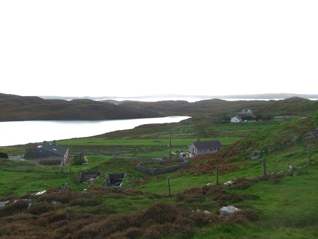


![Islands in Loch a' Bhaile Viewed from the loop road into Tolastadh a&#039; Chaolais from the A858, the main [only] road from Barabhas.](https://s1.geograph.org.uk/geophotos/03/46/55/3465517_0e248291.jpg)
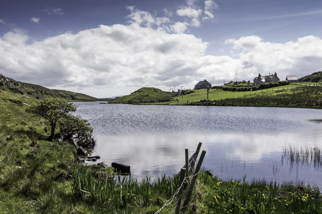
![Dùn in Loch an Dùnain One of many such small forts in the Hebrides, about 2000 years old and often on islands in lochans. This one is by the road [A858] between Dùn Chàrlabhaigh and Siadar. Apparently the climate was milder in those days, and I&#039;m glad for them - it was cold, wet and windy when I was there in late-May.](https://s3.geograph.org.uk/geophotos/03/47/35/3473555_300a7d7f.jpg)
![Loch an Dùnain, with remains of a Dùn One of many such small forts in the Hebrides, about 2000 years old and often on islands in lochans. This one is by the road [A858] between Dùn Chàrlabhaigh and Siadar. Apparently the climate was milder in those days, and I&#039;m glad for them - it was cold, wet and windy when I was there in late-May.](https://s2.geograph.org.uk/geophotos/03/47/35/3473558_5b4d479e.jpg)
Àird na Mòine is located at Grid Ref: NB1839 (Lat: 58.252332, Lng: -6.8076408)
Unitary Authority: Na h-Eileanan an Iar
Police Authority: Highlands and Islands
What 3 Words
///amount.appraised.hovered. Near Carloway, Na h-Eileanan Siar
Nearby Locations
Related Wikis

Tolsta Chaolais
Tolsta Chaolais (also Tolastadh Chaolais, Tolstadh a' Chaolais) is a village on the Isle of Lewis, Scotland. It consists of about forty houses, clustered...

Dun Carloway
Dun Carloway (Scottish Gaelic: Dùn Chàrlabhaigh) is a broch situated in the district of Carloway, on the west coast of the Isle of Lewis, Scotland (grid...

Breaclete
Breacleit (or Roulanish; Scottish Gaelic: Breacleit; Old Norse: Breiðiklettr) is the central village on Great Bernera in the Outer Hebrides, Scotland....

Borrowston, Lewis
Borrowston (Scottish Gaelic: Borghastan), with a population of about 50, is a crofting township situated on the Isle of Lewis, on the Outer Hebrides of...

Great Bernera
Great Bernera (; Scottish Gaelic: Beàrnaraigh Mòr), often known just as Bernera (Scottish Gaelic: Beàrnaraigh), is an island and community in the Outer...
Bernera Riot
The Bernera Riot occurred in 1874, on the island of Great Bernera, in Scotland in response to the Highland Clearances. The use of the term 'Bernera Riot...

Little Bernera
Little Bernera (Scottish Gaelic: Beàrnaraigh Beag) is a small island situated off the west coast of the Isle of Lewis in the Outer Hebrides.Little Bernera...

Carloway
Carloway (Scottish Gaelic: Càrlabhagh [ˈkʰaːɾɫ̪ə.ɤː]) is a crofting township and a district on the west coast of the Isle of Lewis, in the Outer Hebrides...
Nearby Amenities
Located within 500m of 58.252332,-6.8076408Have you been to Àird na Mòine?
Leave your review of Àird na Mòine below (or comments, questions and feedback).