Rubha an Teampaill

Coastal Feature, Headland, Point in Ross-shire

Scotland

Rubha an Teampaill

Exposed gneiss on Carn Neil Snow-covered Mealaisbhal behind.
Exposed gneiss on Carn Neil Credit: Alan Reid

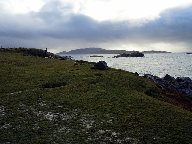
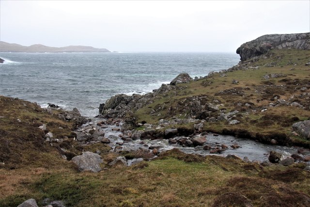
Rubha an Teampaill is a stunning headland located in Ross-shire, Scotland. Situated along the rugged and picturesque coastline, this coastal feature presents a breath-taking view of the surrounding landscape. The name "Rubha an Teampaill" translates to "Headland of the Temple," and it is believed to have derived from an ancient chapel or religious site that once stood there.

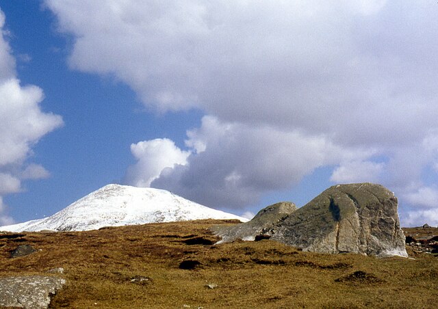
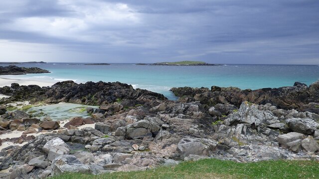
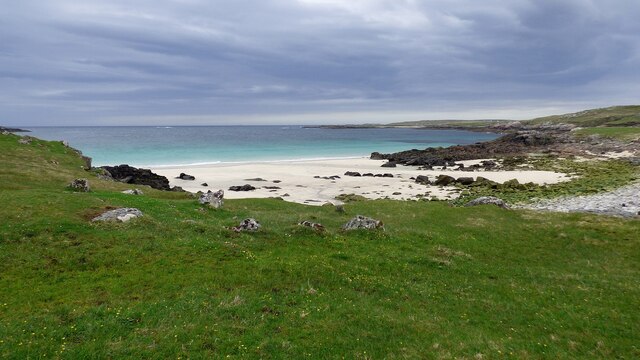
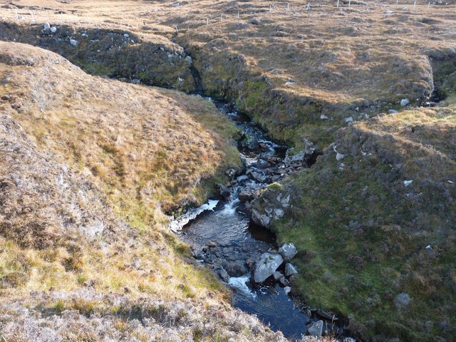
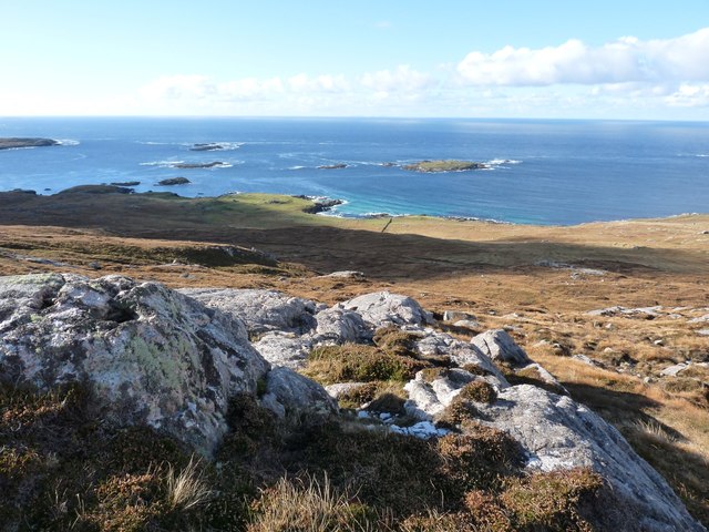
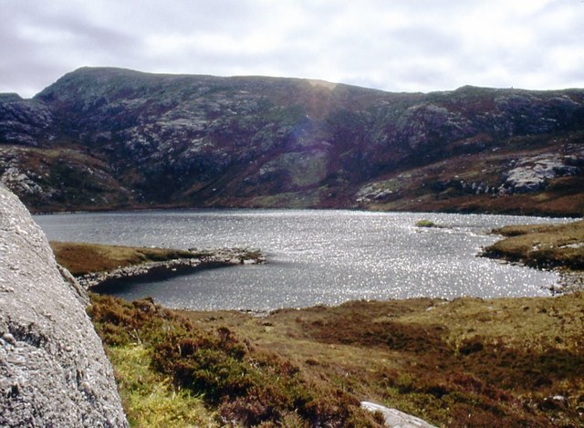
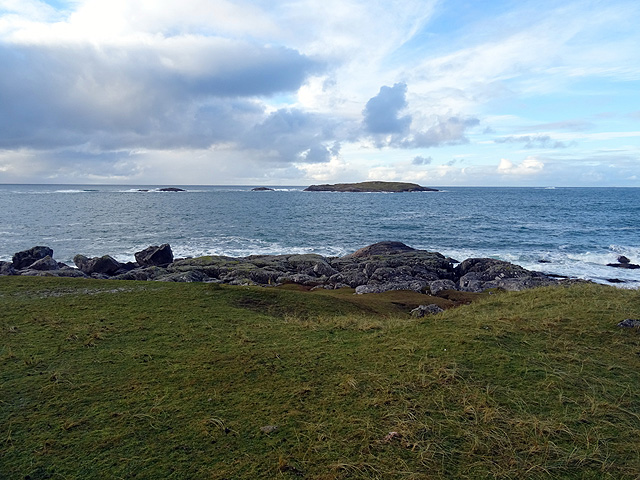
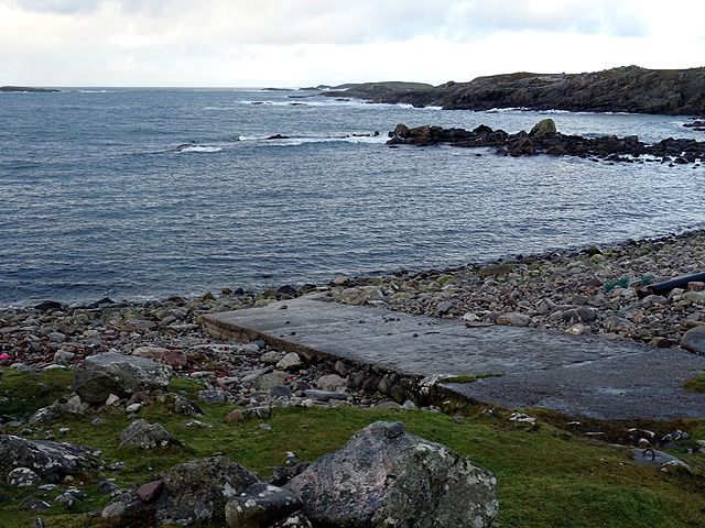
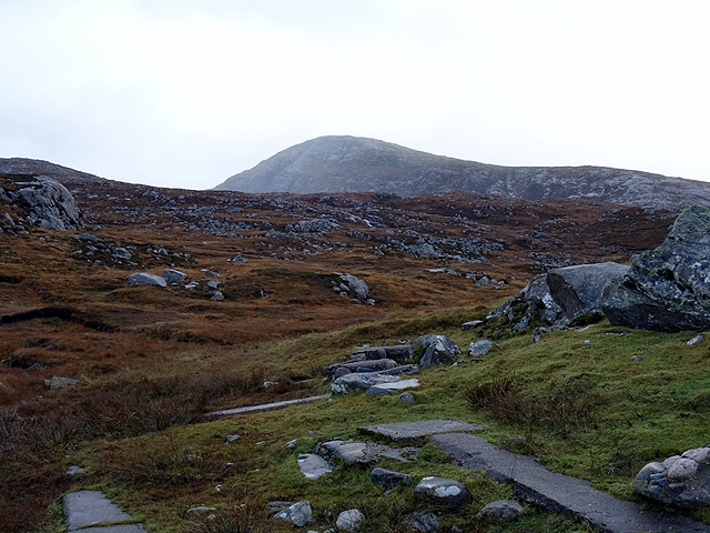
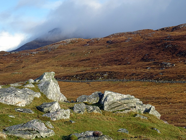
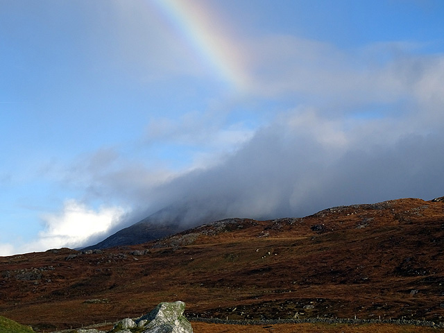
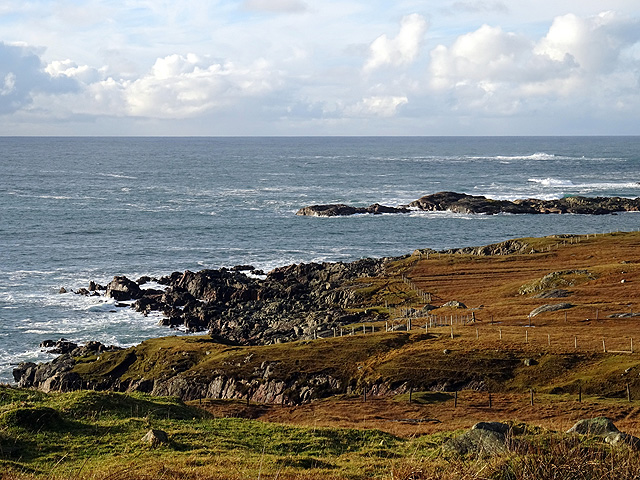
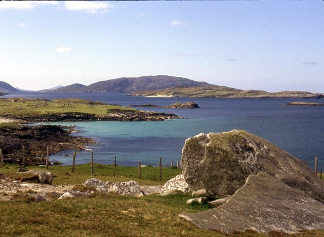
The headland is characterized by its dramatic cliffs, which plummet down to the crashing waves of the North Atlantic Ocean. These cliffs are composed of rugged rock formations, including sandstone and limestone, which have been shaped over centuries by the relentless force of the sea. The headland is also adorned with lush green vegetation, adding to its natural beauty.

Rubha an Teampaill is a popular destination for nature enthusiasts and hikers due to its stunning scenery and abundant wildlife. Visitors can enjoy panoramic views of the ocean, observe seabirds nesting on the cliffs, and even spot seals or dolphins swimming in the nearby waters. The headland is also home to a variety of plant species, including wildflowers and grasses, which thrive in the coastal environment.

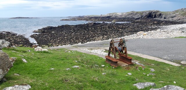
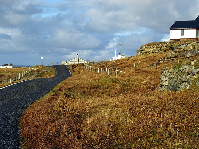
Access to Rubha an Teampaill is relatively easy, with a well-maintained footpath leading to the headland. The path offers an enjoyable walk through the surrounding countryside, allowing visitors to fully appreciate the natural beauty of the area. Whether it be for a peaceful stroll, wildlife observation, or simply to admire the awe-inspiring coastal scenery, Rubha an Teampaill is a must-visit destination for those exploring Ross-shire's coastline.

If you have any feedback on the listing, please let us know in the comments section below.

Rubha an Teampaill Images

Images are sourced within 2km of 58.104807/-7.1111388 or Grid Reference NA9924. Thanks to Geograph Open Source API. All images are credited.

Exposed gneiss on Carn Neil Snow-covered Mealaisbhal behind.
Exposed gneiss on Carn Neil
Snow-covered Mealaisbhal behind.
Slipway and winch at Camas Mol Linnis The slipway is very steep and the winch must have made all the difference.
Slipway and winch at Camas Mol Linnis
The slipway is very steep and the winch must have made all the difference.
Grèineam viewed from Mealasta
Mol Foirs Geòdha A small beach by Western Isles standards.
Mol Foirs Geòdha
A small beach by Western Isles standards.
Abhainn Ruadh Tumbling from the western slopes of the Lewis mountains towards the Atlantic
Abhainn Ruadh
Tumbling from the western slopes of the Lewis mountains towards the Atlantic
Looking west from Taireabhal This hill is near the end of civilisation in Lewis.
Looking west from Taireabhal
This hill is near the end of civilisation in Lewis.
Sparkle on Loch na Clibhe
On the far west of Lewis At Mealasta looking towards the island of Grèineam.
On the far west of Lewis
At Mealasta looking towards the island of Grèineam.
Looking south from Mealasta The larger island in the middle distance is Eileen Mhealasta. Beyond that is Scarp.
Looking south from Mealasta
The larger island in the middle distance is Eileen Mhealasta. Beyond that is Scarp.
The end of the road from Uig The road on the west side of Lewis ends at this remote jetty with a view out over Camas Mol Linnis. The map carries a name Totarol nearby but I'm unable to establish to what that refers.
The end of the road from Uig
The road on the west side of Lewis ends at this remote jetty with a view out over Camas Mol Linnis. The map carries a name Totarol nearby but I'm unable to establish to what that refers.
At the end of the road south of Mealasta Remains of concrete structures suggest busier times here in the past at this very remote location. The distant peak appears to be Naideabhal a Staigh <a href="https://www.geograph.org.uk/gridref/NB012235">NB012235</a>.
At the end of the road south of Mealasta
Remains of concrete structures suggest busier times here in the past at this very remote location. The distant peak appears to be Naideabhal a Staigh NB012235.
Outcropping rock at Mealasta Looking towards Cracabhal.
Outcropping rock at Mealasta
Looking towards Cracabhal.
Truncated rainbow above  Cracabhal Viewed from Mealasta.
Truncated rainbow above Cracabhal
Viewed from Mealasta.
South of Breanais With evidence of light cultivation/crofting near the foreshore.
South of Breanais
With evidence of light cultivation/crofting near the foreshore.
The road through Breanais A scattered but surprisingly populous village which has a considerable evidence of crofting, but probably a lot less carried out now than in the past. No great evidence of fishing, no doubt inhibited by the lack of shelter from the Atlantic.
The road through Breanais
A scattered but surprisingly populous village which has a considerable evidence of crofting, but probably a lot less carried out now than in the past. No great evidence of fishing, no doubt inhibited by the lack of shelter from the Atlantic.
Rough common grazing at Breanais
Allt Hatasaidh reaching the Atlantic
Flotsam washed up at Mealasta, Isle of Lewis The island is Grèineam.


Other Geograph contributors have told me that the item is probably a fender, possibly one which would be used between a submarine and a harbour wall.

The distance the item is from the shore illustrates the ferocity of the storms experienced by the west coast of Lewis.
Flotsam washed up at Mealasta, Isle of Lewis
The island is Grèineam. Other Geograph contributors have told me that the item is probably a fender, possibly one which would be used between a submarine and a harbour wall. The distance the item is from the shore illustrates the ferocity of the storms experienced by the west coast of Lewis.
Show me another place!

Rubha an Teampaill is located at Grid Ref: NA9924 (Lat: 58.104807, Lng: -7.1111388)

Unitary Authority: Na h-Eileanan an Iar

Police Authority: Highlands and Islands

What 3 Words

///informer.most.cooks. Near Carloway, Na h-Eileanan Siar

Related Wikis

Mealista

Mealista (Scottish Gaelic: Mealasta) was a township in the west of the Isle of Lewis. It is currently largely uninhabited due to the Highland Clearances...

Game pieces of the Lewis chessmen hoard

Game pieces of the Lewis chessmen hoard include the ninety-three game pieces of the Lewis chessmen hoard found on the Isle of Lewis in the Outer Hebrides...

Brenish

Brenish (Scottish Gaelic: Brèinis) is a small village situated on the west coast of the Isle of Lewis, which is part of the Outer Hebrides of Scotland...

Eilean Mhealasta

Eilean Mhealasta (Mealista Island) is an uninhabited island off the west coast of Lewis in the Outer Hebrides of Scotland. It takes its name from Mealista...

Gasker

Gasker is a small uninhabited islet in the Outer Hebrides of Scotland, 8 kilometres (4+1⁄2 nautical miles) southwest of Scarp, off the west coast of Harris...

Stac Dhòmhnaill Chaim

Stac Dhòmnuill Chaim, or Stac Dhòmhnaill Chaim, or Stac Domhnuill Chaim, is a fortified promontory located near Mangursta (or Mangersta, Scottish Gaelic...

Abhainn Dearg distillery

Abhainn Dearg distillery ( AV-in JAIRG) or Red River distillery is a Scotch whisky distillery in Uig, on the west coast of the Isle of Lewis in the Outer...

Scarp, Scotland

Scarp (Scottish Gaelic: An Sgarp) is an uninhabited island in the Outer Hebrides of Scotland, west of Hushinish on Harris. Once inhabited, the island was...

Nearby Amenities

Located within 500m of 58.104807,-7.1111388
Created By: dmgroom_coastlines
Lat/Long: 58.10574/-7.11162
Passing Place
Lat/Long: 58.1030952/-7.1079794
Mealasta
Alt Name Gd: Mealastadh
Name En: Mealista
Name Gd: Mealasta
Note: Listed as a locality because it is presumed to be uninhabited
Place: locality
Wikidata: Q367320
Wikipedia: en:Mealista
Lat/Long: 58.104507/-7.1090288
Buaile Fainis
Place: locality
Lat/Long: 58.1007035/-7.1111724
The data included in this document is from www.openstreetmap.org. The data is made available under ODbL.

Have you been to Rubha an Teampaill?

Leave your review of Rubha an Teampaill below (or comments, questions and feedback).